Brakey Wood

Wood, Forest in Essex Chelmsford

England

Brakey Wood

View eastwards along Tofts Chase, Little Baddow
View eastwards along Tofts Chase, Little Baddow Credit: Christopher Hilton

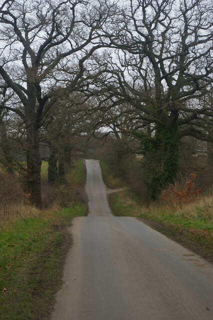
Brakey Wood is a picturesque woodland located in the county of Essex, England. Spread over an area of approximately 100 acres, it is a popular destination for nature enthusiasts and outdoor lovers. Situated near the village of Stanford Rivers, the wood is easily accessible and offers a tranquil escape from the bustling urban life.

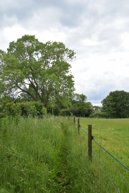
The wood is predominantly composed of broadleaf trees, such as oak, beech, and ash, which provide a stunning display of colors during the autumn months. The diverse vegetation supports a wide variety of wildlife, making it a haven for birdwatchers and nature photographers. Visitors may be lucky enough to spot species such as woodpeckers, owls, and deer as they meander through the peaceful pathways.

Throughout the wood, there are several well-maintained trails and footpaths that allow visitors to explore its beauty at their own pace. These paths lead to hidden clearings and secluded spots, making it an ideal location for picnics or simply enjoying the serenity of nature. Additionally, there are information boards strategically placed around the wood, providing interesting facts about the local flora and fauna.

Brakey Wood is open to the public throughout the year, with no admission fee. However, visitors are encouraged to respect the natural surroundings and adhere to any signage or guidelines in place to preserve the woodland's integrity. Whether it's a leisurely stroll, a family outing, or a chance to connect with nature, Brakey Wood offers a delightful experience for all who venture into its enchanting realm.

If you have any feedback on the listing, please let us know in the comments section below.

Brakey Wood Images

Images are sourced within 2km of 51.757392/0.56656324 or Grid Reference TL7709. Thanks to Geograph Open Source API. All images are credited.

View eastwards along Tofts Chase, Little Baddow
Footpath to "The Forge" on Church Road
Holybreds Farm
Holybreds Farm
The Cock Inn, Boreham, Essex The Cock Inn dates back to the 15th century and stands on the old A12 London to Ipswich road.
The Cock Inn, Boreham, Essex
The Cock Inn dates back to the 15th century and stands on the old A12 London to Ipswich road.
'The Cock Inn' at Boreham, Essex This inn is said to date back to the early part of the 15th century. It stands alongside the old Roman road between London and Colchester, which became the A.12 until it was changed to the new trunk road close by.
'The Cock Inn' at Boreham, Essex
This inn is said to date back to the early part of the 15th century. It stands alongside the old Roman road between London and Colchester, which became the A.12 until it was changed to the new trunk road close by.
Clock House, Boreham, Essex This is a fine timber-framed building that stands alongside the old A.12 road. It probably dates back to the early 15th century.
Clock House, Boreham, Essex
This is a fine timber-framed building that stands alongside the old A.12 road. It probably dates back to the early 15th century.
Chantry Farm, near Boreham, Essex
A house at Crix Farm, Hatfield Peverel, Essex This may be the farmhouse of Crix farm but there was no sign to confirm it.
A house at Crix Farm, Hatfield Peverel, Essex
This may be the farmhouse of Crix farm but there was no sign to confirm it.
House by Mowden Hall Farm, near Hatfield Peverel, Essex
Country road near Fairfields farm, Essex The house in the picture is called Old Fairfields. The road leads to the small village of Nounsley, near Hatfield Peverel.
Country road near Fairfields farm, Essex
The house in the picture is called Old Fairfields. The road leads to the small village of Nounsley, near Hatfield Peverel.
Railway bridge at Hatfield Peverel, Essex
Sunset over Boreham, Essex Looking west at sundown towards Boreham, this shows the public footpath leading to the road.
Sunset over Boreham, Essex
Looking west at sundown towards Boreham, this shows the public footpath leading to the road.
Hatfield Peverel, milepost East of the village, on B1137, against the wall of Crix Farm; giving distances to Witham, 3 miles; on the left hand face, Chelmsford, 5; on the bevel, London, 34. In the distance, the parallel A12 can be seen; this road, B1137, was its predecessor.
Hatfield Peverel, milepost
East of the village, on B1137, against the wall of Crix Farm; giving distances to Witham, 3 miles; on the left hand face, Chelmsford, 5; on the bevel, London, 34. In the distance, the parallel A12 can be seen; this road, B1137, was its predecessor.
Hatfield Peverel, A12 Dual carriageway, looking West towards London; unusually quiet, as it was 8.30am Sunday morning.
Hatfield Peverel, A12
Dual carriageway, looking West towards London; unusually quiet, as it was 8.30am Sunday morning.
Disused rail bridge Bridge connecting nowhere to nowhere over the London-Norwich rail line. Looks as if it once carried a narrow lane but now completely isolated beside the A12.
I got the opportunity to inspect it at close quarters only because the entire eastbound carriageway was stationary for an hour following a crash at Hatfield Peverel.
Disused rail bridge
Bridge connecting nowhere to nowhere over the London-Norwich rail line. Looks as if it once carried a narrow lane but now completely isolated beside the A12. I got the opportunity to inspect it at close quarters only because the entire eastbound carriageway was stationary for an hour following a crash at Hatfield Peverel.
River Ter at Crabbs Hill The River Ter flowing towards Nounsley
River Ter at Crabbs Hill
The River Ter flowing towards Nounsley
Waltham Road Bridge, A12 The A12 is a 129 mile long trunk road from London to Great Yarmouth. It runs through Greater London, Essex, Suffolk and Norfolk. It passes by Brentwood, Colchester and Ipswich as well as passing through Lowestoft.
<span class="nowrap"><a title="http://www.sabre-roads.org.uk/wiki/index.php?title=A12" rel="nofollow ugc noopener" href="http://www.sabre-roads.org.uk/wiki/index.php?title=A12">Link</a><img style="margin-left:2px;" alt="External link" title="External link - shift click to open in new window" src="https://s1.geograph.org.uk/img/external.png" width="10" height="10"/></span> 
Wikipedia: <span class="nowrap"><a title="http://en.wikipedia.org/wiki/A12_road_(England)" rel="nofollow ugc noopener" href="http://en.wikipedia.org/wiki/A12_road_(England)">Link</a><img style="margin-left:2px;" alt="External link" title="External link - shift click to open in new window" src="https://s1.geograph.org.uk/img/external.png" width="10" height="10"/></span>
Waltham Road Bridge, A12
The A12 is a 129 mile long trunk road from London to Great Yarmouth. It runs through Greater London, Essex, Suffolk and Norfolk. It passes by Brentwood, Colchester and Ipswich as well as passing through Lowestoft. LinkExternal link Wikipedia: LinkExternal link
Terling Hall Road Bridge, A12 The A12 is a 129 mile long trunk road from London to Great Yarmouth. It runs through Greater London, Essex, Suffolk and Norfolk. It passes by Brentwood, Colchester and Ipswich as well as passing through Lowestoft.
<span class="nowrap"><a title="http://www.sabre-roads.org.uk/wiki/index.php?title=A12" rel="nofollow ugc noopener" href="http://www.sabre-roads.org.uk/wiki/index.php?title=A12">Link</a><img style="margin-left:2px;" alt="External link" title="External link - shift click to open in new window" src="https://s1.geograph.org.uk/img/external.png" width="10" height="10"/></span> 
Wikipedia: <span class="nowrap"><a title="http://en.wikipedia.org/wiki/A12_road_(England)" rel="nofollow ugc noopener" href="http://en.wikipedia.org/wiki/A12_road_(England)">Link</a><img style="margin-left:2px;" alt="External link" title="External link - shift click to open in new window" src="https://s1.geograph.org.uk/img/external.png" width="10" height="10"/></span>
Terling Hall Road Bridge, A12
The A12 is a 129 mile long trunk road from London to Great Yarmouth. It runs through Greater London, Essex, Suffolk and Norfolk. It passes by Brentwood, Colchester and Ipswich as well as passing through Lowestoft. LinkExternal link Wikipedia: LinkExternal link
Show me another place!

Brakey Wood is located at Grid Ref: TL7709 (Lat: 51.757392, Lng: 0.56656324)

Administrative County: Essex

District: Chelmsford

Police Authority: Essex

What 3 Words

///grouping.joke.buggy. Near Boreham, Essex

Related Wikis

Mowden, Essex

Mowden is a hamlet in the civil parish of Hatfield Peverel, in the Braintree district, in the county of Essex, England. It is about 5 miles away from the...

Essex

Essex ( ESS-iks) is a ceremonial county in the East of England and one of the home counties. It is bordered by Cambridgeshire and Suffolk to the north...

List of local nature reserves in Essex

Essex is a county in the east of England. It is bounded by Suffolk and Cambridgeshire to the north, Hertfordshire to the west, Greater London to the south...
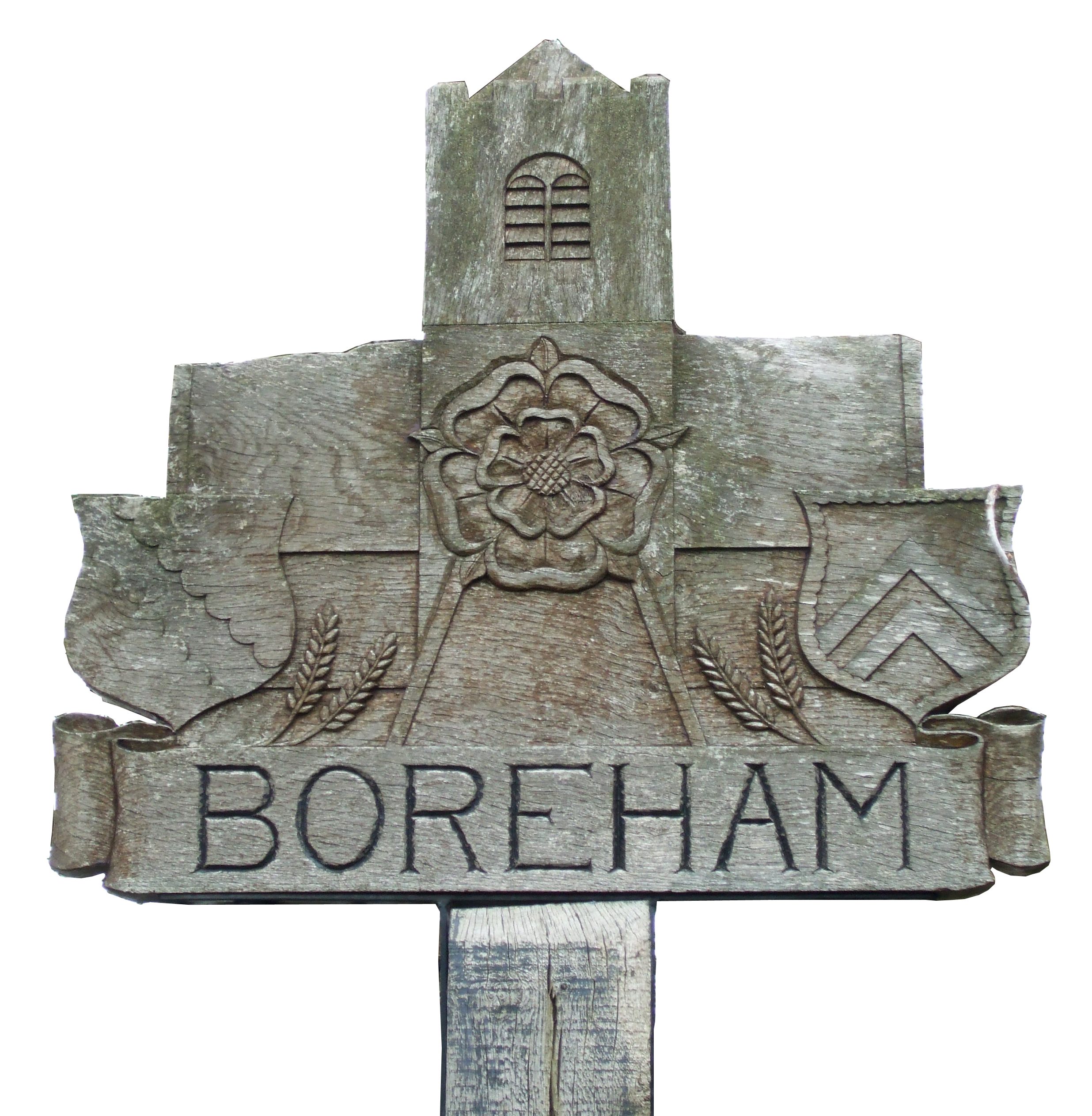
Boreham

Boreham is a village and civil parish, in Essex, England. The parish is in the City of Chelmsford and Chelmsford Parliament constituency. The village is...

Little Baddow

Little Baddow is a village to the east of Chelmsford, Essex. The name Baddow is believed to have been derived from the River Beadwan, now known as the...

Chelmer and Blackwater Navigation

The Chelmer and Blackwater Navigation is the canalisation of the Rivers Chelmer and Blackwater in Essex, in the east of England. The navigation runs for...

Hatfield Peverel

Hatfield Peverel is a village and civil parish at the centre of Essex, England. It is located 6 miles (10 km) north-east from Chelmsford, the nearest...

River Ter

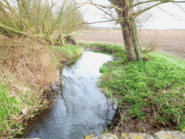
The River Ter is a river in Essex, England that houses various aquatic creatures. The river rises in Stebbing Green and flowing via Terling it joins the...

Nearby Amenities

Located within 500m of 51.757392,0.56656324
The data included in this document is from www.openstreetmap.org. The data is made available under ODbL.

Have you been to Brakey Wood?

Leave your review of Brakey Wood below (or comments, questions and feedback).