Brakes Wood

Wood, Forest in Essex Braintree

England

Brakes Wood

Gosfield Airfield This is the crossing point of the Perimeter track and the end of a runway on the former Gosfield Airfield. Gosfield operated from 1943 initially as a fighter station using P47s, later the base was returned to its intended use as a bomber field operating A20s. Late on in the war C47 Dakotas operated Horsa gliders from the base. Today there is a community woodland, industrial units and the Consumers Association <a href="https://www.geograph.org.uk/photo/221160">TL7731 : Speed Test Centre</a> on the base. To go to the next field in an alphabetical tour of Essex WW2 airfields click on <a href="https://www.geograph.org.uk/photo/221175">TL5923 : Great Dunmow Airfield</a>. Much information was gleaned from Graham Smith’s book “Essex Airfields In The Second World War”. <span class="nowrap"><a title="https://books.google.co.uk/books/about/Essex_Airfields_in_the_Second_World_War.html?id=u3atAAAACAAJ&redir_esc=y" rel="nofollow ugc noopener" href="https://books.google.co.uk/books/about/Essex_Airfields_in_the_Second_World_War.html?id=u3atAAAACAAJ&redir_esc=y">Link</a><img style="margin-left:2px;" alt="External link" title="External link - shift click to open in new window" src="https://s1.geograph.org.uk/img/external.png" width="10" height="10"/></span>
Gosfield Airfield Credit: Glyn Baker

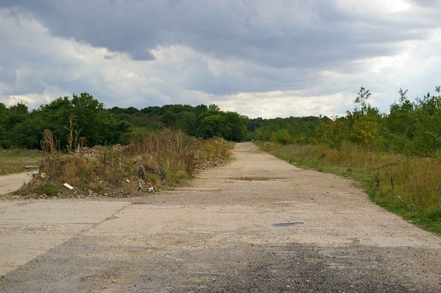
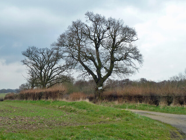
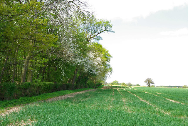
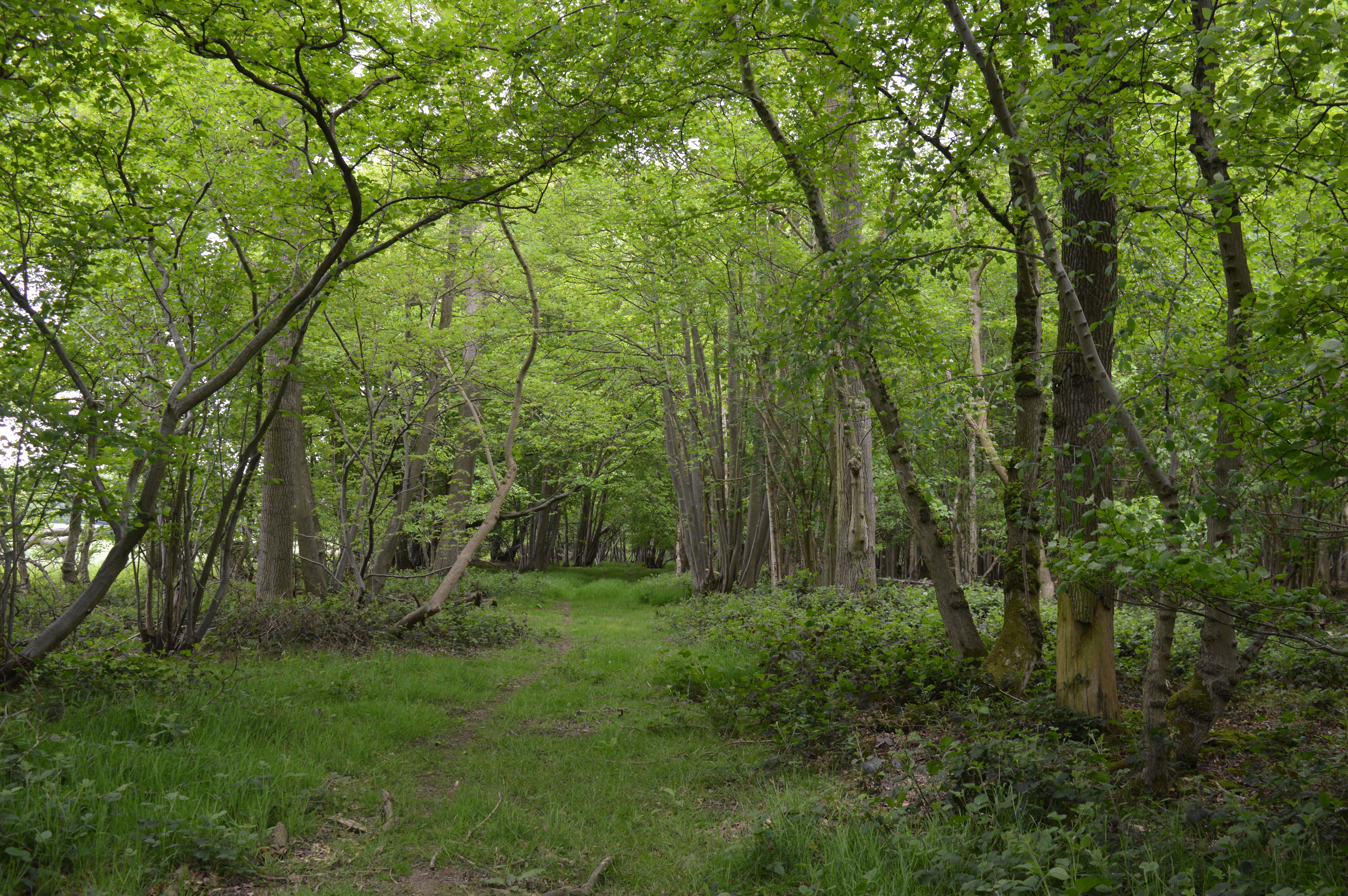
Brakes Wood is a picturesque forest located in the county of Essex, England. Covering an area of approximately 65 hectares, this woodland is a haven for nature enthusiasts and those seeking tranquility amidst lush green surroundings.

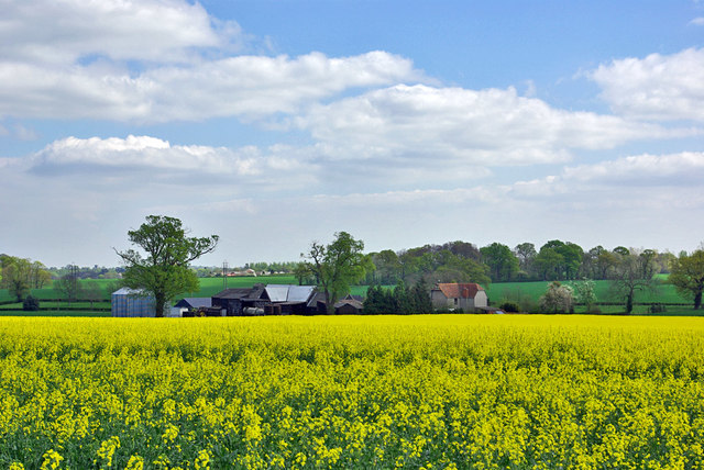
Situated just a few miles away from the town of Billericay, Brakes Wood is easily accessible and attracts visitors from all over the region. The forest is primarily composed of a variety of broadleaf trees, including oak, birch, and beech, which create a stunning canopy of foliage during the summer months. In addition to the trees, the forest floor is adorned with an array of wildflowers, adding bursts of color to the landscape.

One of the highlights of Brakes Wood is its extensive network of walking trails, allowing visitors to explore the forest at their own pace. These well-maintained paths wind through the woodland, offering glimpses of wildlife and opportunities for birdwatching. The forest is home to a diverse range of bird species, including woodpeckers, nightingales, and various birds of prey.

Brakes Wood also boasts a rich history, with evidence of human activity dating back several centuries. The remains of an ancient Roman road can be found within the forest, serving as a reminder of the area's past. Furthermore, the woodland has been designated as a Site of Special Scientific Interest (SSSI), recognizing its importance as a habitat for rare and protected species.

Overall, Brakes Wood in Essex is a captivating destination for nature lovers, offering a peaceful retreat from the hustle and bustle of everyday life. Its natural beauty, wildlife, and historical significance make it a must-visit location for anyone seeking to connect with the great outdoors.

If you have any feedback on the listing, please let us know in the comments section below.

Brakes Wood Images

Images are sourced within 2km of 51.941483/0.57096478 or Grid Reference TL7630. Thanks to Geograph Open Source API. All images are credited.

Gosfield Airfield This is the crossing point of the Perimeter track and the end of a runway on the former Gosfield Airfield. Gosfield operated from 1943 initially as a fighter station using P47s, later the base was returned to its intended use as a bomber field operating A20s. Late on in the war C47 Dakotas operated Horsa gliders from the base. Today there is a community woodland, industrial units and the Consumers Association <a href="https://www.geograph.org.uk/photo/221160">TL7731 : Speed Test Centre</a> on the base. To go to the next field in an alphabetical tour of Essex WW2 airfields click on <a href="https://www.geograph.org.uk/photo/221175">TL5923 : Great Dunmow Airfield</a>. Much information was gleaned from Graham Smith’s book “Essex Airfields In The Second World War”. <span class="nowrap"><a title="https://books.google.co.uk/books/about/Essex_Airfields_in_the_Second_World_War.html?id=u3atAAAACAAJ&redir_esc=y" rel="nofollow ugc noopener" href="https://books.google.co.uk/books/about/Essex_Airfields_in_the_Second_World_War.html?id=u3atAAAACAAJ&redir_esc=y">Link</a><img style="margin-left:2px;" alt="External link" title="External link - shift click to open in new window" src="https://s1.geograph.org.uk/img/external.png" width="10" height="10"/></span>
Gosfield Airfield
This is the crossing point of the Perimeter track and the end of a runway on the former Gosfield Airfield. Gosfield operated from 1943 initially as a fighter station using P47s, later the base was returned to its intended use as a bomber field operating A20s. Late on in the war C47 Dakotas operated Horsa gliders from the base. Today there is a community woodland, industrial units and the Consumers Association TL7731 : Speed Test Centre on the base. To go to the next field in an alphabetical tour of Essex WW2 airfields click on TL5923 : Great Dunmow Airfield. Much information was gleaned from Graham Smith’s book “Essex Airfields In The Second World War”. LinkExternal link
C A's Test Track This runway on the former <a href="https://www.geograph.org.uk/photo/221155">TL7830 : Gosfield Airfield</a> is where the Consumers Association do the research to obtain data for their vehicle tests.
C A's Test Track
This runway on the former TL7830 : Gosfield Airfield is where the Consumers Association do the research to obtain data for their vehicle tests.
Gosfield Perimeter Track This is the perimeter track of the former <a href="https://www.geograph.org.uk/photo/221155">TL7830 : Gosfield Airfield</a> the trees on the right are part of the Gosfield Community Woodland Scheme <span class="nowrap"><a title="http://www.gosfield.org.uk/visit.htm#Community%20Woodland" rel="nofollow ugc noopener" href="http://www.gosfield.org.uk/visit.htm#Community%20Woodland">Link</a><img style="margin-left:2px;" alt="External link" title="External link - shift click to open in new window" src="https://s1.geograph.org.uk/img/external.png" width="10" height="10"/></span>
Gosfield Perimeter Track
This is the perimeter track of the former TL7830 : Gosfield Airfield the trees on the right are part of the Gosfield Community Woodland Scheme LinkExternal link
Speed Test Centre This is the Gate to the <a href="https://www.geograph.org.uk/photo/221157">TL7831 : C A's Test Track</a> on the former <a href="https://www.geograph.org.uk/photo/221155">TL7830 : Gosfield Airfield</a>
Speed Test Centre
This is the Gate to the TL7831 : C A's Test Track on the former TL7830 : Gosfield Airfield
Baker's cottage by Baker's Farm
Road to Liston Hall Farm
Farmhouse at Hawkwood's Farm
Gosfield Lakes Golf Course The 14th green, viewed from the bridleway that crosses the course.
Gosfield Lakes Golf Course
The 14th green, viewed from the bridleway that crosses the course.
Brakes Wood Viewed from the 6th tee on Gosfield Lakes Golf Course.
Brakes Wood
Viewed from the 6th tee on Gosfield Lakes Golf Course.
Houses on Hall Drive, Gosfield Looking across Gosfield Park.
Houses on Hall Drive, Gosfield
Looking across Gosfield Park.
Gosfield Skateramp So called on the sign.
Gosfield Skateramp
So called on the sign.
Play area, Gosfield Park
Field edge with rough track North of Parkhall Road.
Field edge with rough track
North of Parkhall Road.
Parkhall Road Towards Gosfield.
Parkhall Road
Towards Gosfield.
Public bridleway to Southey Green The sign on the tree says "Private No access to golf course", but the bridleway does pass across the golf course.
Public bridleway to Southey Green
The sign on the tree says "Private No access to golf course", but the bridleway does pass across the golf course.
The King's Head, Gosfield
Northern edge of Kemp's Wood A small wood with a few cherry trees in bloom.
Northern edge of Kemp's Wood
A small wood with a few cherry trees in bloom.
Harmas Farm Looking across a field of oilseed rape.
Harmas Farm
Looking across a field of oilseed rape.
Show me another place!

Brakes Wood is located at Grid Ref: TL7630 (Lat: 51.941483, Lng: 0.57096478)

Administrative County: Essex

District: Braintree

Police Authority: Essex

What 3 Words

///caused.fuzz.trains. Near Gosfield, Essex

Related Wikis

Gosfield Hall

Gosfield Hall is a country house in Gosfield, near Braintree in Essex, England. It is a Grade I listed building. The house was built in 1545 by Sir John...

Gosfield

Gosfield is a village in the Braintree district of Essex, England. It is located around two miles west of the town of Halstead. Places of note include...

RAF Gosfield

Royal Air Force Gosfield or more simply RAF Gosfield is a former Royal Air Force station in Essex, England. The airfield is located approximately 5 miles...

Bovingdon Hall Woods

Bovingdon Hall Woods is a 69.4-hectare (171-acre) biological Site of Special Scientific Interest north of Braintree in Essex. It is composed of several...

Gosfield Sandpits

Gosfield Sandpits is an 8.3 hectare Local Nature Reserve in Gosfield, north of Braintree in Essex. It is owned by Gosfield Parish Council, and managed...

Southey Green, Essex

Southey Green is a hamlet near Sible Hedingham, in the Braintree district, in the county of Essex, England. Other nearby hamlets include Forry's Green...

Gosfield School

Gosfield School is an English co-educational independent school in Gosfield, in the Braintree district of Essex. It was founded in 1929. == Setting... ==

Beazley End

Beazley End is a village in Essex, England. == External links == Media related to Beazley End at Wikimedia Commons

Have you been to Brakes Wood?

Leave your review of Brakes Wood below (or comments, questions and feedback).