White's Wood

Wood, Forest in Kent Tunbridge Wells

England

White's Wood

Paper Mill Oast, Hinksden Road, Benenden, Kent Single square kiln oast house. Kiln now with pointed top instead of cowl. Stowage black weatherboarded.
Paper Mill Oast, Hinksden Road, Benenden, Kent Credit: Oast House Archive

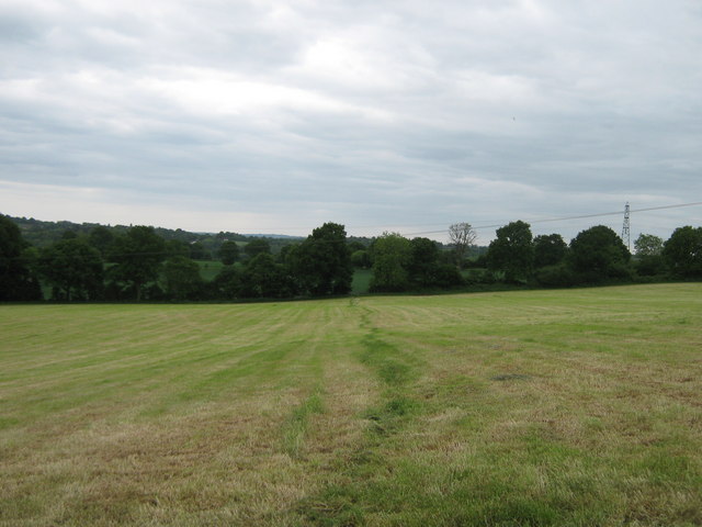
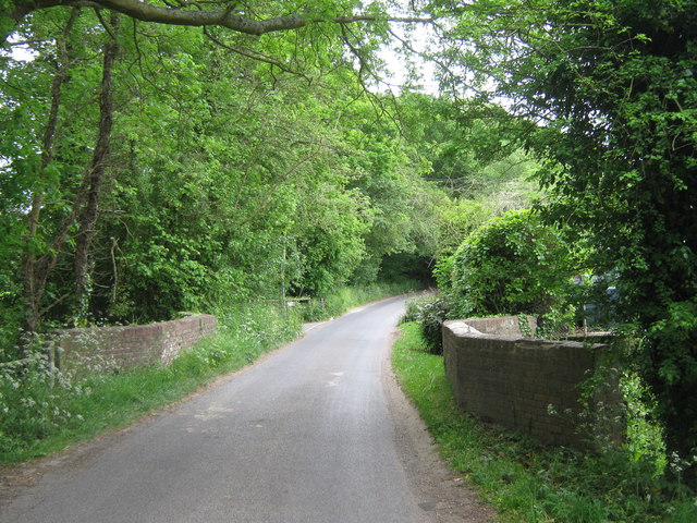
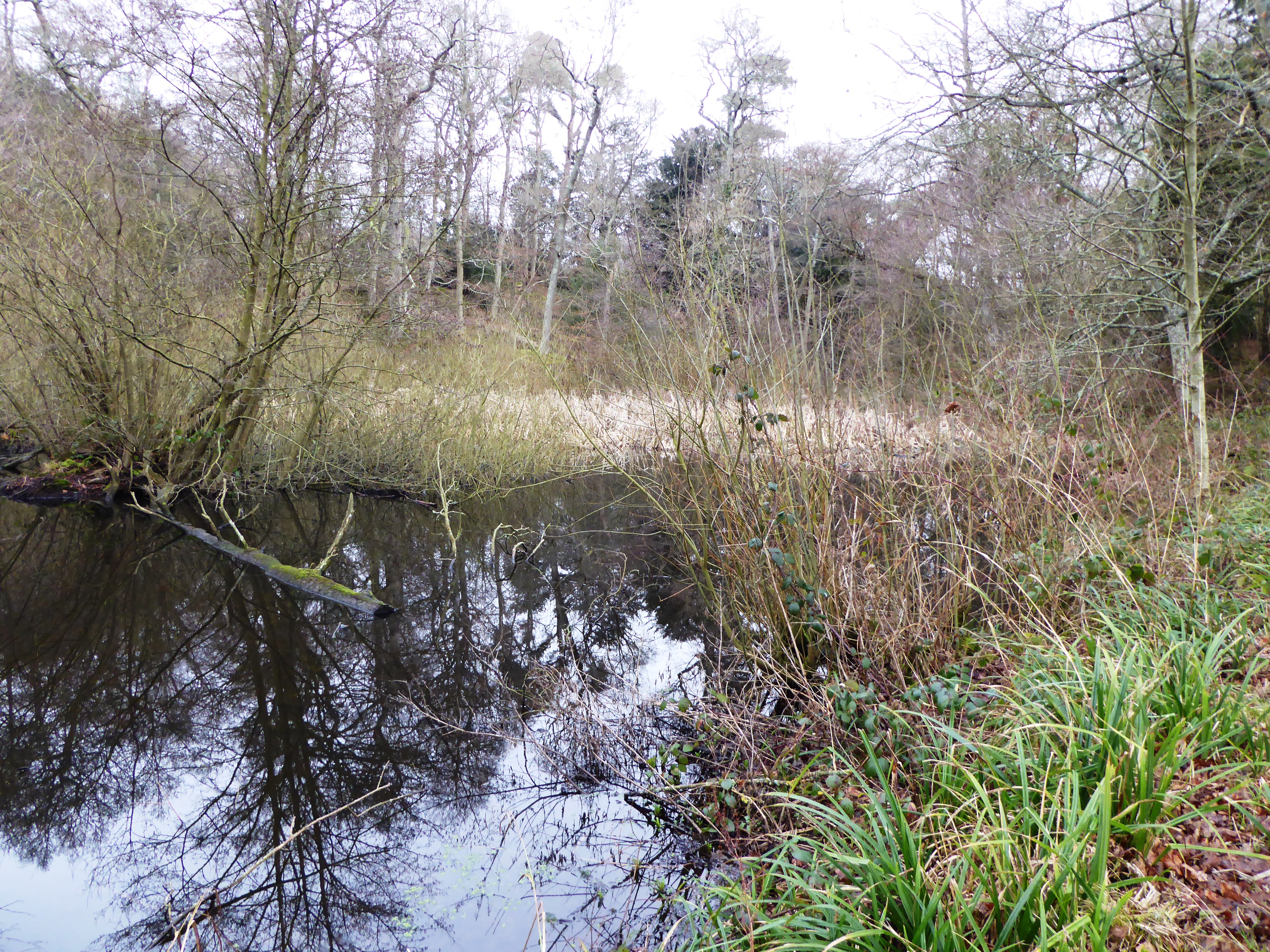
White's Wood is a picturesque forest located in the county of Kent, England. Situated on the outskirts of the small village of White, the wood covers an area of approximately 100 acres. Known for its natural beauty and tranquil atmosphere, White's Wood attracts locals and tourists alike.

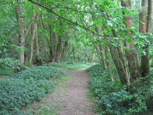
The wood is predominantly composed of deciduous trees, with oak, beech, and birch being the most prominent species. The dense canopy created by these trees provides shelter and a habitat for a diverse range of wildlife, including birds, squirrels, and deer. The forest floor is blanketed with a thick layer of moss and ferns, giving the wood an enchanting and magical feel.

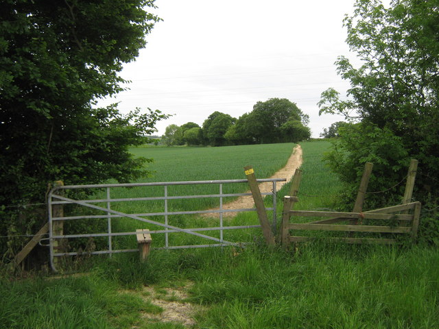
Trails wind their way through the wood, allowing visitors to explore the forest and immerse themselves in its natural wonders. These paths are well-maintained and suitable for walking, jogging, or cycling, making White's Wood a popular spot for outdoor enthusiasts.

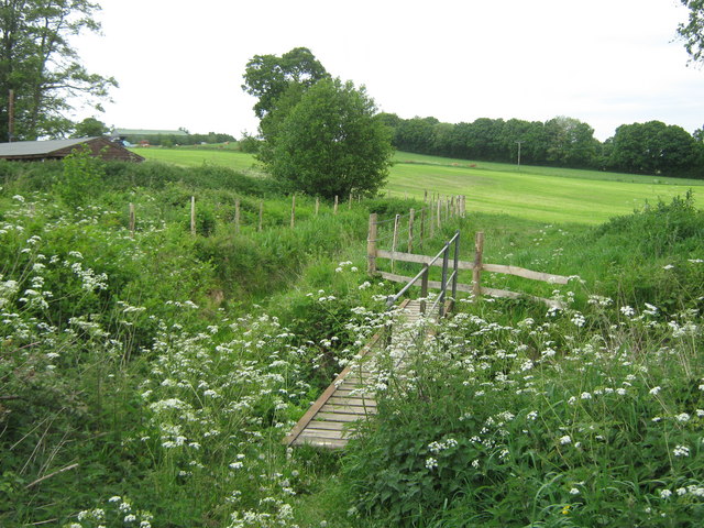
The wood is also home to a variety of plant species, including bluebells, wild garlic, and wood anemones. During the spring months, the forest is transformed into a sea of vibrant colors as these flowers bloom.

White's Wood is not only a haven for nature lovers but also a place of historical significance. It is believed that the wood has been in existence for hundreds of years, with traces of human activity dating back to ancient times.

Overall, White's Wood in Kent offers a peaceful and idyllic escape from the hustle and bustle of everyday life. Its natural beauty, diverse wildlife, and rich history make it a must-visit destination for anyone seeking a connection with nature.

If you have any feedback on the listing, please let us know in the comments section below.
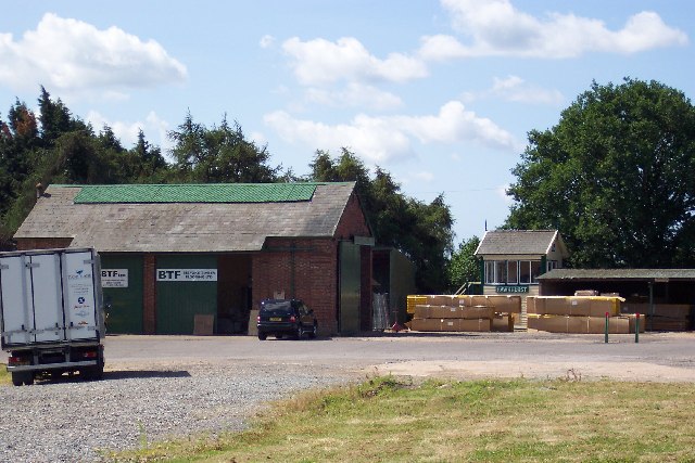
White's Wood Images

Images are sourced within 2km of 51.051737/0.51858171 or Grid Reference TQ7631. Thanks to Geograph Open Source API. All images are credited.

Paper Mill Oast, Hinksden Road, Benenden, Kent Single square kiln oast house. Kiln now with pointed top instead of cowl. Stowage black weatherboarded.
Paper Mill Oast, Hinksden Road, Benenden, Kent
Single square kiln oast house. Kiln now with pointed top instead of cowl. Stowage black weatherboarded.
Footpath to Tilden Farm This path leads from Ninevah Lane, past Forest Farm towards another farm and onwards to Water Lane.
Footpath to Tilden Farm
This path leads from Ninevah Lane, past Forest Farm towards another farm and onwards to Water Lane.
Gate and footpath to Tilden Farm This path leads from Ninevah Lane, past Forest Farm and this gate, towards another farm and onwards to Water Lane.
Gate and footpath to Tilden Farm
This path leads from Ninevah Lane, past Forest Farm and this gate, towards another farm and onwards to Water Lane.
Barn in Tilden Farm As seen from a path from Water Lane, past Tilden Farm leading towards Forest Farm and onwards to Ninevah Lane.
Barn in Tilden Farm
As seen from a path from Water Lane, past Tilden Farm leading towards Forest Farm and onwards to Ninevah Lane.
Cottage near Tilden Farm As seen from a farm track leading from Water Lane towards the farm.
Cottage near Tilden Farm
As seen from a farm track leading from Water Lane towards the farm.
Bridge on Water Lane This road leads from Four Wents to Four Throws.
It leads over the stream from Furnace Mill towards Sopp's Plant Wood.
The bridge is Grade II Listed, same as the next road bridge over another section of the stream.
See <span class="nowrap"><a title="http://www.britishlistedbuildings.co.uk/en-169812-bridge-at-tq-775-314-hawkhurst" rel="nofollow ugc noopener" href="http://www.britishlistedbuildings.co.uk/en-169812-bridge-at-tq-775-314-hawkhurst">Link</a><img style="margin-left:2px;" alt="External link" title="External link - shift click to open in new window" src="https://s1.geograph.org.uk/img/external.png" width="10" height="10"/></span> for more details about the bridge
Bridge on Water Lane
This road leads from Four Wents to Four Throws. It leads over the stream from Furnace Mill towards Sopp's Plant Wood. The bridge is Grade II Listed, same as the next road bridge over another section of the stream. See LinkExternal link for more details about the bridge
Building near Furnace Mill This building is beside one of the mill stream. 
As seen from a footpath leading from Water Lane to Heartenoak Road.
Building near Furnace Mill
This building is beside one of the mill stream. As seen from a footpath leading from Water Lane to Heartenoak Road.
Footpath beside Furnace Mill Stream This track leads through White's Wood towards Heartenoak Road.
Footpath beside Furnace Mill Stream
This track leads through White's Wood towards Heartenoak Road.
Footbridge over Furnace Mill Stream This bridge is on a path leading from Heartenoak Road towards Water Lane near Paul's Farm.
Footbridge over Furnace Mill Stream
This bridge is on a path leading from Heartenoak Road towards Water Lane near Paul's Farm.
Telephone Exchange in Hawkhurst Beside the fire station on Oakley Road.
Telephone Exchange in Hawkhurst
Beside the fire station on Oakley Road.
Infant School, Hawkhurst On the A299 Cranbrook Road.
Was a school now used as a Cadet Drill Hall.
See <a href="https://www.geograph.org.uk/photo/2413364">TQ7630 : Blue Plaque on Infant School</a> for a close-up of the blue plaque on the building.
Infant School, Hawkhurst
On the A299 Cranbrook Road. Was a school now used as a Cadet Drill Hall. See TQ7630 : Blue Plaque on Infant School for a close-up of the blue plaque on the building.
Blue Plaque on Infant School On <a href="https://www.geograph.org.uk/photo/2413358">TQ7630 : Infant School, Hawkhurst</a>.
Blue Plaque on Infant School
Sir Thomas Dunk's Almshouses, Hawkhurst The full name, as given in the title, appears on the rectangular white plate fixed to the railings to the left of the sign post. The scaffolding must have been erected to deal with a maintenance problem.
Sir Thomas Dunk's Almshouses, Hawkhurst
The full name, as given in the title, appears on the rectangular white plate fixed to the railings to the left of the sign post. The scaffolding must have been erected to deal with a maintenance problem.
Royal Oak Hotel, Hawkhurst There are two Tunbridge Wells Borough Council planning applications that may be relevant to this notice: June 2011 11/4000/0678 informal inquiry - insulation and May 2011 11/4000/0501 informal inquiry - repairs to the Royal Oak Hotel, Hawkhurst.
Royal Oak Hotel, Hawkhurst
There are two Tunbridge Wells Borough Council planning applications that may be relevant to this notice: June 2011 11/4000/0678 informal inquiry - insulation and May 2011 11/4000/0501 informal inquiry - repairs to the Royal Oak Hotel, Hawkhurst.
Foxhole Lane through Tongs Wood
Oak and Ivy Public House
All Saints Church (Derelict), Hawkhurst The Church has been derelict for about 20 years after it was sold off. Its future is uncertain.
All Saints Church (Derelict), Hawkhurst
The Church has been derelict for about 20 years after it was sold off. Its future is uncertain.
Graffiti on disused All Saints Church
Show me another place!

White's Wood is located at Grid Ref: TQ7631 (Lat: 51.051737, Lng: 0.51858171)

Administrative County: Kent

District: Tunbridge Wells

Police Authority: Kent

What 3 Words

///overhead.crafts.according. Near Hawkhurst, Kent

Related Wikis

Hawkhurst

Hawkhurst is a village and civil parish in the borough of Tunbridge Wells in Kent, England. The village is located close to the border with East Sussex...

Beal's Green

Beal's Green is a hamlet north of Hawkhurst in Kent, South East England.

Marlborough House School

Marlborough House School is a co-educational preparatory school situated in 34 acres (14 ha) of countryside in Hawkhurst, Kent. The school currently has...

Hawkhurst railway station

Hawkhurst railway station was on the closed Hawkhurst Branch in Kent, England. == Background == The station was opened on 4 September 1893, when the line...

Hawkhurst Moor

Hawkhurst Moor is a village green and sports field at Hawkhurst in Kent. It was the centre of the original village and lies to the south of the modern...

Collingwood Nature Reserve

Collingwood is a 3-hectare (7.4-acre) nature reserve south of Hawkhurst in Kent. It is managed by the Kent Wildlife Trust.This reserve is woodland which...

Robins Wood

Robins Wood is a 47.7-hectare (118-acre) biological Site of Special Scientific Interest between Tunbridge Wells and Ashford in Kent.This is a deep valley...

Parsonage Wood

Parsonage Wood is a 9.7-hectare (24-acre) biological Site of Special Scientific Interest south-east of Cranbrook in Kent. It is owned and managed by the...

Nearby Amenities

Located within 500m of 51.051737,0.51858171
Barrier: stile
Lat/Long: 51.0501504/0.5251016
Barrier: bollard
Lat/Long: 51.0550731/0.5178809
Power: pole
Lat/Long: 51.0545057/0.522381
Power: pole
Lat/Long: 51.0535687/0.5200346
Power: pole
Lat/Long: 51.0532482/0.5170883
Power: pole
Lat/Long: 51.0533315/0.51699
Power: pole
Lat/Long: 51.0498877/0.5140489
Power: pole
Lat/Long: 51.0524068/0.5180334
Power: pole
Lat/Long: 51.0547498/0.5238203
Power: pole
Lat/Long: 51.0530151/0.519078
Power: pole
Lat/Long: 51.0505692/0.5151528
Power: pole
Lat/Long: 51.054311/0.5212773
Power: pole
Lat/Long: 51.0510948/0.5159615
Power: pole
Lat/Long: 51.052434/0.5180057
Generator Method: photovoltaic
Generator Output Electricity: yes
Generator Source: solar
Generator Type: solar_photovoltaic_panel
Location: roof
Power: generator
Lat/Long: 51.0495776/0.512833
Generator Method: photovoltaic
Generator Output Electricity: yes
Generator Source: solar
Generator Type: solar_photovoltaic_panel
Location: roof
Power: generator
Lat/Long: 51.0497546/0.5126291
Generator Method: photovoltaic
Generator Output Electricity: yes
Generator Source: solar
Generator Type: solar_photovoltaic_panel
Location: roof
Power: generator
Lat/Long: 51.0498002/0.5123556
Generator Method: photovoltaic
Generator Output Electricity: yes
Generator Source: solar
Generator Type: solar_photovoltaic_panel
Location: roof
Power: generator
Lat/Long: 51.0494123/0.513415
Generator Method: photovoltaic
Generator Output Electricity: yes
Generator Source: solar
Generator Type: solar_photovoltaic_panel
Location: roof
Power: generator
Lat/Long: 51.0493988/0.5134794
Ford: yes
Lat/Long: 51.0534733/0.5122372
Ford: yes
Lat/Long: 51.0538314/0.5195986
The data included in this document is from www.openstreetmap.org. The data is made available under ODbL.

Have you been to White's Wood?

Leave your review of White's Wood below (or comments, questions and feedback).