Foxhill Plantation

Wood, Forest in Norfolk King's Lynn and West Norfolk

England

Foxhill Plantation

Castle Acre to Harpley (180b) Hikers passing the Dogotel, a Claridges for dogs
Castle Acre to Harpley (180b) Credit: Basher Eyre

Foxhill Plantation is a historic woodland located in Norfolk, England. Covering approximately 150 acres, this beautiful forest is home to a diverse range of flora and fauna. The woodland consists mainly of oak, beech, and pine trees, creating a lush and vibrant ecosystem.

Foxhill Plantation has a rich history dating back to the 18th century when it was established as a hunting ground for the local gentry. Over the years, the woodland has been carefully managed to maintain its natural beauty and ecological balance. Visitors to the plantation can enjoy peaceful walks along the well-maintained trails, taking in the sights and sounds of the forest.

In addition to its natural beauty, Foxhill Plantation also serves as an important habitat for a variety of wildlife species, including deer, squirrels, birds, and insects. Conservation efforts are in place to protect and preserve the woodland and its inhabitants for future generations to enjoy.

Overall, Foxhill Plantation is a tranquil and picturesque destination for nature lovers and outdoor enthusiasts alike, offering a peaceful retreat from the hustle and bustle of city life.

If you have any feedback on the listing, please let us know in the comments section below.

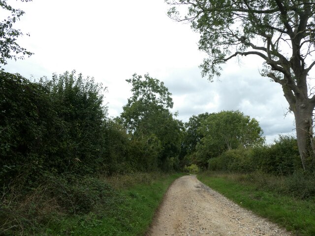
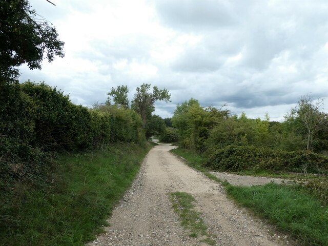
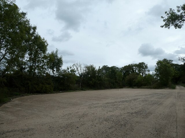
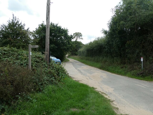
Foxhill Plantation Images

Images are sourced within 2km of 52.797985/0.59778215 or Grid Reference TF7525. Thanks to Geograph Open Source API. All images are credited.

Castle Acre to Harpley (180b) Hikers passing the Dogotel, a Claridges for dogs
Castle Acre to Harpley (180b)
Hikers passing the Dogotel, a Claridges for dogs
Castle Acre to Harpley (172) Gate on The Peddars Way
Castle Acre to Harpley (172)
Gate on The Peddars Way
Castle Acre to Harpley (173) Overhanging tree branches on The Peddars Way
Castle Acre to Harpley (173)
Overhanging tree branches on The Peddars Way
Castle Acre to Harpley (174) Field boundary on The Peddars Way
Castle Acre to Harpley (174)
Field boundary on The Peddars Way
Castle Acre to Harpley (175) Approaching a quarry on The Peddars Way
Castle Acre to Harpley (175)
Approaching a quarry on The Peddars Way
Castle Acre to Harpley (176) The Peddars Way meets the path to the quarry
Castle Acre to Harpley (176)
The Peddars Way meets the path to the quarry
Castle Acre to Harpley (177) Turning area for quarry vehicles seen from The Peddars Way
Castle Acre to Harpley (177)
Turning area for quarry vehicles seen from The Peddars Way
Castle Acre to Harpley (178) Padlocked entrance to the quarry
Castle Acre to Harpley (178)
Padlocked entrance to the quarry
Castle Acre to Harpley (179) Looking from the Dogotel back along The Peddars Way
Castle Acre to Harpley (179)
Looking from the Dogotel back along The Peddars Way
Castle Acre to Harpley (180a) Entrance to the Dogotel
Castle Acre to Harpley (180a)
Entrance to the Dogotel
Castle Acre to Harpley (181) The Peddars Way: footpath sign at Harpley Dams
Castle Acre to Harpley (181)
The Peddars Way: footpath sign at Harpley Dams
Castle Acre to Harpley (182) Journey's end for 2022, the A148 glimpsed at Harpley.
Castle Acre to Harpley (182)
Journey's end for 2022, the A148 glimpsed at Harpley.
Disused Quarry, Harpley Dams This was the entrance to a large disused compound which is perhaps connected to quarrying or gravel extraction.
Disused Quarry, Harpley Dams
This was the entrance to a large disused compound which is perhaps connected to quarrying or gravel extraction.
A  glorious afternoon on The Peddars Way Taken on the section from Harpley Dams to the tumuli near Bunker's Hill
A glorious afternoon on The Peddars Way
Taken on the section from Harpley Dams to the tumuli near Bunker's Hill
A perfect day to be walking The Peddars Way Taken on the section from Harpley Dams to the tumuli near Bunker's Hill
A perfect day to be walking The Peddars Way
Taken on the section from Harpley Dams to the tumuli near Bunker's Hill
Dog leading the (Peddars) way The Peddars Way is a long distance footpath in Norfolk. It is 46 miles long and follows the route of a Roman road. It has been suggested by more than one writer that it was not created by the Romans but was an ancient trackway, a branch or extension of the Icknield Way, used and remodelled by the Romans. The name is said to be derived from the Latin pedester – on foot.  It starts at Knettishall Heath in Suffolk (near the Norfolk-Suffolk border, about 4 miles east of Thetford), and it links with the Norfolk Coast Path at Holme-next-the-Sea.
Combined with the Norfolk Coast Path, it forms the Peddars Way & Norfolk Coast Path National Trail, one of 15 National Trails in England and Wales, and the two paths together run for 97 miles.
Wikipedia: <span class="nowrap"><a title="http://en.wikipedia.org/wiki/Peddars_Way" rel="nofollow ugc noopener" href="http://en.wikipedia.org/wiki/Peddars_Way">Link</a><img style="margin-left:2px;" alt="External link" title="External link - shift click to open in new window" src="https://s1.geograph.org.uk/img/external.png" width="10" height="10"/></span>
Dog leading the (Peddars) way
The Peddars Way is a long distance footpath in Norfolk. It is 46 miles long and follows the route of a Roman road. It has been suggested by more than one writer that it was not created by the Romans but was an ancient trackway, a branch or extension of the Icknield Way, used and remodelled by the Romans. The name is said to be derived from the Latin pedester – on foot. It starts at Knettishall Heath in Suffolk (near the Norfolk-Suffolk border, about 4 miles east of Thetford), and it links with the Norfolk Coast Path at Holme-next-the-Sea. Combined with the Norfolk Coast Path, it forms the Peddars Way & Norfolk Coast Path National Trail, one of 15 National Trails in England and Wales, and the two paths together run for 97 miles. Wikipedia: LinkExternal link
Peddars Way track Leading south to Harpley Dams
Peddars Way track
Leading south to Harpley Dams
Harpley Dams Looking SSE along the Peddars Way at Harpley Dams
Harpley Dams
Looking SSE along the Peddars Way at Harpley Dams
Show me another place!

Foxhill Plantation is located at Grid Ref: TF7525 (Lat: 52.797985, Lng: 0.59778215)

Administrative County: Norfolk

District: King's Lynn and West Norfolk

Police Authority: Norfolk

What 3 Words

///levels.adjusted.vibrating. Near Grimston, Norfolk

Related Wikis

Flitcham, Norfolk

Flitcham is a village and civil parish in the English county of Norfolk. The village is located 7.1 miles (11.4 km) north-east of King's Lynn and 33 miles...

Hillington railway station

Hillington railway station was a station in Hillington, Norfolk on the now closed Midland and Great Northern Joint Railway line between South Lynn and...

Hillington, Norfolk

Hillington is a village and civil parish in the English county of Norfolk. It covers an area of 10.27 km2 (3.97 sq mi) and had a population of 287 in 123...

Flitcham with Appleton

Flitcham with Appleton is a civil parish in the English county of Norfolk. It covers an area of 17.08 km2 (6.59 sq mi) and had a population of 236 in 96...

Nearby Amenities

Located within 500m of 52.797985,0.59778215
Parking
Fee: no
Parking: layby
Lat/Long: 52.7995084/0.5959266
Power: pole
Lat/Long: 52.8009939/0.5992162
Power: pole
Lat/Long: 52.8010847/0.6007183
Power: pole
Lat/Long: 52.8011593/0.6022391
Power: pole
Lat/Long: 52.8002528/0.5923659
Location Transition: yes
Power: pole
Transformer: distribution
Lat/Long: 52.8001328/0.5935648
Give Way
Lat/Long: 52.8001313/0.6008858
Power: pole
Lat/Long: 52.7973435/0.6016785
Power: pole
Lat/Long: 52.79771/0.6017348
Power: pole
Lat/Long: 52.7982565/0.6015685
Power: pole
Lat/Long: 52.798756/0.6014438
Power: pole
Transformer: distribution
Lat/Long: 52.7998182/0.6017992
Power: pole
Lat/Long: 52.8003728/0.6019199
Entrance: main
Lat/Long: 52.8000744/0.6021827
Power: pole
Lat/Long: 52.8009031/0.5976981
Give Way
Lat/Long: 52.7998173/0.5961131
The data included in this document is from www.openstreetmap.org. The data is made available under ODbL.

Have you been to Foxhill Plantation?

Leave your review of Foxhill Plantation below (or comments, questions and feedback).