Dell Plantation

Wood, Forest in Suffolk West Suffolk

England

Dell Plantation

Stubble field near A14
Stubble field near A14 Credit: Hugh Venables

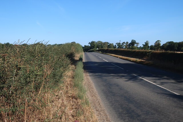
Dell Plantation, located in Suffolk, is a sprawling woodland area characterized by its dense forest cover and scenic beauty. Covering an extensive area of approximately 200 acres, the plantation is a haven for nature enthusiasts and offers a wide range of recreational activities for visitors.

The woodland of Dell Plantation is predominantly comprised of a mixture of deciduous and coniferous trees, including oak, beech, pine, and cedar. These trees provide a rich and diverse habitat for various wildlife species, such as deer, foxes, rabbits, and a multitude of bird species. The plantation is also home to several rare and protected plant species, making it an important ecological site.

Visitors to Dell Plantation can enjoy numerous walking trails that traverse through the woodland, allowing them to immerse themselves in the tranquility and serenity of nature. The pathways are well-marked and offer stunning views of the surrounding landscape, making it an ideal location for leisurely strolls or more adventurous hikes.

The plantation also features several designated picnic areas, where visitors can relax and enjoy a meal amidst the natural surroundings. Additionally, Dell Plantation offers opportunities for camping, birdwatching, and photography, attracting nature enthusiasts from far and wide.

Managed by the local council, Dell Plantation is meticulously maintained to preserve its natural beauty and biodiversity. The plantation serves as an important educational resource, hosting guided tours and workshops on environmental conservation and sustainable land management.

Overall, Dell Plantation in Suffolk provides a serene retreat for individuals seeking respite from the hustle and bustle of urban life, offering a unique and immersive experience in the heart of nature.

If you have any feedback on the listing, please let us know in the comments section below.

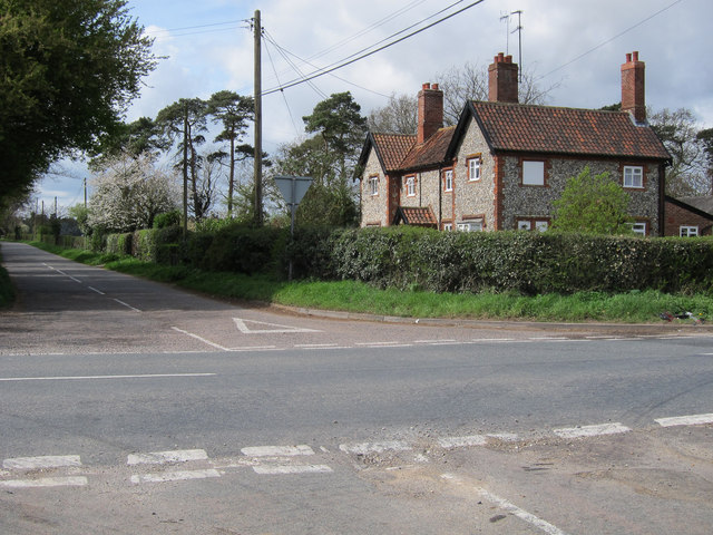
Dell Plantation Images

Images are sourced within 2km of 52.26644/0.56001986 or Grid Reference TL7466. Thanks to Geograph Open Source API. All images are credited.

Stubble field near A14
Minor road away from A14
Footpath to Robin's Hall
Footpath to Heath Farm
Sugar beet field near A14
East end of Mount Plantation, from the railway
Higham village sign Suffolk has 400 villages and towns with village or town signs, give or take one or two. 
The tradition of village signs is believed to have started in Norfolk early in the 20th century when Edward VII suggested that village signs would aid motorists and give a feature of interest on the Sandringham Estate.
Many of the signs  were made by Harry Carter, an art and woodwork master at Hamond’s Grammar School, in Swaffham.
Many have now been replaced with fibreglass or modern plastics. The story behind the sign is given as accurately as possible.
Higham village sign
Suffolk has 400 villages and towns with village or town signs, give or take one or two. The tradition of village signs is believed to have started in Norfolk early in the 20th century when Edward VII suggested that village signs would aid motorists and give a feature of interest on the Sandringham Estate. Many of the signs were made by Harry Carter, an art and woodwork master at Hamond’s Grammar School, in Swaffham. Many have now been replaced with fibreglass or modern plastics. The story behind the sign is given as accurately as possible.
Farm buildings at Higham Hall
The road close to Higham church
Tuddenham Corner Desnage Lodge Cottages.
Tuddenham Corner
Desnage Lodge Cottages.
Tuddenham Corner
Tuddenham Corner
Path to South Farm
Path to South Farm
St Stephen's church in Higham For more information go to: <a title="https://www.geograph.org.uk/photo/1958761" href="https://www.geograph.org.uk/photo/1958761">Link</a>.
St Stephen's church in Higham
For more information go to: Link.
Houses north of Higham
Former goods shed at Higham railway station (closed)
Former goods shed at Higham railway station (closed) The building now houses a shop selling lamps and lighting.
Former goods shed at Higham railway station (closed)
The building now houses a shop selling lamps and lighting.
Railway buildings at Higham station (closed)
Victorian postbox at Higham railway station For a wider view of this location see > <a title="https://www.geograph.org.uk/photo/2930679" href="https://www.geograph.org.uk/photo/2930679">Link</a>.
Victorian postbox at Higham railway station
For a wider view of this location see > Link.
Show me another place!

Dell Plantation is located at Grid Ref: TL7466 (Lat: 52.26644, Lng: 0.56001986)

Administrative County: Suffolk

District: West Suffolk

Police Authority: Suffolk

What 3 Words

///probably.obliging.blush. Near Mildenhall, Suffolk

Related Wikis

Higham railway station (Suffolk)

Higham railway station was a station serving Higham in the English county of Suffolk. It was opened by the Great Eastern Railway in 1854 when the railway...

A14 road (England)

The A14 is a major trunk road in England, running 127 miles (204 km) from Catthorpe Interchange, a major intersection at the southern end of the M6 and...

Higham, West Suffolk

Higham is a village and civil parish in the West Suffolk district of Suffolk in the east of England. Located midway between Bury St Edmunds and Newmarket...

Desning Hall

Desning Hall was a manor house in Risbridge Hundred, in Suffolk, England, dating from Anglo-Saxon times. Desning Hall's last resident was Sidney Arthur...

Gazeley Windmill

Gazeley Mill is a tower mill at Gazeley, Suffolk, England which has been converted to residential accommodation. == History == Gazeley Mill was built in...

Denham Castle

Denham Castle, also known as Castle Holes, is a medieval motte and bailey castle near the village of Gazeley, Suffolk, England. The castle was also known...

Gazeley

Gazeley is a village and civil parish in the West Suffolk district of Suffolk in eastern England and is part of the West Suffolk UK Parliament constituency...

Cavenham

Cavenham is a village and civil parish in Suffolk, England, 10 kilometres (6 mi) northwest of Bury St Edmunds. It is in the local government district of...

Nearby Amenities

Located within 500m of 52.26644,0.56001986
Motorway Junction
Higham Interchange
Layer: 3
Ref: 40
Lat/Long: 52.2669048/0.5550552
Bus Stop
War Memorial
Naptan AtcoCode: 390020139
Naptan Bearing: NE
Naptan BusStopType: CUS
Naptan CommonName: War Memorial
Naptan Indicator: opp
Naptan Landmark: War Memorial
Naptan NaptanCode: sufajgda
Naptan Street: Lower Green
Naptan Verified: no
Source: naptan_import
Lat/Long: 52.2641138/0.5569673
Bus Stop
War Memorial
Naptan AtcoCode: 390020140
Naptan Bearing: SW
Naptan CommonName: War Memorial
Naptan Indicator: adj
Naptan Landmark: War Memorial
Naptan NaptanCode: sufajgdg
Naptan Street: Lower Green
Naptan Verified: no
Source: naptan_import
Lat/Long: 52.2640195/0.5571671
Bus Stop
War Memorial
Naptan AtcoCode: 390020428
Naptan Bearing: N
Naptan BusStopType: CUS
Naptan CommonName: War Memorial
Naptan Indicator: o/s
Naptan Landmark: War Memorial
Naptan NaptanCode: sufjpmwd
Naptan Street: Lower Green
Naptan Verified: no
Source: naptan_import
Lat/Long: 52.2636621/0.5566482
Parking
Lat/Long: 52.2664155/0.5656591
Higham
Historic Railway: station
Railway: site
Wikidata: Q5757808
Wikipedia: en:Higham railway station (Suffolk)
Lat/Long: 52.2651274/0.5584962
Historic: memorial
Memorial: war_memorial
Lat/Long: 52.2640067/0.5568998
Fixme: incomplete
Lat/Long: 52.2630333/0.563033
Give Way
Direction: forward
Lat/Long: 52.2663107/0.5591471
Stop
Stop: minor
Lat/Long: 52.2661347/0.5627218
The data included in this document is from www.openstreetmap.org. The data is made available under ODbL.

Have you been to Dell Plantation?

Leave your review of Dell Plantation below (or comments, questions and feedback).