Little Hucksteep Wood

Wood, Forest in Sussex Rother

England

Little Hucksteep Wood

Level Crossing at Mountfield East Sussex Small level crossing on narrow road from Netherfield to Mountfield East Sussex on the Hastings to Charing Cross line.
Level Crossing at Mountfield East Sussex Credit: Janet Richardson

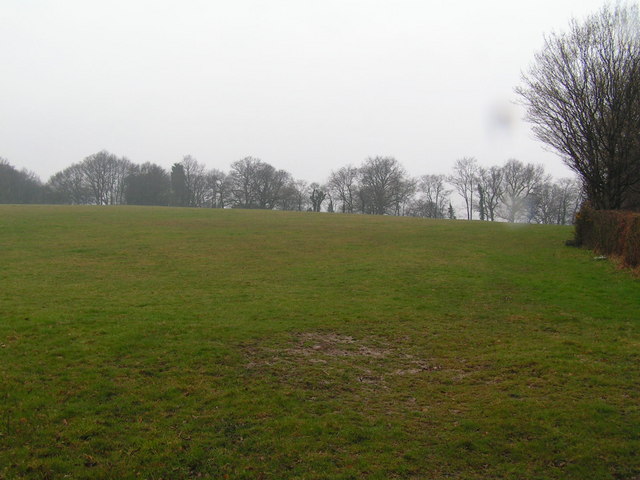
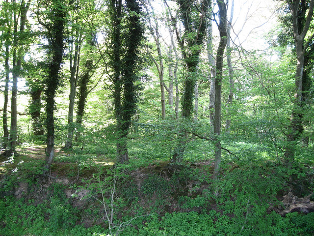
Little Hucksteep Wood is a charming forest located in the picturesque county of Sussex, England. Spread across an area of approximately 50 acres, this woodland is renowned for its natural beauty and tranquil atmosphere. It is situated near the village of Hucksteep, giving it its name.

The wood comprises a diverse range of tree species, including oak, beech, birch, and ash, which create a rich and vibrant canopy overhead. The forest floor is adorned with a carpet of mosses, ferns, and wildflowers, adding to its enchanting appeal. The dense foliage provides a habitat for an array of wildlife, including squirrels, deer, foxes, and a variety of bird species.

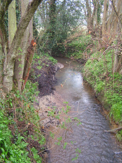
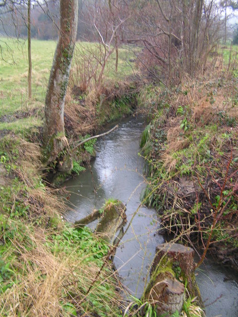
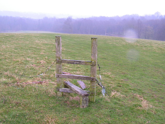
Little Hucksteep Wood offers an idyllic escape from the hustle and bustle of everyday life, making it a popular destination for nature enthusiasts and hikers. The network of winding trails and pathways allows visitors to explore the wood at their own pace and discover its hidden treasures. The wood is also home to a small stream that meanders through its heart, adding to its charm and providing a serene backdrop for relaxation.

Throughout the year, Little Hucksteep Wood showcases the beauty of each season. In spring, the forest bursts into life with the blossoming of colorful wildflowers, while autumn brings a spectacular display of vibrant foliage. The wood is open to the public year-round, and visitors can enjoy picnicking, wildlife spotting, or simply immersing themselves in the peaceful ambiance and natural splendor of this beautiful woodland retreat.

If you have any feedback on the listing, please let us know in the comments section below.

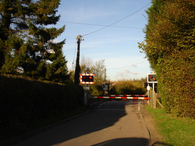
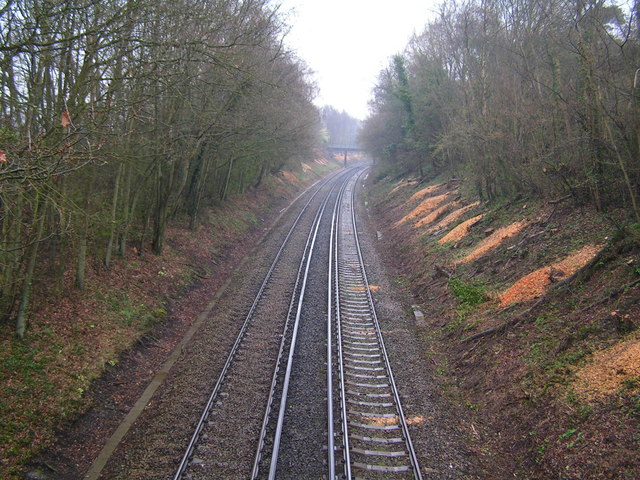
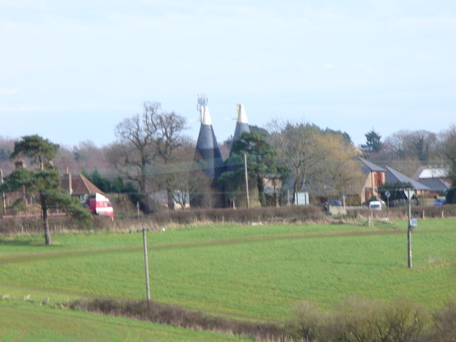
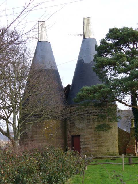
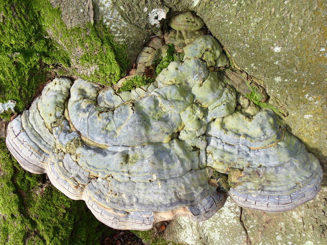
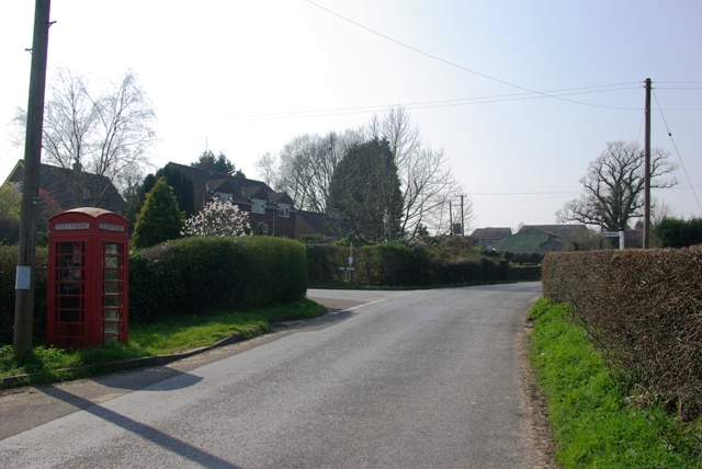
Little Hucksteep Wood Images

Images are sourced within 2km of 50.948103/0.47550085 or Grid Reference TQ7319. Thanks to Geograph Open Source API. All images are credited.

Level Crossing at Mountfield East Sussex Small level crossing on narrow road from Netherfield to Mountfield East Sussex on the Hastings to Charing Cross line.
Level Crossing at Mountfield East Sussex
Small level crossing on narrow road from Netherfield to Mountfield East Sussex on the Hastings to Charing Cross line.
Narrow Road Eatenden Lane a very narrow road between Netherfield and Mountfield East Sussex with Crowhurst Wood on the left and Upper Hucksteep Wood on the right.
Narrow Road
Eatenden Lane a very narrow road between Netherfield and Mountfield East Sussex with Crowhurst Wood on the left and Upper Hucksteep Wood on the right.
Mountfield Church Nr Battle East Sussex The structure of Mountfield Church was destroyed in the aftermath of the Battle of Hastings in 1066. Rebuilt between 1180 and 1200. A modest little church surrounded by beautiful countryside on all sides.
Mountfield Church Nr Battle East Sussex
The structure of Mountfield Church was destroyed in the aftermath of the Battle of Hastings in 1066. Rebuilt between 1180 and 1200. A modest little church surrounded by beautiful countryside on all sides.
The River Line A few miles downstream from here this river joins the R. Brede
The River Line
A few miles downstream from here this river joins the R. Brede
Tonbridge to Hastings railway line This is the main London to Hastings line via Tonbridge
Tonbridge to Hastings railway line
This is the main London to Hastings line via Tonbridge
A small wealden stream A small tributary of the R. Line
A small wealden stream
A small tributary of the R. Line
A field near Lower Gate Farm Typical wealden scene
A field near Lower Gate Farm
Typical wealden scene
A defunct stile The footpath running through this area is difficult to follow and this stile sums it up!
A defunct stile
The footpath running through this area is difficult to follow and this stile sums it up!
Netherfield Church The sandstone tower of Netherfield Church under restoration.  The wording under the ornamental clock is "Redeem the time".
Netherfield Church
The sandstone tower of Netherfield Church under restoration. The wording under the ornamental clock is "Redeem the time".
The Old Schoolhouse, Netherfield An interesting sandstone building next to Netherfield Churchyard.
The Old Schoolhouse, Netherfield
An interesting sandstone building next to Netherfield Churchyard.
The Church of St John the Baptist at  Netherfield Despite its appearance of greater age, St John's Church was dedicated in 1860, apparently the gift of Lady Webster to the village in memory of her husband, Sir Godfrey Webster of Battle Abbey.
The Church of St John the Baptist at Netherfield
Despite its appearance of greater age, St John's Church was dedicated in 1860, apparently the gift of Lady Webster to the village in memory of her husband, Sir Godfrey Webster of Battle Abbey.
The Church Clock at Netherfield This decorative clock is to be found on the south face of the church tower high above the entrance doorway.
The Church Clock at Netherfield
This decorative clock is to be found on the south face of the church tower high above the entrance doorway.
The Church Tower at Netherfield St John the Baptist parish church was designed by Samuel Sanders Teulon, a Victorian architect. He was also responsible for the very attractive School and School-master's house that are adjacent to the churchyard.
The Church Tower at Netherfield
St John the Baptist parish church was designed by Samuel Sanders Teulon, a Victorian architect. He was also responsible for the very attractive School and School-master's house that are adjacent to the churchyard.
Wealden Landscape, Vinehall Street Grassy fields, woods and oast houses are typical of this area of the Weald. Across the view runs the A21 London - Hastings road.
Wealden Landscape, Vinehall Street
Grassy fields, woods and oast houses are typical of this area of the Weald. Across the view runs the A21 London - Hastings road.
Oasts, Vinehall Street Industrial relics from the East Sussex hop industry which have not yet been converted into a desirable country residence.
Oasts, Vinehall Street
Industrial relics from the East Sussex hop industry which have not yet been converted into a desirable country residence.
Fungus on a Beech Tree This one is about one foot wide, two or three inches thick, and solidly fixed to the tree trunk.
Fungus on a Beech Tree
This one is about one foot wide, two or three inches thick, and solidly fixed to the tree trunk.
In Limekiln Wood An unsuccessful attempt to show the humps and hollows produced by ancient limestone digging from the Purbeck beds which outcrop here.
In Limekiln Wood
An unsuccessful attempt to show the humps and hollows produced by ancient limestone digging from the Purbeck beds which outcrop here.
Mountfield, red phonebox At the junction of Church Road and Hoath Hill (currently unofficially renamed Oat Hill).
Mountfield, red phonebox
At the junction of Church Road and Hoath Hill (currently unofficially renamed Oat Hill).
Show me another place!

Little Hucksteep Wood is located at Grid Ref: TQ7319 (Lat: 50.948103, Lng: 0.47550085)

Administrative County: East Sussex

District: Rother

Police Authority: Sussex

What 3 Words

///lows.switch.compliant. Near Battle, East Sussex

Related Wikis

Mountfield Halt railway station

Mountfield Halt (TQ 746 197 50°57′01″N 0°29′12″E) was situated on the Hastings Line between Robertsbridge and Battle. It opened in 1923 and was closed...

Mountfield, East Sussex

Mountfield is a village and civil parish in the Rother district of East Sussex, England, and three miles (5 km) north-west of Battle. It is mentioned in...

Vinehall School

Vinehall School is a co-educational day, boarding school and nursery located at Vinehall Street, near the town of Robertsbridge, East Sussex. It takes...

Vinehall Street

Vinehall Street (or Vinehall), is a linear settlement in the civil parishes of Mountfield and Whatlington, and the Rother district of East Sussex, England...

River Line SSSI

River Line SSSI is a 2.2-hectare (5.4-acre) geological Site of Special Scientific Interest south of Robertsbridge in East Sussex. It is a Geological Conservation...

Whatlington

Whatlington is a village and civil parish in the Rother district of East Sussex, England. The village is seven miles (11 km) north of Hastings, just off...

Darwell Reservoir

Darwell Reservoir lies to the west of Mountfield, East Sussex, England. The reservoir provides water for Southern Water customers. The reservoir covers...

Glottenham Castle

Glottenham Castle was a castle in Mountfield, East Sussex, around 5 miles (8 km) north of Battle Abbey. Built in the 13th century, it was abandoned in...

Nearby Amenities

Located within 500m of 50.948103,0.47550085
Riverhall
Crossing Barrier: full
Crossing Bell: yes
Crossing Light: yes
Railway: level_crossing
Lat/Long: 50.9511385/0.4789611
Riverhall
Crossing Barrier: full
Crossing Bell: yes
Crossing Light: yes
Railway: level_crossing
Lat/Long: 50.9510978/0.4789288
Power: pole
Lat/Long: 50.9500918/0.4703575
Power: pole
Lat/Long: 50.9482938/0.472903
Stop
Direction: backward
Stop: minor
Lat/Long: 50.9504893/0.4783802
Great Crabden Wood
Natural: wood
Lat/Long: 50.9474854/0.481533
Brickhouse Wood
Natural: wood
Lat/Long: 50.9436708/0.4747005
Hucksteep Wood
Natural: wood
Lat/Long: 50.9473752/0.4717394
Power: pole
Lat/Long: 50.9457839/0.4763488
Power: pole
Lat/Long: 50.9441178/0.4787505
Power: pole
Lat/Long: 50.9448375/0.4802903
Stop
Direction: backward
Stop: minor
Lat/Long: 50.9505408/0.4785793
The data included in this document is from www.openstreetmap.org. The data is made available under ODbL.

Have you been to Little Hucksteep Wood?

Leave your review of Little Hucksteep Wood below (or comments, questions and feedback).