Four Acre Belt

Wood, Forest in Suffolk West Suffolk

England

Four Acre Belt
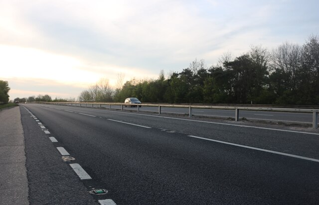
Newmarket Road at the Kentford Interchange You can't see the interchange as it goes under the road.
Newmarket Road at the Kentford Interchange Credit: David Howard

The Four Acre Belt is a dense woodland located in Suffolk, England. Covering an area of approximately four acres, this forested area is known for its natural beauty and tranquil atmosphere. Nestled within the rolling countryside, the Four Acre Belt is a haven for nature enthusiasts and those seeking an escape from the hustle and bustle of urban life.

The woodland features a diverse range of tree species, including oak, beech, and birch, which create a rich and varied ecosystem. This vibrant habitat supports a wide array of wildlife, such as deer, foxes, and numerous species of birds.

Visitors to the Four Acre Belt can enjoy a range of activities, including walking, hiking, and birdwatching. The forest is crisscrossed by a network of well-maintained trails, providing opportunities for leisurely strolls or more challenging hikes. Along the paths, visitors can marvel at the abundance of flora and fauna that call this woodland home.

The peaceful ambiance of the Four Acre Belt makes it an ideal spot for relaxation and meditation. The gentle rustling of leaves and the melodic songs of birds create a soothing soundtrack, allowing visitors to unwind and reconnect with nature.

In addition to its natural beauty, the Four Acre Belt also holds historical significance. The forest has been part of the Suffolk landscape for centuries, and remnants of ancient structures and artifacts have been discovered within its boundaries.

Overall, the Four Acre Belt in Suffolk offers a delightful combination of natural splendor and historical interest. Whether one seeks a leisurely stroll or a serene retreat, this woodland provides a captivating experience for all who venture into its enchanting embrace.

If you have any feedback on the listing, please let us know in the comments section below.

Four Acre Belt Images

Images are sourced within 2km of 52.274255/0.54795111 or Grid Reference TL7367. Thanks to Geograph Open Source API. All images are credited.

Newmarket Road at the Kentford Interchange You can't see the interchange as it goes under the road.
Newmarket Road at the Kentford Interchange
You can't see the interchange as it goes under the road.
Newmarket Road, Kentford
Stubble field near A14
Minor road away from A14
Footpath to Robin's Hall
Footpath to Heath Farm
Sugar beet field near A14
East end of Mount Plantation, from the railway
Mount Plantation from the railway On the left, a lorry makes its way along the Icknield Way.
Mount Plantation from the railway
On the left, a lorry makes its way along the Icknield Way.
Higham village sign Suffolk has 400 villages and towns with village or town signs, give or take one or two. 
The tradition of village signs is believed to have started in Norfolk early in the 20th century when Edward VII suggested that village signs would aid motorists and give a feature of interest on the Sandringham Estate.
Many of the signs  were made by Harry Carter, an art and woodwork master at Hamond’s Grammar School, in Swaffham.
Many have now been replaced with fibreglass or modern plastics. The story behind the sign is given as accurately as possible.
Higham village sign
Suffolk has 400 villages and towns with village or town signs, give or take one or two. The tradition of village signs is believed to have started in Norfolk early in the 20th century when Edward VII suggested that village signs would aid motorists and give a feature of interest on the Sandringham Estate. Many of the signs were made by Harry Carter, an art and woodwork master at Hamond’s Grammar School, in Swaffham. Many have now been replaced with fibreglass or modern plastics. The story behind the sign is given as accurately as possible.
Mount Plantation
Mount Plantation
A14 seen from the railway line
A14 The A14 is a major road running 127 miles from Felixstowe to the Catthorpe Interchange, the junction of the M1 and M6 motorways near Rugby. The road connects East Anglia with the West Midlands and The North.
Wikipedia: <span class="nowrap"><a title="http://en.wikipedia.org/wiki/A14_road_(England)" rel="nofollow ugc noopener" href="http://en.wikipedia.org/wiki/A14_road_(England)">Link</a><img style="margin-left:2px;" alt="External link" title="External link - shift click to open in new window" src="https://s1.geograph.org.uk/img/external.png" width="10" height="10"/></span>
A14
The A14 is a major road running 127 miles from Felixstowe to the Catthorpe Interchange, the junction of the M1 and M6 motorways near Rugby. The road connects East Anglia with the West Midlands and The North. Wikipedia: LinkExternal link
Potato field By the minor road to Tuddenham Corner.
Potato field
By the minor road to Tuddenham Corner.
Potato field Furrowed field ready for potatoes.
Potato field
Furrowed field ready for potatoes.
Tuddenham Corner Desnage Lodge Cottages.
Tuddenham Corner
Desnage Lodge Cottages.
Tuddenham Corner
Tuddenham Corner
Hill Farm 40m above sea level, the highest point is about 50m (this is East Anglia, everything is relative). On Higham Road.
Hill Farm
40m above sea level, the highest point is about 50m (this is East Anglia, everything is relative). On Higham Road.
Show me another place!

Four Acre Belt is located at Grid Ref: TL7367 (Lat: 52.274255, Lng: 0.54795111)

Administrative County: Suffolk

District: West Suffolk

Police Authority: Suffolk

What 3 Words

///strain.curiosity.spaceship. Near Mildenhall, Suffolk

Related Wikis

A14 road (England)

The A14 is a major trunk road in England, running 127 miles (204 km) from Catthorpe Interchange, a major intersection at the southern end of the M6 and...

Higham railway station (Suffolk)

Higham railway station was a station serving Higham in the English county of Suffolk. It was opened by the Great Eastern Railway in 1854 when the railway...

Higham, West Suffolk

Higham is a village and civil parish in the West Suffolk district of Suffolk in the east of England. Located midway between Bury St Edmunds and Newmarket...

Kentford

Kentford is a village and civil parish located in the West Suffolk district of Suffolk in eastern England. Situated on the banks of the River Kennet, the...

Have you been to Four Acre Belt?

Leave your review of Four Acre Belt below (or comments, questions and feedback).