Elderbush Belt

Wood, Forest in Suffolk West Suffolk

England

Elderbush Belt

Fields south of Lakenheath: aerial 2022
Fields south of Lakenheath: aerial 2022 Credit: Simon Tomson

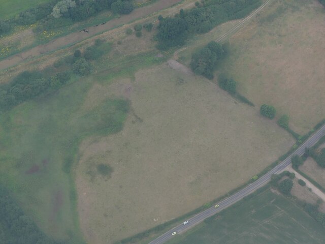
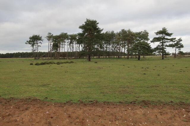
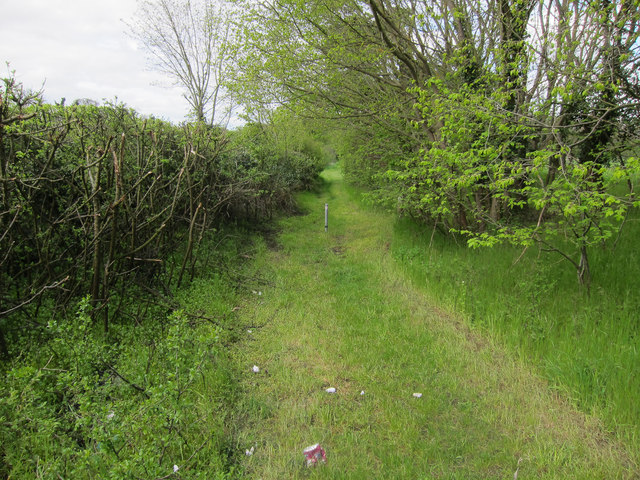
Elderbush Belt is a small woodland area located in Suffolk, England. It is situated in the eastern part of the county, near the town of Woodbridge. Covering an area of approximately 200 acres, Elderbush Belt is known for its dense forest and diverse range of plant and animal species.

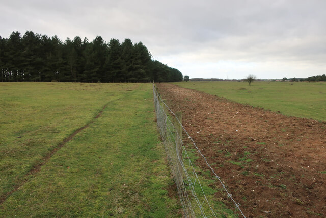
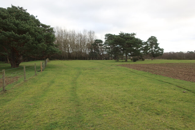
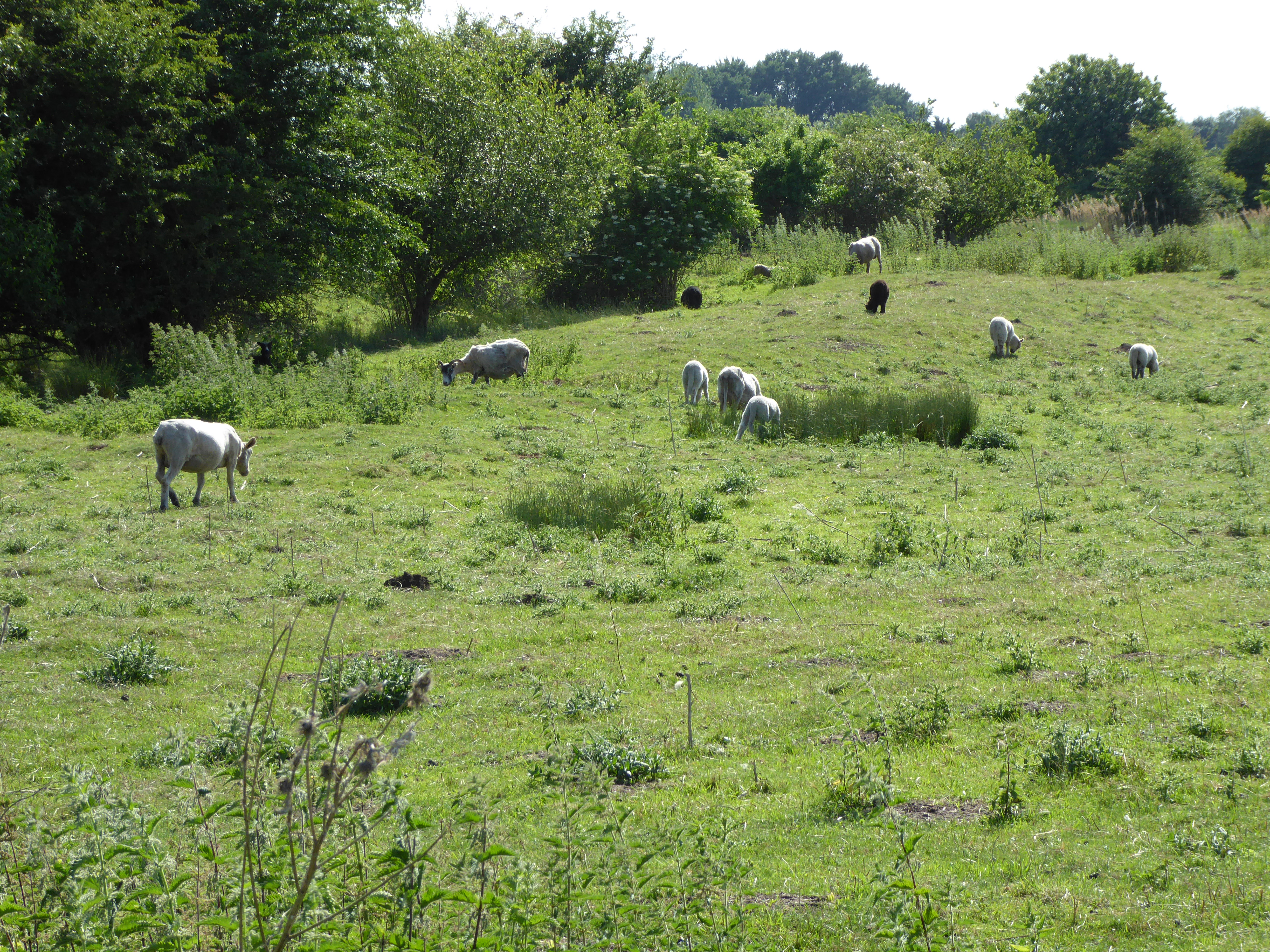
The woodland is predominantly made up of elder trees, hence its name, but it also features a variety of other tree species such as oak, beech, and ash. The thick vegetation provides a home to numerous wildlife species, including birds, mammals, and insects. Visitors to Elderbush Belt can expect to see a variety of bird species, including woodpeckers, tits, and finches, as well as small mammals like squirrels and rabbits.

The woodland is crisscrossed with a network of walking trails, allowing visitors to explore its natural beauty. These trails range from easy strolls to more challenging hikes, catering to all levels of fitness and experience. Along the paths, visitors can enjoy the sights and sounds of the forest, as well as take in the fresh air and tranquility that the area offers.

Elderbush Belt is a popular destination for nature enthusiasts, birdwatchers, and those seeking a peaceful escape from the hustle and bustle of everyday life. It provides a unique opportunity to immerse oneself in the natural beauty of Suffolk's woodlands and experience the serenity of the forest.

If you have any feedback on the listing, please let us know in the comments section below.

Elderbush Belt Images

Images are sourced within 2km of 52.391993/0.55045203 or Grid Reference TL7380. Thanks to Geograph Open Source API. All images are credited.

Fields south of Lakenheath: aerial 2022
R.A.F. Lakenheath: aerial 2022 (1) ...where the Air Traffic Controller always calls me Ma'am"!
R.A.F. Lakenheath: aerial 2022 (1)
...where the Air Traffic Controller always calls me Ma'am"!
R.A.F. Lakenheath: aerial 2022 (2) ...where the Air Traffic Controller always calls me Ma'am"!
R.A.F. Lakenheath: aerial 2022 (2)
...where the Air Traffic Controller always calls me Ma'am"!
Lakenheath Warren The area is open access land, but only between November and February, <a href="https://www.geograph.org.uk/photo/7383126">TL7779 : Open access sign</a>
Lakenheath Warren
The area is open access land, but only between November and February, TL7779 : Open access sign
Bridleway by Lakenheath Warren
Bridleway by Lakenheath Warren With stripped ground to as part of management of the area for wildlife and rare plants.
Bridleway by Lakenheath Warren
With stripped ground to as part of management of the area for wildlife and rare plants.
A1065 past Lakenheath Airfield The high fence is not to protect the base, rather to protect vehicles from errant balls from a golf driving range.
A1065 past Lakenheath Airfield
The high fence is not to protect the base, rather to protect vehicles from errant balls from a golf driving range.
Common Lane Bridleway to the Cut-off Channel.
Common Lane
Bridleway to the Cut-off Channel.
B1112 to Lakenheath Between Lakenheath Airfield and Lakenheath village.
B1112 to Lakenheath
Between Lakenheath Airfield and Lakenheath village.
Common Lane Bridleway to the Cut-off Channel, through some damp woodland.
Common Lane
Bridleway to the Cut-off Channel, through some damp woodland.
Footbridge over the Cut-off Channel
Footpath along Cut-off Channel The Cut-off channel is a drainage channel around the edge of the Fens.
Footpath along Cut-off Channel
The Cut-off channel is a drainage channel around the edge of the Fens.
Footpath along Cut-off Channel The Cut-off channel is a drainage channel around the edge of the Fens.
Footpath along Cut-off Channel
The Cut-off channel is a drainage channel around the edge of the Fens.
Cut-off Channel From the footbridge.
Cut-off Channel
From the footbridge.
Bridleway near Cut-off Channel
High Fen Grassland by the Cut-off Channel, close to the edge of the Fens.
High Fen
Grassland by the Cut-off Channel, close to the edge of the Fens.
Eriswell Hall Originally a 15th century manor house but with many later modifications and additions. See <span class="nowrap"><a title="http://www.britishlistedbuildings.co.uk/en-275830-eriswell-hall-eriswell-suffolk" rel="nofollow ugc noopener" href="http://www.britishlistedbuildings.co.uk/en-275830-eriswell-hall-eriswell-suffolk">Link</a><img style="margin-left:2px;" alt="External link" title="External link - shift click to open in new window" src="https://s1.geograph.org.uk/img/external.png" width="10" height="10"/></span>
Eriswell Hall
Originally a 15th century manor house but with many later modifications and additions. See LinkExternal link
Runway lights and control tower at Lakenheath air base The lights along the runway flash and pulse-unlike civilian runway lights.
Runway lights and control tower at Lakenheath air base
The lights along the runway flash and pulse-unlike civilian runway lights.
Show me another place!

Elderbush Belt is located at Grid Ref: TL7380 (Lat: 52.391993, Lng: 0.55045203)

Administrative County: Suffolk

District: West Suffolk

Police Authority: Suffolk

What 3 Words

///flashback.loudness.wasps. Near Lakenheath, Suffolk

Nearby Locations

Elderbush Belt

Related Wikis

Eriswell Low Warren

Eriswell Low Warren is a 7.4-hectare (18-acre) biological Site of Special Scientific Interest north-east of Eriswell in Suffolk. It is a Nature Conservation...

Lordswell Field

Lordswell Field or Lord's Well Field is a 3.2-hectare (7.9-acre) biological Site of Special Scientific Interest in Eriswell in Suffolk. It is a Nature...

RAF Lakenheath

Royal Air Force Lakenheath or RAF Lakenheath (IATA: LKZ, ICAO: EGUL) is a Royal Air Force station near the village of Lakenheath in Suffolk, England, UK...

RAF Lakenheath SSSI

RAF Lakenheath is a 111 hectare biological Site of Special Scientific Interest covering parts of RAF Lakenheath Royal Air Force base, east of Lakenheath...

Maidscross Hill

Maidscross Hill is a 44.8-hectare (111-acre) biological Site of Special Scientific Interest on the eastern outskirts of Lakenheath in Suffolk. It is a...

Foxhole Heath

Foxhole Heath is an 85.2-hectare (211-acre) biological Site of Special Scientific Interest east of Eriswell in Suffolk. It is a Nature Conservation Review...

Lakenheath Warren

Lakenheath Warren is a 588.3-hectare (1,454-acre) biological Site of Special Scientific Interest south-east of Lakenheath in Suffolk, England. It is a...

Wilde Street Meadow

Wilde Street Meadow is an 11.6-hectare (29-acre) biological Site of Special Scientific Interest between Lakenheath and Mildenhall in Suffolk, England.This...

Nearby Amenities

Located within 500m of 52.391993,0.55045203
Traffic Signals
Lat/Long: 52.3949927/0.5518123
Barrier: block
Source: Bing;survey
Lat/Long: 52.3892671/0.5447362
Internet Cafe
USO Lakenheath
Addr City: Brandon
Addr Housenumber: 998
Addr Postcode: IP27 9PN
Addr Street: Brandon Road
Internet Access: wlan
Internet Access Fee: no
Internet Access Ssid: USO Public
Operator: United Service Organizations Inc.
Operator Type: private_non_profit
Website: https://www.uso.org
Lat/Long: 52.3906273/0.5455174
Camera Mount: pole
Camera Type: dome
Man Made: surveillance
Surveillance: outdoor
Surveillance Type: camera
Surveillance Zone: area
Lat/Long: 52.395583/0.5514752
'Bridleway' sign
Information: guidepost
Tourism: information
Lat/Long: 52.3951926/0.5524876
The data included in this document is from www.openstreetmap.org. The data is made available under ODbL.

Have you been to Elderbush Belt?

Leave your review of Elderbush Belt below (or comments, questions and feedback).