Dalehole Plantation

Wood, Forest in Suffolk West Suffolk

England

Dalehole Plantation

The A1065 heading north approaching Brandon Road turning for Mildenhall
The A1065 heading north approaching Brandon Road turning for Mildenhall Credit: Roy Hughes

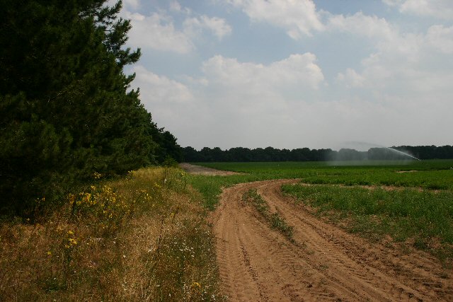
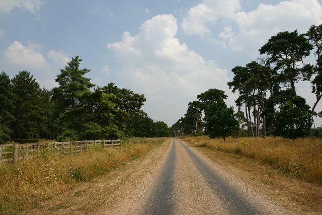
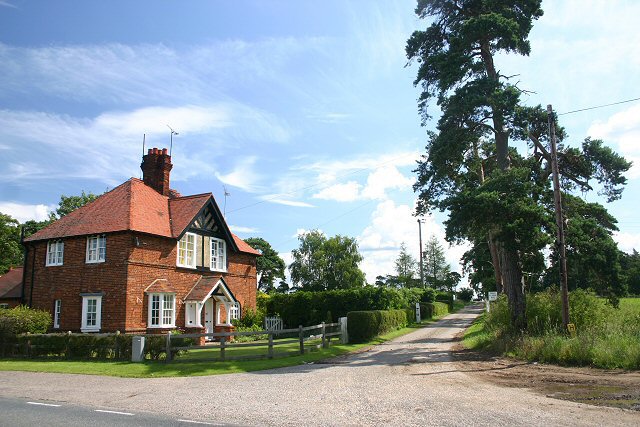
Dalehole Plantation is a wooded area located in Suffolk, England. The plantation covers a vast area of land, with dense forests and a variety of tree species including oak, birch, and pine. The landscape is characterized by rolling hills and winding paths, making it a popular destination for hikers and nature enthusiasts.

The plantation is home to a diverse range of wildlife, including deer, foxes, and a variety of bird species. The dense foliage provides ample cover for these animals, creating a thriving ecosystem within the plantation.

Visitors to Dalehole Plantation can enjoy peaceful walks through the forest, taking in the sights and sounds of nature. The plantation is also a popular spot for picnics and outdoor activities, with designated areas for visitors to relax and enjoy the surroundings.

Overall, Dalehole Plantation offers a tranquil escape from the hustle and bustle of everyday life, allowing visitors to reconnect with nature and appreciate the beauty of the Suffolk countryside.

If you have any feedback on the listing, please let us know in the comments section below.

Dalehole Plantation Images

Images are sourced within 2km of 52.365057/0.53849963 or Grid Reference TL7277. Thanks to Geograph Open Source API. All images are credited.

The A1065 heading north approaching Brandon Road turning for Mildenhall
The A1065 heading north approaching the B1112 crossroads
Patterned ground, Lakenheath Road, Mildenhall: aerial 2022 (1)
Patterned ground, Lakenheath Road, Mildenhall: aerial 2022 (2)
B1112 by Foxhole Heath
Bridleway to St Helena Farm On the eastern fringe of Mildenhall, leading north from Brandon Road.
Bridleway to St Helena Farm
On the eastern fringe of Mildenhall, leading north from Brandon Road.
Entrance to Mildenhall Woods A small car park with space for four vehicles, and an information board, at the entrance to Mildenhall Woods.
Entrance to Mildenhall Woods
A small car park with space for four vehicles, and an information board, at the entrance to Mildenhall Woods.
Field entrance near Chamberlain's Buildings Farm Looking east from the B1112.
Field entrance near Chamberlain's Buildings Farm
Looking east from the B1112.
B1112 at Foxhole Heath The road snakes across typical Breckland country.
B1112 at Foxhole Heath
The road snakes across typical Breckland country.
Private track to Rakeheath Farm This track leads eastwards across open heathland towards Rakeheath and Rakebottom Farms.
Private track to Rakeheath Farm
This track leads eastwards across open heathland towards Rakeheath and Rakebottom Farms.
Eriswell Church Unusual cone-shaped yews line the churchyard at the rear of St Lawrence Church.
Eriswell Church
Unusual cone-shaped yews line the churchyard at the rear of St Lawrence Church.
Footpath to Eriswell The village of Eriswell is just over the crest of this rise.
Footpath to Eriswell
The village of Eriswell is just over the crest of this rise.
Cut-off Channel The old maps call this Eriswell Lode, which is more evocative than 'Cut-off Channel' as shown on modern maps.  Looking south from the bridge carrying the road from RAF Lakenheath to Holywell Row.
Cut-off Channel
The old maps call this Eriswell Lode, which is more evocative than 'Cut-off Channel' as shown on modern maps. Looking south from the bridge carrying the road from RAF Lakenheath to Holywell Row.
Eldon Lane, Holywell Row As well as serving a number of houses, this lane is also a byway to Eriswell.
Eldon Lane, Holywell Row
As well as serving a number of houses, this lane is also a byway to Eriswell.
College Heath, Mildenhall Track leading east from A1101, north of Mildenhall.
College Heath, Mildenhall
Track leading east from A1101, north of Mildenhall.
Track to Codson Hill This track leads eastwards from the A1065, north of Mildenhall.
Track to Codson Hill
This track leads eastwards from the A1065, north of Mildenhall.
Uncultivated field near Mildenhall This field lies to the west of the A1065, two kilometres north of Mildenhall.
Uncultivated field near Mildenhall
This field lies to the west of the A1065, two kilometres north of Mildenhall.
Track to High Lodge This private track leads eastwards from the A1065 to High Lodge on the Elveden Estate.
Track to High Lodge
This private track leads eastwards from the A1065 to High Lodge on the Elveden Estate.
Show me another place!

Dalehole Plantation is located at Grid Ref: TL7277 (Lat: 52.365057, Lng: 0.53849963)

Administrative County: Suffolk

District: West Suffolk

Police Authority: Suffolk

What 3 Words

///spent.catchers.trader. Near Mildenhall, Suffolk

Nearby Locations

Dalehole Plantation

Related Wikis

Eriswell

Eriswell is a village and civil parish of West Suffolk in the English county of Suffolk. About forty scattered archaeological finds have been made here...

Foxhole Heath

Foxhole Heath is an 85.2-hectare (211-acre) biological Site of Special Scientific Interest east of Eriswell in Suffolk. It is a Nature Conservation Review...

Eriswell Low Warren

Eriswell Low Warren is a 7.4-hectare (18-acre) biological Site of Special Scientific Interest north-east of Eriswell in Suffolk. It is a Nature Conservation...

How Hill Track

How Hill Track is a 3.1-hectare (7.7-acre) biological Site of Special Scientific Interest east of Mildenhall in Suffolk. It is in the Breckland Special...

Nearby Amenities

Located within 500m of 52.365057,0.53849963
Fixme: incomplete
Lat/Long: 52.365482/0.5339848
Fixme: incomplete
Lat/Long: 52.3655967/0.5332624
Fixme: incomplete
Lat/Long: 52.3657506/0.5337434
Power: pole
Lat/Long: 52.3664254/0.5444829
Power: pole
Lat/Long: 52.3679754/0.5420851
Power: pole
Lat/Long: 52.3656622/0.5457865
Power: pole
Lat/Long: 52.3688232/0.5409424
Fixme: incomplete
Lat/Long: 52.3651429/0.5338212
Note: I couldn't see this from the road
Lat/Long: 52.3640136/0.5394843
The data included in this document is from www.openstreetmap.org. The data is made available under ODbL.

Have you been to Dalehole Plantation?

Leave your review of Dalehole Plantation below (or comments, questions and feedback).