Cobbler's Grove
Wood, Forest in Suffolk West Suffolk
England
Cobbler's Grove

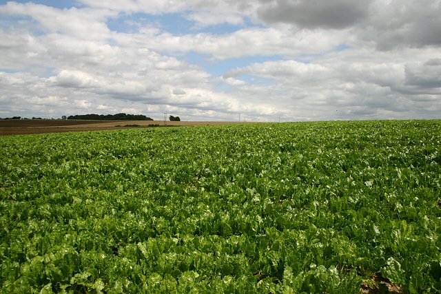
Cobbler's Grove, Suffolk, is a picturesque woodland located in the eastern region of England. Nestled amidst the rolling hills and serene landscapes of Suffolk, this enchanting forest is a haven for nature lovers and outdoor enthusiasts alike.
Covering an expansive area of approximately 500 acres, Cobbler's Grove is home to a diverse range of plant and animal species, making it an important ecological site in the region. The forest predominantly consists of native deciduous trees, such as oak, birch, and beech, which create a vibrant and ever-changing canopy throughout the seasons.
The forest floor of Cobbler's Grove is adorned with a rich tapestry of wildflowers, ferns, and mosses, adding to its natural charm. A network of well-maintained trails weaves its way through the forest, providing visitors with the opportunity to explore and immerse themselves in the beauty of this woodland paradise.
The grove is not only known for its scenic beauty but also for its historical significance. The area has been inhabited for centuries, and remnants of ancient settlements, including burial mounds and earthworks, can still be found within the forest. These archaeological sites offer a glimpse into the region's past and attract history enthusiasts from far and wide.
Cobbler's Grove is a popular destination for outdoor activities such as hiking, bird-watching, and photography. The forest is home to a wide array of bird species, including woodpeckers, owls, and various songbirds, making it a haven for bird-watchers. Additionally, the tranquil atmosphere and stunning landscapes make it a perfect spot for capturing captivating photographs.
Overall, Cobbler's Grove, Suffolk, is a magical woodland retreat that offers a blend of natural beauty, historical significance, and recreational opportunities for visitors to enjoy.
If you have any feedback on the listing, please let us know in the comments section below.
Cobbler's Grove Images
Images are sourced within 2km of 52.081197/0.51340891 or Grid Reference TL7245. Thanks to Geograph Open Source API. All images are credited.


Cobbler's Grove is located at Grid Ref: TL7245 (Lat: 52.081197, Lng: 0.51340891)
Administrative County: Suffolk
District: West Suffolk
Police Authority: Suffolk
What 3 Words
///bolsters.touched.passion. Near Kedington, Suffolk
Nearby Locations
Related Wikis

Boyton End, Suffolk
Boyton End is a hamlet in Suffolk, England. Boyton was recorded in the Domesday Book as Alia Boituna. == References ==

Cotton Hall
Cotton Hall is a Grade II listed stately home in the village of Kedington, Suffolk, England. It is located on the banks of the River Stour and is one of...

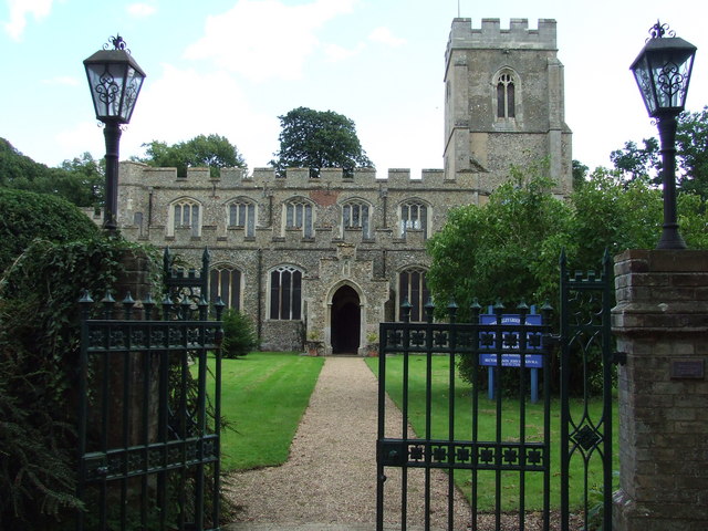
Kedington
Kedington is a village and civil parish in the West Suffolk district of Suffolk in eastern England, located between the towns of Clare and Haverhill in...
Stour Brook
Stour Brook is a river that starts north west of the town of Haverhill, Suffolk just over the Cambridgeshire border in the parish of West Wickham. After...
Calford Green
Calford Green is a small hamlet situated 0.5 miles south of Kedington and two miles east of Haverhill in south-west Suffolk, United Kingdom. == External... ==

Wixoe
Wixoe is a village and civil parish in the West Suffolk district of Suffolk in eastern England. Located on the northern bank of the River Stour, two miles...
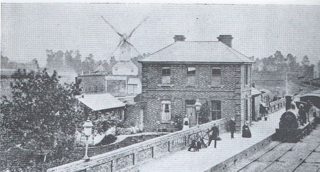
Stoke railway station (Suffolk)
Stoke railway station was a station that served the village of Stoke-by-Clare in Suffolk, England. It opened in 1865 on the Stour Valley Railway between...
Stoke-by-Clare
Stoke-by-Clare is a small village and civil parish in Suffolk located in the valley of the River Stour, about two miles west of Clare.In 1124 Richard...
Nearby Amenities
Located within 500m of 52.081197,0.51340891Have you been to Cobbler's Grove?
Leave your review of Cobbler's Grove below (or comments, questions and feedback).