Sandhole Wood

Wood, Forest in Kent Tunbridge Wells

England

Sandhole Wood

The Royal Oak, Flimwell Pub beside the busy A21.
The Royal Oak, Flimwell Credit: Oast House Archive

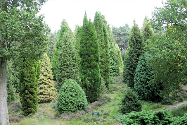
Sandhole Wood is a picturesque woodland located in the county of Kent, England. Situated near the village of Sandhole, the wood covers an area of approximately 100 acres. It is a popular destination for nature enthusiasts, walkers, and families looking to enjoy the outdoors.

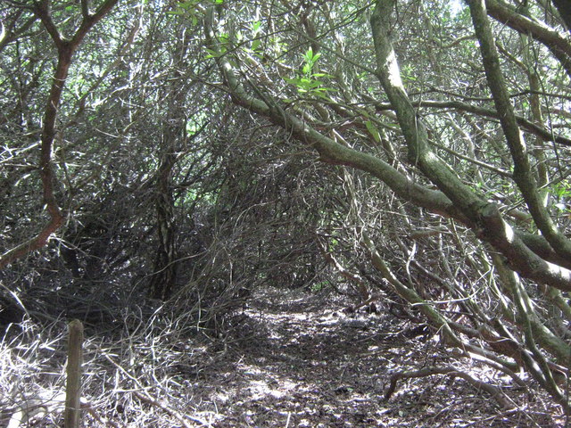
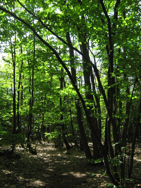
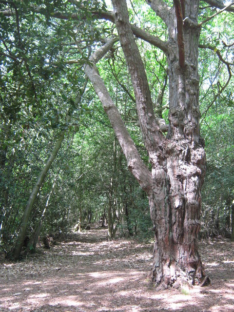
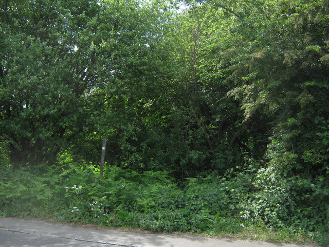
The wood is predominantly made up of native broadleaf trees such as oak, beech, and birch, creating a diverse and vibrant ecosystem. These trees provide a dense canopy, which offers shade during the summer months and a vibrant display of colors during the autumn season. The forest floor is covered in a rich carpet of wildflowers, ferns, and mosses, adding to the visual appeal of the woodland.

Sandhole Wood is home to a variety of wildlife, including mammals such as deer, foxes, and badgers. A wide range of bird species can also be spotted here, including woodpeckers, owls, and various songbirds. The wood provides an ideal habitat for these creatures due to its natural resources and secluded environment.

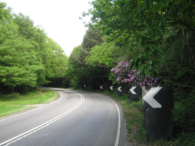
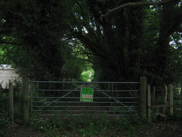
The wood offers several walking trails that wind through its serene landscape. These trails vary in difficulty, catering to both casual strollers and more experienced hikers. Along the way, visitors can enjoy the peaceful ambiance of the woodland while taking in the breathtaking views of the surrounding countryside.

Sandhole Wood is a cherished natural gem in Kent, providing a tranquil escape from the bustling city life. Whether it's for a leisurely walk, bird watching, or simply enjoying the beauty of nature, this wood offers something for everyone.

If you have any feedback on the listing, please let us know in the comments section below.

Sandhole Wood Images

Images are sourced within 2km of 51.056616/0.45672504 or Grid Reference TQ7231. Thanks to Geograph Open Source API. All images are credited.

The Royal Oak, Flimwell Pub beside the busy A21.
The Royal Oak, Flimwell
Pub beside the busy A21.
Flimwell crossroads Looking from A268 Hawkhurst Road onto a busy junction with the A21 (left and right) and High Street (ahead). It was proposed to bypass this junction to the East of here, including a by pass of Hurst Green, to improve the A21 to Hastings, however this was recently completely scrapped and numerous houses compulsory purchased for millions decades ago are now being sold.
Flimwell crossroads
Looking from A268 Hawkhurst Road onto a busy junction with the A21 (left and right) and High Street (ahead). It was proposed to bypass this junction to the East of here, including a by pass of Hurst Green, to improve the A21 to Hastings, however this was recently completely scrapped and numerous houses compulsory purchased for millions decades ago are now being sold.
Country Furniture Barns Ltd Furniture shop on Hawkhurst Road.
Country Furniture Barns Ltd
Furniture shop on Hawkhurst Road.
Coach Holidays As the name suggests the firm provides coach holidays to Europe.
Coach Holidays
As the name suggests the firm provides coach holidays to Europe.
Coach Holidays As the name suggests the firm provides coach holidays to Europe.
Coach Holidays
As the name suggests the firm provides coach holidays to Europe.
A21 at Flimwell The A21 is a 63 mile major trunk road running  from Lewisham in Greater London to Hastings, East Sussex. The road is broken up by the M25 motorway between junction 4 and 5.
Wikipedia <span class="nowrap"><a title="http://en.wikipedia.org/wiki/A21_road_(England)" rel="nofollow ugc noopener" href="http://en.wikipedia.org/wiki/A21_road_(England)">Link</a><img style="margin-left:2px;" alt="External link" title="External link - shift click to open in new window" src="https://s1.geograph.org.uk/img/external.png" width="10" height="10"/></span>
A21 at Flimwell
The A21 is a 63 mile major trunk road running from Lewisham in Greater London to Hastings, East Sussex. The road is broken up by the M25 motorway between junction 4 and 5. Wikipedia LinkExternal link
Houses by the A21 On London Road opposite <a href="https://www.geograph.org.uk/photo/2318995">TQ7131 : The Royal Oak, Flimwell</a>
Houses by the A21
On London Road opposite TQ7131 : The Royal Oak, Flimwell
Mick Gould Commercials Breakdown recovery and repair workshop for trucks. The company has a fleet or distinct American style red recovery trucks.
Mick Gould Commercials
Breakdown recovery and repair workshop for trucks. The company has a fleet or distinct American style red recovery trucks.
Lawson Cypress collection at bedgebury Pinetum The collection of conifers was started in the 1840's by the Beresford Hope family. It's now jointly managed by the Forestry Commission and Kew Gardens. Taxonomy of conifers is complex but Chamaecyparis lawsonia is the basic scientific name for this group, that will be followed by the individual cultivar or varietal name.
Lawson Cypress collection at bedgebury Pinetum
The collection of conifers was started in the 1840's by the Beresford Hope family. It's now jointly managed by the Forestry Commission and Kew Gardens. Taxonomy of conifers is complex but Chamaecyparis lawsonia is the basic scientific name for this group, that will be followed by the individual cultivar or varietal name.
Providence Chapel Converted chapel on the B2087 Flimwell High Street.
Providence Chapel
Converted chapel on the B2087 Flimwell High Street.
No. 6 and 5 Red Oast Cottages On the B2087 Flimwell High Street is three pairs of cottages. This is the third pair.
No. 6 and 5 Red Oast Cottages
On the B2087 Flimwell High Street is three pairs of cottages. This is the third pair.
A21 to Flimwell This road leads up from Hurst Green towards Lamberhurst.
It winds past Ringden Wood on the right.
A21 to Flimwell
This road leads up from Hurst Green towards Lamberhurst. It winds past Ringden Wood on the right.
Overgrown path to Hawkhurst Road This path leads up through Ringden Wood (through overgrown rhododendron shrubs) towards the road near Mount Pleasant Farm.
Overgrown path to Hawkhurst Road
This path leads up through Ringden Wood (through overgrown rhododendron shrubs) towards the road near Mount Pleasant Farm.
Track in Ringden Wood Leads parallel towards Hawkhurst Road.
Track in Ringden Wood
Leads parallel towards Hawkhurst Road.
Pine tree in Ringden Wood This mixed woodland is near the A21.
Pine tree in Ringden Wood
This mixed woodland is near the A21.
Footpath into Ringden Wood This path leads into a overgrown wood, heading towards the A21 road to Hurst Green.
Footpath into Ringden Wood
This path leads into a overgrown wood, heading towards the A21 road to Hurst Green.
Gate into Bedgebury Forest This track leads from the A268 Hawkhurst Road, into the Forestry Association managed forest. A footpath also leads through on this track towards the A21 London Road near Flimwell.
Gate into Bedgebury Forest
This track leads from the A268 Hawkhurst Road, into the Forestry Association managed forest. A footpath also leads through on this track towards the A21 London Road near Flimwell.
Show me another place!

Sandhole Wood is located at Grid Ref: TQ7231 (Lat: 51.056616, Lng: 0.45672504)

Administrative County: Kent

District: Tunbridge Wells

Police Authority: Kent

What 3 Words

///sometime.styled.mouths. Near Flimwell, East Sussex

Nearby Locations

Adams's Wood Sandhole Wood

Related Wikis

Flimwell

Flimwell is a village in the civil parish of Ticehurst, in the Rother district of East Sussex, England. It is located close to the border with Kent at...

St Augustine's Church, Flimwell

St Augustine's Church is the Anglican parish church of Flimwell, a village in the Rother district of East Sussex, England. It was consecrated in 1839 after...

Bedgebury Forest

Bedgebury Forest is a 10.5 square kilometres (2,600 acres) forest surrounding Bedgebury National Pinetum, near Flimwell in Kent. In contrast to the National...

Bedgebury National Pinetum

Bedgebury National Pinetum at Bedgebury, Kent, in the United Kingdom, is a recreational and conservational arboretum managed by Forestry England that was...

Nearby Amenities

Located within 500m of 51.056616,0.45672504
Post Box
Operator: Royal Mail
Operator Wikidata: Q638098
Post Box Type: lamp
Ref: TN5 320
Royal Cypher: EIIR
Royal Cypher Wikidata: Q33102113
Lat/Long: 51.0528925/0.4547701
Charging Station
Flimwell Supercharger
Access: customers
Addr City: Flimwell
Addr Country: GB
Addr Postcode: TN5 7FJ
Addr Street: Hawkhurst Road
Brand: Tesla Supercharger
Brand Wikidata: Q17089620
Capacity: 6
Fee: yes
Opening Hours: 24/7
Operator: Tesla, Inc.
Socket Tesla Supercharger Ccs: 6
Socket Tesla Supercharger Ccs Output: 250 kW
Website: https://www.tesla.com/findus/location/supercharger/flimwellsupercharger
Lat/Long: 51.0524625/0.4548262
Generator Method: photovoltaic
Generator Output Electricity: yes
Generator Source: solar
Generator Type: solar_photovoltaic_panel
Location: roof
Power: generator
Lat/Long: 51.0525047/0.4545392
Generator Method: photovoltaic
Generator Output Electricity: yes
Generator Source: solar
Generator Type: solar_photovoltaic_panel
Location: roof
Power: generator
Lat/Long: 51.052621/0.4546438
Generator Method: photovoltaic
Generator Output Electricity: yes
Generator Source: solar
Generator Type: solar_photovoltaic_panel
Location: roof
Power: generator
Lat/Long: 51.0525089/0.4551682
Generator Method: photovoltaic
Generator Output Electricity: yes
Generator Source: solar
Generator Type: solar_photovoltaic_panel
Location: roof
Power: generator
Lat/Long: 51.0522964/0.4547591
Generator Method: photovoltaic
Generator Output Electricity: yes
Generator Source: solar
Generator Type: solar_photovoltaic_panel
Location: roof
Power: generator
Lat/Long: 51.0521818/0.455773
Generator Method: photovoltaic
Generator Output Electricity: yes
Generator Source: solar
Generator Type: solar_photovoltaic_panel
Location: roof
Power: generator
Lat/Long: 51.0538021/0.4519871
The data included in this document is from www.openstreetmap.org. The data is made available under ODbL.

Have you been to Sandhole Wood?

Leave your review of Sandhole Wood below (or comments, questions and feedback).