Beechdown Wood
Wood, Forest in Sussex Rother
England
Beechdown Wood

Beechdown Wood is a picturesque woodland located in the county of Sussex, England. Covering an area of approximately 100 acres, it is a captivating and diverse forest that offers a tranquil escape for nature enthusiasts and outdoor lovers alike.
The wood is predominantly composed of beech trees, from which it derives its name. These majestic trees create a dense canopy, providing shade and shelter to a variety of flora and fauna. The forest floor is carpeted with bluebells in the spring, creating a breathtaking sight that attracts many visitors.
As one wanders through Beechdown Wood, they will encounter a rich array of wildlife. The forest is home to numerous bird species, including woodpeckers, owls, and warblers, which can be heard singing their melodious tunes. Squirrels, badgers, and foxes are also common inhabitants, adding to the woodland's natural charm.
There are several walking trails that wind through the wood, allowing visitors to explore its beauty at their own pace. These paths are well-maintained, making it accessible to all ages and fitness levels. Along the way, benches and picnic spots are strategically placed, providing opportunities for rest and reflection amidst the serene surroundings.
Beechdown Wood is not only a haven for wildlife and walkers, but it also serves as an important conservation area. Efforts have been made to preserve and protect the woodland, ensuring its longevity for future generations to enjoy. The management of the forest includes sustainable practices, such as selective tree felling and replanting, to maintain its ecological balance.
Overall, Beechdown Wood is a captivating forest that offers a peaceful retreat from the hustle and bustle of everyday life. Its natural beauty, diverse wildlife, and well-maintained trails make it a must-visit destination for nature lovers and those seeking a moment of solace in the heart of Sussex.
If you have any feedback on the listing, please let us know in the comments section below.
Beechdown Wood Images
Images are sourced within 2km of 50.916723/0.4382933 or Grid Reference TQ7115. Thanks to Geograph Open Source API. All images are credited.


Beechdown Wood is located at Grid Ref: TQ7115 (Lat: 50.916723, Lng: 0.4382933)
Administrative County: East Sussex
District: Rother
Police Authority: Sussex
What 3 Words
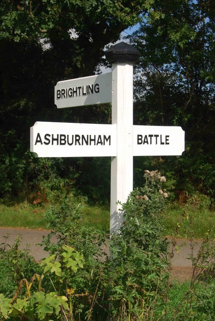
///comb.engineers.broadcast. Near Battle, East Sussex
Nearby Locations
Related Wikis
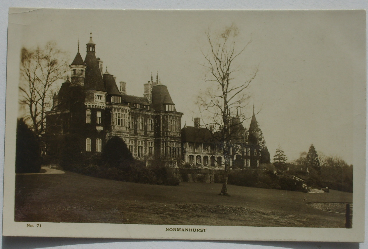
Normanhurst Court
Normanhurst Court was a large manor house in the village of Catsfield in East Sussex. == History == The building of the house was initiated by Thomas Brassey...

Battle of Mercredesburne
The Battle of Mercredesburne was one of three battles fought as part of the conquest of what became the Kingdom of Sussex in southern England. The battles...
Claverham Community College
Claverham Community College is a comprehensive secondary school/community college in Battle, East Sussex, England. It has sports facilities such as a climbing...

Penhurst
Penhurst is a village and civil parish, sharing a parish council with neighbouring Ashburnham, in the Rother district of East Sussex, England. It is located...

Catsfield
Catsfield is a village and civil parish in the Rother district of East Sussex, England. It is located six miles (9.7 km) north of Bexhill, and three miles...

Ashburnham Park
Ashburnham Park is a 109.9-hectare (272-acre) biological Site of Special Scientific Interest north-west of Hastings in East Sussex. It is a Nature Conservation...
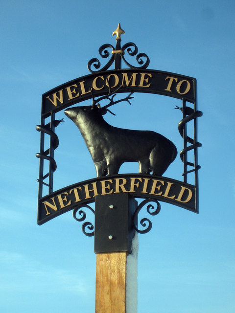
Netherfield, East Sussex
Netherfield is a village in the civil parish of Battle, in the Rother district, in the county of East Sussex, England.In the 1870-1872 Imperial Gazetteer...
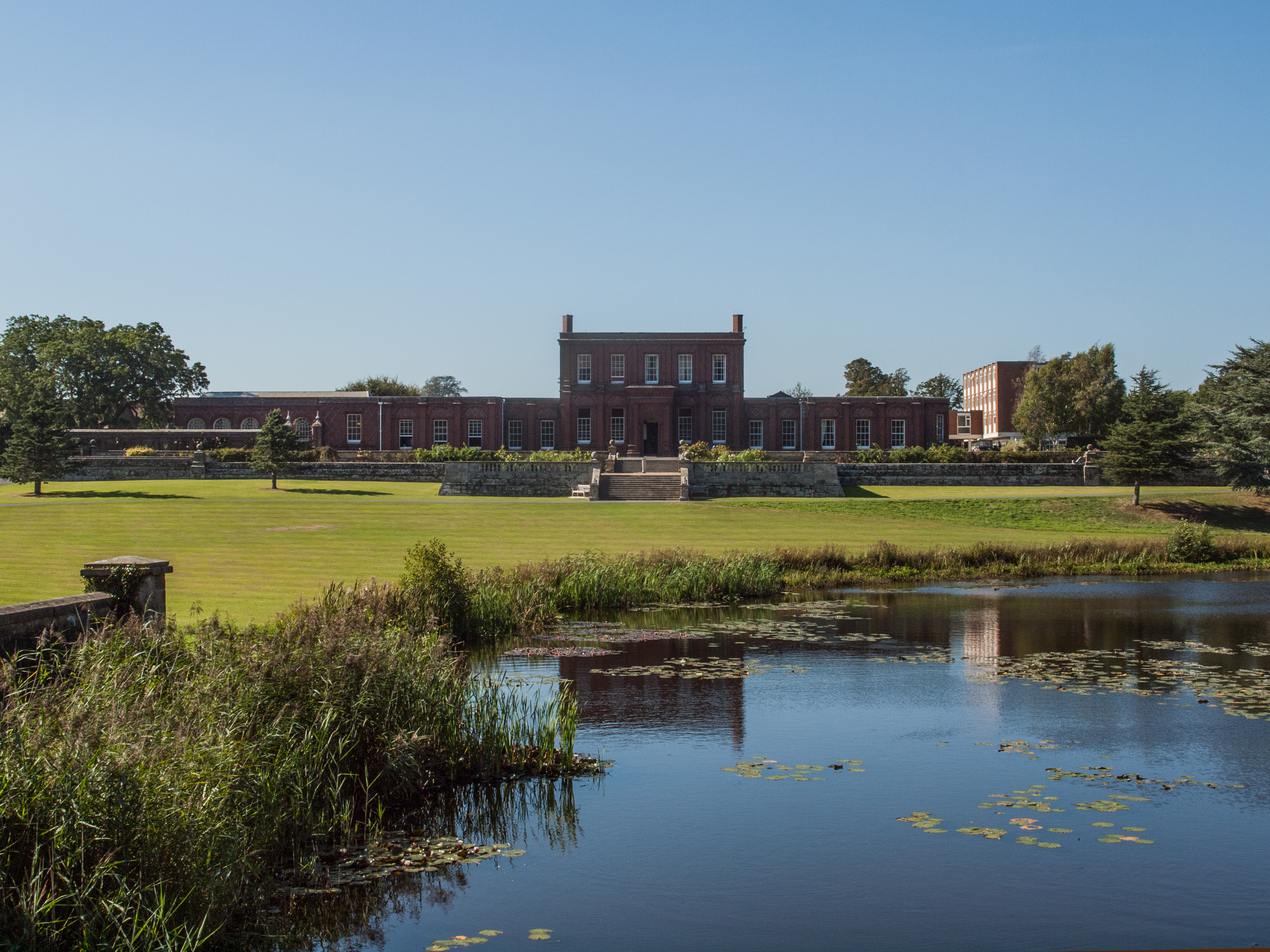
Ashburnham Place
Ashburnham Place is an English country house, now used as a Christian conference and prayer centre, five miles west of Battle, East Sussex. It was one...
Nearby Amenities
Located within 500m of 50.916723,0.4382933Have you been to Beechdown Wood?
Leave your review of Beechdown Wood below (or comments, questions and feedback).