Court Wood

Wood, Forest in Sussex Wealden

England

Court Wood

Compass Lane Looking towards Ninfield.
Compass Lane Credit: Robin Webster

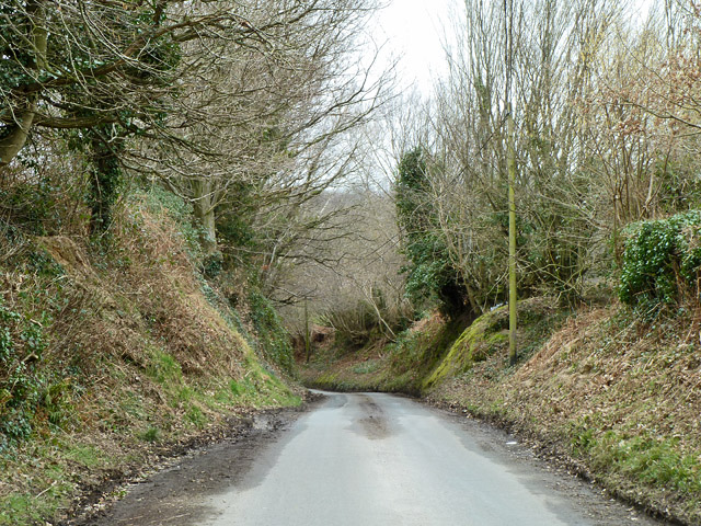
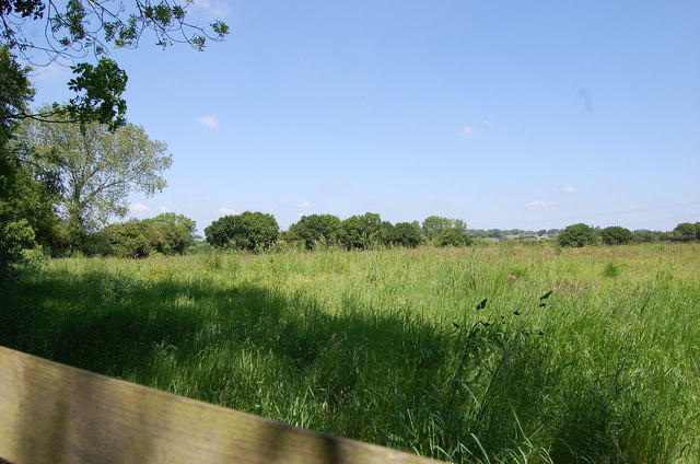
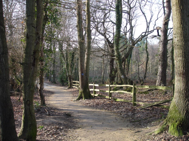
Located in Sussex, England, Court Wood is a picturesque woodland that boasts a rich history and abundant natural beauty. Covering an area of approximately 50 acres, this enchanting forest is situated in close proximity to the village of Forest Row. Court Wood is known for its diverse and well-preserved ecosystem, making it a popular destination for nature enthusiasts and hikers.

The woodland is home to a wide variety of indigenous trees, including oak, beech, and ash, which create a captivating and lush green canopy. The forest floor is adorned with a carpet of wildflowers, making it a haven for flora and fauna. Visitors can spot an array of wildlife, such as deer, foxes, and birds, while exploring the numerous trails that wind through the wood.

Court Wood has a rich historical background, with evidence of human activity dating back to the Iron Age. Archaeological discoveries have revealed ancient settlements and burial sites within the woodland, providing a glimpse into the area's past. The wood is also known for its connection to the poet and artist William Blake, who found inspiration in the serene surroundings and often visited the area for creative inspiration.

Today, Court Wood offers a tranquil escape from the bustling city life, providing locals and tourists alike with a serene and idyllic setting. Whether it's for a leisurely walk, a picnic, or simply to immerse oneself in the beauty of nature, Court Wood is a hidden gem that continues to captivate visitors with its natural charm and historical significance.

If you have any feedback on the listing, please let us know in the comments section below.

Court Wood Images

Images are sourced within 2km of 50.889581/0.43172784 or Grid Reference TQ7112. Thanks to Geograph Open Source API. All images are credited.

Compass Lane Looking towards Ninfield.
Compass Lane
Looking towards Ninfield.
Compass Lane meets Combe Lane A grass triangle at the junction.
Compass Lane meets Combe Lane
A grass triangle at the junction.
Timber Yard, Ashburnham The house is presumably Timber Yard Cottage. It is surrounded by quite a range of buildings, but with very little sign of timber now.
Timber Yard, Ashburnham
The house is presumably Timber Yard Cottage. It is surrounded by quite a range of buildings, but with very little sign of timber now.
Old Direction Sign - Signpost by Combe Lane, Ninfield Parish Black iron cap finial - 3 arms; East Sussex wood by the UC road, in parish of Ninfield (Wealden District), Coombe Lane, on grass triangle at junction with Coombe Hill.

Surveyed

Milestone Society National ID: SX_TQ6912
Old Direction Sign - Signpost by Combe Lane, Ninfield Parish
Black iron cap finial - 3 arms; East Sussex wood by the UC road, in parish of Ninfield (Wealden District), Coombe Lane, on grass triangle at junction with Coombe Hill. Surveyed Milestone Society National ID: SX_TQ6912
The Water Tower at Ninfield The water tower, located on the main road near Standard Hill, was built in 1964-65 by the Eastbourne Waterworks Company to supplement a local reservoir built in 1907. The tower also provides a base for various communications aerials and on the eastern side at least is somewhat disguised by tall evergreens.
The Water Tower at Ninfield
The water tower, located on the main road near Standard Hill, was built in 1964-65 by the Eastbourne Waterworks Company to supplement a local reservoir built in 1907. The tower also provides a base for various communications aerials and on the eastern side at least is somewhat disguised by tall evergreens.
Coombe Hill Cottage near Ninfield Coombe Hill Cottage is to be found in Compass Lane, a small back road that runs between Standard Hill at Ninfield and the A271 south of Ashburnham Place. The charming brick and tile-clad cottage is Grade II listed.
Coombe Hill Cottage near Ninfield
Coombe Hill Cottage is to be found in Compass Lane, a small back road that runs between Standard Hill at Ninfield and the A271 south of Ashburnham Place. The charming brick and tile-clad cottage is Grade II listed.
Entering Ninfield
Entering Ninfield
Millers Mews, Ninfield
Field near Russells Green
House on Combe Lane
House on Combe Lane
The Maltings, Standard Hill, Ninfield, East Sussex Possible internal kiln oast house.
The Maltings, Standard Hill, Ninfield, East Sussex
Possible internal kiln oast house.
The Maltings, Standard Hill, Ninfield, East Sussex Possible internal kiln oast house.
The Maltings, Standard Hill, Ninfield, East Sussex
Possible internal kiln oast house.
Valley near Ninfield in Winter Christmas Day 2009
Valley near Ninfield in Winter
Christmas Day 2009
Compass Lane
Compass Lane
St Laurence Parish Church Catsfield East Sussex St Laurence Church East Sussex is situated on a hill above the small village of Catsfield which is 3 miles south of Battle.
St Laurence Parish Church Catsfield East Sussex
St Laurence Church East Sussex is situated on a hill above the small village of Catsfield which is 3 miles south of Battle.
Church of St Mary The Virgin Ninfield East Sussex Ninfield Church is situated on a high position.On a clear day there are fine views across Pevensey marshes, the sea and on to the South Downs and Beachy Head.The earliest written record of the church in Ninfield is in the Domesday survey of 1086. It was restored in 1885.
Church of St Mary The Virgin Ninfield East Sussex
Ninfield Church is situated on a high position.On a clear day there are fine views across Pevensey marshes, the sea and on to the South Downs and Beachy Head.The earliest written record of the church in Ninfield is in the Domesday survey of 1086. It was restored in 1885.
Farmland Ninfield East Sussex On the Hooe to Ninfield Road looking south west across fields and farmland.The south downs in the far distance.
Farmland Ninfield East Sussex
On the Hooe to Ninfield Road looking south west across fields and farmland.The south downs in the far distance.
Fir Tree Catsfield East Sussex Fir Tree on junction of Potman's Lane and Spratts Lane from Lunsford Cross going north to Catsfield.
Fir Tree Catsfield East Sussex
Fir Tree on junction of Potman's Lane and Spratts Lane from Lunsford Cross going north to Catsfield.
Show me another place!

Court Wood is located at Grid Ref: TQ7112 (Lat: 50.889581, Lng: 0.43172784)

Administrative County: East Sussex

District: Wealden

Police Authority: Sussex

What 3 Words

///crusted.pops.acrobatic. Near Ninfield, East Sussex

Related Wikis

Ninfield

Ninfield is a village and civil parish in the Wealden District of East Sussex, England. The village is quite linear and centred 4 miles (6.4 km) north...

Catsfield

Catsfield is a village and civil parish in the Rother district of East Sussex, England. It is located six miles (9.7 km) north of Bexhill, and three miles...
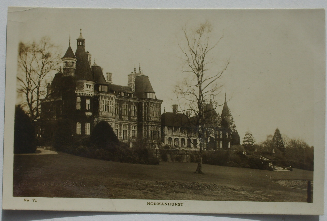
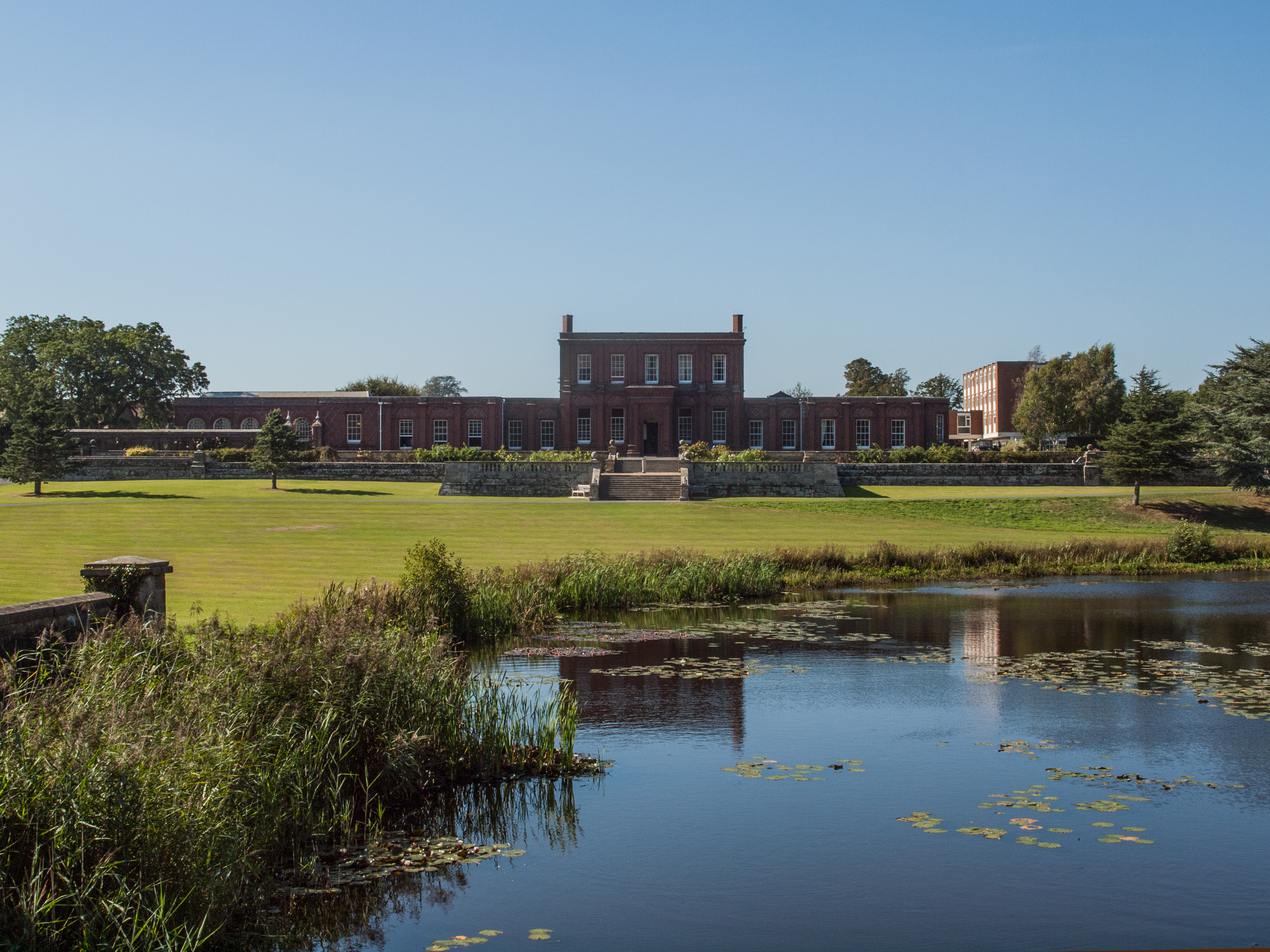
Normanhurst Court

Normanhurst Court was a large manor house in the village of Catsfield in East Sussex. == History == The building of the house was initiated by Thomas Brassey...

Ashburnham Park

Ashburnham Park is a 109.9-hectare (272-acre) biological Site of Special Scientific Interest north-west of Hastings in East Sussex. It is a Nature Conservation...

Bexhill and Battle (UK Parliament constituency)

Bexhill and Battle () is a constituency in East Sussex represented in the House of Commons of the UK Parliament since 2015 by Huw Merriman of the Conservative...

Ashburnham Place

Ashburnham Place is an English country house, now used as a Christian conference and prayer centre, five miles west of Battle, East Sussex. It was one...

Hooe Common

Hooe Common is a village in the Wealden district of East Sussex. == References ==

High Woods

High Woods is a 33.7-hectare (83-acre) biological Site of Special Scientific Interest on the northern outskirts of Bexhill-on-Sea in East Sussex. It is...

Nearby Amenities

Located within 500m of 50.889581,0.43172784
Power: tower
Lat/Long: 50.8920496/0.4324891
Power: tower
Lat/Long: 50.8905754/0.4349015
Location Transition: yes
Power: tower
Lat/Long: 50.8935224/0.4300089
Power: pole
Lat/Long: 50.8909523/0.4298481
Power: pole
Lat/Long: 50.8922333/0.4321254
Power: pole
Lat/Long: 50.8903686/0.4295665
Power: pole
Lat/Long: 50.8925429/0.4330132
Power: pole
Lat/Long: 50.8932197/0.4349766
Power: pole
Lat/Long: 50.8928711/0.4340056
Power: pole
Lat/Long: 50.8919996/0.4295316
Power: pole
Lat/Long: 50.8897612/0.4292768
Power: pole
Lat/Long: 50.8934766/0.430414
Power: tower
Lat/Long: 50.8887615/0.4378711
Power: pole
Lat/Long: 50.889115/0.4289685
Power: pole
Lat/Long: 50.8912281/0.4293143
Power: pole
Lat/Long: 50.8918846/0.4311114
Power: pole
Lat/Long: 50.892964/0.4297891
Power: pole
Lat/Long: 50.888621/0.4287324
Power: pole
Lat/Long: 50.8915413/0.4301218
Power: pole
Lat/Long: 50.8885719/0.4285876
Power: pole
Lat/Long: 50.8881658/0.429065
Power: pole
Lat/Long: 50.8895448/0.4288424
Power: pole
Lat/Long: 50.8870387/0.4306876
Power: pole
Lat/Long: 50.8876614/0.4294511
Power: pole
Lat/Long: 50.8903788/0.429089
Power: pole
Lat/Long: 50.8865277/0.431385
Power: pole
Lat/Long: 50.8876108/0.4299153
Power: pole
Lat/Long: 50.886279/0.4317445
Power: pole
Lat/Long: 50.8853821/0.4337212
Power: pole
Lat/Long: 50.885306/0.4336327
Power: pole
Lat/Long: 50.8861284/0.4314682
The data included in this document is from www.openstreetmap.org. The data is made available under ODbL.

Have you been to Court Wood?

Leave your review of Court Wood below (or comments, questions and feedback).