Centenary Wood

Wood, Forest in Essex Chelmsford

England

Centenary Wood

Roundabout on Chelmer Valley Road, Chelmsford
Roundabout on Chelmer Valley Road, Chelmsford Credit: David Howard

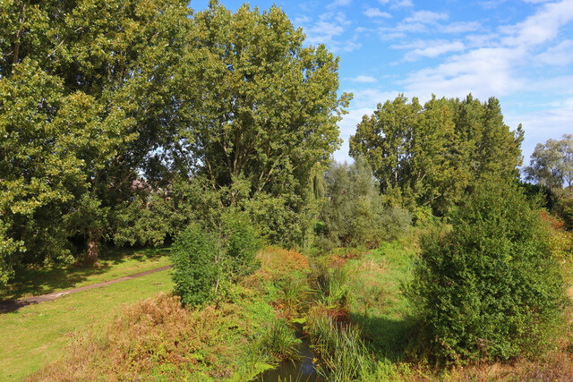
Centenary Wood, located in Essex, is a breathtakingly beautiful woodland area that covers an estimated area of approximately 100 acres. It is primarily known for its diverse range of trees and abundant wildlife, making it a popular destination for nature enthusiasts and hikers alike.

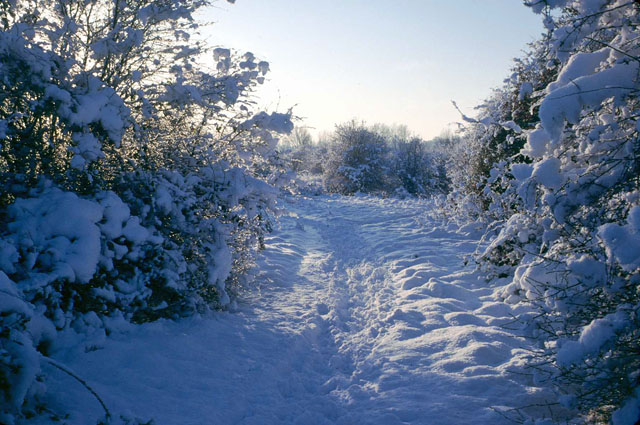
The wood is home to a wide variety of tree species, including oak, birch, beech, and maple, which create a stunning canopy of colors during the autumn season. The well-maintained footpaths wind their way through the wood, allowing visitors to explore its natural beauty at their own pace.

Centenary Wood is not only a haven for trees but also provides a habitat for a rich array of wildlife. It is common to spot various species of birds, such as woodpeckers, owls, and thrushes, as they make their nests among the branches. The wood is also home to small mammals like squirrels, rabbits, and foxes, which can often be seen darting through the undergrowth.

The wood has been carefully managed to preserve its natural charm and to encourage biodiversity. There are designated areas for wildflowers and grasses to flourish, attracting butterflies and other insects. Additionally, there are several ponds within the wood, providing a habitat for amphibians and creating a serene atmosphere.

Centenary Wood offers an escape from the hustle and bustle of everyday life, providing visitors with a tranquil and peaceful environment. Whether one chooses to take a leisurely stroll, engage in birdwatching, or simply sit and enjoy the serenity of nature, this woodland gem is a must-visit for anyone seeking solace in the great outdoors.

If you have any feedback on the listing, please let us know in the comments section below.

Centenary Wood Images

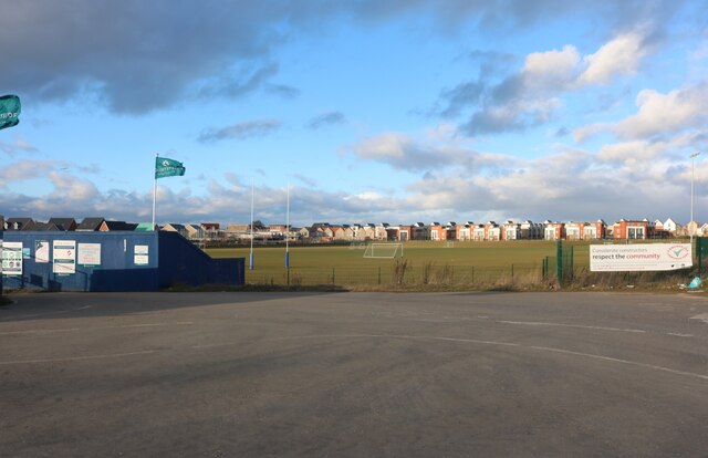
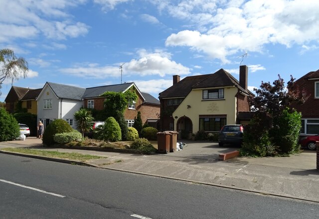
Images are sourced within 2km of 51.761974/0.4775629 or Grid Reference TL7109. Thanks to Geograph Open Source API. All images are credited.

Roundabout on Chelmer Valley Road, Chelmsford
Chelmer Valley Road, Chelmsford
Beaulieu Park School playing fields I hope the housing estate going up on the left isn't going to take over any of them.
Beaulieu Park School playing fields
I hope the housing estate going up on the left isn't going to take over any of them.
The new Beaulieu Park housing estate, Chelmsford By Beaulieu Park School.
The new Beaulieu Park housing estate, Chelmsford
By Beaulieu Park School.
White Hart Lane, Chelmsford
River Chelmer River Chelmer and Mill Lane.
River Chelmer
River Chelmer and Mill Lane.
Butler's Farm Trees near the B1008 near Broomfield.
Butler's Farm
Trees near the B1008 near Broomfield.
River Chelmer View from Valley Bridge, Chelmsford.
River Chelmer
View from Valley Bridge, Chelmsford.
Aubrey Close Residential road near Chelmsford.
Aubrey Close
Residential road near Chelmsford.
Pillbox near Broomfield Abandoned fortification near Broomfield.
Pillbox near Broomfield
Abandoned fortification near Broomfield.
Rainbow near Broomfield View towards Croxtons Mill.
Rainbow near Broomfield
View towards Croxtons Mill.
Houses on Patching Hall Lane, Chelmsford
Patching Hall Lane, Chelmsford
School Lane Towards Parsonage Green.
School Lane
Towards Parsonage Green.
Flats on School Lane
Broomfield Library On Main Road.
Broomfield Library
On Main Road.
Main Road (B1008), Broomfield
The Kings Arms, Broomfield On Main Road.
See <a href="https://www.geograph.org.uk/photo/7267108">TL7010 : Sign for the Kings Arms, Broomfield</a> for sign.
The Kings Arms, Broomfield
On Main Road. See TL7010 : Sign for the Kings Arms, Broomfield for sign.
Show me another place!

Centenary Wood is located at Grid Ref: TL7109 (Lat: 51.761974, Lng: 0.4775629)

Administrative County: Essex

District: Chelmsford

Police Authority: Essex

What 3 Words

///faces.allows.online. Near Chelmsford, Essex

Nearby Locations

Centenary Wood

Related Wikis

Broomfield, Essex

Broomfield is a village and residential suburb in the City of Chelmsford district, immediately north of the city itself. It is the site of a major Accident...

Chelmsford Rural District

Chelmsford Rural District was a local government district in Essex, England from 1894 to 1974. It surrounded, but did not include, the town of Chelmsford...

Newland Grove

Newland Grove is a 3.2-hectare (7.9-acre) nature reserve north of Chelmsford in Essex. It is managed by the Essex Wildlife Trust.The site is rough grassland...

Chelmer Valley High School

Chelmer Valley High School (CVHS) is an academy based on a large site on the outskirts of Chelmsford, Essex, England. It has specialisms in engineering...

St John Payne Catholic School

Saint John Payne Catholic School is a Roman Catholic voluntary aided school in Chelmsford, Essex. Established in 1959, the school serves the mid Essex...

Broomfield Hospital

Broomfield Hospital is an acute district general hospital in Chelmsford, Essex. It is managed by the Mid and South Essex NHS Foundation Trust. == History... ==

The Boswells School

The Boswells School is an age 11–18, secondary school and college, The Boswells College, with academy status situated in the city of Chelmsford, Essex...

Springfield, Essex

Springfield is a civil parish of the Borough of Chelmsford in Essex, England, which is now a north-eastern suburb of the city of Chelmsford. == History... ==

Nearby Amenities

Located within 500m of 51.761974,0.4775629
Bus Stop
New Road
Bench: no
Bin: no
Bus: yes
Departures Board: timetable
Naptan AtcoCode: 15000100303
Naptan Bearing: S
Naptan CommonName: New Road
Naptan Crossing: New Road
Naptan Indicator: Opp
Naptan Landmark: New Road
Naptan NaptanCode: esxdwapj
Naptan PlusbusZoneRef: CHLMSFD
Naptan Street: Main Road
Naptan Verified: no
Public Transport: platform
Shelter: no
Source: naptan_import
Tactile Paving: yes
Lat/Long: 51.7642041/0.4729669
Bus Stop
New Road
Bench: no
Bin: yes
Bus: yes
Departures Board: no
Naptan AtcoCode: 15000100304
Naptan Bearing: N
Naptan CommonName: New Road
Naptan Crossing: New Road
Naptan Indicator: Adj
Naptan Landmark: New Road
Naptan NaptanCode: esxdwgdj
Naptan PlusbusZoneRef: CHLMSFD
Naptan Street: Main Road
Naptan Verified: no
Public Transport: platform
Shelter: no
Source: naptan_import
Tactile Paving: yes
Lat/Long: 51.7645758/0.4726977
Bus Stop
Post Office Road
Bench: no
Bin: no
Bus: yes
Departures Board: no
Lit: yes
Naptan AtcoCode: 15003402201
Naptan Bearing: N
Naptan CommonName: Post Office
Naptan Crossing: Post Office Road
Naptan Indicator: Opp
Naptan Landmark: Post Office
Naptan NaptanCode: esxdwdmd
Naptan PlusbusZoneRef: CHLMSFD
Naptan Street: Main Road
Naptan Verified: no
Public Transport: platform
Shelter: no
Source: naptan_import
Tactile Paving: yes
Lat/Long: 51.7604786/0.4733616
Bus Stop
Post Office Road
Bench: yes
Bin: yes
Bus: yes
Departures Board: timetable
Lit: yes
Naptan AtcoCode: 15003402202
Naptan Bearing: S
Naptan CommonName: Post Office
Naptan Crossing: Post Office Road
Naptan Indicator: o/s
Naptan Landmark: Post Office
Naptan NaptanCode: esxdwdmg
Naptan PlusbusZoneRef: CHLMSFD
Naptan Street: Main Road
Naptan Verified: no
Public Transport: platform
Shelter: no
Source: naptan_import
Tactile Paving: yes
Lat/Long: 51.7598993/0.4736626
Bus Stop
Erick Avenue
Bench: no
Bin: yes
Bus: yes
Departures Board: timetable
Lit: yes
Naptan AtcoCode: 15003402203
Naptan Bearing: N
Naptan CommonName: Erick Avenue
Naptan Crossing: Erick Avenue
Naptan Indicator: Adj
Naptan Landmark: Erick Avenue
Naptan NaptanCode: esxdwdmj
Naptan PlusbusZoneRef: CHLMSFD
Naptan Street: Main Road
Naptan Verified: no
Public Transport: platform
Shelter: no
Source: naptan_import
Tactile Paving: yes
Lat/Long: 51.7587385/0.4736363
Bus Stop
The Angel
Bench: yes
Bin: yes
Bus: yes
Departures Board: realtime
Lit: yes
Naptan AtcoCode: 1500IM862
Naptan Bearing: S
Naptan CommonName: The Angel
Naptan Crossing: School Lane
Naptan Indicator: o/s
Naptan Landmark: The Angel
Naptan NaptanCode: esxdwgda
Naptan PlusbusZoneRef: CHLMSFD
Naptan Street: Main Road
Naptan Verified: no
Public Transport: platform
Shelter: yes
Source: naptan_import
Tactile Paving: yes
Lat/Long: 51.7618311/0.4733891
Bus Stop
The Angel
Bench: yes
Bin: no
Bus: yes
Departures Board: timetable
Lit: yes
Naptan AtcoCode: 1500IM862B
Naptan Bearing: N
Naptan CommonName: The Angel
Naptan Crossing: School Lane
Naptan Indicator: Opp
Naptan Landmark: The Angel
Naptan NaptanCode: esxdwgdg
Naptan PlusbusZoneRef: CHLMSFD
Naptan Street: Main Road
Naptan Verified: no
Public Transport: platform
Shelter: no
Source: naptan_import
Tactile Paving: yes
Lat/Long: 51.7628016/0.4730464
Turning Circle
Lat/Long: 51.7605606/0.4745052
Fast Food
Mozza Pizza & Kebab
Addr City: Chelmsford
Addr Housenumber: 163
Addr Postcode: CM1 7DJ
Addr Street: Main Road
Cuisine: pizza;kebab
Delivery: yes
Drive Through: no
Opening Hours: Mo-Su 17:00-23:00
Phone: +44 1245 444944
Takeaway: only
Website: https://mozzapizzaandkebab.co.uk/
Lat/Long: 51.7607536/0.4732294
Post Box
Brand: Royal Mail
Brand Wikidata: Q638098
Brand Wikipedia: en:Royal Mail
Drive Through: no
Operator: Royal Mail
Operator Wikidata: Q638098
Lat/Long: 51.7658554/0.4760417
Turning Circle
Lat/Long: 51.7614605/0.4746274
Broomfield Food Express
Phone: +44 7365 229328
Shop: convenience
Lat/Long: 51.7630746/0.4726694
Crossing
Crossing: traffic_signals
Crossing Island: no
Crossing Ref: puffin
Tactile Paving: yes
Lat/Long: 51.7623291/0.4732371
Crossing
Crossing: unmarked
Crossing Island: yes
Crossing Markings: no
Tactile Paving: no
Lat/Long: 51.7593993/0.4737263
Barrier: stile
Lat/Long: 51.7649641/0.4829945
Turning Circle
Lat/Long: 51.7603155/0.4721062
Fast Food
Suraya
Addr City: Chelmsford
Addr Housenumber: 159
Addr Postcode: CM1 7DJ
Addr Street: Main Road
Cuisine: indian
Delivery: yes
Drive Through: no
Opening Hours: Mo-Su, PH 17:00-23:00
Phone: +44 1245 442014;+44 1245 445227
Takeaway: only
Website: https://surayaindian.co.uk/
Lat/Long: 51.7606658/0.4732536
Fast Food
Panda Eats
Addr City: Chelmsford
Addr Housenumber: 161
Addr Postcode: CM1 7DJ
Addr Street: Main Road
Cuisine: fish_and_chips;chinese;asian
Drive Through: no
Phone: +44 1245 440125
Takeaway: only
Lat/Long: 51.7607077/0.4732426
Broomfield Parish Sign
Information: guidepost
Tourism: information
Lat/Long: 51.7629567/0.4730005
Communication Mobile Phone: yes
Man Made: mast
Tower Type: communication
Lat/Long: 51.7586826/0.4792119
Turning Circle
Lat/Long: 51.7582904/0.4751607
Crossing
Crossing: unmarked
Crossing Markings: no
Lat/Long: 51.7643645/0.4727365
Crossing
Crossing: unmarked
Crossing Island: no
Crossing Markings: no
Tactile Paving: no
Lat/Long: 51.7630494/0.4730013
Traffic Calming: island
Lat/Long: 51.7640597/0.4729634
Main Style
Addr City: Chelmsford
Addr Housenumber: 104
Addr Postcode: CM1 7AE
Addr Street: Main Road
Email: teresa.mainstyle@gmail.com
Opening Hours: Mo 10:00-15:00; Tu 09:00-13:00; We 10:00-16:00; Th 09:00-15:00; Fr 09:00-17:00; Sa 09:30-15:00; Su off
Opening Hours Covid19: off
Phone: +44 1245 443618
Shop: hairdresser
Website: http://www.mainstylebroomfield.com/
Lat/Long: 51.7589211/0.4738571
Prima Master Dry Cleaners
Addr City: Chelmsford
Addr Housenumber: 100
Addr Postcode: CM1 7AE
Addr Street: Main Road
Opening Hours: Mo-Fr 10:00-16:00; Sa-Su off
Operator: Prima Cleaners
Phone: +44 1245 512838
Shop: dry_cleaning
Website: https://primacleaners.co.uk/
Lat/Long: 51.7588214/0.4738869
The Main Man
Addr City: Chelmsford
Addr Housenumber: 100A
Addr Postcode: CM1 7AE
Addr Street: Main Road
Internet Access: wlan
Internet Access Fee: customers
Opening Hours: Tu-Fr 10:00-19:00; Sa 08:00-17:00; Mo, Su off
Opening Hours Covid19: off
Shop: hairdresser
Website: https://www.treatwell.co.uk/place/the-main-man/
Lat/Long: 51.7587893/0.4738885
Colour: Grey
Man Made: street_cabinet
Ref: 7N32
Street Cabinet: traffic_control
Lat/Long: 51.7625279/0.4729763
Waste Basket
Lat/Long: 51.7625954/0.4729125
Colour: silver
Man Made: street_cabinet
Utility: power
Lat/Long: 51.7625313/0.4729596
Colour: green
Man Made: street_cabinet
Utility: telecom
Lat/Long: 51.762412/0.4730186
Material: wood
Power: pole
Lat/Long: 51.762314/0.4730638
Material: wood
Power: pole
Lat/Long: 51.7627071/0.4730295
Waterway: weir
Lat/Long: 51.7650744/0.4826608
Traffic Signals
Traffic Signals: traffic_lights
Traffic Signals Direction: forward
Lat/Long: 51.7622914/0.4732467
Traffic Signals
Traffic Signals: traffic_lights
Traffic Signals Direction: backward
Lat/Long: 51.7623724/0.4732298
Advertising: board
Lat/Long: 51.7599124/0.4736951
Advertising: board
Lat/Long: 51.7600048/0.4736652
Advertising: board
Lit: no
Support: pole
Lat/Long: 51.7617134/0.4734652
Traffic Calming: island
Lat/Long: 51.7612667/0.4734222
Bench
Backrest: yes
Colour: green
Material: metal
Lat/Long: 51.7628579/0.4730034
Bench
Lat/Long: 51.7577126/0.4756957
Bench
Lat/Long: 51.7577157/0.4757628
Bicycle Parking
Bicycle Parking: stands
Capacity: 4
Covered: no
Lat/Long: 51.7607921/0.4732908
Bicycle Parking
Covered: yes
Lat/Long: 51.7623244/0.4742944
Playground: teenshelter
Lat/Long: 51.7623428/0.4745188
Bicycle Parking
Bicycle Parking: wall_loops
Lat/Long: 51.7631439/0.4733009
Booth: K6
Covered: booth
Disused Amenity: telephone
Man Made: telephone_box
Lat/Long: 51.7625627/0.4729281
The data included in this document is from www.openstreetmap.org. The data is made available under ODbL.

Have you been to Centenary Wood?

Leave your review of Centenary Wood below (or comments, questions and feedback).