Boughton Wood

Wood, Forest in Norfolk King's Lynn and West Norfolk

England

Boughton Wood

Stoke Ferry Hall Dates from 1792 <span class="nowrap"><a title="https://historicengland.org.uk/listing/the-list/list-entry/1077744?section=official-list-entry" rel="nofollow ugc noopener" href="https://historicengland.org.uk/listing/the-list/list-entry/1077744?section=official-list-entry">Link</a><img style="margin-left:2px;" alt="External link" title="External link - shift click to open in new window" src="https://s1.geograph.org.uk/img/external.png" width="10" height="10"/></span>
Stoke Ferry Hall Credit: Jonathan Thacker

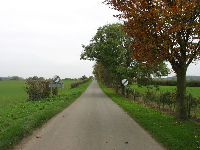
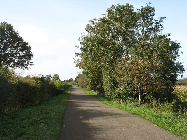
Boughton Wood is a picturesque woodland located in Norfolk, England. Covering an area of approximately 20 hectares, this ancient woodland is a significant natural habitat and a popular destination for nature enthusiasts.

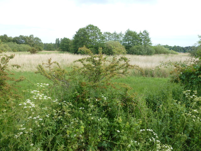
The wood is characterized by a diverse range of trees, including oak, beech, ash, and birch. These towering trees create a dense canopy that provides shade and shelter for a variety of wildlife. The forest floor is adorned with a rich carpet of bluebells in the spring, creating a stunning display of color.

Boughton Wood boasts a network of well-maintained footpaths and trails, allowing visitors to explore its natural beauty. The paths wind through the wood, offering peaceful and tranquil walks amidst the serene surroundings. The wood is also home to a variety of bird species, making it a haven for birdwatchers.

In addition to its natural beauty, Boughton Wood has a fascinating history. The wood has been in existence for centuries and has been managed sustainably to preserve its ecological balance. It is believed that the wood was once part of a larger forest that covered the area during the medieval period.

Boughton Wood is easily accessible, with nearby parking facilities and public transport links. It is open to the public throughout the year, providing a peaceful retreat for those seeking solace in nature. Whether it is a leisurely stroll, birdwatching, or simply immersing oneself in the tranquility of the woodland, Boughton Wood offers a memorable experience for all who visit.

If you have any feedback on the listing, please let us know in the comments section below.

Boughton Wood Images

Images are sourced within 2km of 52.585431/0.51869631 or Grid Reference TF7001. Thanks to Geograph Open Source API. All images are credited.

Stoke Ferry Hall Dates from 1792 <span class="nowrap"><a title="https://historicengland.org.uk/listing/the-list/list-entry/1077744?section=official-list-entry" rel="nofollow ugc noopener" href="https://historicengland.org.uk/listing/the-list/list-entry/1077744?section=official-list-entry">Link</a><img style="margin-left:2px;" alt="External link" title="External link - shift click to open in new window" src="https://s1.geograph.org.uk/img/external.png" width="10" height="10"/></span>
Stoke Ferry Hall
Dates from 1792 LinkExternal link
Cottages, High Street, Stoke Ferry
Park House, Stoke Ferry Dates from about 1770 <span class="nowrap"><a title="https://historicengland.org.uk/listing/the-list/list-entry/1170433?section=official-list-entry" rel="nofollow ugc noopener" href="https://historicengland.org.uk/listing/the-list/list-entry/1170433?section=official-list-entry">Link</a><img style="margin-left:2px;" alt="External link" title="External link - shift click to open in new window" src="https://s1.geograph.org.uk/img/external.png" width="10" height="10"/></span>
Park House, Stoke Ferry
Dates from about 1770 LinkExternal link
Former church of All Saints'. Stoke Ferry Largely dates from 1848 though of medieval origin <span class="nowrap"><a title="https://historicengland.org.uk/listing/the-list/list-entry/1077742?section=official-list-entry" rel="nofollow ugc noopener" href="https://historicengland.org.uk/listing/the-list/list-entry/1077742?section=official-list-entry">Link</a><img style="margin-left:2px;" alt="External link" title="External link - shift click to open in new window" src="https://s1.geograph.org.uk/img/external.png" width="10" height="10"/></span> Closed for worship in 2001; now in secular use.
Former church of All Saints'. Stoke Ferry
Largely dates from 1848 though of medieval origin LinkExternal link Closed for worship in 2001; now in secular use.
The Old Chemist's Shop, Stoke Ferry Dates from 1824 though the rear of the building is somewhat older <span class="nowrap"><a title="https://historicengland.org.uk/listing/the-list/list-entry/1077737?section=official-list-entry" rel="nofollow ugc noopener" href="https://historicengland.org.uk/listing/the-list/list-entry/1077737?section=official-list-entry">Link</a><img style="margin-left:2px;" alt="External link" title="External link - shift click to open in new window" src="https://s1.geograph.org.uk/img/external.png" width="10" height="10"/></span>
The Old Chemist's Shop, Stoke Ferry
Dates from 1824 though the rear of the building is somewhat older LinkExternal link
The Corner Shop, Stoke Ferry
The Old Granary, Stoke Ferry Now in domestic use <span class="nowrap"><a title="https://historicengland.org.uk/listing/the-list/list-entry/1077779?section=official-list-entry" rel="nofollow ugc noopener" href="https://historicengland.org.uk/listing/the-list/list-entry/1077779?section=official-list-entry">Link</a><img style="margin-left:2px;" alt="External link" title="External link - shift click to open in new window" src="https://s1.geograph.org.uk/img/external.png" width="10" height="10"/></span>
The Old Granary, Stoke Ferry
Now in domestic use LinkExternal link
Former miller's house, Stoke Ferry Dates to the mid eighteenth century <span class="nowrap"><a title="https://historicengland.org.uk/listing/the-list/list-entry/1077778?section=official-list-entry" rel="nofollow ugc noopener" href="https://historicengland.org.uk/listing/the-list/list-entry/1077778?section=official-list-entry">Link</a><img style="margin-left:2px;" alt="External link" title="External link - shift click to open in new window" src="https://s1.geograph.org.uk/img/external.png" width="10" height="10"/></span>
Former miller's house, Stoke Ferry
Dates to the mid eighteenth century LinkExternal link
High Street, Stoke Ferry
Cobbles, Stoke Ferry Eighteenth century house now used as offices <span class="nowrap"><a title="https://historicengland.org.uk/listing/the-list/list-entry/1077745?section=official-list-entry" rel="nofollow ugc noopener" href="https://historicengland.org.uk/listing/the-list/list-entry/1077745?section=official-list-entry">Link</a><img style="margin-left:2px;" alt="External link" title="External link - shift click to open in new window" src="https://s1.geograph.org.uk/img/external.png" width="10" height="10"/></span>
Cobbles, Stoke Ferry
Eighteenth century house now used as offices LinkExternal link
All Saints' Lodge, Stoke Ferry All Saints' Lodge dates to the sixteenth century <span class="nowrap"><a title="https://historicengland.org.uk/listing/the-list/list-entry/1077739?section=official-list-entry" rel="nofollow ugc noopener" href="https://historicengland.org.uk/listing/the-list/list-entry/1077739?section=official-list-entry">Link</a><img style="margin-left:2px;" alt="External link" title="External link - shift click to open in new window" src="https://s1.geograph.org.uk/img/external.png" width="10" height="10"/></span>
All Saints' Lodge, Stoke Ferry
All Saints' Lodge dates to the sixteenth century LinkExternal link
Crown House, Stoke Ferry Dates to the sixteenth century but with a nineteenth century facade <span class="nowrap"><a title="https://historicengland.org.uk/listing/the-list/list-entry/1077743?section=official-list-entry" rel="nofollow ugc noopener" href="https://historicengland.org.uk/listing/the-list/list-entry/1077743?section=official-list-entry">Link</a><img style="margin-left:2px;" alt="External link" title="External link - shift click to open in new window" src="https://s1.geograph.org.uk/img/external.png" width="10" height="10"/></span>
Crown House, Stoke Ferry
Dates to the sixteenth century but with a nineteenth century facade LinkExternal link
Canterbury House, Stoke Ferry Has sixteenth century origins <span class="nowrap"><a title="https://historicengland.org.uk/listing/the-list/list-entry/1077746?section=official-list-entry" rel="nofollow ugc noopener" href="https://historicengland.org.uk/listing/the-list/list-entry/1077746?section=official-list-entry">Link</a><img style="margin-left:2px;" alt="External link" title="External link - shift click to open in new window" src="https://s1.geograph.org.uk/img/external.png" width="10" height="10"/></span>
Canterbury House, Stoke Ferry
Has sixteenth century origins LinkExternal link
Derelict cottages, Stoke Ferry
The Blue Bell Hot work, Geographing.
The Blue Bell
Hot work, Geographing.
Stoke Road at Chapel Barn
Oxborough Wood Nature Reserve
Stoke Road, near Oxborough
Show me another place!

Boughton Wood is located at Grid Ref: TF7001 (Lat: 52.585431, Lng: 0.51869631)

Administrative County: Norfolk

District: King's Lynn and West Norfolk

Police Authority: Norfolk

What 3 Words

///airless.severe.bids. Near Stoke Ferry, Norfolk

Nearby Locations

Boughton Wood

Related Wikis

Boughton, Norfolk

Boughton is a village and a civil parish in the English county of Norfolk. The village is 44.4 miles (71.5 km) west of Norwich, 15.1 miles (24.3 km) south...

Boughton Fen

Boughton Fen is a 15.7-hectare (39-acre) biological Site of Special Scientific Interest east of Downham Market in Norfolk. it is common land registered...

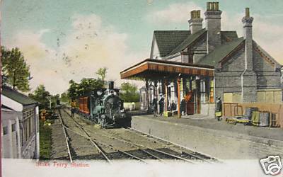
Stoke Ferry railway station

Stoke Ferry is a closed railway station in Norfolk. It was the terminus of a 7ΒΌ mile branch line from Denver which opened on 1 August 1882 and finally...
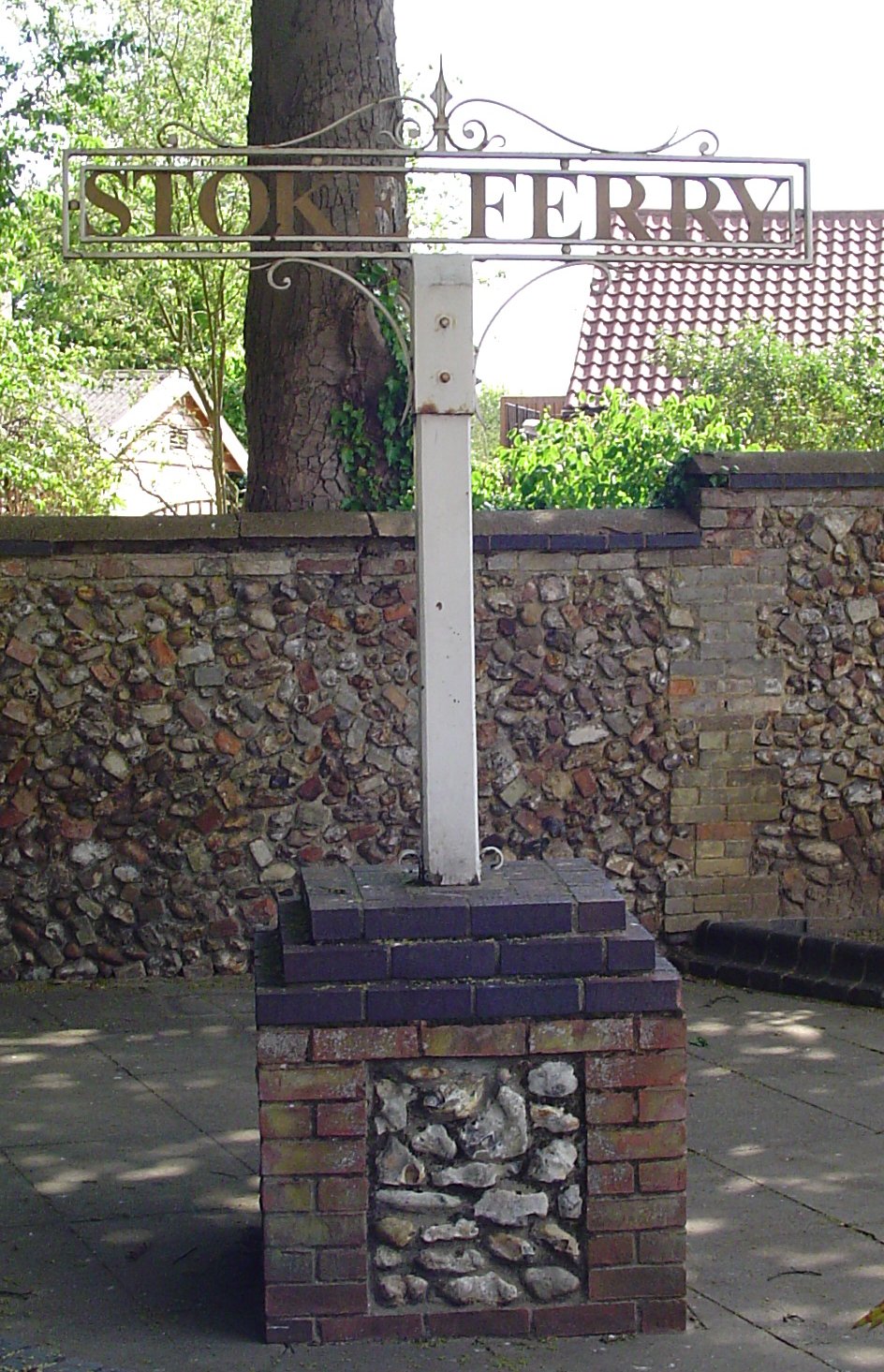
Stoke Ferry

Stoke Ferry is a village and civil parish in the English county of Norfolk, 6.5 miles southeast of Downham Market. The village lies on the River Wissey...

Wretton

Wretton is a village and civil parish in the English county of Norfolk. It covers an area of 4.7 km2 (1.8 sq mi) and had a population of 392 in 155 households...

Wereham

Wereham is a small village and civil parish in the English county of Norfolk. == Location == Wereham lies in the Wissey valley and is on the main A134...

Winnold House

Winnold House, formerly the Benedictine Priory of St Winwaloe, is a country house in the parish of Wereham in Norfolk, England. The house is constructed...

RAF Barton Bendish

RAF Barton Bendish was an airfield for the Royal Air Force located on the far side of the Downham Market to Swaffham road from its parent station, RAF...

Nearby Amenities

Located within 500m of 52.585431,0.51869631
Boughton
Aeroway: aerodrome
Lat/Long: 52.5843819/0.5153039
Power: pole
Lat/Long: 52.5872581/0.5120552
The data included in this document is from www.openstreetmap.org. The data is made available under ODbL.

Have you been to Boughton Wood?

Leave your review of Boughton Wood below (or comments, questions and feedback).