Ash Holt Plantation

Wood, Forest in Norfolk King's Lynn and West Norfolk

England

Ash Holt Plantation

Wheat field towards Boughton Road
Wheat field towards Boughton Road Credit: Hugh Venables

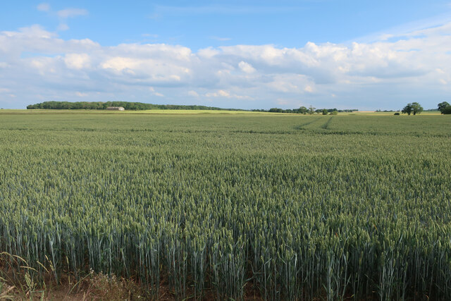
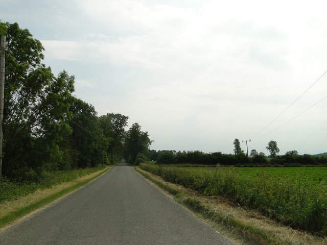
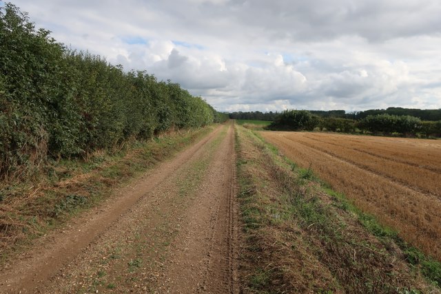
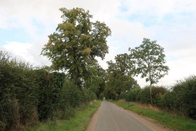
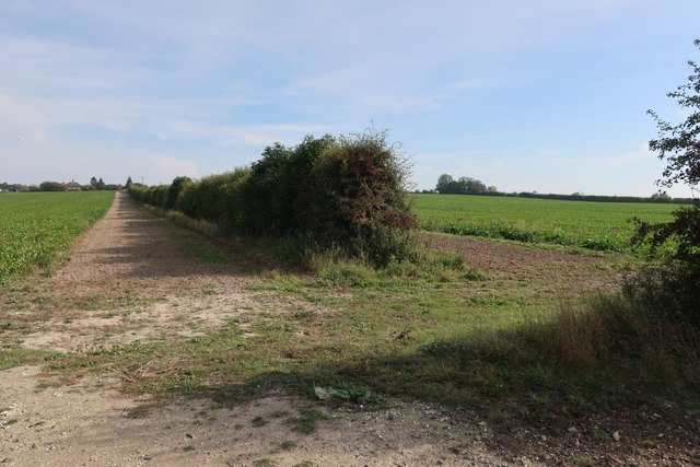
Ash Holt Plantation is a prominent woodland area located in Norfolk, England. Covering a sprawling area, it is widely recognized for its dense forest and rich biodiversity. The plantation is situated in close proximity to the village of Ashwellthorpe, making it easily accessible for visitors and locals alike.

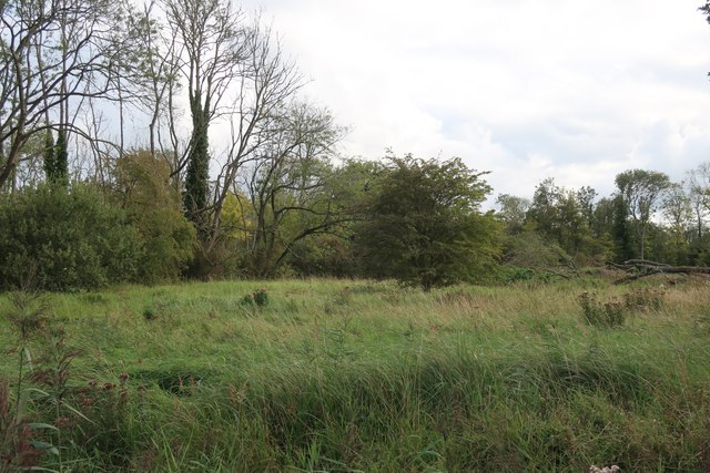
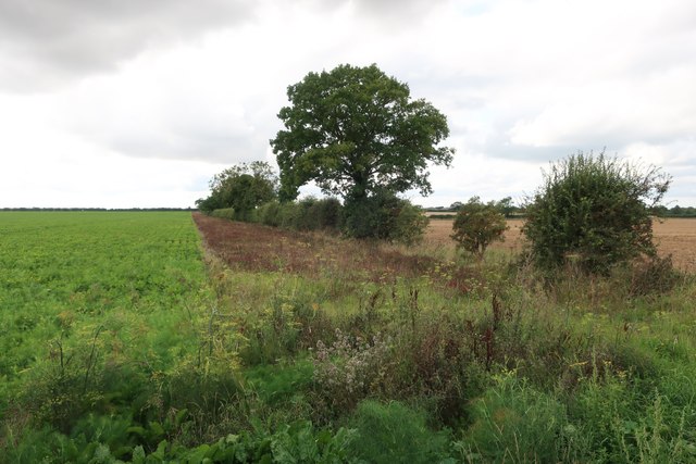
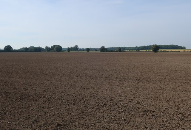
The woodland stretches across a diverse landscape, encompassing various types of trees such as oak, beech, and birch, which create a picturesque and serene environment. The plantation is also distinguished for its well-maintained pathways, allowing visitors to explore the woodland and admire its natural beauty.

Ash Holt Plantation is home to a wide range of wildlife, including numerous bird species, mammals, and insects. Visitors can catch a glimpse of popular woodland birds like woodpeckers, jays, and robins. The woodland also provides shelter for animals such as foxes, deer, and squirrels, adding to its ecological significance.

The plantation offers a peaceful retreat for nature enthusiasts, providing opportunities for walking, hiking, and wildlife observation. The dense forest serves as an ideal location for nature photography, with its vibrant foliage and tranquil atmosphere providing a perfect backdrop.

Ash Holt Plantation is managed and maintained by local authorities, ensuring its preservation and protection. Efforts are made to conserve the woodland's natural resources, while also promoting sustainable practices. The plantation is a cherished natural asset of Norfolk, providing a sanctuary for both wildlife and humans, and offering a chance to connect with nature in a serene setting.

If you have any feedback on the listing, please let us know in the comments section below.

Ash Holt Plantation Images

Images are sourced within 2km of 52.6126/0.51597186 or Grid Reference TF7004. Thanks to Geograph Open Source API. All images are credited.

Wheat field towards Boughton Road
Organ in St Andrew's Church The instrument occupying the 14th-century west tower arch is a rare survival of the work of Joseph Halmshaw & Sons, organ builders of Birmingham, who were active in the later 19th century and at the beginning of the 20th. For two Lincolnshire examples of their work see <a href="https://www.geograph.org.uk/photo/5911089">SK9364 : Organ, St Michael's church, South Hykeham</a> and <a href="https://www.geograph.org.uk/photo/2982696">SK9760 : Organ in All Saints' church, Coleby</a>.
Organ in St Andrew's Church
The instrument occupying the 14th-century west tower arch is a rare survival of the work of Joseph Halmshaw & Sons, organ builders of Birmingham, who were active in the later 19th century and at the beginning of the 20th. For two Lincolnshire examples of their work see SK9364 : Organ, St Michael's church, South Hykeham and SK9760 : Organ in All Saints' church, Coleby.
St. Andrew's church, Barton Bendish This is an interesting little church with some unusual features. The 15th c. porch has flushwork depicting the cross of St Andrew. A stair turret ascends the 14th c. tower on the south side, above the parapet is a pyramidal cap. In my opinion the late Norman doorway has at some time been made narrower which has created a point to the once rounded top, there is a detached column either side. Inside the nave are box pews dated 1623 and a small coeval poor box. Behind the pulpit is a small 14th c. niche and in the north wall are the old rood stairs. The chancel, to my mind is the most interesting part of the church just below the 14th c. piscina are two unique additional drains set into the floor which is covered with 14th c. patterned tiles. Adjacent to it is a graduated dropped sill sedilia.
St. Andrew's church, Barton Bendish
This is an interesting little church with some unusual features. The 15th c. porch has flushwork depicting the cross of St Andrew. A stair turret ascends the 14th c. tower on the south side, above the parapet is a pyramidal cap. In my opinion the late Norman doorway has at some time been made narrower which has created a point to the once rounded top, there is a detached column either side. Inside the nave are box pews dated 1623 and a small coeval poor box. Behind the pulpit is a small 14th c. niche and in the north wall are the old rood stairs. The chancel, to my mind is the most interesting part of the church just below the 14th c. piscina are two unique additional drains set into the floor which is covered with 14th c. patterned tiles. Adjacent to it is a graduated dropped sill sedilia.
Barton Bendish St. Mary's church The church had a tower which fell in 1421 and lasted until 1710. An attractive crocketted ogee hood-mould over the chancel door. The west Norman door has unusual banding around the columns of the jamb, the inner columns are an unusual bobbin design, with four orders of decoration above. It was salvaged from All Saints when it was demolished. Inside next to the south door is a painting of a wheel with a figure of Catherine, beneath her, a coffin on a bier. On the end of one of the Carolean benches is carved 1637; only slightly later that the Holy table which has ‘EL 1633’ carved on the front. High on the east wall hang two worm-eaten angels seemingly from the screen. A dropped-sill sedilia with quatrefoil decoration below. The piscina may be below floor level if it was similar to the one at Barton Bendish St Andrew’s.
Barton Bendish St. Mary's church
The church had a tower which fell in 1421 and lasted until 1710. An attractive crocketted ogee hood-mould over the chancel door. The west Norman door has unusual banding around the columns of the jamb, the inner columns are an unusual bobbin design, with four orders of decoration above. It was salvaged from All Saints when it was demolished. Inside next to the south door is a painting of a wheel with a figure of Catherine, beneath her, a coffin on a bier. On the end of one of the Carolean benches is carved 1637; only slightly later that the Holy table which has ‘EL 1633’ carved on the front. High on the east wall hang two worm-eaten angels seemingly from the screen. A dropped-sill sedilia with quatrefoil decoration below. The piscina may be below floor level if it was similar to the one at Barton Bendish St Andrew’s.
Fincham Road, Barton Bendish
Barton Bendish War Memorial The Memorial bears 17 names and an additional six on a small marble making a total of 23 for WW1, with WW2 having claimed four lives.
Barton Bendish War Memorial
The Memorial bears 17 names and an additional six on a small marble making a total of 23 for WW1, with WW2 having claimed four lives.
Private land near Barton Bendish New gates and an explanatory sign should keep people out of these fields near Barton Bendish. Viewed from Fincham Road.
Private land near Barton Bendish
New gates and an explanatory sign should keep people out of these fields near Barton Bendish. Viewed from Fincham Road.
Approaching Barton Bendish Approaching Barton Bendish on a dull summer morning. The entrance to Barton Hall is on the corner and in the next square.
Approaching Barton Bendish
Approaching Barton Bendish on a dull summer morning. The entrance to Barton Hall is on the corner and in the next square.
In St Andrew's graveyard This gravestone at St Andrew’s in Barton Bendish, dated 1793, shows some symbolic carving across the top. The large vase in the centre is flanked by two winged souls that indicate the rise of the deceased’s soul to Heaven. I found a few examples of this style in other Norfolk graveyards.
In St Andrew's graveyard
This gravestone at St Andrew’s in Barton Bendish, dated 1793, shows some symbolic carving across the top. The large vase in the centre is flanked by two winged souls that indicate the rise of the deceased’s soul to Heaven. I found a few examples of this style in other Norfolk graveyards.
St Andrew's church St Andrew’s church, Barton Bendish. For information on this interesting old building, see <a href="https://www.geograph.org.uk/photo/3914239">TF7105 : St. Andrew's church, Barton Bendish</a>
St Andrew's church
St Andrew’s church, Barton Bendish. For information on this interesting old building, see TF7105 : St. Andrew's church, Barton Bendish
Church of St Andrew The porch front has several embedded masonry saltires as decoration
Church of St Andrew
The porch front has several embedded masonry saltires as decoration
Footpath from The Channels
Footpath to The Channels
Beachamwell Road
Beachamwell Road
The Channels
The Channels
Field margin by Fieldbarn Road
Fields near Barton Bendish
Tilled field near Barton Bendish
Show me another place!

Ash Holt Plantation is located at Grid Ref: TF7004 (Lat: 52.6126, Lng: 0.51597186)

Administrative County: Norfolk

District: King's Lynn and West Norfolk

Police Authority: Norfolk

What 3 Words

///animates.compacts.invisible. Near Stoke Ferry, Norfolk

Nearby Locations

Ash Holt Plantation

Related Wikis

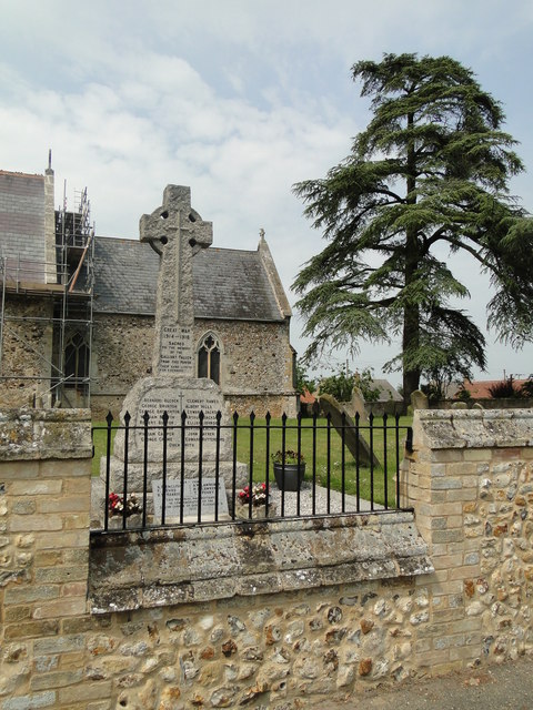
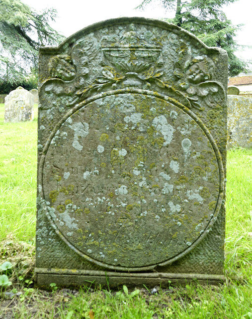
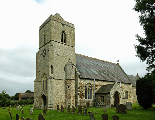
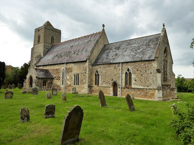
St Andrew's Church, Barton Bendish

St Andrew's Church is a medieval Anglican parish church in the village of Barton Bendish, Norfolk, England. This village used to have two more parish churches...

St Mary's Church, Barton Bendish

St Mary's Church is a redundant medieval Anglican church in the village of Barton Bendish, Norfolk, England. This village had two more parish churches...

Barton Bendish

Barton Bendish is a civil parish and small ancient village in the English county of Norfolk located 10 miles (16 km) south of King's Lynn and 90 miles...

Winnold House

Winnold House, formerly the Benedictine Priory of St Winwaloe, is a country house in the parish of Wereham in Norfolk, England. The house is constructed...

Related Videos

Oil Leek- Engine failure ?

Oil leek during flight. what could it be?

360 VR - My first flight in an Avid speedwing Mk4 Nose Wheel version powered by Jabiru 2200A Engine.

AVID Speedwing MK4 Nose wheel - Jabiru Powered VR360 Take off. Don't forget to use your finger to position the camera angle ...

Wildlife Photography - Boughton Fen Nature Reserve is my NEMESIS!

In this video I take you behind the scenes to a local nature reserve that is fast becoming the nemesis of my wildlife photography!

Nearby Amenities

Located within 500m of 52.6126,0.51597186
Hall Farm
Place: farm
Source: NLS - OS 1:25k 1st Series 1937-61
Lat/Long: 52.6119017/0.5213752
The data included in this document is from www.openstreetmap.org. The data is made available under ODbL.

Have you been to Ash Holt Plantation?

Leave your review of Ash Holt Plantation below (or comments, questions and feedback).