Broad Oak Wood

Wood, Forest in Kent Gravesham

England

Broad Oak Wood

Cobham mausoleum Deep in Cobham woods stands this Neo-Classical style mausoleum.

This mausoleum was built on the instructions of the 3rd Earl of Darnley by architect James Watt in 1786.
Cobham mausoleum Credit: Silver fox

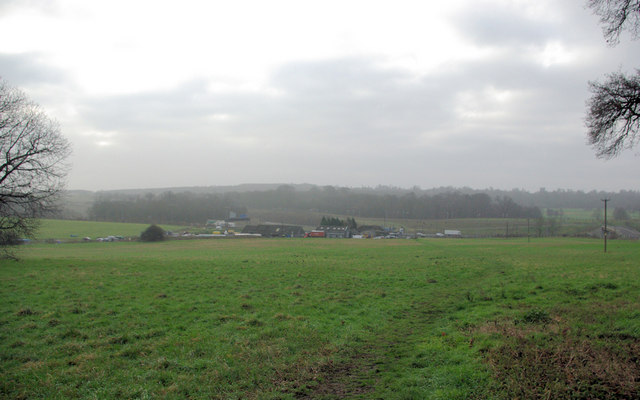
Broad Oak Wood is a picturesque woodland located in the county of Kent, England. Spanning over 100 acres, it is a popular destination for nature enthusiasts and hikers alike. The wood is situated in the southeastern part of the county, near the village of Broad Oak.

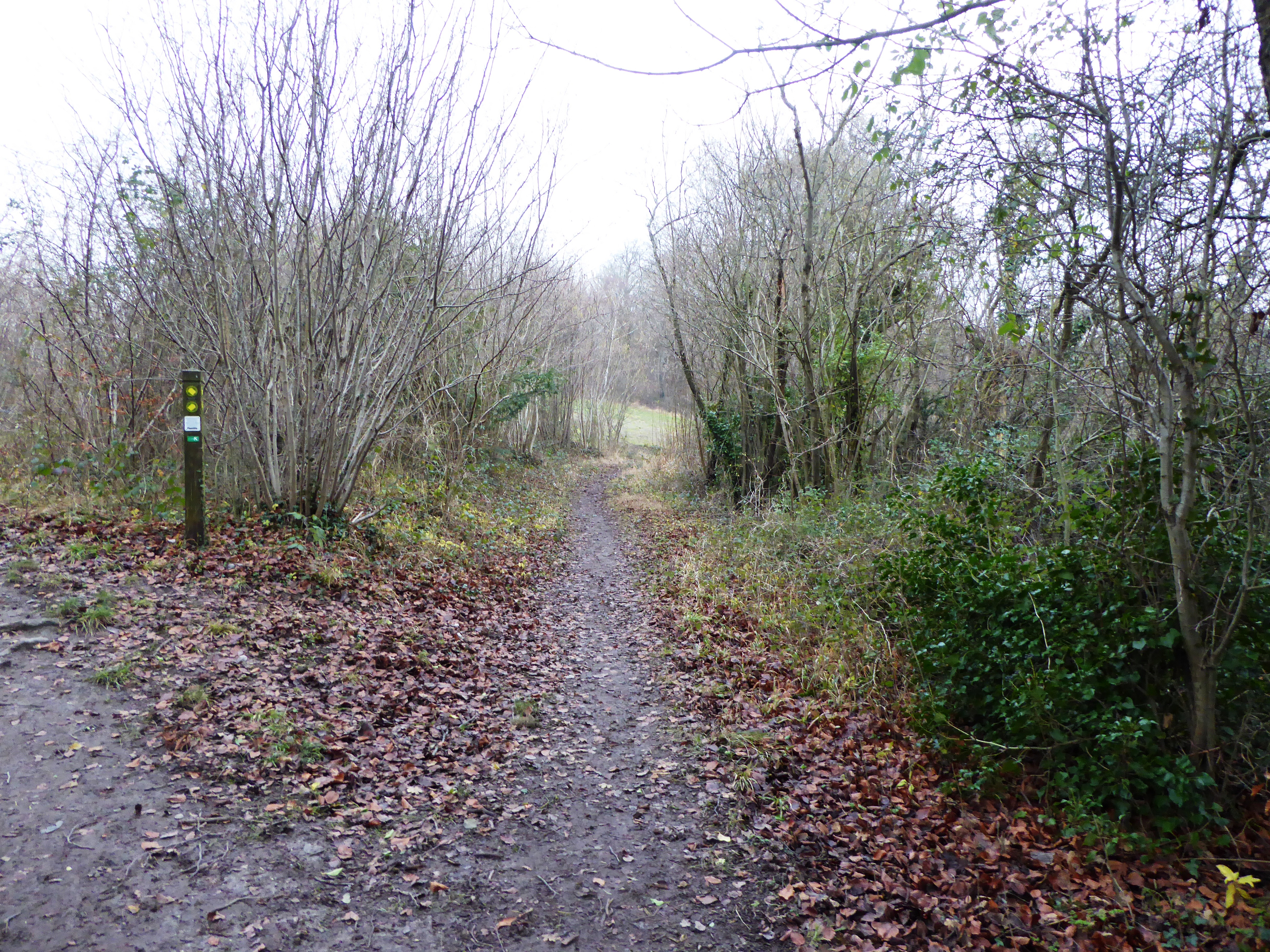
The woodland is predominantly composed of mature oak trees, hence its name, but it also features a diverse range of other tree species, including beech, ash, and birch. The canopy formed by these towering trees provides a dense and shaded environment, which is ideal for various wildlife species.

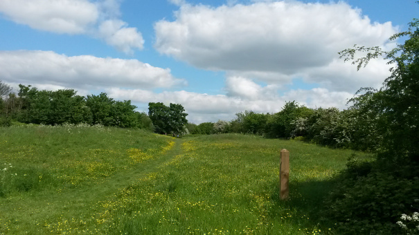
Broad Oak Wood is teeming with a rich variety of flora and fauna. The forest floor is covered in a thick carpet of mosses, ferns, and wildflowers, contributing to the woodland's enchanting beauty. The wood is also home to several bird species, such as woodpeckers, owls, and various songbirds, which can be heard chirping and singing throughout the day.

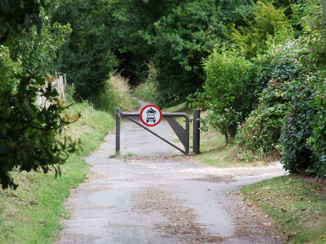
Walking trails wind through the wood, offering visitors the opportunity to explore its natural wonders and take in the serene surroundings. The trails are well-maintained and suitable for all ages and abilities. Additionally, there are picnic areas scattered throughout the wood, allowing visitors to relax and enjoy a meal amidst nature.

Broad Oak Wood is a designated Site of Special Scientific Interest (SSSI) due to its ecological significance. The wood has been protected and managed to preserve its unique biodiversity and maintain its natural balance. It also serves as an important habitat for several endangered species, making it a place of great importance for conservation efforts in the region.

Overall, Broad Oak Wood is a haven of tranquility, offering visitors a chance to immerse themselves in nature's beauty and experience the wonders of a truly ancient woodland.

If you have any feedback on the listing, please let us know in the comments section below.

Broad Oak Wood Images

Images are sourced within 2km of 51.391577/0.44808 or Grid Reference TQ7068. Thanks to Geograph Open Source API. All images are credited.

Cobham mausoleum Deep in Cobham woods stands this Neo-Classical style mausoleum.

This mausoleum was built on the instructions of the 3rd Earl of Darnley by architect James Watt in 1786.
Cobham mausoleum
Deep in Cobham woods stands this Neo-Classical style mausoleum. This mausoleum was built on the instructions of the 3rd Earl of Darnley by architect James Watt in 1786.
Lower Bush Looking south across the London - Chatham railway and Lower Bush.
Lower Bush
Looking south across the London - Chatham railway and Lower Bush.
View towards Park Pale Park Pale is by the A2 just about where it becomes the M2. The Channel Tunnel Rail Link (CTRL) may also mistily be seen.
View towards Park Pale
Park Pale is by the A2 just about where it becomes the M2. The Channel Tunnel Rail Link (CTRL) may also mistily be seen.
Stile, Footpath Across Railway, Cuxton This is a site where a public footpath crosses the London to Chatham and Dover railway line. You need to keep alert and get across smartly -- trains come past here at 60mph.
Stile, Footpath Across Railway, Cuxton
This is a site where a public footpath crosses the London to Chatham and Dover railway line. You need to keep alert and get across smartly -- trains come past here at 60mph.
Footpath down to Railbridge, near Lower Bush Taken from footpath from Whiteleaves Wood, Mill Hill to Cobham Park.
Footpath leads down to bush Road in Lower Bush. Road in background is Upper Bush Road leading to Upper Bush Farm, on other side of the valley.
Footpath down to Railbridge, near Lower Bush
Taken from footpath from Whiteleaves Wood, Mill Hill to Cobham Park. Footpath leads down to bush Road in Lower Bush. Road in background is Upper Bush Road leading to Upper Bush Farm, on other side of the valley.
Track along Cobham Park Great Wood Hedge in centre of photo, divides Nor Wood (closest to viewer) from Lodge Wood (further away). Also a County Boundary, dividing Medway (closest) and Gravesham (further).
Track along Cobham Park Great Wood
Hedge in centre of photo, divides Nor Wood (closest to viewer) from Lodge Wood (further away). Also a County Boundary, dividing Medway (closest) and Gravesham (further).
Darnley's Mausoleum from Norwood Grove On footpath from Cuxton to Shorne in Great Wood of Cobham Park.
Darnley's Mausoleum from Norwood Grove
On footpath from Cuxton to Shorne in Great Wood of Cobham Park.
Darnley Mausoleum under restoration On footpath from Strood (heading left) to Cobham (heading right).
Roof now repaired as well as other details.
Will look great after repairs.
Darnley Mausoleum under restoration
On footpath from Strood (heading left) to Cobham (heading right). Roof now repaired as well as other details. Will look great after repairs.
New Entrance to Darnley's Mausoleum On footpath from (heading left) Strood, towards (heading right) Cobham.
In Great Woods of Cobham Park.
New Entrance to Darnley's Mausoleum
On footpath from (heading left) Strood, towards (heading right) Cobham. In Great Woods of Cobham Park.
Rochester and Cobham Golf Course Taken from footpath in Cobham Park from Cobham (heading right) to Strood (heading left). Footpath beside overgrown hedge.
Cobham Hall (now a school) in background.
Rochester and Cobham Golf Course
Taken from footpath in Cobham Park from Cobham (heading right) to Strood (heading left). Footpath beside overgrown hedge. Cobham Hall (now a school) in background.
Cobham Hall School From footpath in Rochester and Cobham Golf Course, heading to Shorne from Cobham Village.
Cobham Hall School
From footpath in Rochester and Cobham Golf Course, heading to Shorne from Cobham Village.
Clubhouse of Rochester and Cobham Golf Course Taken from footpath through golf course to Shorne from Cobham.
Practice range in front, where golfers stand protected in dark wooden shed and hit toward coloured signs at various distances.
Clubhouse of Rochester and Cobham Golf Course
Taken from footpath through golf course to Shorne from Cobham. Practice range in front, where golfers stand protected in dark wooden shed and hit toward coloured signs at various distances.
Entrance to Rochester and Cobham Golf Course On small road that goes over M2 and CTRL, from Shorne.
Also part of a footpath from Shorne to Cobham, goes through the golf course on a well marked route. Although beware flying golfballs from amateur golfers...
Entrance to Rochester and Cobham Golf Course
On small road that goes over M2 and CTRL, from Shorne. Also part of a footpath from Shorne to Cobham, goes through the golf course on a well marked route. Although beware flying golfballs from amateur golfers...
CTRL railbridge over road Unnamed road heads towards Shorne from Rochester and Cobham Golf Course.
Also part of a footpath from Cobham to Higham and Shorne.
Footpath on right heads towards Knight's Place, but maybe diverted or blocked as footpath on other side of Place is diverted. Railway carries fast trains from Ashford/Folkestone to London, heading right to left.
CTRL railbridge over road
Unnamed road heads towards Shorne from Rochester and Cobham Golf Course. Also part of a footpath from Cobham to Higham and Shorne. Footpath on right heads towards Knight's Place, but maybe diverted or blocked as footpath on other side of Place is diverted. Railway carries fast trains from Ashford/Folkestone to London, heading right to left.
A2 becomes M2 A2 from London/M2 now becomes Motorway, hence blue signs. Then carries on over Medway Bridge, to Medway Towns then to South.
Road to left heads to A289 Wainscott By-pass heading to Isle of Grain and Medway Tunnel. Taken from Road bridge and footpath from Cobham to Shorne via Golf course.
A2 becomes M2
A2 from London/M2 now becomes Motorway, hence blue signs. Then carries on over Medway Bridge, to Medway Towns then to South. Road to left heads to A289 Wainscott By-pass heading to Isle of Grain and Medway Tunnel. Taken from Road bridge and footpath from Cobham to Shorne via Golf course.
Darnley Mausoleum, Cobham
Bowesden Lane, Shorne
Approaching M2 Motorway
Show me another place!

Broad Oak Wood is located at Grid Ref: TQ7068 (Lat: 51.391577, Lng: 0.44808)

Administrative County: Kent

District: Gravesham

Police Authority: Kent

What 3 Words

///dozed.payer.sudden. Near Strood, Kent

Related Wikis

Cobham Woods

Cobham Woods is a 242.7 hectares (600 acres) biological Site of Special Scientific Interest on the western outskirts of Rochester in Kent. It is in the...

Darnley Mausoleum

The Darnley Mausoleum, or Cobham Mausoleum as it is often now referred to, is a Grade I Listed building, now owned by the National Trust and situated in...

Strood Academy

Strood Academy is a coeducational secondary school and sixth form with academy status, located in Strood in the English county of Kent. == History == Strood...

Rochester United F.C.

Rochester United F.C. is an English football club located in Strood, in Kent. The club are members of the Southern Counties East League Division One and...

Faversham Strike Force F.C.

Faversham Strike Force Football Club is a football club based in Faversham, England. They are currently members of the Southern Counties East League Division...

Chatham Town WFC

Chatham Town Women, previously known as Gillingham Women's Football Club, is an English women's football club. The club compete in the FA Women's National...

Great Crabbles Wood

Great Crabbles Wood is a 33-hectare (82-acre) biological Site of Special Scientific Interest north-west of Rochester in Kent.Most of the wood is mixed...

Rede Common

Rede Common is a 11.2-hectare (28-acre) Local Nature Reserve in Strood in Kent. It is owned and managed by Medway Council in partnership with Friends...

Nearby Amenities

Located within 500m of 51.391577,0.44808
Knight's Place
Place: hamlet
Source: npe
Lat/Long: 51.3937216/0.4444196
Barrier: kissing_gate
Lat/Long: 51.3931511/0.4416785
Location: outdoor
Phases: 1
Power: transformer
Transformer: auto
Voltage Primary: -25000
Voltage Secondary: 25000
Windings: 2
Lat/Long: 51.3935425/0.4522385
Barrier: stile
Lat/Long: 51.3936096/0.4436504
Crossing
Lat/Long: 51.3956936/0.4492074
Crossing
Lat/Long: 51.3955387/0.4492518
Bench
Lat/Long: 51.3896317/0.4457677
The data included in this document is from www.openstreetmap.org. The data is made available under ODbL.

Have you been to Broad Oak Wood?

Leave your review of Broad Oak Wood below (or comments, questions and feedback).