Jamies Wood

Wood, Forest in Cambridgeshire East Cambridgeshire

England

Jamies Wood

Field by Bradley Road, Cowlinge
Field by Bradley Road, Cowlinge Credit: David Howard

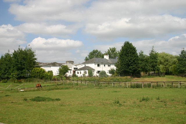
Jamies Wood is a small woodland area located in the county of Cambridgeshire, England. Stretching over approximately 10 hectares, it is situated near the village of Wood, which is about 10 miles south of Cambridge. The wood is named after the local landowner and is a popular destination for nature enthusiasts and walkers.

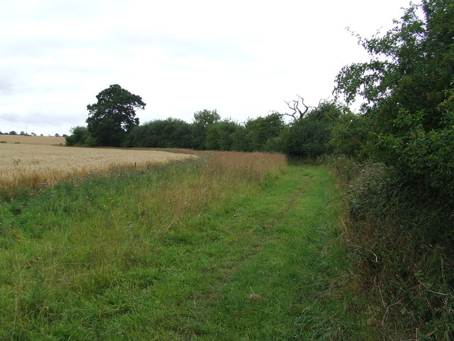
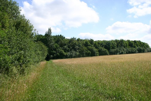
The woodland is predominantly composed of broadleaf trees, such as oak, beech, and ash, which create a diverse and vibrant ecosystem. The dense canopy provides shelter for a variety of bird species, including woodpeckers, tits, and finches, making it an excellent spot for birdwatching. Additionally, small mammals like squirrels and hedgehogs can also be spotted in the wood.

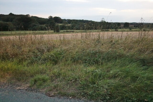
The woodland floor is covered with a rich carpet of wildflowers, including bluebells, primroses, and wood anemones, which bloom in spring and add a splash of color to the landscape. This attracts a myriad of insects, including butterflies and bees, which contribute to the area's biodiversity.

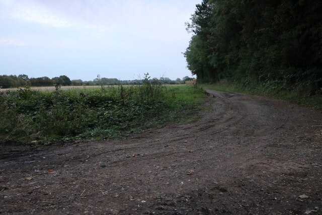
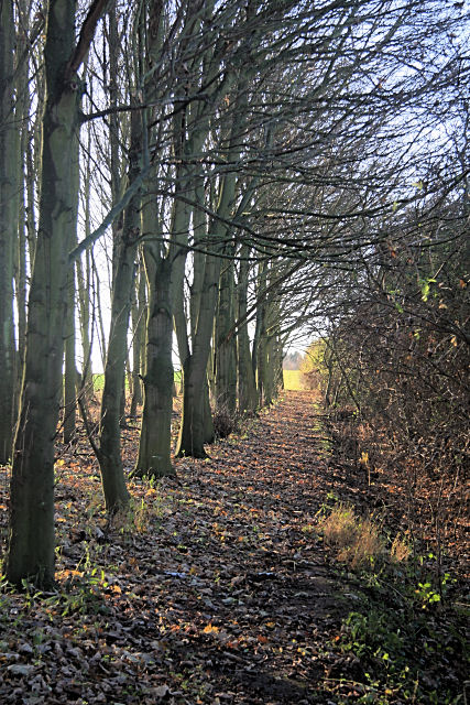
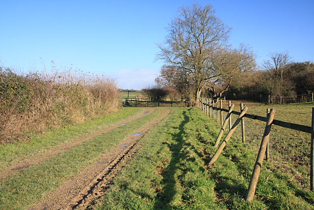
There are several well-marked trails within Jamies Wood, allowing visitors to explore and enjoy the natural beauty of the surroundings. These paths wind through the trees, offering peaceful and tranquil surroundings for walkers and nature lovers alike.

Overall, Jamies Wood in Cambridgeshire provides a serene escape from the busy city life and offers visitors the opportunity to connect with nature in a picturesque setting.

If you have any feedback on the listing, please let us know in the comments section below.

Jamies Wood Images

Images are sourced within 2km of 52.179157/0.48097031 or Grid Reference TL6956. Thanks to Geograph Open Source API. All images are credited.

Field by Bradley Road, Cowlinge
View from The Belt near Lidgate Looking towards Newmarket Road
View from The Belt near Lidgate
Looking towards Newmarket Road
Footpath Footpath and field boundary near to Cowlinge, Suffolk.
Footpath
Footpath and field boundary near to Cowlinge, Suffolk.
Bridgelands Farm from Lidgate Belt Looking south west across the valley formed by the River Kennett.
Bridgelands Farm from Lidgate Belt
Looking south west across the valley formed by the River Kennett.
Footpath to Kirtling This path, overgrown in places, links Upend and Kirtling.
Footpath to Kirtling
This path, overgrown in places, links Upend and Kirtling.
Vicarage Farm, Kirtling This stud farm is situated between the villages of Kirtling and Cowlinge.
Vicarage Farm, Kirtling
This stud farm is situated between the villages of Kirtling and Cowlinge.
Footpath to Kirtling A wide path cuts through a field of wheat, with Banstead Farm on the hill at the left of the photo.
Footpath to Kirtling
A wide path cuts through a field of wheat, with Banstead Farm on the hill at the left of the photo.
Footpath to Kirtling The path follows the edge of a wood, alongside a hedge.
Footpath to Kirtling
The path follows the edge of a wood, alongside a hedge.
Footpath to Upend This is near the end of the footpath from Kirtling, as it approaches the minor road linking Lidgate and Upend. Spare posts are resting against the fence.
Footpath to Upend
This is near the end of the footpath from Kirtling, as it approaches the minor road linking Lidgate and Upend. Spare posts are resting against the fence.
Almost ready for harvesting Arable crop by Bradley Road.
Almost ready for harvesting
Arable crop by Bradley Road.
New woodland from Newmarket Road Not marked on the 1:25000 map and about a hundred metres out on the 1:50000 map.
New woodland from Newmarket Road
Not marked on the 1:25000 map and about a hundred metres out on the 1:50000 map.
Entering Upend Entering Upend, Cambridgeshire.
Entering Upend
Entering Upend, Cambridgeshire.
View Through The trees Wood near to Upend, Cambridgeshire.
View Through The trees
Wood near to Upend, Cambridgeshire.
Footpath Footpath through the wood near to Upend, Cambridgeshire.
Footpath
Footpath through the wood near to Upend, Cambridgeshire.
Kissing Gate Kissing gate and footpath sign near to Upend, Cambridgeshire.
Kissing Gate
Kissing gate and footpath sign near to Upend, Cambridgeshire.
Re-routed footpath The most recent map shows the footpath following the edge of the field rather than cutting through the crop. Slightly longer but makes far more sense.
Re-routed footpath
The most recent map shows the footpath following the edge of the field rather than cutting through the crop. Slightly longer but makes far more sense.
Re-routed footpath by Great Wood The most recent map shows it following the edge of the field, which is also the Suffolk/Cambridgeshire border. This arrangement is much more efficient than going through the middle of the field <a href="https://www.geograph.org.uk/photo/201617">TL7055 : Footpath to Kirtling</a>.
Re-routed footpath by Great Wood
The most recent map shows it following the edge of the field, which is also the Suffolk/Cambridgeshire border. This arrangement is much more efficient than going through the middle of the field TL7055 : Footpath to Kirtling.
Wheat field by Great Wood
Show me another place!

Jamies Wood is located at Grid Ref: TL6956 (Lat: 52.179157, Lng: 0.48097031)

Administrative County: Cambridgeshire

District: East Cambridgeshire

Police Authority: Cambridgeshire

What 3 Words

///pine.observes.headlines. Near Newmarket, Suffolk

Nearby Locations

Mill End Jamies Wood

Related Wikis

Kirtling

Kirtling, together with Kirtling Green and Kirtling Towers, is a scattered settlement in the south-eastern edge of the English county of Cambridgeshire...
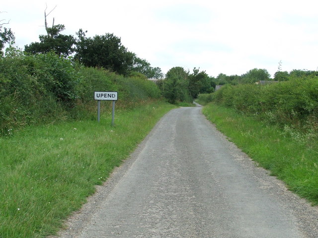
Upend

Upend is a hamlet in the east of Cambridgeshire. It is five miles (8.0 km) south-east of Newmarket and lies in the same parish as Kirtling. Until the...

Kirtling Tower

Kirtling Tower was a medieval castle and Tudor country house in Kirtling, Cambridgeshire, England, of which the gatehouse still remains. == History... ==

Lidgate

Lidgate is a small village and a civil parish in the West Suffolk district, in the English county of Suffolk. Lidgate is located on the B1063 road in between...

Nearby Amenities

Located within 500m of 52.179157,0.48097031
Military: bunker
Lat/Long: 52.1778261/0.4759894
Bus Stop
Mill Road
Naptan AtcoCode: 0500EKIRT004
Naptan Bearing: E
Naptan BusStopType: CUS
Naptan CommonName: Mill Road
Naptan Indicator: opp
Naptan Landmark: Mill Road
Naptan NaptanCode: cmbdgwmd
Naptan ShortCommonName: Mill Road
Naptan Street: Newmarket Road
Naptan Verified: no
Source: naptan_import
Lat/Long: 52.1833869/0.4794019
Bus Stop
Mill Road
Naptan AtcoCode: 0500EKIRT010
Naptan Bearing: W
Naptan BusStopType: CUS
Naptan CommonName: Mill Road
Naptan Indicator: near
Naptan Landmark: Mill Road
Naptan NaptanCode: cmbdgwpa
Naptan ShortCommonName: Mill Road
Naptan Street: Newmarket Road
Naptan Verified: no
Source: naptan_import
Lat/Long: 52.183315/0.4793979
Power: pole
Lat/Long: 52.1828052/0.4780338
Power: pole
Lat/Long: 52.1829318/0.4832428
Power: pole
Lat/Long: 52.1827033/0.4805551
Power: pole
Lat/Long: 52.1828168/0.4819259
Operator: po
Lat/Long: 52.1830207/0.4845031
The data included in this document is from www.openstreetmap.org. The data is made available under ODbL.

Have you been to Jamies Wood?

Leave your review of Jamies Wood below (or comments, questions and feedback).