Bushy Wood

Wood, Forest in Essex Chelmsford

England

Bushy Wood
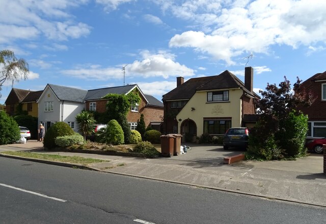
Houses on Patching Hall Lane, Chelmsford
Houses on Patching Hall Lane, Chelmsford Credit: JThomas

Bushy Wood is a picturesque woodland located in the county of Essex, England. Covering an area of approximately 100 hectares, it is situated near the village of Danbury and is part of the wider Danbury Commons and Blakes Wood Site of Special Scientific Interest (SSSI).

The wood is predominantly composed of deciduous trees, including oak, beech, and hornbeam, which create a dense canopy that provides shade and shelter for a rich variety of flora and fauna. Bluebells carpet the forest floor in spring, creating a stunning display of vibrant colors, while in autumn, the wood is transformed into a tapestry of golden hues as the leaves change.

Traversing through Bushy Wood, visitors can explore a network of well-maintained footpaths and trails, allowing them to appreciate the natural beauty and tranquility of the area. The wood also offers opportunities for recreational activities such as walking, jogging, and birdwatching.

Wildlife thrives within Bushy Wood, with a diverse range of species making it their home. Bird enthusiasts can spot woodpeckers, nuthatches, and tawny owls, among others. Small mammals like squirrels, badgers, and foxes can also be spotted, while the wood's ponds support a variety of amphibians and insects.

Managed by the Essex Wildlife Trust, Bushy Wood is a haven for nature lovers, providing an escape from the hustle and bustle of daily life. Its accessibility, combined with its natural beauty and biodiversity, make it a popular destination for both locals and visitors seeking to immerse themselves in the wonders of the English countryside.

If you have any feedback on the listing, please let us know in the comments section below.

Bushy Wood Images

Images are sourced within 2km of 51.768072/0.44447268 or Grid Reference TL6810. Thanks to Geograph Open Source API. All images are credited.

Houses on Patching Hall Lane, Chelmsford
Patching Hall Lane, Chelmsford
School Lane Towards Parsonage Green.
School Lane
Towards Parsonage Green.
Main Road (B1008), Broomfield
The Kings Arms, Broomfield On Main Road.
See <a href="https://www.geograph.org.uk/photo/7267108">TL7010 : Sign for the Kings Arms, Broomfield</a> for sign.
The Kings Arms, Broomfield
On Main Road. See TL7010 : Sign for the Kings Arms, Broomfield for sign.
Sign for the Kings Arms, Broomfield See <a href="https://www.geograph.org.uk/photo/7267106">TL7010 : The Kings Arms, Broomfield</a> for context.
Sign for the Kings Arms, Broomfield
War Memorial on Church Green, Broomfield
Postbox at Chelmsford CM1 399. Royal Mail list this box as 'CM1 399D Woodhall Road'.
Postbox at Chelmsford
CM1 399. Royal Mail list this box as 'CM1 399D Woodhall Road'.
The Pig and Whistle, Chignall Smeally
Walkers skirt the old gravel pit, 1982 On the way from Great Waltham and back via the White Horse at Pleshey. The tower crane on the horizon towards the right was a help in locating this shot, as it could only have been engaged on extensions to Broomfield Hospital.
Walkers skirt the old gravel pit, 1982
On the way from Great Waltham and back via the White Horse at Pleshey. The tower crane on the horizon towards the right was a help in locating this shot, as it could only have been engaged on extensions to Broomfield Hospital.
Woodhall Hill, Chignall Smealy The outskirts of Chignall Smealy, a diffuse settlement whose 'centre' is little different to this part, in terms of population density.
Woodhall Hill, Chignall Smealy
The outskirts of Chignall Smealy, a diffuse settlement whose 'centre' is little different to this part, in terms of population density.
Tree by the open road Breeds Road has a spot height of 61 m recorded on OS maps between the camera and the tree. This modest height still commands a long view thanks to the local absence of hedges.
Tree by the open road
Breeds Road has a spot height of 61 m recorded on OS maps between the camera and the tree. This modest height still commands a long view thanks to the local absence of hedges.
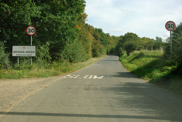
Entering Broads Green So far little to be seen of this settlement in Great Waltham parish.
Entering Broads Green
So far little to be seen of this settlement in Great Waltham parish.
Flooded Gravel Pit near Broads Green
Footpath in Border Wood
Small Pond Beside the public footpath, close to the centre of TL6811.
Small Pond
Beside the public footpath, close to the centre of TL6811.
Flooded Gravel Pit Known by the local angling club as 'Tufnell Mere', it contains a large head of carp as well as other fish. The water level of this pit has fluctuated greatly over the years, and is currently much higher than normal, as can be seen by the semi-submerged willow trees at the far end of the pit.
Flooded Gravel Pit
Known by the local angling club as 'Tufnell Mere', it contains a large head of carp as well as other fish. The water level of this pit has fluctuated greatly over the years, and is currently much higher than normal, as can be seen by the semi-submerged willow trees at the far end of the pit.
Footpath near Partridgegreen The barns in the distance are at Partridgegreen.
Footpath near Partridgegreen
The barns in the distance are at Partridgegreen.
Show me another place!

Bushy Wood is located at Grid Ref: TL6810 (Lat: 51.768072, Lng: 0.44447268)

Administrative County: Essex

District: Chelmsford

Police Authority: Essex

What 3 Words

///aware.overtones.inflates. Near Chelmsford, Essex

Nearby Locations

Bushy Wood

Related Wikis

London Basin

The London Basin is an elongated, roughly triangular sedimentary basin approximately 250 kilometres (160 mi) long which underlies London and a large area...

West Chelmsford (UK Parliament constituency)

West Chelmsford was a parliamentary constituency represented in the House of Commons of the Parliament of the United Kingdom. From 1997 to 2010 it elected...

Chignall

Chignall is a civil parish in the City of Chelmsford in Essex, England. The civil parish has 311 inhabitants (2011). The villages were recorded in the...

Chelmer Valley High School

Chelmer Valley High School (CVHS) is an academy based on a large site on the outskirts of Chelmsford, Essex, England. It has specialisms in engineering...

Fanner's Green

Fanner's Green is a hamlet and cul-de-sac road in the Great Waltham civil parish of the Chelmsford district of Essex, England. It is situated 1 mile (1...

Broomfield Hospital

Broomfield Hospital is an acute district general hospital in Chelmsford, Essex. It is managed by the Mid and South Essex NHS Foundation Trust. == History... ==

Chelmsford City F.C.

Chelmsford City Football Club is a semi-professional football club based in Chelmsford, Essex, England. Currently members of the National League South...

Broomfield, Essex

Broomfield is a village and residential suburb in the City of Chelmsford district, immediately north of the city itself. It is the site of a major Accident...

Nearby Amenities

Located within 500m of 51.768072,0.44447268
Colour: red nd white
Marker: aerial
Material: plastic
Utility: gas
Lat/Long: 51.7691976/0.4385079
Colour: red nd white
Marker: aerial
Material: plastic
Utility: gas
Lat/Long: 51.7692188/0.4386172
The data included in this document is from www.openstreetmap.org. The data is made available under ODbL.

Have you been to Bushy Wood?

Leave your review of Bushy Wood below (or comments, questions and feedback).