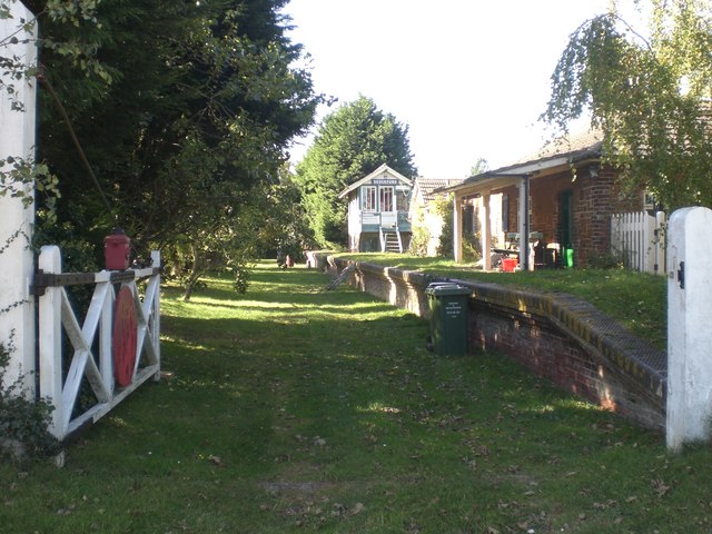
Church Farm Wood
Wood, Forest in Norfolk King's Lynn and West Norfolk
England
Church Farm Wood

Church Farm Wood is a picturesque woodland located in Norfolk, England. Spanning approximately 50 acres, this forested area is a haven for nature enthusiasts and those seeking tranquility amidst the stunning English countryside. The wood is situated near the village of Church Farm, which gives it its name.
The woodland is predominantly comprised of native tree species, such as oak, beech, and birch, creating a diverse and rich ecosystem. The dense canopy provides ample shade and shelter for a variety of wildlife, including birds, mammals, and insects. Visitors may spot species such as woodpeckers, foxes, and butterflies as they explore the wood's many trails.
Church Farm Wood offers several marked paths that wind through its enchanting landscape, allowing visitors to immerse themselves in its natural beauty. These paths range in difficulty, catering to both casual strollers and more experienced hikers. Along the way, visitors can enjoy the sights and sounds of the wood, from the rustling leaves to the chirping birdsong.
The woodland also features a small stream that meanders through its heart, adding to its charm and providing a water source for the local wildlife. This stream can be crossed via a quaint wooden bridge, offering a picturesque spot for photographers or those seeking a peaceful pause.
Overall, Church Farm Wood is a captivating forested area that showcases the beauty of Norfolk's natural environment. With its diverse range of flora and fauna, well-maintained paths, and tranquil ambiance, it is a must-visit destination for nature lovers and those seeking respite from the bustling modern world.
If you have any feedback on the listing, please let us know in the comments section below.
Church Farm Wood Images
Images are sourced within 2km of 52.914135/0.50774602 or Grid Reference TF6838. Thanks to Geograph Open Source API. All images are credited.

Church Farm Wood is located at Grid Ref: TF6838 (Lat: 52.914135, Lng: 0.50774602)
Administrative County: Norfolk
District: King's Lynn and West Norfolk
Police Authority: Norfolk
What 3 Words
///abundance.daredevil.ratio. Near Heacham, Norfolk
Nearby Locations
Related Wikis
Heacham F.C.
Heacham Football Club is a football club based in Heacham, England. They are currently members of the Eastern Counties League Premier Division and play...
Heacham
Heacham is a large village in West Norfolk, England, overlooking The Wash. It lies between King's Lynn, 14 miles (23 km) to the south, and Hunstanton,...
Heacham Brick Pit
Heacham Brick Pit is a 0.8-hectare (2.0-acre) geological Site of Special Scientific Interest in Heacham, north of King's Lynn in Norfolk. It is a Geological...
Ringstead Downs
Ringstead Downs is a 6.9-hectare (17-acre) biological Site of Special Scientific Interest east of Hunstanton in Norfolk. It is in the Norfolk Coast Area...
Heacham railway station
Heacham was a railway station which served the seaside resort of Heacham in Norfolk, England. Opened in 1862, the station became a junction where services...
Wild Ken Hill
Wild Ken Hill is a rewilding and regenerative agriculture project located in Norfolk, England, at the edge of The Wash. == History == The name Ken Hill...
Sedgeford railway station
Sedgeford was a railway station which served the village of Sedgeford in Norfolk, England. Opened by the West Norfolk Junction Railway in 1866, passenger...
Paul Nicholas School of Acting & Performing Arts
The Paul Nicholas School of Acting & Performing Arts was a franchise of stage and performance schools created by actor and singer Paul Nicholas for young...
Nearby Amenities
Located within 500m of 52.914135,0.50774602Have you been to Church Farm Wood?
Leave your review of Church Farm Wood below (or comments, questions and feedback).


