Dragon's Plantation

Wood, Forest in Suffolk West Suffolk

England

Dragon's Plantation

Field and driveway in Burnt Fen
Field and driveway in Burnt Fen Credit: David Howard

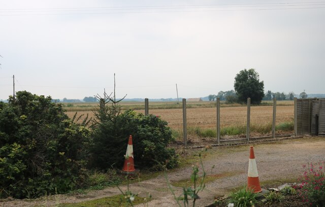
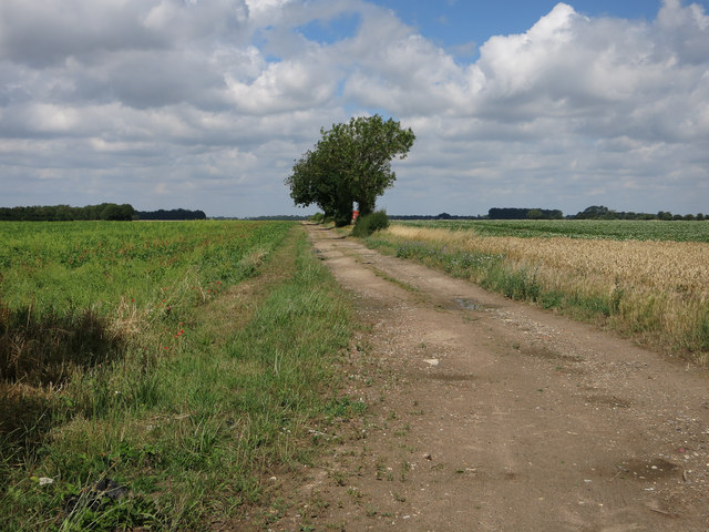
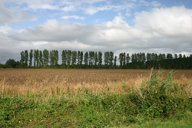
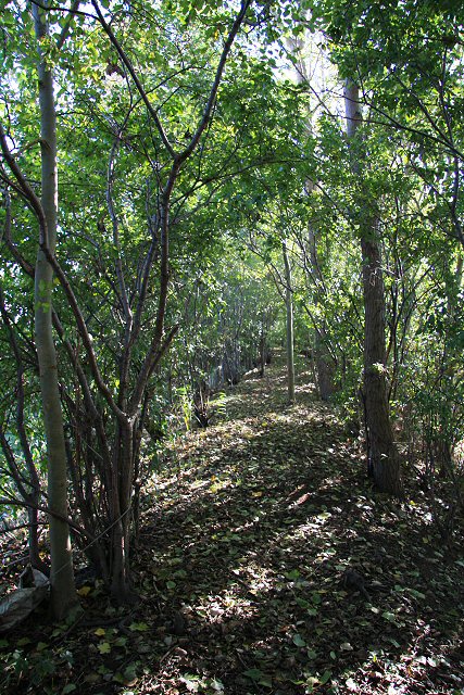
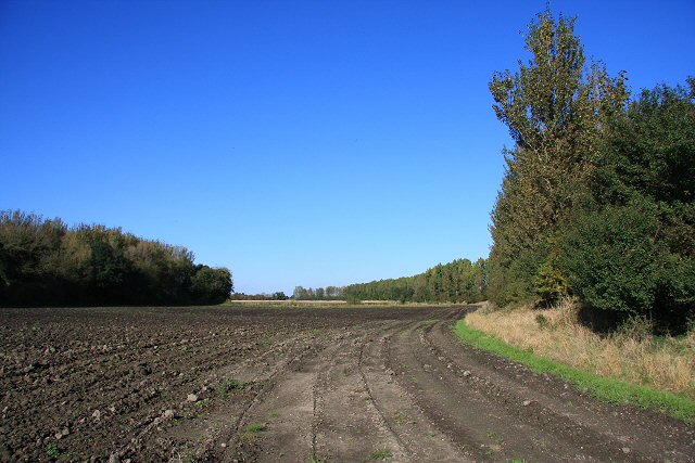
Dragon's Plantation is a picturesque woodland located in Suffolk, England. Spread across an expansive area, this enchanting forest is known for its dense canopy, diverse flora, and serene ambiance. The plantation derives its name from the mythical creatures that are said to have roamed these woods in ancient times.

Covered in a lush green carpet of vegetation, Dragon's Plantation offers a sanctuary for various plant species. Towering oak, beech, and pine trees dominate the landscape, providing ample shade and shelter for a plethora of smaller plants and animals. The forest floor is adorned with a vibrant array of wildflowers, ferns, and mosses, creating a stunning tapestry of colors. This rich biodiversity attracts numerous bird species, making it a popular spot for birdwatchers and nature enthusiasts.

Traversing through Dragon's Plantation, visitors can explore its well-maintained trails that wind their way through the woods. These paths offer a chance to immerse oneself in the tranquility of nature, with occasional glimpses of sunlight filtering through the thick foliage. Along the way, there are several picnic areas and benches where one can take a break and appreciate the beauty of the surroundings.

Dragon's Plantation also boasts a small lake, providing a habitat for aquatic life and adding to the scenic allure of the area. Visitors can enjoy leisurely walks around the lake or engage in fishing activities, adding an extra dimension to their visit.

Overall, Dragon's Plantation in Suffolk is a captivating woodland retreat, offering visitors a chance to reconnect with nature and experience the serenity of a truly magical forest.

If you have any feedback on the listing, please let us know in the comments section below.

Dragon's Plantation Images

Images are sourced within 2km of 52.410452/0.46195194 or Grid Reference TL6782. Thanks to Geograph Open Source API. All images are credited.

Field and driveway in Burnt Fen
Poplar Farm Cottages, Burnt Fen
Minor road off Undley Road
Track near Cupola Farm
Poplars used as windbreak These poplars lie east-west, forming a windbreak in these low-lying fields west of Lakenheath.
Poplars used as windbreak
These poplars lie east-west, forming a windbreak in these low-lying fields west of Lakenheath.
Farmland and ditch near Kenny Hill Looking north-eastwards towards Poplar Farm, north of Kenny Hill.
Farmland and ditch near Kenny Hill
Looking north-eastwards towards Poplar Farm, north of Kenny Hill.
Marly field at Sedge Fen The white of the fields in this low-lying area is caused by ‘shell marl’ that formed on the bed of the former lake Redmere.
Marly field at Sedge Fen
The white of the fields in this low-lying area is caused by ‘shell marl’ that formed on the bed of the former lake Redmere.
Farmland at Sedge Fen Looking east near Lea Farm.
Farmland at Sedge Fen
Looking east near Lea Farm.
Track to New Barns Farm, Undley A private track leading south-east from the end of a no-through road.
Track to New Barns Farm, Undley
A private track leading south-east from the end of a no-through road.
Track to Chalk Farm, Undley A private track, leading north-westwards from a no-through road at Undley, near Lakenheath.
Track to Chalk Farm, Undley
A private track, leading north-westwards from a no-through road at Undley, near Lakenheath.
Up beet This fearsome machine is harvesting sugar beet.  Periodically the tractor and trailer draw up alongside and the beet are unloaded via the conveyor belt.
Up beet
This fearsome machine is harvesting sugar beet. Periodically the tractor and trailer draw up alongside and the beet are unloaded via the conveyor belt.
Bare field adjacent to Cupola Farm This field won't be bare for long...drying winds lead to the light peaty soil blowing away.  In extreme cases this becomes a Fen Blow where the air is literally full of soil.
Bare field adjacent to Cupola Farm
This field won't be bare for long...drying winds lead to the light peaty soil blowing away. In extreme cases this becomes a Fen Blow where the air is literally full of soil.
Cross Bank This footpath leads southwards towards Undley Hall.  It is on the top of an earthen bank, two to three metres above the surrounding fenland, possibly a former dam to prevent flooding.
Cross Bank
This footpath leads southwards towards Undley Hall. It is on the top of an earthen bank, two to three metres above the surrounding fenland, possibly a former dam to prevent flooding.
Farmland near Undley On the right and hidden by the trees is Cross Bank, a raised earthen dyke, along which a footpath runs. The small copse to the left is unnamed.
Farmland near Undley
On the right and hidden by the trees is Cross Bank, a raised earthen dyke, along which a footpath runs. The small copse to the left is unnamed.
Trees at Sedge Fen Compare this photo, taken in October, with one <a href="https://www.geograph.org.uk/photo/368971">TL6783 : Marly field at Sedge Fen</a> taken in March.
Trees at Sedge Fen
Compare this photo, taken in October, with one TL6783 : Marly field at Sedge Fen taken in March.
Rollered field at Sedge Fen A distant tractor is rolling this sandy field in preparation for the next crop sowing.
Rollered field at Sedge Fen
A distant tractor is rolling this sandy field in preparation for the next crop sowing.
Farmland at Sedge Fen Compare this photo, taken in October, with <a href="https://www.geograph.org.uk/photo/368975">TL6783 : Farmland at Sedge Fen</a> taken in March from the same location.
Farmland at Sedge Fen
Compare this photo, taken in October, with TL6783 : Farmland at Sedge Fen taken in March from the same location.
Show me another place!

Dragon's Plantation is located at Grid Ref: TL6782 (Lat: 52.410452, Lng: 0.46195194)

Administrative County: Suffolk

District: West Suffolk

Police Authority: Suffolk

What 3 Words

///outfit.motoring.uniform. Near Lakenheath, Suffolk

Nearby Locations

Dragon's Plantation

Related Wikis

Undley bracteate

The Undley bracteate is a 5th-century bracteate found in Undley Common, near Lakenheath, Suffolk. It bears the earliest known inscription that can be argued...

Lakenheath Poor's Fen

Lakenheath Poor's Fen is a 5.2-hectare biological Site of Special Scientific Interest west of Lakenheath in Suffolk.This is mainly fen with diverse flora...

Lackford Hundred

Lackford was a hundred of Suffolk, consisting of 83,712 acres (338.77 km2).The hundred fills the north western corner of Suffolk and is triangular in shape...

Stallode Wash, Lakenheath

Stallode Wash, Lakenheath is a 34.1-hectare (84-acre) biological Site of Special Scientific Interest north-west of Lakenheath in Suffolk.This is grassland...

Shippea Hill railway station

Shippea Hill railway station (originally Mildenhall Road and later Burnt Fen) is on the Breckland Line in the east of England, serving the Burnt Fen area...

Lakenheath

Lakenheath is a village and civil parish in the West Suffolk district of Suffolk in eastern England. It has a population of 4,691 according to the 2011...

Lakenheath F.C.

Lakenheath Football Club is a football club based in Lakenheath, Suffolk, England. They are currently members of the Eastern Counties League Premier Division...

Beck Row, Holywell Row and Kenny Hill

Beck Row, Holywell Row and Kenny Hill is a civil parish in the Forest Heath district of Suffolk, England. According to the 2001 census, it had a population...

Have you been to Dragon's Plantation?

Leave your review of Dragon's Plantation below (or comments, questions and feedback).