Hoghole Wood

Wood, Forest in Sussex Wealden

England

Hoghole Wood

View to Bewl Water Reservoir Looking from the Sussex Border Path towards the reservoir. Little Butts Farm at the end of the field. The dam of the reservoir just seen to the left.
View to Bewl Water Reservoir Credit: Oast House Archive

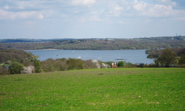
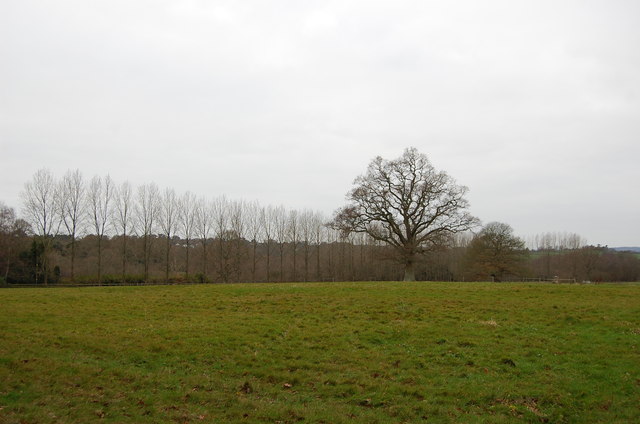
Hoghole Wood, located in Sussex, England, is a charming woodland area renowned for its natural beauty and diverse wildlife. Spanning over 100 acres, this ancient forest offers a tranquil retreat for nature enthusiasts and outdoor adventurers alike.

The wood is predominantly composed of native broadleaf trees, including oak, beech, and ash, which create a dense canopy that provides shade and shelter for the various flora and fauna inhabiting the area. The forest floor is adorned with a vibrant carpet of bluebells during the spring months, creating a picturesque scene that attracts many visitors.

Hoghole Wood is home to a wide range of wildlife, making it a popular spot for birdwatching and animal spotting. Visitors may be fortunate enough to catch a glimpse of deer, foxes, badgers, and rabbits, as well as a variety of bird species, including great spotted woodpeckers, tawny owls, and nuthatches.

The wood offers several well-marked walking trails, allowing visitors to explore its natural wonders at their own pace. These trails meander through the forest, offering breathtaking views of ancient trees, babbling brooks, and peaceful clearings, where visitors can relax and enjoy a picnic surrounded by nature's tranquility.

For those interested in the history of Hoghole Wood, there are remnants of an Iron Age hill fort on its outskirts, adding an element of intrigue and archaeological significance to the area.

Overall, Hoghole Wood in Sussex is a haven for nature lovers, offering a wealth of natural beauty, wildlife, and historical significance. Whether for a leisurely stroll, birdwatching, or simply seeking solace in nature, this enchanting woodland provides a memorable experience for all who visit.

If you have any feedback on the listing, please let us know in the comments section below.
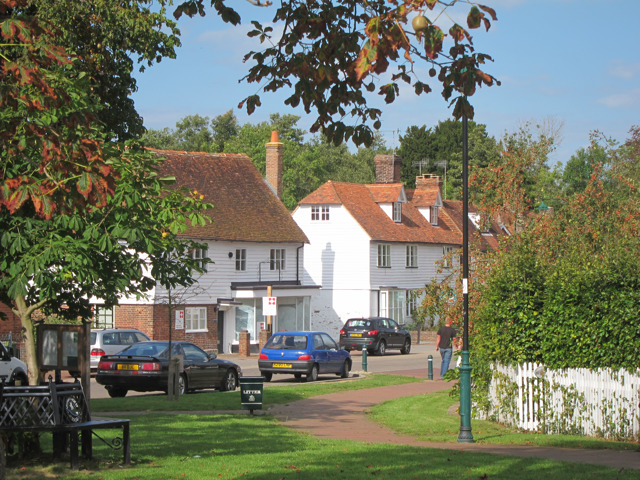
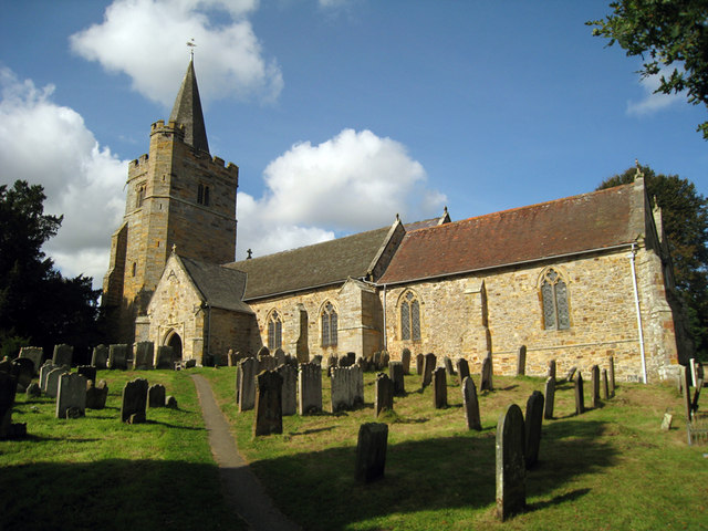
Hoghole Wood Images

Images are sourced within 2km of 51.087663/0.3771435 or Grid Reference TQ6634. Thanks to Geograph Open Source API. All images are credited.

View to Bewl Water Reservoir Looking from the Sussex Border Path towards the reservoir. Little Butts Farm at the end of the field. The dam of the reservoir just seen to the left.
View to Bewl Water Reservoir
Looking from the Sussex Border Path towards the reservoir. Little Butts Farm at the end of the field. The dam of the reservoir just seen to the left.
View of Bayham Abbey As seen from Clay Hill Road.
Looks across the old ruins of the former abbey beside the River Teise.
View of Bayham Abbey
As seen from Clay Hill Road. Looks across the old ruins of the former abbey beside the River Teise.
Damselfly near Hook Green Beside a footpath near B2169 Bayham Road, on a private hedge.
A female Beautiful Demoiselle, (Calopteryx virgo).

See <span class="nowrap"><a title="http://en.wikipedia.org/wiki/Beautiful_Demoiselle" rel="nofollow ugc noopener" href="http://en.wikipedia.org/wiki/Beautiful_Demoiselle">Link</a><img style="margin-left:2px;" alt="External link" title="External link - shift click to open in new window" src="https://s1.geograph.org.uk/img/external.png" width="10" height="10"/></span> for more details.
My first of the year!
Damselfly near Hook Green
Beside a footpath near B2169 Bayham Road, on a private hedge. A female Beautiful Demoiselle, (Calopteryx virgo). See LinkExternal link for more details. My first of the year!
Down Farm Oasts, Lamberhurst Four round kilned oast house, brick built kiln roofs. Built 1879.

Grade II listed.
Down Farm Oasts, Lamberhurst
Four round kilned oast house, brick built kiln roofs. Built 1879. Grade II listed.
Down Farm Oasts, Lamberhurst The plaque reads 1876
Down Farm Oasts, Lamberhurst
The plaque reads 1876
Vineyard Oast, Lamberhurst Down Single round kiln oast house. As a working oast house the building had three round kilns.

Grade II listed.
Vineyard Oast, Lamberhurst Down
Single round kiln oast house. As a working oast house the building had three round kilns. Grade II listed.
Chequers Oast, Spray Hill, Lamberhurst Twin Square Kiln Oast House.
Chequers Oast, Spray Hill, Lamberhurst
Twin Square Kiln Oast House.
The Broadway This bent, was once the main A21 road. Lamberhurst is now bypassed by a dual carriageway.
The Broadway
This bent, was once the main A21 road. Lamberhurst is now bypassed by a dual carriageway.
Victoria House Stores Village shop and post office in the centre of the village.
Victoria House Stores
Village shop and post office in the centre of the village.
Victoria House Stores detail Village shop and post office in the centre of the village.
Victoria House Stores detail
Village shop and post office in the centre of the village.
Chequers Oast, Spray Hill, Lamberhurst Twin Square Kiln Oast House.
Chequers Oast, Spray Hill, Lamberhurst
Twin Square Kiln Oast House.
Chequers Oast, Spray Hill, Lamberhurst Twin Square Kiln Oast House.
Chequers Oast, Spray Hill, Lamberhurst
Twin Square Kiln Oast House.
Scotney Castle access road bridge, A21 The A21 is a 63 mile major trunk road running  from Lewisham in Greater London to Hastings, East Sussex. The road is broken up by the M25 motorway between junction 4 and 5.
Wikipedia <span class="nowrap"><a title="http://en.wikipedia.org/wiki/A21_road_(England)" rel="nofollow ugc noopener" href="http://en.wikipedia.org/wiki/A21_road_(England)">Link</a><img style="margin-left:2px;" alt="External link" title="External link - shift click to open in new window" src="https://s1.geograph.org.uk/img/external.png" width="10" height="10"/></span>
Scotney Castle access road bridge, A21
The A21 is a 63 mile major trunk road running from Lewisham in Greater London to Hastings, East Sussex. The road is broken up by the M25 motorway between junction 4 and 5. Wikipedia LinkExternal link
B2169 to Lamberhurst The old A21 before the bypass was built.
B2169 to Lamberhurst
The old A21 before the bypass was built.
Field and Trees off Monk's Lane
Monk's Lane
Monk's Lane
Crossroads on Newbury Lane Left is Bewl Bridge Lane and right is Sleepers Stile Road
Crossroads on Newbury Lane
Left is Bewl Bridge Lane and right is Sleepers Stile Road
Lane to Free Heath, off Sleepers Stile road
Show me another place!

Hoghole Wood is located at Grid Ref: TQ6634 (Lat: 51.087663, Lng: 0.3771435)

Administrative County: East Sussex

District: Wealden

Police Authority: Sussex

What 3 Words

///gearing.sentences.fruitcake. Near Lamberhurst, Kent

Related Wikis

Bewl Bridge Rowing Club

Bewl Bridge Rowing Club is a rowing club on the Bewl Water, based at Bewlbridge Lane, Lamberhurst, Wadhurst, Tunbridge Wells. Rowers aged 12 and upwards...

Lamberhurst

Lamberhurst ( is a village and civil parish in the borough of Tunbridge Wells in Kent, England. The parish contains the hamlets of The Down and Hook Green...

Scotney Castle

Scotney Castle is an English country house with formal gardens south-east of Lamberhurst in the valley of the River Bewl in Kent, England. It belongs to...

Scotney Castle SSSI

Scotney Castle SSSI is a 112.5-hectare (278-acre) biological Site of Special Scientific Interest in the grounds of Scotney Castle, a National Trust property...

Bewl Water

Bewl Water is a reservoir in the valley of the River Bewl, straddling the boundary between Kent and East Sussex in England. It is about 2 miles (3.2 km...

Bayham Old Abbey

Bayham Old Abbey is an English Heritage property, located near Lamberhurst, Kent, England. Founded c. 1208 through a combination of the failing Premonstratensian...

St Mary's Church, Lamberhurst

St Mary's Church is a parish church in Lamberhurst, Kent. It is a Grade I listed building. == Building == The first buildings on the site were erected...

Rehoboth Chapel, Pell Green

Rehoboth Chapel is a former Strict Baptist place of worship in the hamlet of Pell Green in East Sussex, England. Pell Green is in the parish of Wadhurst...

Nearby Amenities

Located within 500m of 51.087663,0.3771435
Barrier: stile
Bicycle: no
Foot: yes
Material: wood
Source: survey
Stile: stepover
Lat/Long: 51.090883/0.3726126
The data included in this document is from www.openstreetmap.org. The data is made available under ODbL.

Have you been to Hoghole Wood?

Leave your review of Hoghole Wood below (or comments, questions and feedback).