Plunder Wood

Wood, Forest in Cambridgeshire East Cambridgeshire

England

Plunder Wood

Field by Stour Valley Path
Field by Stour Valley Path Credit: Hugh Venables

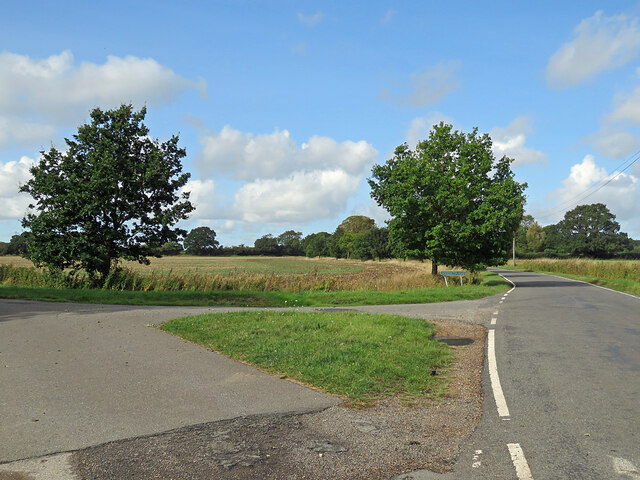
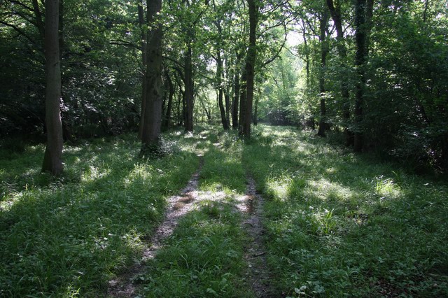
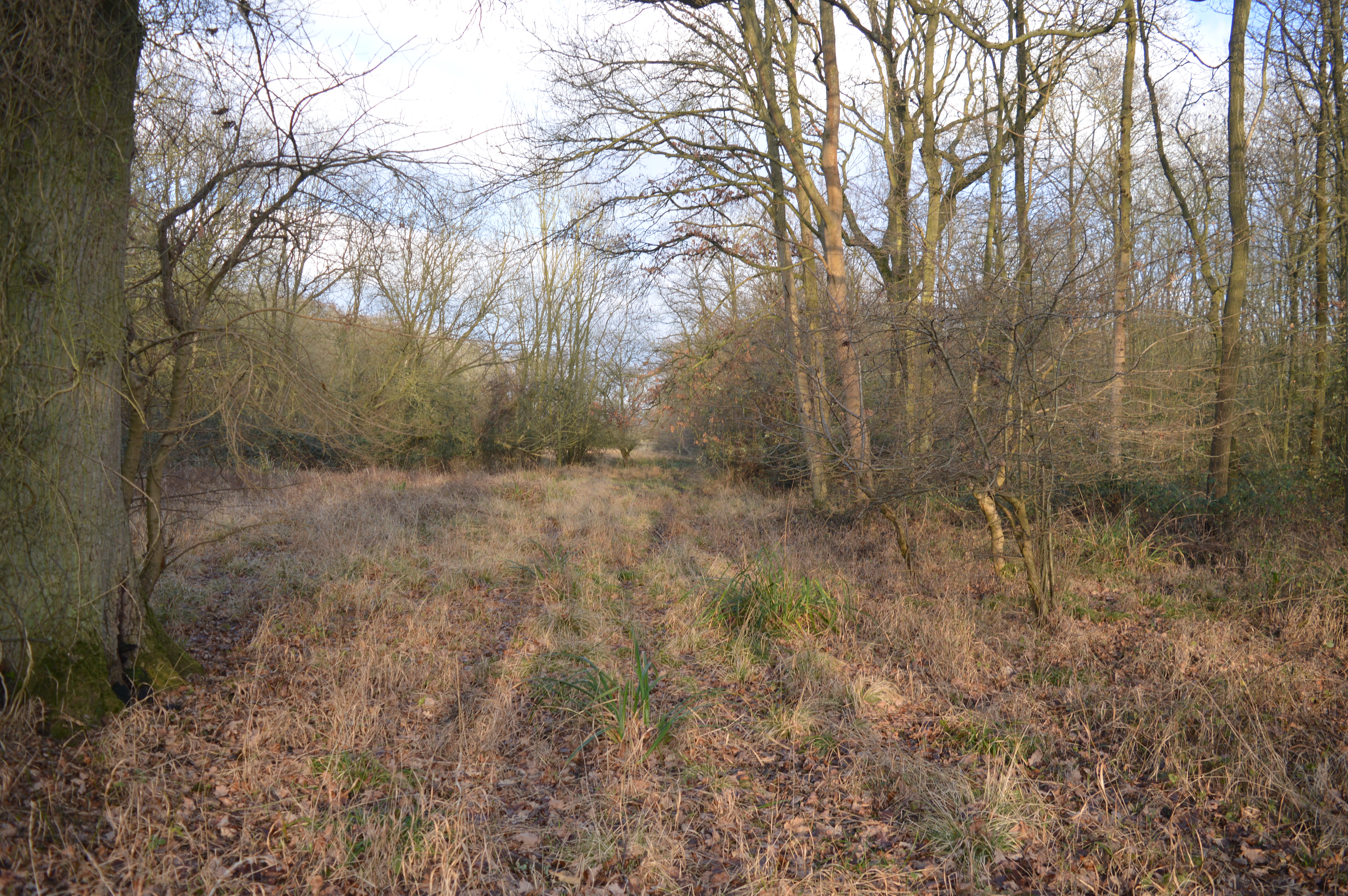
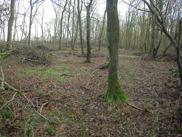
Plunder Wood is a picturesque forest located in Cambridgeshire, England. Covering an area of approximately 500 acres, it is a popular destination for nature enthusiasts and outdoor adventurers alike. The woodland is characterized by its dense canopy of ancient trees, primarily consisting of oak, beech, and ash.

The forest is known for its rich biodiversity, playing host to a wide variety of flora and fauna. Visitors can expect to encounter a diverse range of wildlife, including deer, foxes, badgers, and numerous species of birds. The tranquil atmosphere and peaceful surroundings make it an ideal spot for birdwatching and wildlife photography.

Plunder Wood offers an extensive network of walking trails that wind through the forest, allowing visitors to explore its hidden gems. These well-maintained paths cater to all fitness levels, providing options for leisurely strolls or more challenging hikes. The trails are adorned with vibrant wildflowers during the spring and summer months, adding to the enchanting ambiance of the wood.

The forest also features a designated picnic area, complete with benches and tables, providing an opportunity for visitors to relax and enjoy a meal amidst the serene surroundings. Additionally, there are several designated camping spots for those seeking an overnight adventure.

Plunder Wood is easily accessible, with ample parking facilities available nearby. The forest is open to the public year-round, offering a peaceful retreat from the hustle and bustle of everyday life. Whether one seeks solitude, wildlife encounters, or simply a breath of fresh air, Plunder Wood is a must-visit destination for nature lovers in Cambridgeshire.

If you have any feedback on the listing, please let us know in the comments section below.

Plunder Wood Images

Images are sourced within 2km of 52.165799/0.43416295 or Grid Reference TL6654. Thanks to Geograph Open Source API. All images are credited.

Field by Stour Valley Path
Path by Ten Wood
Path by Ten Wood
Between Widgham Farm and Dullingham Leys This dead-end lane, largely tree-lined, serves isolated houses and stud farms in the horse-racing country south of Newmarket.
Between Widgham Farm and Dullingham Leys
This dead-end lane, largely tree-lined, serves isolated houses and stud farms in the horse-racing country south of Newmarket.
Brook Farm This dead-end lane, largely tree-lined, serves isolated houses and stud farms in the horse-racing country south of Newmarket.
Brook Farm
This dead-end lane, largely tree-lined, serves isolated houses and stud farms in the horse-racing country south of Newmarket.
The end of the road at Widgham Green The twisting single-track lane from Dullingham, which serves isolated houses and stud farms in the horse-racing country south of Newmarket, ends here, at the gates of Widgham Park.
The end of the road at Widgham Green
The twisting single-track lane from Dullingham, which serves isolated houses and stud farms in the horse-racing country south of Newmarket, ends here, at the gates of Widgham Park.
New lake near Widgham Green Previously horse paddocks, though there are still plenty of them in the area. Attracting some new wildlife into the generally dry area.
New lake near Widgham Green
Previously horse paddocks, though there are still plenty of them in the area. Attracting some new wildlife into the generally dry area.
Woodditton Road and Ditton Park Wood The road from Kirtling Green to Woodditton (ahead) on a fine September morning.
Woodditton Road and Ditton Park Wood
The road from Kirtling Green to Woodditton (ahead) on a fine September morning.
Oak Farm Barn On Woodditton Road, not far from Kirtling Green. Oak Farm House, to the right, which is not very visible from the road, is Grade II listed and its earliest parts date from the sixteenth century.
Oak Farm Barn
On Woodditton Road, not far from Kirtling Green. Oak Farm House, to the right, which is not very visible from the road, is Grade II listed and its earliest parts date from the sixteenth century.
On the road from Longacre Green Farm This gravelly lane serves an isolated farm (some way behind the camera) and joins the Stour Valley Path, which leads on to Great Bradley.
On the road from Longacre Green Farm
This gravelly lane serves an isolated farm (some way behind the camera) and joins the Stour Valley Path, which leads on to Great Bradley.
A lane, a ditch and a dead tree This gravelly lane serves Longacre Green Farm (some way behind the camera) and joins the Stour Valley Path, which leads on to Great Bradley.
A lane, a ditch and a dead tree
This gravelly lane serves Longacre Green Farm (some way behind the camera) and joins the Stour Valley Path, which leads on to Great Bradley.
Woodditton Road and a dead-end lane The lane to the left leads to Longacre Green Farm, the road ahead to Woodditton and Newmarket. Towards the end of September it was still late summer on this fine morning in East Cambridgeshire.
Woodditton Road and a dead-end lane
The lane to the left leads to Longacre Green Farm, the road ahead to Woodditton and Newmarket. Towards the end of September it was still late summer on this fine morning in East Cambridgeshire.
Farm track and footpath near Great Bradley The notice at the start of this track in the shallow valley of the infant River Stour forbids vehicles, cycles and horses. The smaller notice asks that dogs be kept under close control as this is a conservation area.
Farm track and footpath near Great Bradley
The notice at the start of this track in the shallow valley of the infant River Stour forbids vehicles, cycles and horses. The smaller notice asks that dogs be kept under close control as this is a conservation area.
Great Bradley: the south side of St Mary's Church "Perp W tower ... Early Tudor S porch of brick with a stepped gable containing six niches. Brick porch windows" (Nikolaus Pevsner).
Great Bradley: the south side of St Mary's Church
"Perp W tower ... Early Tudor S porch of brick with a stepped gable containing six niches. Brick porch windows" (Nikolaus Pevsner).
Great Bradley: The Fox As the name suggests, this was once a public house. The Grade II listed building is older than it looks. Nineteenth-century brick cladding cases a 17th-century  timber frame.
Great Bradley: The Fox
As the name suggests, this was once a public house. The Grade II listed building is older than it looks. Nineteenth-century brick cladding cases a 17th-century timber frame.
Great Bradley: pantiles on the corner Red and buff pantiles on a plain cottage.
Great Bradley: pantiles on the corner
Red and buff pantiles on a plain cottage.
Great Bradley: houses on the main road There is a mixture of timber-framed and more modern houses.
Great Bradley: houses on the main road
There is a mixture of timber-framed and more modern houses.
Across the Stour Valley Looking across the shallow valley of the infant River Stour from the B1061 at Lower Hill Farm near Great Bradley. Though principally a Suffolk river, the Stour rises not far from here, near Weston Green in Cambridgeshire. Plunder Wood is on the skyline behind the barn.
Across the Stour Valley
Looking across the shallow valley of the infant River Stour from the B1061 at Lower Hill Farm near Great Bradley. Though principally a Suffolk river, the Stour rises not far from here, near Weston Green in Cambridgeshire. Plunder Wood is on the skyline behind the barn.
Into Suffolk on a September morning This picture, taken against the light on a fine late-summer morning, shows the junction where the lane from Carlton joins the B1061 half way between Burrough Green and Great Bradley (ahead).
Into Suffolk on a September morning
This picture, taken against the light on a fine late-summer morning, shows the junction where the lane from Carlton joins the B1061 half way between Burrough Green and Great Bradley (ahead).
Show me another place!

Plunder Wood is located at Grid Ref: TL6654 (Lat: 52.165799, Lng: 0.43416295)

Administrative County: Cambridgeshire

District: East Cambridgeshire

Police Authority: Cambridgeshire

What 3 Words

///spent.speeded.business. Near Kedington, Suffolk

Related Wikis

Out and Plunder Woods

Out and Plunder Woods is a 38.6-hectare (95-acre) biological Site of Special Scientific Interest between Great Bradley and Burrough Green in Cambridgeshire...

Ten Wood

Ten Wood is a 17.7-hectare (44-acre) biological Site of Special Scientific Interest east of Burrough Green in Cambridgeshire.This ancient wood is of the...

Great Bradley

Great Bradley is a village and civil parish in the West Suffolk district of Suffolk in eastern England. According to Eilert Ekwall the meaning of the village...

Carlton Wood

Carlton Wood is a 10.4-hectare (26-acre) biological Site of Special Scientific Interest on the eastern boundary of Cambridgeshire, and west of Great Bradley...

Burrough Green

Burrough Green is a village and parish in Cambridgeshire, England. The population of the village at the 2011 census was 378. The soil is various; subsoil...

Castle Newnham School

Castle Newnham School is a coeducational all-through school located over two sites in Bedford, Bedfordshire, England.The school was formed in January 2016...

Park Wood, Cambridgeshire

Park Wood is an 8.1-hectare (20-acre) biological Site of Special Scientific Interest east of Brinkley in Cambridgeshire.This is woodland of the wet ash/maple...

Kirtling

Kirtling, together with Kirtling Green and Kirtling Towers, is a scattered settlement in the south-eastern edge of the English county of Cambridgeshire...

Nearby Amenities

Located within 500m of 52.165799,0.43416295
The data included in this document is from www.openstreetmap.org. The data is made available under ODbL.

Have you been to Plunder Wood?

Leave your review of Plunder Wood below (or comments, questions and feedback).