Tongs Wood

Wood, Forest in Kent Tunbridge Wells

England

Tongs Wood

Access road towards Old Farm This road leads from the A21 towards the farm, in the background are Old Farm Bungalows (half way along the road).
Access road towards Old Farm Credit: David Anstiss

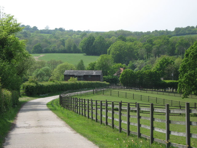
Tongs Wood, located in the county of Kent, England, is a picturesque woodland area renowned for its natural beauty and diverse wildlife. Situated near the village of Goudhurst, this enchanting forest covers approximately 24 hectares, providing a tranquil escape from the bustling urban life.

One of the key features of Tongs Wood is its rich biodiversity. The woodland is home to a variety of plant species, including oak, beech, and birch trees, which create a dense canopy overhead. These trees not only provide a stunning display of colors during autumn but also offer a habitat for numerous bird species, such as woodpeckers and warblers. Additionally, the forest floor is adorned with an array of wildflowers, adding to the natural charm of the area.

As visitors venture through Tongs Wood, they can explore the numerous walking trails that meander through the forest. These paths offer an opportunity to immerse oneself in nature, observing the wildlife and enjoying the peaceful ambiance. The wood is also a popular spot for families and outdoor enthusiasts, who can engage in activities like picnicking, birdwatching, and photography.

Furthermore, Tongs Wood has been designated as a Site of Special Scientific Interest (SSSI) due to its ecological significance. The wood is home to various protected species, including the rare heath fritillary butterfly and dormice. Conservation efforts are in place to maintain and preserve the natural habitat of these species.

In conclusion, Tongs Wood in Kent is a captivating woodland area, cherished for its scenic beauty, diverse flora and fauna, and opportunities for outdoor recreation. Whether seeking solace in nature or exploring the wonders of biodiversity, Tongs Wood offers a truly enriching experience for visitors of all ages.

If you have any feedback on the listing, please let us know in the comments section below.

Tongs Wood Images

Images are sourced within 2km of 51.114837/0.37380863 or Grid Reference TQ6637. Thanks to Geograph Open Source API. All images are credited.

Access road towards Old Farm This road leads from the A21 towards the farm, in the background are Old Farm Bungalows (half way along the road).
Access road towards Old Farm
This road leads from the A21 towards the farm, in the background are Old Farm Bungalows (half way along the road).
Pond in Little Sandhurst Wood As seen from a footpath from Swan Farm on the A21, leading towards Sandhurst Farm. The pond is on a woodland stream leading towards River Teise.
Pond in Little Sandhurst Wood
As seen from a footpath from Swan Farm on the A21, leading towards Sandhurst Farm. The pond is on a woodland stream leading towards River Teise.
Stile in Little Sandhurst Wood As seen from a footpath from Swan Farm on the A21, leading towards Sandhurst Farm.
Stile in Little Sandhurst Wood
As seen from a footpath from Swan Farm on the A21, leading towards Sandhurst Farm.
Fallen tree in Little Sandhurst Wood As seen from a footpath from Swan Farm on the A21, leading towards Sandhurst Farm. Walkers have to duck or climb over the tree.
Fallen tree in Little Sandhurst Wood
As seen from a footpath from Swan Farm on the A21, leading towards Sandhurst Farm. Walkers have to duck or climb over the tree.
Woodland track junction in Little Sandhurst Wood As seen from a footpath from Swan Farm on the A21, leading towards Sandhurst Farm. The footpath follows the track on the left towards the access road to Sandhurst Farm.

Note; large scale OS Map is incorrect. The footpath has been diverted away from the farm and through the wood. The small scale Get-a-map is correct,
Woodland track junction in Little Sandhurst Wood
As seen from a footpath from Swan Farm on the A21, leading towards Sandhurst Farm. The footpath follows the track on the left towards the access road to Sandhurst Farm. Note; large scale OS Map is incorrect. The footpath has been diverted away from the farm and through the wood. The small scale Get-a-map is correct,
Sandhurst Farm Oast House As seen from a footpath from Swan Farm on the A21, leading through Little Sandhurst Wood.
Sandhurst Farm Oast House
As seen from a footpath from Swan Farm on the A21, leading through Little Sandhurst Wood.
Footpath in Little Sandhurst Wood A footpath leads from Swan Farm on the A21, though the wood near Sandhurst Farm, towards Clay Hill Road, near Clay Hill Cottages.

Note; large scale OS Map is incorrect. The footpath has been diverted away from the farm and through the wood. The small scale Get-a-map is correct,
Footpath in Little Sandhurst Wood
A footpath leads from Swan Farm on the A21, though the wood near Sandhurst Farm, towards Clay Hill Road, near Clay Hill Cottages. Note; large scale OS Map is incorrect. The footpath has been diverted away from the farm and through the wood. The small scale Get-a-map is correct,
Woodland Track junction in Little Sandhurst Wood As seen from a footpath from Clay Hill Road, leading through the wood near Sandhurst Farm towards Swan Farm on the A21.
The footpath follows the track on the right. Although the other track leads back to the first. 

See <a href="https://www.geograph.org.uk/photo/2391968">TQ6438 : Woodland track junction in Little Sandhurst Wood</a>.

Note; large scale OS Map is incorrect. The footpath has been diverted away from the farm and through the wood. The small scale Get-a-map is correct,
Woodland Track junction in Little Sandhurst Wood
As seen from a footpath from Clay Hill Road, leading through the wood near Sandhurst Farm towards Swan Farm on the A21. The footpath follows the track on the right. Although the other track leads back to the first. See TQ6438 : Woodland track junction in Little Sandhurst Wood. Note; large scale OS Map is incorrect. The footpath has been diverted away from the farm and through the wood. The small scale Get-a-map is correct,
Access road to Sandhurst Farm This road leads from Clay Hill Road through Little Sandhurst Wood. 
In the background is Dundale Wood.
Access road to Sandhurst Farm
This road leads from Clay Hill Road through Little Sandhurst Wood. In the background is Dundale Wood.
Track junction in Clay Hill Wood This junction is on a footpath leading from Old Swan Farm, through Little Sandhurst Wood near Sandhurst Farm, then it leads through this wood towards Clay Hill Road. The footpath follows the track on the left. The other track leads deeper into the wood.
The look-out beside the tree is probably used by hunters.
Track junction in Clay Hill Wood
This junction is on a footpath leading from Old Swan Farm, through Little Sandhurst Wood near Sandhurst Farm, then it leads through this wood towards Clay Hill Road. The footpath follows the track on the left. The other track leads deeper into the wood. The look-out beside the tree is probably used by hunters.
Pond near Clay Hill Cottages As seen from a footpath heading towards Clay Hill Road.
Pond near Clay Hill Cottages
As seen from a footpath heading towards Clay Hill Road.
View of Bayham Abbey As seen from Clay Hill Road.
Looks across the old ruins of the former abbey beside the River Teise.
View of Bayham Abbey
As seen from Clay Hill Road. Looks across the old ruins of the former abbey beside the River Teise.
Cuckoo Lane
Cuckoo Lane
Lindridge Place Farm Oast Single round kiln oast house.
Lindridge Place Farm Oast
Single round kiln oast house.
View from the A21
View from the A21
Farmland by the A21 near Key's Green
Oast at Little Coldharbour Farm Single round kiln oast house.
Oast at Little Coldharbour Farm
Single round kiln oast house.
Bayham Old Abbey Bayham Abbey ruins include much of the 13th to 15th-century church, the chapter house and a 14th-century gatehouse. It was built in the first half of the 13th century by Premonstratensian canons and by the 15th century the original design had been enlarged with new transepts. The abbey was amongst the first to be dissolved in 1538. It was leased by the King to Anthony Browne, 1st Viscount Montagu, until Queen Elizabeth sold the estate. After various changes in ownership Bayham was sold to Sir John Pratt in 1714 and remained with that family until 1961 when it was donated to English Heritage. It is now set in grounds designed by famous landscape gardener Humphry Repton.
Bayham Old Abbey
Bayham Abbey ruins include much of the 13th to 15th-century church, the chapter house and a 14th-century gatehouse. It was built in the first half of the 13th century by Premonstratensian canons and by the 15th century the original design had been enlarged with new transepts. The abbey was amongst the first to be dissolved in 1538. It was leased by the King to Anthony Browne, 1st Viscount Montagu, until Queen Elizabeth sold the estate. After various changes in ownership Bayham was sold to Sir John Pratt in 1714 and remained with that family until 1961 when it was donated to English Heritage. It is now set in grounds designed by famous landscape gardener Humphry Repton.
Show me another place!

Tongs Wood is located at Grid Ref: TQ6637 (Lat: 51.114837, Lng: 0.37380863)

Administrative County: Kent

District: Tunbridge Wells

Police Authority: Kent

What 3 Words

///marshes.apes.discusses. Near Lamberhurst, Kent

Nearby Locations

Cooksbroom Wood Tongs Wood

Related Wikis

Lamberhurst Quarter

Lamberhurst Quarter is a hamlet on the A21 road, in the English county of Kent. It is near the village of Lamberhurst. == References == http://getamap...

Brookland Wood

Brookland Wood is a 10.9-hectare (27-acre) biological Site of Special Scientific Interest east of Tunbridge Wells in Kent.This site has diverse types of...

Bayham Old Abbey

Bayham Old Abbey is an English Heritage property, located near Lamberhurst, Kent, England. Founded c. 1208 through a combination of the failing Premonstratensian...

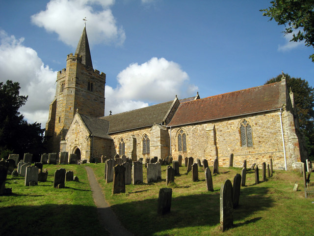
St Mary's Church, Lamberhurst

St Mary's Church is a parish church in Lamberhurst, Kent. It is a Grade I listed building. == Building == The first buildings on the site were erected...
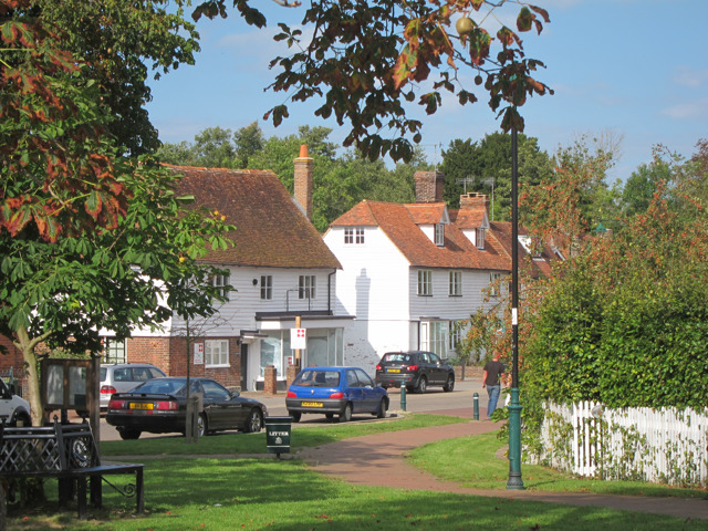
Lamberhurst

Lamberhurst ( is a village and civil parish in the borough of Tunbridge Wells in Kent, England. The parish contains the hamlets of The Down and Hook Green...

Tunbridge Wells (UK Parliament constituency)

Tunbridge Wells is a constituency in Kent represented in the House of Commons of the UK Parliament since 2005 by Greg Clark, a Conservative who served...

St Luke's Church, Matfield

St Luke's Church is a parish church in the village of Matfield, Kent, England. It is a Grade II listed building.The church is dedicated to Luke the Evangelist...

Scotney Castle

Scotney Castle is an English country house with formal gardens south-east of Lamberhurst in the valley of the River Bewl in Kent, England. It belongs to...

Nearby Amenities

Located within 500m of 51.114837,0.37380863
Barrier: stile
Bicycle: no
Foot: yes
Material: wood
Source: survey
Stile: stepover
Lat/Long: 51.1110148/0.371807
Power: pole
Lat/Long: 51.1144353/0.3675637
Power: pole
Lat/Long: 51.1131904/0.3697435
Power: pole
Lat/Long: 51.1121415/0.3714816
Power: pole
Lat/Long: 51.1117104/0.3729363
Power: pole
Lat/Long: 51.1112282/0.3746024
The data included in this document is from www.openstreetmap.org. The data is made available under ODbL.

Have you been to Tongs Wood?

Leave your review of Tongs Wood below (or comments, questions and feedback).