Gravelpit Wood

Wood, Forest in Essex Basildon

England

Gravelpit Wood

Brookman’s Farm
Brookman’s Farm Credit: Alan Hughes

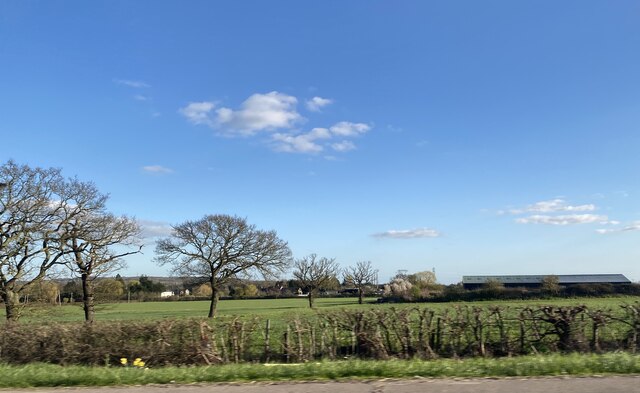
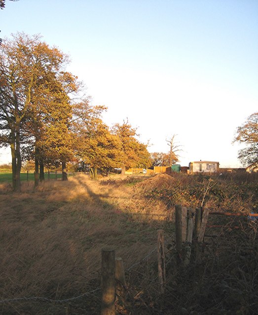
Gravelpit Wood is a picturesque woodland located in Essex, England. Covering an area of approximately 50 acres, it is a popular destination for nature lovers, hikers, and birdwatchers. The wood is nestled within the larger Epping Forest, adding to its charm and natural beauty.

The woodland is characterized by a diverse range of tree species, including oak, beech, and birch. This variety of trees creates a vibrant and ever-changing landscape throughout the seasons. In spring, the wood comes alive with a carpet of bluebells, creating a stunning spectacle for visitors.

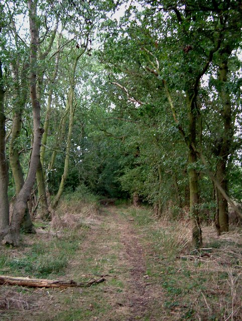
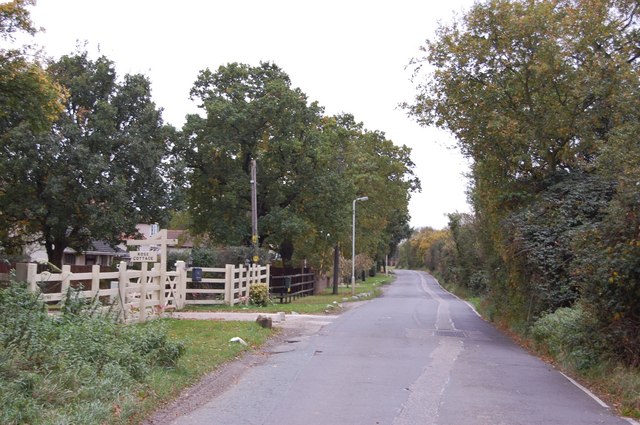
Gravelpit Wood offers a network of well-maintained walking trails, providing visitors with the opportunity to explore its natural wonders. The paths are easily accessible and suitable for all ages and fitness levels. Along the trails, there are informative signposts that highlight points of interest, such as ancient trees or historical landmarks.

Bird enthusiasts will find Gravelpit Wood particularly appealing, as it is home to a wide array of bird species. From majestic owls to colorful woodpeckers, the wood provides a haven for these feathered friends. Birdwatchers can often spot rare and migratory birds, making it an ideal spot for photography and observation.

In addition to its natural beauty, Gravelpit Wood also offers amenities such as picnic areas and benches, allowing visitors to relax and take in the tranquil surroundings. The wood is open to the public year-round, and there are no entrance fees.

Overall, Gravelpit Wood is a hidden gem in Essex, offering a peaceful retreat from the hustle and bustle of everyday life. Its rich biodiversity, well-maintained trails, and stunning scenery make it a must-visit destination for nature enthusiasts.

If you have any feedback on the listing, please let us know in the comments section below.

Gravelpit Wood Images

Images are sourced within 2km of 51.586066/0.39228934 or Grid Reference TQ6590. Thanks to Geograph Open Source API. All images are credited.

Brookman’s Farm
Brookman’s Farm
Herongate - The Olde Dog Inn A weather-boarded C18th inn on the Billericay Road out of Herongate with a good choice of ales on offer. 
EH Grade II listed: <span class="nowrap"><a title="https://historicengland.org.uk/listing/the-list/list-entry/1205513?section=official-list-entry" rel="nofollow ugc noopener" href="https://historicengland.org.uk/listing/the-list/list-entry/1205513?section=official-list-entry">Link</a><img style="margin-left:2px;" alt="External link" title="External link - shift click to open in new window" src="https://s1.geograph.org.uk/img/external.png" width="10" height="10"/></span>
See their website here: <span class="nowrap"><a title="https://theoldedoginn.co.uk" rel="nofollow ugc noopener" href="https://theoldedoginn.co.uk">Link</a><img style="margin-left:2px;" alt="External link" title="External link - shift click to open in new window" src="https://s1.geograph.org.uk/img/external.png" width="10" height="10"/></span>
Herongate - The Olde Dog Inn
A weather-boarded C18th inn on the Billericay Road out of Herongate with a good choice of ales on offer. EH Grade II listed: LinkExternal link See their website here: LinkExternal link
View towards Poles Wood
Steeple View Farm Farmland north of Laindon, Basildon.
Steeple View Farm
Farmland north of Laindon, Basildon.
A128 to A127 Byway This is a picture of the Byway between Tilbury Road near the  A128 and the A127 at Green Meadows Nurseries. The picture was taken a few yards past the point where the ruts caused by numerous 4x4’s peter out.
A128 to A127 Byway
This is a picture of the Byway between Tilbury Road near the A128 and the A127 at Green Meadows Nurseries. The picture was taken a few yards past the point where the ruts caused by numerous 4x4’s peter out.
Friern Manor Hotel, Dunton, Essex An old manor house - converted to a country hotel. On the west side of Lower Dunton Road.
Friern Manor Hotel, Dunton, Essex
An old manor house - converted to a country hotel. On the west side of Lower Dunton Road.
Fords Research & Engineering Centre, Dunton, Essex Ford Motor Company's main research facility in Europe.
Fords Research & Engineering Centre, Dunton, Essex
Ford Motor Company's main research facility in Europe.
Southfields Industrial Estate, Laindon, Essex
Royal Court  on Brookmeade; Laindon “High Rise” accommodation is not a common feature of Laindon but the 1960’s high density living planners still managed to throw up a couple of blocks here.
Royal Court on Brookmeade; Laindon
“High Rise” accommodation is not a common feature of Laindon but the 1960’s high density living planners still managed to throw up a couple of blocks here.
Ford's Dunton Technical Centre "Automobile Research Centre" on the OS maps.
Ford's Dunton Technical Centre
"Automobile Research Centre" on the OS maps.
Durham Road
Durham Road
Bridleway No. 161 to Dunton Wayletts No chance of  me getting through here without a machete and bolt croppers, let alone my horse. Fortunately such blatant PRW obstruction is rare in south Essex.
Bridleway No. 161 to Dunton Wayletts
No chance of me getting through here without a machete and bolt croppers, let alone my horse. Fortunately such blatant PRW obstruction is rare in south Essex.
Approach Road to Ford's Dunton Ford's plant at Dunton is for research and development. This is the road approaching the entrance.
Approach Road to Ford's Dunton
Ford's plant at Dunton is for research and development. This is the road approaching the entrance.
Southfields Industrial Estate These storage tanks and radio mast are on Bramston Link.
Southfields Industrial Estate
These storage tanks and radio mast are on Bramston Link.
Southfields Industrial Estate These units are on the corner of Bramston Link and Christy Way.
Southfields Industrial Estate
These units are on the corner of Bramston Link and Christy Way.
The Old Rectory, Dunton. The windows of the Old Rectory look out across flat fields to Dunton Church a few hundred metres to the south (behind photographer position). The house now caters for wedding parties and other functions.
The Old Rectory, Dunton.
The windows of the Old Rectory look out across flat fields to Dunton Church a few hundred metres to the south (behind photographer position). The house now caters for wedding parties and other functions.
West Mayne, Laindon The view looks west along West Mayne towards the Durham Road roundabout.
West Mayne, Laindon
The view looks west along West Mayne towards the Durham Road roundabout.
Wheatfield with tyre tracks Tyre tracks heading north but no clear sign of footpath No.101 to Dunton which runs across there somewhere according to the sign.
Wheatfield with tyre tracks
Tyre tracks heading north but no clear sign of footpath No.101 to Dunton which runs across there somewhere according to the sign.
Show me another place!

Gravelpit Wood is located at Grid Ref: TQ6590 (Lat: 51.586066, Lng: 0.39228934)

Administrative County: Essex

District: Basildon

Police Authority: Essex

What 3 Words

///spider.lend.inform. Near Ingrave, Essex

Nearby Locations

Gravelpit Wood

Related Wikis

Dunton Wayletts

Dunton Wayletts or Dunton is hamlet and former civil parish in the Borough of Basildon in Essex, England. It lies on the western outskirts of the borough...

Dunton Technical Centre

The Dunton Campus (informally Ford Dunton or Dunton) is a major automotive research and development facility located in Dunton Wayletts, Laindon, Essex...

Billericay Rural District

Billericay Rural District was a local government district in Essex, England from 1894 to 1934. It consisted of the following parishes: Basildon Brentwood...

Little Burstead

Little Burstead is a village in Essex, England. It lies 2.25 miles (4 km) south-south-west of Billericay and 4.5 miles (7 km) east-south-east of Brentwood...

Laindon

Laindon is a town and civil parish, which now forms part of the town of Basildon, in the Basildon district, in Essex, England. It is between Basildon and...

All Saints Church, East Horndon

All Saints' Church is a redundant Anglican church in the village of East Horndon, Essex, England. It is recorded in the National Heritage List for England...

Langdon Nature Reserve

Langdon Nature Reserve (also described as Langdon Nature Discovery Park) is a 210 hectare nature reserve west of Basildon in Essex. It is managed by the...

East Horndon

East Horndon is a village and former civil parish, now in the parish of West Horndon, in the south of the borough of Brentwood in Essex in the East of...

Nearby Amenities

Located within 500m of 51.586066,0.39228934
Motorway Junction
Dunton Junction
Lat/Long: 51.5846247/0.3986201
Crossing
Bicycle: yes
Crossing: unmarked
Lat/Long: 51.5843236/0.3948639
Crossing
Bicycle: yes
Crossing: unmarked
Lat/Long: 51.5838896/0.3950417
Crossing
Bicycle: yes
Crossing: unmarked
Lat/Long: 51.5830015/0.3891729
Crossing
Bicycle: yes
Crossing: unmarked
Lat/Long: 51.5833515/0.3888262
Crossing
Crossing: unmarked
Crossing Markings: no
Lat/Long: 51.5829122/0.391884
Crossing
Crossing: unmarked
Crossing Markings: no
Lat/Long: 51.582844/0.3922926
Crossing
Crossing: unmarked
Crossing Markings: no
Lat/Long: 51.5818695/0.3941095
Crossing
Crossing: unmarked
Crossing Markings: no
Lat/Long: 51.5819539/0.3940584
The data included in this document is from www.openstreetmap.org. The data is made available under ODbL.

Have you been to Gravelpit Wood?

Leave your review of Gravelpit Wood below (or comments, questions and feedback).