Carlton Wood

Wood, Forest in Cambridgeshire South Cambridgeshire

England

Carlton Wood

Collapsed shed, fallen apples, pink cottages and a red car Near Raynor's Bridge on the undulating road from Carlton to Brinkley (ahead). The pink row is Little Low Cottages.

Keith Edkins was here in 2018: <a href="https://www.geograph.org.uk/photo/5922622">TL6353 : Old shed at Raynor Bridge</a>.
Collapsed shed, fallen apples, pink cottages and a red car Credit: John Sutton

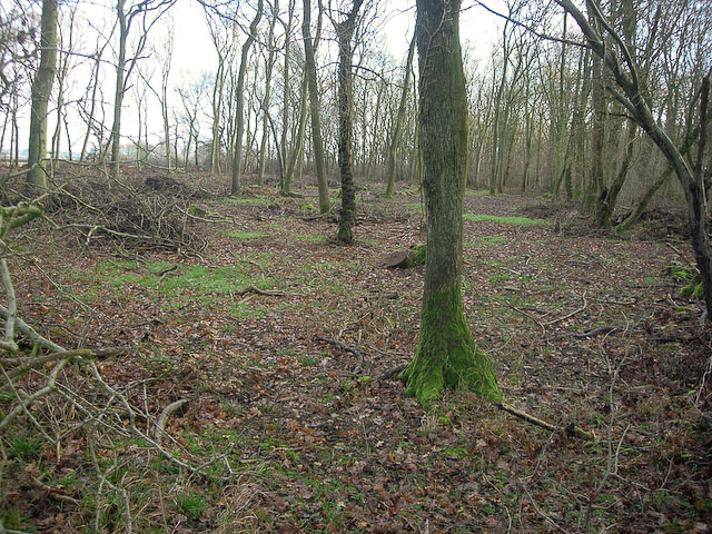
Carlton Wood is a picturesque forest located in the county of Cambridgeshire, England. Covering an area of approximately 100 hectares, this woodland is a haven for nature enthusiasts and outdoor lovers alike.

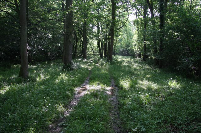
The wood is predominantly composed of deciduous trees, with a rich variety of species such as oak, beech, and birch. These towering trees create a dense canopy, casting dappled sunlight onto the forest floor below. In spring, the woodland comes alive with vibrant wildflowers, including bluebells and primroses, adding bursts of color to the serene surroundings.

Carlton Wood is home to a diverse range of wildlife, making it a popular spot for birdwatchers and animal enthusiasts. Visitors may catch a glimpse of native birds, such as woodpeckers, jays, and tawny owls, as well as mammals like deer, foxes, and badgers. The tranquil atmosphere of the forest provides a peaceful habitat for these creatures, allowing them to thrive undisturbed.

For those seeking leisurely walks or adventurous hikes, Carlton Wood offers a network of well-maintained trails. These pathways wind through the forest, offering breathtaking views of the natural scenery. Visitors can explore the wood at their own pace, immersing themselves in the beauty of the surroundings and taking in the fresh air.

In summary, Carlton Wood in Cambridgeshire is a stunning forest that boasts a rich variety of flora and fauna. With its idyllic landscape and peaceful ambiance, it is an ideal destination for nature lovers and outdoor enthusiasts seeking to escape the hustle and bustle of everyday life.

If you have any feedback on the listing, please let us know in the comments section below.

Carlton Wood Images

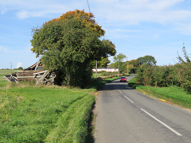
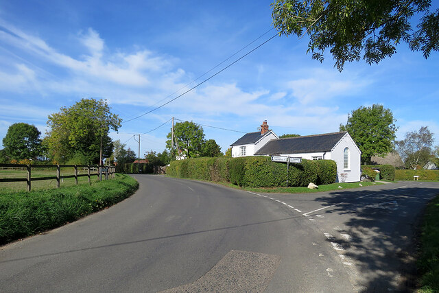
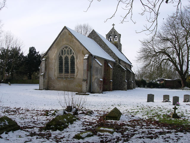
Images are sourced within 2km of 52.150271/0.41656308 or Grid Reference TL6552. Thanks to Geograph Open Source API. All images are credited.

Collapsed shed, fallen apples, pink cottages and a red car Near Raynor's Bridge on the undulating road from Carlton to Brinkley (ahead). The pink row is Little Low Cottages.

Keith Edkins was here in 2018: <a href="https://www.geograph.org.uk/photo/5922622">TL6353 : Old shed at Raynor Bridge</a>.
Collapsed shed, fallen apples, pink cottages and a red car
Near Raynor's Bridge on the undulating road from Carlton to Brinkley (ahead). The pink row is Little Low Cottages. Keith Edkins was here in 2018: TL6353 : Old shed at Raynor Bridge.
Carlton: a cottage on Brinkley Road In the valley of the River Stour, which rises on nearby Wratting Common. The original parts of the Grade II listed cottage were built in the 18th century.
Carlton: a cottage on Brinkley Road
In the valley of the River Stour, which rises on nearby Wratting Common. The original parts of the Grade II listed cottage were built in the 18th century.
Carlton Hill: across the Stour Valley John Constable's Stour is a Suffolk river, but it rises not far from here, at Wratting Common near Weston Colville in the hills of East Cambridgeshire and reaches the sea at Manningtree in Essex. <a href="https://www.geograph.org.uk/photo/7307887">TL6453 : Carlton: a cottage on Brinkley Road</a> is a closer look at the house in the centre middle distance.
Carlton Hill: across the Stour Valley
John Constable's Stour is a Suffolk river, but it rises not far from here, at Wratting Common near Weston Colville in the hills of East Cambridgeshire and reaches the sea at Manningtree in Essex. TL6453 : Carlton: a cottage on Brinkley Road is a closer look at the house in the centre middle distance.
Carlton: former school and school house This is where Church Road, Brinkley Road (left) and Acre Road (right) meet. The picture was taken on a sunny October morning when only some trees' leaves had changed colour.
Carlton: former school and school house
This is where Church Road, Brinkley Road (left) and Acre Road (right) meet. The picture was taken on a sunny October morning when only some trees' leaves had changed colour.
Carlton: houses and path on Church Road Looking towards Carlton Hill at the north end of this straggling Cambridgeshire village.
Carlton: houses and path on Church Road
Looking towards Carlton Hill at the north end of this straggling Cambridgeshire village.
Carlton: white walls on Church Street Looking towards the centre of the village on a bright October morning.
Carlton: white walls on Church Street
Looking towards the centre of the village on a bright October morning.
Carlton: churchyard light and shade Taken from shaded Carlton Green Road on a sunny October morning. St Peter's is a small and rewarding church: see, for instance, <a href="https://www.geograph.org.uk/photo/3143308">TL6452 : Carlton: St Peter - font</a>, <a href="https://www.geograph.org.uk/photo/3143323">TL6452 : Carlton: St Peter - south window</a> and <a href="https://www.geograph.org.uk/photo/3143339">TL6452 : Carlton: St Peter - interior</a>, taken ten years before.
Carlton: churchyard light and shade
Taken from shaded Carlton Green Road on a sunny October morning. St Peter's is a small and rewarding church: see, for instance, TL6452 : Carlton: St Peter - font, TL6452 : Carlton: St Peter - south window and TL6452 : Carlton: St Peter - interior, taken ten years before.
Autumn rolling A tractor pulling a huge disc roller, photographed from the road from Carlton Green to Carlton on a sunny October morning.
Autumn rolling
A tractor pulling a huge disc roller, photographed from the road from Carlton Green to Carlton on a sunny October morning.
On the road to Carlton Between Carlton Green and Carlton on a sunny October morning.
On the road to Carlton
Between Carlton Green and Carlton on a sunny October morning.
Carlton Green: once a pub The red-roofed cottage was once a public house.
Carlton Green: once a pub
The red-roofed cottage was once a public house.
Towards Carlton Green A straight stretch of the winding road from Little Thurlow.
Towards Carlton Green
A straight stretch of the winding road from Little Thurlow.
Nearing Temple End Plantation A short stretch of the Little Thurlow to Carlton Green road forms the county boundary: Suffolk and Temple End Plantation are to the left, Cambridgeshire to the right.
Nearing Temple End Plantation
A short stretch of the Little Thurlow to Carlton Green road forms the county boundary: Suffolk and Temple End Plantation are to the left, Cambridgeshire to the right.
A farm track on the county boundary Cambridgeshire to the left of the hedge, Suffolk to the right.
A farm track on the county boundary
Cambridgeshire to the left of the hedge, Suffolk to the right.
Great Bradley: the south side of St Mary's Church "Perp W tower ... Early Tudor S porch of brick with a stepped gable containing six niches. Brick porch windows" (Nikolaus Pevsner).
Great Bradley: the south side of St Mary's Church
"Perp W tower ... Early Tudor S porch of brick with a stepped gable containing six niches. Brick porch windows" (Nikolaus Pevsner).
Great Bradley: The Fox As the name suggests, this was once a public house. The Grade II listed building is older than it looks. Nineteenth-century brick cladding cases a 17th-century  timber frame.
Great Bradley: The Fox
As the name suggests, this was once a public house. The Grade II listed building is older than it looks. Nineteenth-century brick cladding cases a 17th-century timber frame.
Great Bradley: pantiles on the corner Red and buff pantiles on a plain cottage.
Great Bradley: pantiles on the corner
Red and buff pantiles on a plain cottage.
Great Bradley: houses on the main road There is a mixture of timber-framed and more modern houses.
Great Bradley: houses on the main road
There is a mixture of timber-framed and more modern houses.
Across the Stour Valley Looking across the shallow valley of the infant River Stour from the B1061 at Lower Hill Farm near Great Bradley. Though principally a Suffolk river, the Stour rises not far from here, near Weston Green in Cambridgeshire. Plunder Wood is on the skyline behind the barn.
Across the Stour Valley
Looking across the shallow valley of the infant River Stour from the B1061 at Lower Hill Farm near Great Bradley. Though principally a Suffolk river, the Stour rises not far from here, near Weston Green in Cambridgeshire. Plunder Wood is on the skyline behind the barn.
Show me another place!

Carlton Wood is located at Grid Ref: TL6552 (Lat: 52.150271, Lng: 0.41656308)

Administrative County: Cambridgeshire

District: South Cambridgeshire

Police Authority: Cambridgeshire

What 3 Words

///elbowed.musically.community. Near Balsham, Cambridgeshire

Nearby Locations

Carlton Wood

Related Wikis

Carlton Wood

Carlton Wood is a 10.4-hectare (26-acre) biological Site of Special Scientific Interest on the eastern boundary of Cambridgeshire, and west of Great Bradley...

Great Bradley

Great Bradley is a village and civil parish in the West Suffolk district of Suffolk in eastern England. According to Eilert Ekwall the meaning of the village...

Carlton, Cambridgeshire

Carlton is a village and civil parish near the eastern boundary of the county of Cambridgeshire in the east of England. It is in the district of South...

Out and Plunder Woods

Out and Plunder Woods is a 38.6-hectare (95-acre) biological Site of Special Scientific Interest between Great Bradley and Burrough Green in Cambridgeshire...

Have you been to Carlton Wood?

Leave your review of Carlton Wood below (or comments, questions and feedback).