The Alders

Wood, Forest in Kent Tonbridge and Malling

England

The Alders

HGVs
HGVs Credit: David Long

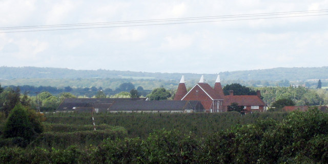
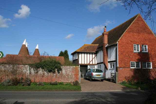
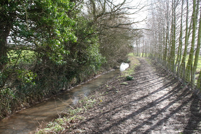
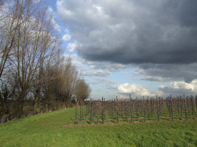
The Alders, located in Kent, England, is a picturesque woodland area known for its dense forest and thriving biodiversity. Covering an extensive area, The Alders is a haven for nature enthusiasts and wildlife enthusiasts alike.

The woodland is dominated by a variety of alder trees, which give the area its name. These trees, with their broad leaves and distinctive cones, create a beautiful and serene atmosphere, especially during the autumn months when their foliage transforms into vibrant hues of red and gold.

The Alders is home to a plethora of wildlife, making it a popular spot for birdwatchers and animal lovers. Bird species such as woodpeckers, owls, and finches can be spotted in the treetops, while rabbits, squirrels, and foxes can be seen scurrying along the forest floor. The area also attracts a diverse range of insects, including butterflies and bees, which thrive on the abundant wildflowers that dot the forest.

Visitors to The Alders can enjoy a range of activities, such as hiking, picnicking, and nature walks. Several well-marked trails wind through the forest, offering stunning views of the surrounding countryside and opportunities to spot the local flora and fauna. The tranquil atmosphere of The Alders makes it an ideal destination for those seeking a peaceful retreat from the hustle and bustle of city life.

Overall, The Alders in Kent is a captivating woodland area that showcases the beauty of nature. Its thriving ecosystem, diverse wildlife, and serene ambiance make it a must-visit destination for nature lovers and outdoor enthusiasts.

If you have any feedback on the listing, please let us know in the comments section below.

The Alders Images

Images are sourced within 2km of 51.201307/0.36556866 or Grid Reference TQ6547. Thanks to Geograph Open Source API. All images are credited.

Methodist Chapel at East Peckham
The Hop Farm, Beltring Whitbread's tourist attraction, The Hop Farm, with museum in the old oast houses and ornamental cart and barrows tastefully positioned outside.
The Hop Farm, Beltring
Whitbread's tourist attraction, The Hop Farm, with museum in the old oast houses and ornamental cart and barrows tastefully positioned outside.
The Bell
The Bell
The Man of Kent 16th century building
The Man of Kent
16th century building
Sluice Weir Lock Sluice Weir Lock near East Peckham.
Sluice Weir Lock
Sluice Weir Lock near East Peckham.
Kent House Oast Fine building between Hadlow and East Peckham, seen from the junction of Pierce Mill Lane and Hatches Lane.
Kent House Oast
Fine building between Hadlow and East Peckham, seen from the junction of Pierce Mill Lane and Hatches Lane.
Golden Green A small village, East of Tonbridge.
Golden Green
A small village, East of Tonbridge.
Oast House Four round kilned oast house.
Oast House
Four round kilned oast house.
War & Peace show, Beltring Hop Farm The War & Peace show is one of the largest of its kind in Europe, people come from around the Europe to take part.
War & Peace show, Beltring Hop Farm
The War & Peace show is one of the largest of its kind in Europe, people come from around the Europe to take part.
Ploggs Hall Oast, Whetsted Road, near Five Oak Green, Kent
Oast House at Moat Farm, Whetsted Road, Five Oak Green, Kent An Oast House is a building used to dry fresh hops before they are sent to the brewers, to be used for flavouring beer. A traditional Oast House consists of the 'oast' and the 'stowage'. The oast was a kiln, with a plenum chamber fired by charcoal at ground floor and the drying floor directly above. The steep pitched roof channelled the hot air through the hops to the top. The stowage, was the barn section, it had a cooling floor and press at first floor and storage area at ground floor. Read more <a title="https://www.geograph.org.uk/article/Oast-Houses" href="https://www.geograph.org.uk/article/Oast-Houses">Link</a>
Oast House at Moat Farm, Whetsted Road, Five Oak Green, Kent
An Oast House is a building used to dry fresh hops before they are sent to the brewers, to be used for flavouring beer. A traditional Oast House consists of the 'oast' and the 'stowage'. The oast was a kiln, with a plenum chamber fired by charcoal at ground floor and the drying floor directly above. The steep pitched roof channelled the hot air through the hops to the top. The stowage, was the barn section, it had a cooling floor and press at first floor and storage area at ground floor. Read more Link
Oak Weir Lock, River Medway, Kent The River Medway is navigable all the way up to Tonbridge, and divides the Kentishman (who was born north and west of its arc) from the Man of Kent (who was born outside the arc). A good path is available so that you can walk the whole navigable stretch, if you don't have a boat, and a very pleasant walk it is.  Here we see the river at Oak Weir Lock No 5 (they are numbered from the top) as it was on a summer's day in 1974.  It is unchanged to this day.
Oak Weir Lock, River Medway, Kent
The River Medway is navigable all the way up to Tonbridge, and divides the Kentishman (who was born north and west of its arc) from the Man of Kent (who was born outside the arc). A good path is available so that you can walk the whole navigable stretch, if you don't have a boat, and a very pleasant walk it is. Here we see the river at Oak Weir Lock No 5 (they are numbered from the top) as it was on a summer's day in 1974. It is unchanged to this day.
The Barn and Poplar Farm Oasts, Barnes Street, Kent A typical Kentish scene with a large timber-framed house (possibly it was originally a barn) and the tips of oast houses visible in the background.  Barnes Street is a very pleasant village on the minor road from Tonbridge to East Peckham.
The Barn and Poplar Farm Oasts, Barnes Street, Kent
A typical Kentish scene with a large timber-framed house (possibly it was originally a barn) and the tips of oast houses visible in the background. Barnes Street is a very pleasant village on the minor road from Tonbridge to East Peckham.
The Wealdway: south from Barnes Street, Kent This section of the Wealdway is very pleasant. It runs alongside a small stream, a tributary of the River Medway, which is reached at Ford Green Bridge.  The path then turns due west and follows the river into Tonbridge.
The Wealdway: south from Barnes Street, Kent
This section of the Wealdway is very pleasant. It runs alongside a small stream, a tributary of the River Medway, which is reached at Ford Green Bridge. The path then turns due west and follows the river into Tonbridge.
New orchards at Moat Farm This apple orchard was probably planted about 2 years ago and is protected from northerly winds by the poplar windbreak to the left.
New orchards at Moat Farm
This apple orchard was probably planted about 2 years ago and is protected from northerly winds by the poplar windbreak to the left.
Stone Castle Farm and Oast Nicely reflected in the pond with a willow just coming into leaf in front.
Stone Castle Farm and Oast
Nicely reflected in the pond with a willow just coming into leaf in front.
Show me another place!

The Alders is located at Grid Ref: TQ6547 (Lat: 51.201307, Lng: 0.36556866)

Administrative County: Kent

District: Tonbridge and Malling

Police Authority: Kent

What 3 Words

///windpipe.websites.spends. Near East Peckham, Kent

Nearby Locations

Mays Wood The Alders

Related Wikis

Branbridges

Branbridges is a village in Kent, England, on the River Medway. It is near East Peckham, and the nearest railway station is Beltring. Today it has practically...
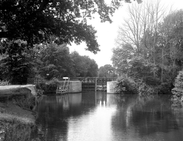
River Bourne, Kent

The River Bourne rises in the parish of Ightham, Kent and flows in a generally south easterly direction through the parishes of Borough Green, Platt, Plaxtol...

Golden Green

Golden Green is a village in the Medway valley near Tonbridge in Kent, England. It is 1 mile (1.6 km) from the larger village of Hadlow (of which it is...

Five Oak Green

Five Oak Green is a village near Tonbridge, Kent in the Civil Parish of Capel. The village was a centre for hop growing. In the 19th century, The Rose...

Holy Trinity Church, East Peckham

St Mary's Church is a parish church in East Peckham, Kent. It is a Grade II listed building. == Building == Built of coursed rubble stone with a tiled...
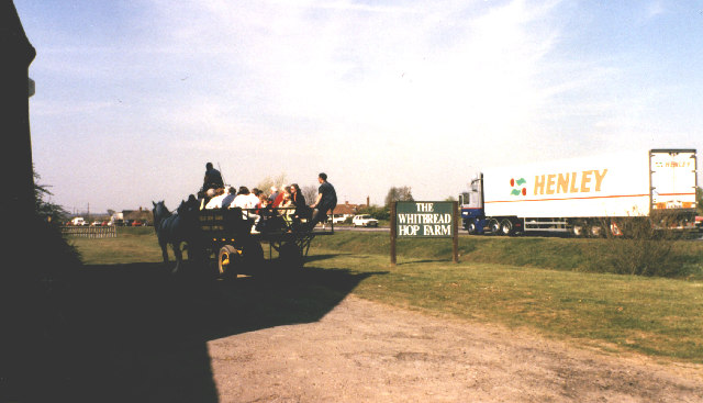
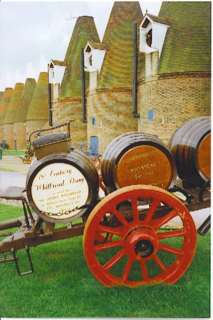
Hop Farm

The Hop Farm is a 400-acre (1.6 km2) Country Park in Beltring, near East Peckham in the English county of Kent. The farm is over 450 years old and has...

Beltring

Beltring is a village in the local government district of Tonbridge and Malling in Kent, England. It is in the civil parish of East Peckham. Beltring is...

East Peckham

East Peckham is a village and civil parish in Kent, England on the River Medway. The parish covers the main village as well as Hale Street and Beltring...

Nearby Amenities

Located within 500m of 51.201307,0.36556866
Power: pole
Lat/Long: 51.2044977/0.3632019
Power: pole
Lat/Long: 51.1985979/0.3645476
Power: pole
Lat/Long: 51.199522/0.3644742
Power: pole
Lat/Long: 51.202314/0.3636904
Power: pole
Lat/Long: 51.2023272/0.3638235
Power: pole
Lat/Long: 51.2045137/0.363328
Power: pole
Lat/Long: 51.1974596/0.3647472
Power: pole
Lat/Long: 51.2052762/0.3630203
Power: pole
Lat/Long: 51.1995011/0.3643555
Power: pole
Lat/Long: 51.2003214/0.3642862
Power: pole
Lat/Long: 51.203346/0.3634579
Power: pole
Lat/Long: 51.197472/0.3646184
Power: pole
Lat/Long: 51.2052928/0.3631388
Power: pole
Lat/Long: 51.1986108/0.3646862
Power: pole
Lat/Long: 51.2012881/0.3639271
Power: pole
Lat/Long: 51.201302/0.3640595
Power: pole
Lat/Long: 51.2003022/0.3641577
Power: pole
Lat/Long: 51.2033617/0.363586
Waterway: lock_gate
Lat/Long: 51.2000872/0.3656542
Waterway: weir
Lat/Long: 51.2002355/0.3648473
Barrier: kissing_gate
Bicycle: no
Foot: yes
Material: metal
Lat/Long: 51.2002651/0.3589303
The data included in this document is from www.openstreetmap.org. The data is made available under ODbL.

Have you been to The Alders?

Leave your review of The Alders below (or comments, questions and feedback).