Homelye Wood

Wood, Forest in Essex Uttlesford

England

Homelye Wood

Footbridge, A120 The A120 is a trunk road that runs east-west across East Anglia from Harwich to Puckeridge, 63 miles in length. It follows the route of the Roman Road, Stane Street. <span class="nowrap"><a title="http://www.sabre-roads.org.uk/wiki/index.php?title=A120" rel="nofollow ugc noopener" href="http://www.sabre-roads.org.uk/wiki/index.php?title=A120">Link</a><img style="margin-left:2px;" alt="External link" title="External link - shift click to open in new window" src="https://s1.geograph.org.uk/img/external.png" width="10" height="10"/></span>
Footbridge, A120 Credit: N Chadwick

Homelye Wood, located in Essex, England, is a picturesque forest that covers an area of approximately 200 hectares. It is renowned for its natural beauty, rich biodiversity, and tranquil atmosphere, making it a popular destination for nature enthusiasts and outdoor enthusiasts alike.

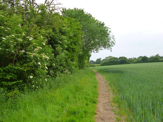
The wood is predominantly made up of broadleaf trees, including oak, beech, and ash, which create a dense canopy that provides shade during the summer months. The forest floor is covered in a thick carpet of moss, ferns, and wildflowers, adding to the enchanting ambiance of the woodland.

Homelye Wood is home to a wide variety of wildlife, making it a haven for nature lovers. Visitors may catch a glimpse of deer grazing amongst the trees, squirrels scurrying up trunks, and a plethora of bird species, including woodpeckers and owls. The wood is also home to a diverse range of insects, including butterflies, beetles, and dragonflies, adding to the ecological importance of the area.

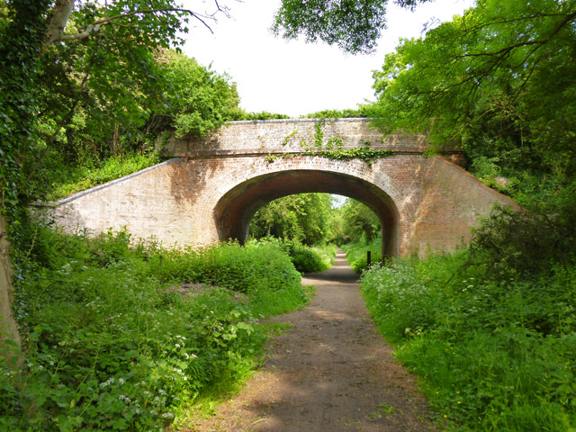
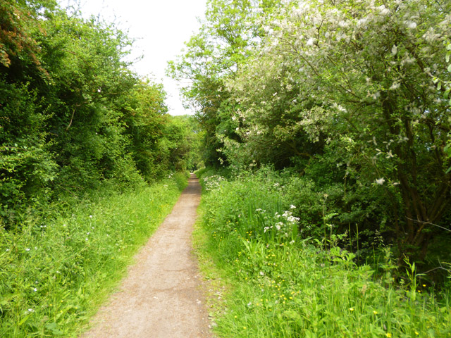
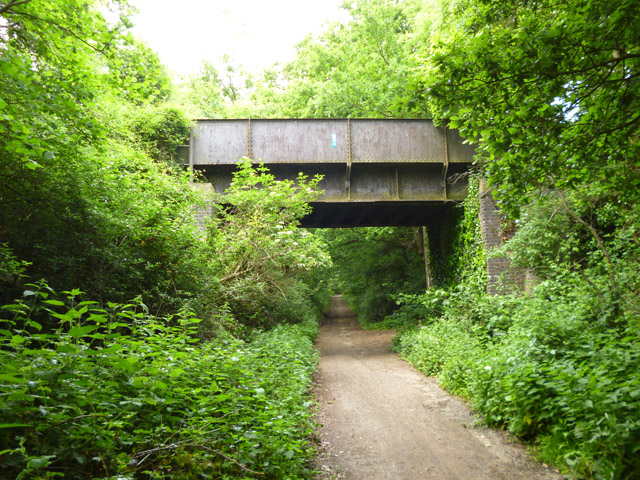
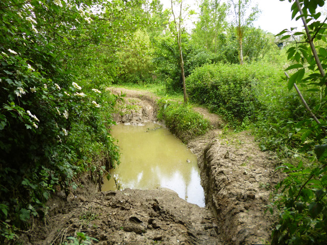
The forest offers a network of well-maintained walking trails that allow visitors to explore its beauty at their leisure. These trails wind through the wood, taking visitors past ancient trees, bubbling streams, and serene ponds. The forest also features several designated picnic areas and benches, providing opportunities for visitors to relax and enjoy the peaceful surroundings.

Homelye Wood is not only a natural gem but also holds historical significance. It has been protected as a Site of Special Scientific Interest (SSSI) due to its ecological importance and as a designated Local Wildlife Site (LWS). The wood is owned and managed by a local authority, ensuring its preservation for future generations to enjoy.

If you have any feedback on the listing, please let us know in the comments section below.
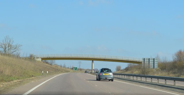
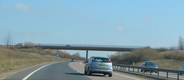
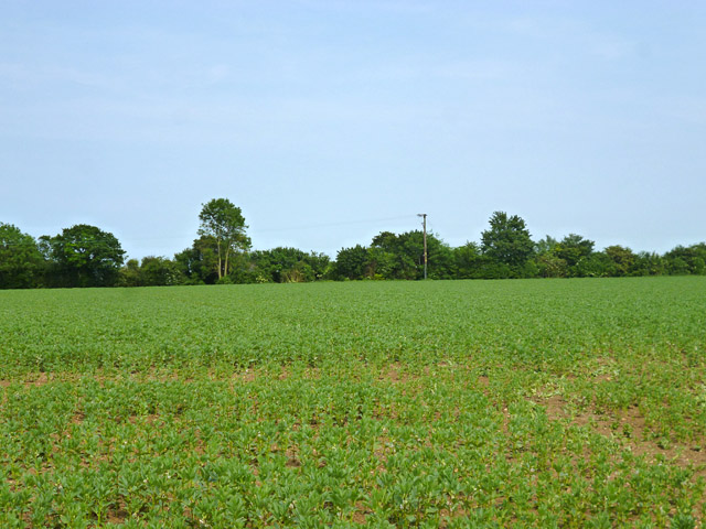
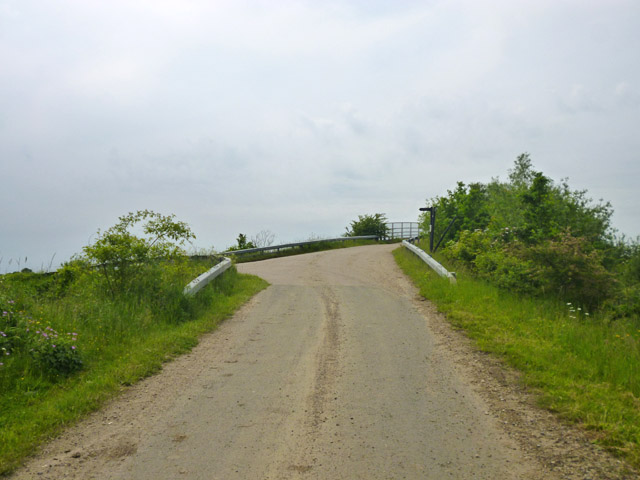
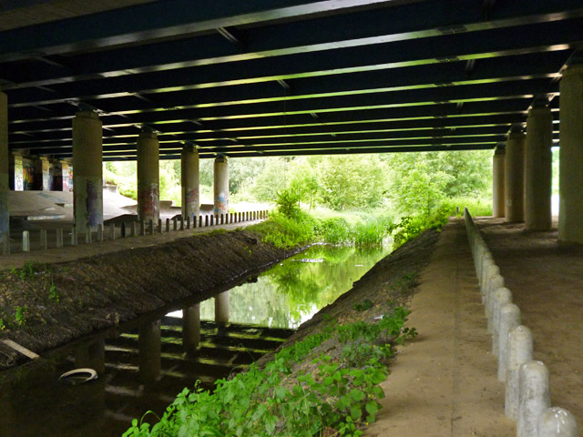
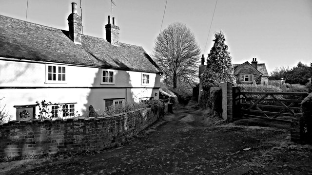
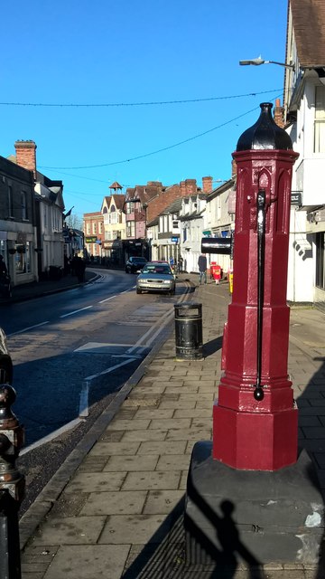
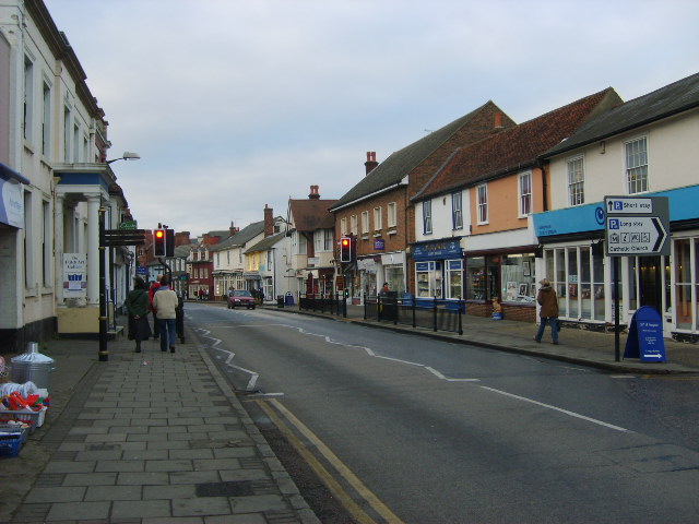
Homelye Wood Images

Images are sourced within 2km of 51.876803/0.38986718 or Grid Reference TL6422. Thanks to Geograph Open Source API. All images are credited.

Footbridge, A120 The A120 is a trunk road that runs east-west across East Anglia from Harwich to Puckeridge, 63 miles in length. It follows the route of the Roman Road, Stane Street. <span class="nowrap"><a title="http://www.sabre-roads.org.uk/wiki/index.php?title=A120" rel="nofollow ugc noopener" href="http://www.sabre-roads.org.uk/wiki/index.php?title=A120">Link</a><img style="margin-left:2px;" alt="External link" title="External link - shift click to open in new window" src="https://s1.geograph.org.uk/img/external.png" width="10" height="10"/></span>
Footbridge, A120
The A120 is a trunk road that runs east-west across East Anglia from Harwich to Puckeridge, 63 miles in length. It follows the route of the Roman Road, Stane Street. LinkExternal link
Station Road Bridge, A120 The A120 is a trunk road that runs east-west across East Anglia from Harwich to Puckeridge, 63 miles in length. It follows the route of the Roman Road, Stane Street. <span class="nowrap"><a title="http://www.sabre-roads.org.uk/wiki/index.php?title=A120" rel="nofollow ugc noopener" href="http://www.sabre-roads.org.uk/wiki/index.php?title=A120">Link</a><img style="margin-left:2px;" alt="External link" title="External link - shift click to open in new window" src="https://s1.geograph.org.uk/img/external.png" width="10" height="10"/></span>
Station Road Bridge, A120
The A120 is a trunk road that runs east-west across East Anglia from Harwich to Puckeridge, 63 miles in length. It follows the route of the Roman Road, Stane Street. LinkExternal link
A field of beans Between the new and old A120, the latter, the ancient Stane Street, now B1256.
A field of beans
Between the new and old A120, the latter, the ancient Stane Street, now B1256.
Grange Lane near the A120 The lane ramps up to a farm and footpath bridge over the A120, but itself turns left and after a short distance degenerates to a public byway through to Great Dunmow.
Grange Lane near the A120
The lane ramps up to a farm and footpath bridge over the A120, but itself turns left and after a short distance degenerates to a public byway through to Great Dunmow.
Old railway bridge, Little Dunmow Brook Lane crosses the former Bishop's Stortford - Braintree railway, now a cycle path.
Old railway bridge, Little Dunmow
Brook Lane crosses the former Bishop's Stortford - Braintree railway, now a cycle path.
The Flitch Way The former Bishop's Stortford - Braintree railway, now a cycle path.
The Flitch Way
The former Bishop's Stortford - Braintree railway, now a cycle path.
Old railway bridge The former Bishop's Stortford - Braintree railway crosses a byway. The Flitch Way cycle path, mostly using the railway route, does not cross here, but ramps down from the embankment on the other side of the bridge. It then passes under the bridge and uses the byway for the rest of the way into Great Dunmow.
Old railway bridge
The former Bishop's Stortford - Braintree railway crosses a byway. The Flitch Way cycle path, mostly using the railway route, does not cross here, but ramps down from the embankment on the other side of the bridge. It then passes under the bridge and uses the byway for the rest of the way into Great Dunmow.
Off-roaders' wallow The public byway here is a magnet for off-roaders, who, fortunately for other users, confine their more extreme fun to tracks off the byway, between the byway and the River Chelmer. This is perhaps the most extreme bit I found. It appears to be rather deep.
Off-roaders' wallow
The public byway here is a magnet for off-roaders, who, fortunately for other users, confine their more extreme fun to tracks off the byway, between the byway and the River Chelmer. This is perhaps the most extreme bit I found. It appears to be rather deep.
Footpath to Little Dunmow The path skirts round The Moors to the left. In these parts such a name implies a pretty damp area. The mapped route of the public path actually passes through this, but there is no trace of anybody trying to follow the route. There is a fair bit of optimistic routing of public paths through marshes around here, fortunately most have reasonable ways round, as this.
Footpath to Little Dunmow
The path skirts round The Moors to the left. In these parts such a name implies a pretty damp area. The mapped route of the public path actually passes through this, but there is no trace of anybody trying to follow the route. There is a fair bit of optimistic routing of public paths through marshes around here, fortunately most have reasonable ways round, as this.
Rose Farm and Rose Farm Cottage, Little Dunmow Rose Farm, on the left, was built around 1400. The thatched house is of 16th century or earlier build. Both are grade II listed.
Rose Farm and Rose Farm Cottage, Little Dunmow
Rose Farm, on the left, was built around 1400. The thatched house is of 16th century or earlier build. Both are grade II listed.
The Ivy House, Little Dunmow Dated 'circa 1630' on the front, it is grade II listed.
The Ivy House, Little Dunmow
Dated 'circa 1630' on the front, it is grade II listed.
A120 bridge over River Chelmer Particularly wide, as four lanes of dual carriageway and also two slip roads cross the river. The bridge also crosses a public byway, used by National Cycle Route 16.
A120 bridge over River Chelmer
Particularly wide, as four lanes of dual carriageway and also two slip roads cross the river. The bridge also crosses a public byway, used by National Cycle Route 16.
River Chelmer under A120 A public byway passes to the right of the columns on the right, and the area seems to be popular with off-roaders. The bollards along the river banks are almost certainly to deter attempts to ford the river here.
River Chelmer under A120
A public byway passes to the right of the columns on the right, and the area seems to be popular with off-roaders. The bollards along the river banks are almost certainly to deter attempts to ford the river here.
A120 Chelmer bridge - graffiti As is usual with structures with large expanses of bare concrete, unofficial adornment soon appears.
A120 Chelmer bridge - graffiti
As is usual with structures with large expanses of bare concrete, unofficial adornment soon appears.
A120 Chelmer bridge - graffiti As is usual with structures with large expanses of bare concrete, unofficial adornment soon appears.
A120 Chelmer bridge - graffiti
As is usual with structures with large expanses of bare concrete, unofficial adornment soon appears.
A120 Chelmer bridge - graffiti As is usual with structures with large expanses of bare concrete, unofficial adornment soon appears.
A120 Chelmer bridge - graffiti
As is usual with structures with large expanses of bare concrete, unofficial adornment soon appears.
Frosty lane, Great Dunmow
Pump, High Street, Great Dunmow
Show me another place!

Homelye Wood is located at Grid Ref: TL6422 (Lat: 51.876803, Lng: 0.38986718)

Administrative County: Essex

District: Uttlesford

Police Authority: Essex

What 3 Words

///upward.swung.lakeside. Near Great Dunmow, Essex

Nearby Locations

Homelye Wood

Related Wikis

Church End Mill, Great Dunmow

Church End Mill is a grade II listed Tower mill at Great Dunmow, Essex, England which has been converted to residential use. == History == Church End Mill...

Bran End

Bran End is a village in Essex, England. == External links == Media related to Bran End at Wikimedia Commons

Little Dunmow

Little Dunmow is a village situated in the Uttlesford district, in rural Essex, England, in the vale of the River Chelmer about 3 miles (4.8 km) east-southeast...

Little Dunmow Priory

Little Dunmow Priory in Little Dunmow was an Augustinian priory in Essex, England. The priory was founded as a church by Juga de Baynard in 1104, dedicated...

Dunmow railway station

Dunmow railway station was a station serving Great Dunmow, Essex. The station was 9 miles 38 chains (15.25 km) from Bishop's Stortford on the Bishop's...

Great Dunmow

Great Dunmow is a historic market town and civil parish in the Uttlesford district of Essex, England. It lies to the north of the A120 road, approximately...

Old Town Hall, Great Dunmow

The Old Town Hall is a municipal building in the Market Place, Great Dunmow, Essex, England. The structure, which is now in retail use, is a Grade II listed...

Felsted railway station

Felsted railway station was located in Essex between Felsted and Little Dunmow. The station was 11 miles 61 chains (18.93 km) from Bishop's Stortford on...

Nearby Amenities

Located within 500m of 51.876803,0.38986718
Power: pole
Lat/Long: 51.8768828/0.3875969
Power: pole
Lat/Long: 51.8803186/0.3863005
Power: pole
Lat/Long: 51.879131/0.386756
Power: pole
Lat/Long: 51.8757155/0.3880386
Power: pole
Lat/Long: 51.8748979/0.3883441
Power: pole
Lat/Long: 51.8730507/0.3890555
Power: pole
Lat/Long: 51.8780277/0.3871576
Power: pole
Lat/Long: 51.874094/0.3886773
Gussetts Water Tower
Man Made: water_tower
Lat/Long: 51.8752183/0.3941576
Bus Stop
Homelye Chase
Bus: yes
Naptan AtcoCode: 15004632155
Naptan NaptanCode: esxjgpmd
Public Transport: platform
Source: naptan
Lat/Long: 51.8743025/0.3952699
Bus Stop
Homelye Chase
Bus: yes
Naptan AtcoCode: 15004632154
Naptan NaptanCode: esxjgpma
Public Transport: platform
Source: naptan
Lat/Long: 51.8743431/0.3950396
The data included in this document is from www.openstreetmap.org. The data is made available under ODbL.

Have you been to Homelye Wood?

Leave your review of Homelye Wood below (or comments, questions and feedback).