Fengate

Settlement in Norfolk Broadland

England

Fengate

Queuing traffic at roadworks on the A140
Queuing traffic at roadworks on the A140 Credit: Helen Steed

Fengate is a small village located in the county of Norfolk, England. Situated approximately 5 miles east of the city of Peterborough, Fengate is nestled amidst the beautiful East Anglian countryside. With a population of around 300 residents, the village has a tight-knit community feel.

The history of Fengate dates back to ancient times, with evidence suggesting human habitation in the area as far back as the Neolithic period. The village grew in importance during the Roman era, as it served as a key trading route between the settlements of Peterborough and Crowland.

Today, Fengate retains much of its rural charm, with picturesque cottages and traditional buildings dotting the landscape. The village boasts a small but vibrant local economy, with a handful of local businesses including a post office and a village shop. The village also has a primary school, providing education for the local children.

For those seeking outdoor activities, Fengate offers ample opportunities for walking and exploring the surrounding countryside. The nearby River Nene provides a tranquil setting for fishing and boating enthusiasts. The village is also conveniently located near the Ferry Meadows Country Park, a popular recreational area that offers a range of activities such as cycling, birdwatching, and picnicking.

Overall, Fengate offers a peaceful and idyllic escape from the hustle and bustle of nearby urban areas. With its rich history and picturesque setting, the village is a hidden gem in the heart of Norfolk.

If you have any feedback on the listing, please let us know in the comments section below.
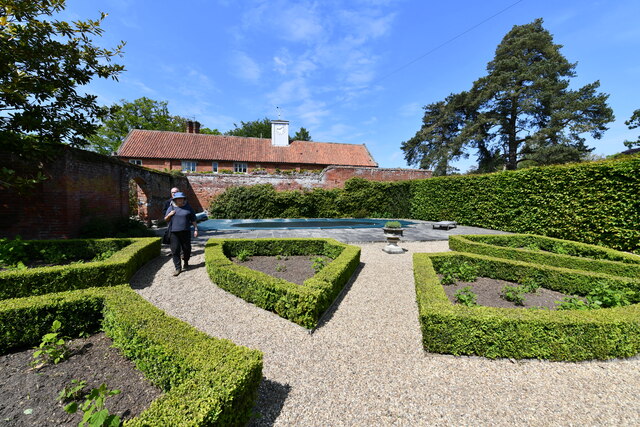
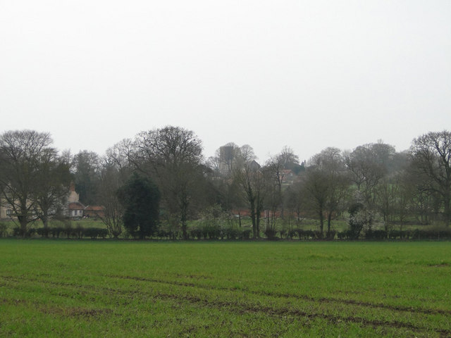
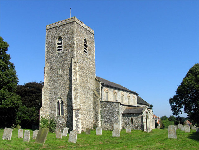
Fengate Images

Images are sourced within 2km of 52.772539/1.251905 or Grid Reference TG1924. Thanks to Geograph Open Source API. All images are credited.

Queuing traffic at roadworks on the A140
Marsham, Bolwick Hall
Marsham, Bolwick Hall: Red rhododendron
Marsham, Bolwick Hall: Kitchen garden
Marsham, Bolwick Hall: Borders planted with Smooth Hydrangeas
Marsham, Bolwick Hall: Stable cottage
Marsham, Bolwick Hall: Lawn
Marsham, Bolwick Hall: Iris
Marsham, Bolwick Hall: Eastern aspect with visitors relaxing on the lawn
Marsham, Bolwick Hall: Eastern aspect
Mill Road, Marsham Although Mill House is still standing and occupied the mill referred to has long gone.
Mill Road, Marsham
Although Mill House is still standing and occupied the mill referred to has long gone.
'Dead Nettles' beside Mill Road, Marsham Red dead nettle; Lamium purpureum
'Dead Nettles' beside Mill Road, Marsham
Red dead nettle; Lamium purpureum
Field of winter wheat, with Marsham church behind the trees
Bure Valley Railway level crossing This level crossing is near Spratt's Green and is seen from a train heading towards Wroxham.
Bure Valley Railway level crossing
This level crossing is near Spratt's Green and is seen from a train heading towards Wroxham.
Approaching the A140 In the centre of the image can be seen the entrance to the tunnel taking the Bure Valley Railway beneath the A140 Norwich-Cromer road. The Bure Valley Path remains on the surface to cross the road on the level.
Approaching the A140
In the centre of the image can be seen the entrance to the tunnel taking the Bure Valley Railway beneath the A140 Norwich-Cromer road. The Bure Valley Path remains on the surface to cross the road on the level.
Lake at Bolwick Hall, Marsham
Lake with Bolwick Hall, Marsham
Show me another place!

Fengate is located at Grid Ref: TG1924 (Lat: 52.772539, Lng: 1.251905)

Administrative County: Norfolk

District: Broadland

Police Authority: Norfolk

What 3 Words

///thrashed.hoot.enclosing. Near Aylsham, Norfolk

Related Wikis

Marsham, Norfolk

Marsham is a village and civil parish in the English county of Norfolk, about 10 miles (16 km) north of Norwich. It covers an area of 7.40 km2 (2.86 sq...

Bolwick Hall

Bolwick Hall is located at Marsham, Norfolk, 1 mile south of Aylsham. == History == The hall is recorded in the Domesday Book of 1086 and given to King...

Aylsham

Aylsham ( or ) is a historic market town and civil parish on the River Bure in north Norfolk, England, nearly 9 mi (14 km) north of Norwich. The river...

Aylsham South railway station

Aylsham South railway station served the town of Aylsham in Norfolk from 1880 to 1981. The period station buildings were subsequently demolished in 1990...

Aylsham railway station

Aylsham railway station is located in the town of Aylsham in Norfolk and is the northern terminus of the Bure Valley Railway, a narrow gauge operation...

Aylsham Bypass Tunnel

The Aylsham Bypass Tunnel is the only railway tunnel in Norfolk, England currently open to trains. It carries the narrow gauge Bure Valley Railway under...

Cawston Road Mill, Aylsham

Cawston Road Mill is a tower mill at Aylsham, Norfolk, England which has been truncated and converted for use as a holiday home. == History == Cawston...

Brampton, Norfolk

Brampton is a small village and parish in the county of Norfolk, England, in the Bure Valley, east of Aylsham. == History == Brampton was the subject of...

Nearby Amenities

Located within 500m of 52.772539,1.251905
Marsham
Place: village
Source: OS_OpenData_StreetView
Lat/Long: 52.7689799/1.2527893
Bus Stop
The Green
Naptan AtcoCode: 2900M031
Naptan Bearing: N
Naptan CommonName: The Green
Naptan Indicator: adj
Naptan Latitude: 52.7698362
Naptan Locality: Marsham
Naptan Longitude: 1.2562482
Naptan NaptanCode: nfodgdtm
Naptan ShortCommonName: Old Norwich Road
Naptan Street: Old Norwich Road
Shelter: yes
Source: naptan_import;survey
Lat/Long: 52.7697129/1.2562153
Bus Stop
The Green
Naptan AtcoCode: 2900M032
Naptan Bearing: S
Naptan CommonName: The Green
Naptan Indicator: opp
Naptan Latitude: 52.7696302
Naptan Locality: Marsham
Naptan Longitude: 1.2565442
Naptan NaptanCode: nfodgdtp
Naptan ShortCommonName: Old Norwich Road
Naptan Street: Old Norwich Road
Shelter: yes
Source: naptan_import;survey
Lat/Long: 52.7695327/1.2564084
Crossing
Crossing: uncontrolled
Lat/Long: 52.7746272/1.2562551
Crossing
Crossing: uncontrolled
Lat/Long: 52.7711885/1.2566201
Marsham
Inscription: WI 1985 / Birthplace of Sir George Edwards KBE 89 5th October 1850 / 6th December 1933 / Founder of Farm Workers Union in 1908
Man Made: village_sign
Material: metal
Lat/Long: 52.7692041/1.2541714
Post Box
Operator: Royal Mail
Post Box Mounting: pier
Post Box Type: lamp
Royal Cypher: EIIR
Royal Cypher Wikidata: Q33102113
Lat/Long: 52.7691351/1.2541862
Grit Bin
Colour: blue
Lat/Long: 52.7693899/1.2503359
Give Way
Lat/Long: 52.7693899/1.2501544
Crossing
Crossing: unmarked
Lat/Long: 52.7690904/1.254269
Give Way
Lat/Long: 52.7692721/1.2543468
Telephone
Defibrillator
Booth: K6
Covered: booth
Defibrillator Location: inside old red phone box in front of Marsham Village Hall
Emergency: defibrillator
Listed Status: Grade II
Man Made: telephone_box
Ref GB The Circuit: 5C2ED892-27F0-4BE8-A4F9-B0B900E37ED9
Lat/Long: 52.7694897/1.2531957
Clock
Display: analog
Faces: 1
Lat/Long: 52.7694963/1.2531736
Advertising: board
Lat/Long: 52.7694897/1.2532501
The data included in this document is from www.openstreetmap.org. The data is made available under ODbL.

Have you been to Fengate?

Leave your review of Fengate below (or comments, questions and feedback).