Gaywood Plantation

Wood, Forest in Norfolk King's Lynn and West Norfolk

England

Gaywood Plantation

King's Lynn station The northern terminus of the Great Northern electrified Fen line from Kings Cross, with additional trains by Greater Anglia from Liverpool Street. This building dates to 1871-2.
King's Lynn station Credit: Chris Morgan

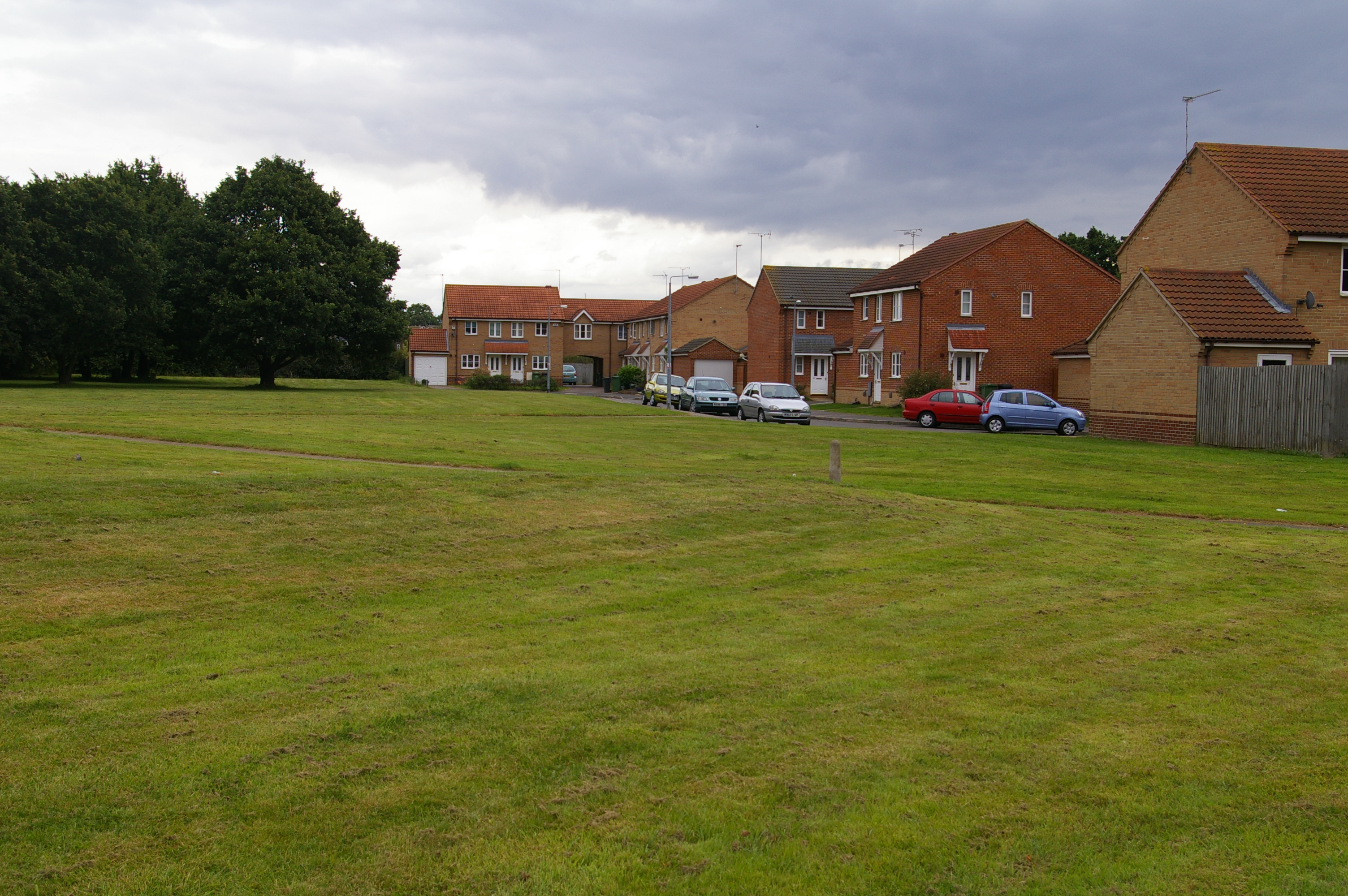
Gaywood Plantation is a historic woodland located in Norfolk, England. Spanning an area of approximately 150 acres, it is nestled in the heart of the Gaywood neighborhood, just a few miles away from the town of King's Lynn. The plantation is renowned for its vast and diverse collection of trees, making it a cherished natural treasure in the region.

The woodland consists of a mixture of broadleaf and coniferous trees, including oak, beech, birch, and pine, which create a rich and varied ecosystem. The plantation is home to a wide array of wildlife, such as deer, squirrels, foxes, and a plethora of bird species. This makes it a popular destination for nature enthusiasts and birdwatchers.

Gaywood Plantation offers a serene and peaceful environment, attracting locals and visitors alike who seek solace in nature. It provides numerous walking trails and paths, allowing visitors to explore its beauty at their own pace. These paths are well-maintained and provide access to various viewpoints, picnic areas, and benches, offering visitors an opportunity to relax and immerse themselves in the tranquil surroundings.

The plantation also boasts a small pond, which serves as a habitat for ducks and other aquatic creatures. It adds to the overall charm and natural beauty of the area, providing a picturesque scene for visitors to enjoy.

Gaywood Plantation holds historical significance, as it has been a part of the local landscape for centuries. Its preservation and conservation efforts are crucial to maintain its ecological balance and protect its unique flora and fauna.

Overall, Gaywood Plantation is a cherished natural gem in Norfolk, providing a haven for wildlife, recreational activities, and a place of tranquility for all who visit.

If you have any feedback on the listing, please let us know in the comments section below.

Gaywood Plantation Images

Images are sourced within 2km of 52.748644/0.42859852 or Grid Reference TF6419. Thanks to Geograph Open Source API. All images are credited.

King's Lynn station The northern terminus of the Great Northern electrified Fen line from Kings Cross, with additional trains by Greater Anglia from Liverpool Street. This building dates to 1871-2.
King's Lynn station
The northern terminus of the Great Northern electrified Fen line from Kings Cross, with additional trains by Greater Anglia from Liverpool Street. This building dates to 1871-2.
St James' Park, King's Lynn Part of the larger Walks, see the Friends of the Walks website: <span class="nowrap"><a title="http://www.thewalks.uk/history-of-the-walks/" rel="nofollow ugc noopener" href="http://www.thewalks.uk/history-of-the-walks/">Link</a><img style="margin-left:2px;" alt="External link" title="External link - shift click to open in new window" src="https://s1.geograph.org.uk/img/external.png" width="10" height="10"/></span>
St James' Park, King's Lynn
Part of the larger Walks, see the Friends of the Walks website: LinkExternal link
Guannock Gate and town wall, King's Lynn
King's Lynn Railway Station Built for the Great Eastern Railway 1871-2 <span class="nowrap"><a title="https://historicengland.org.uk/listing/the-list/list-entry/1389399?section=official-list-entry" rel="nofollow ugc noopener" href="https://historicengland.org.uk/listing/the-list/list-entry/1389399?section=official-list-entry">Link</a><img style="margin-left:2px;" alt="External link" title="External link - shift click to open in new window" src="https://s1.geograph.org.uk/img/external.png" width="10" height="10"/></span>
King's Lynn Railway Station
Built for the Great Eastern Railway 1871-2 LinkExternal link
Red Mount Chapel, King's Lynn Late fifteenth century Pilgrimage Chapel <span class="nowrap"><a title="https://historicengland.org.uk/listing/the-list/list-entry/1195403?section=official-list-entry" rel="nofollow ugc noopener" href="https://historicengland.org.uk/listing/the-list/list-entry/1195403?section=official-list-entry">Link</a><img style="margin-left:2px;" alt="External link" title="External link - shift click to open in new window" src="https://s1.geograph.org.uk/img/external.png" width="10" height="10"/></span>
Red Mount Chapel, King's Lynn
Late fifteenth century Pilgrimage Chapel LinkExternal link
The Gaywood River, King's Lynn Looking from St. John's Walk towards the culvert beneath the railway.
The Gaywood River, King's Lynn
Looking from St. John's Walk towards the culvert beneath the railway.
Mayor's Avenue, The Walks, King's Lynn Follows the line of the town walls.
Mayor's Avenue, The Walks, King's Lynn
Follows the line of the town walls.
North Guannock Gate and parts of the town wall The originals dated from the thirteenth century but much of what remains dates from the early nineteenth century
North Guannock Gate and parts of the town wall
The originals dated from the thirteenth century but much of what remains dates from the early nineteenth century
Tower Gardens, King's Lynn
Arches in Tower Gardens, King's Lynn Resited from a house near Tuesday Market <span class="nowrap"><a title="https://historicengland.org.uk/listing/the-list/list-entry/1290265?section=official-list-entry" rel="nofollow ugc noopener" href="https://historicengland.org.uk/listing/the-list/list-entry/1290265?section=official-list-entry">Link</a><img style="margin-left:2px;" alt="External link" title="External link - shift click to open in new window" src="https://s1.geograph.org.uk/img/external.png" width="10" height="10"/></span>
Arches in Tower Gardens, King's Lynn
Resited from a house near Tuesday Market LinkExternal link
County Court, King's Lynn Dates from 1861 <span class="nowrap"><a title="https://historicengland.org.uk/listing/the-list/list-entry/1210671?section=official-list-entry" rel="nofollow ugc noopener" href="https://historicengland.org.uk/listing/the-list/list-entry/1210671?section=official-list-entry">Link</a><img style="margin-left:2px;" alt="External link" title="External link - shift click to open in new window" src="https://s1.geograph.org.uk/img/external.png" width="10" height="10"/></span>
County Court, King's Lynn
Dates from 1861 LinkExternal link
Former Stepney Chapel, King's Lynn Dates from 1841 <span class="nowrap"><a title="https://historicengland.org.uk/listing/the-list/list-entry/1298167?section=official-list-entry" rel="nofollow ugc noopener" href="https://historicengland.org.uk/listing/the-list/list-entry/1298167?section=official-list-entry">Link</a><img style="margin-left:2px;" alt="External link" title="External link - shift click to open in new window" src="https://s1.geograph.org.uk/img/external.png" width="10" height="10"/></span>
Former Stepney Chapel, King's Lynn
Dates from 1841 LinkExternal link
St. John's Terrace, King's Lynn Mid nineteenth century terrace of houses <span class="nowrap"><a title="https://historicengland.org.uk/listing/the-list/list-entry/1195338?section=official-list-entry" rel="nofollow ugc noopener" href="https://historicengland.org.uk/listing/the-list/list-entry/1195338?section=official-list-entry">Link</a><img style="margin-left:2px;" alt="External link" title="External link - shift click to open in new window" src="https://s1.geograph.org.uk/img/external.png" width="10" height="10"/></span>
St. John's Terrace, King's Lynn
Mid nineteenth century terrace of houses LinkExternal link
St. John's church, King's Lynn Built 1844-6 <span class="nowrap"><a title="https://historicengland.org.uk/listing/the-list/list-entry/1391201?section=official-list-entry" rel="nofollow ugc noopener" href="https://historicengland.org.uk/listing/the-list/list-entry/1391201?section=official-list-entry">Link</a><img style="margin-left:2px;" alt="External link" title="External link - shift click to open in new window" src="https://s1.geograph.org.uk/img/external.png" width="10" height="10"/></span> Designed by Anthony Salvin <span class="nowrap"><a title="https://en.wikipedia.org/wiki/Anthony_Salvin" rel="nofollow ugc noopener" href="https://en.wikipedia.org/wiki/Anthony_Salvin">Link</a><img style="margin-left:2px;" alt="External link" title="External link - shift click to open in new window" src="https://s1.geograph.org.uk/img/external.png" width="10" height="10"/></span>
St. John's church, King's Lynn
Built 1844-6 LinkExternal link Designed by Anthony Salvin LinkExternal link
Bandstand, The Walks, King's Lynn
Bridge over the Gaywood River, The Walks, King's Lynn
The Gaywood River, The Walks, King's Lynn Red Mount Chapel in the distance.
The Gaywood River, The Walks, King's Lynn
Red Mount Chapel in the distance.
Broad Walk, King's Lynn Crossing the Gaywood River.
Broad Walk, King's Lynn
Crossing the Gaywood River.
Show me another place!

Gaywood Plantation is located at Grid Ref: TF6419 (Lat: 52.748644, Lng: 0.42859852)

Administrative County: Norfolk

District: King's Lynn and West Norfolk

Police Authority: Norfolk

What 3 Words

///relatives.birds.reserving. Near King's Lynn, Norfolk

Related Wikis

Fairstead, Norfolk

The Fairstead Estate is a suburb of King's Lynn, Norfolk, England. The population of Fairstead ward of King's Lynn and West Norfolk Borough at the 2011...

King's Lynn Academy

King's Lynn Academy (formerly "the Park High School") is a 11-16 mixed secondary school in the West Norfolk town of King's Lynn. It is situated on Queen...

Gaywood, Norfolk

Gaywood is an eastern suburb of King's Lynn, in the King's Lynn and West Norfolk district, in the county of Norfolk, England. Previously a civil parish...

King Edward VII Academy

King Edward VII Academy (known as KES Academy) is a large, mixed comprehensive secondary school in Gaywood Road (A148), King's Lynn, Norfolk, England with...

King's Lynn F.C.

King's Lynn Football Club was an English association football club based in King's Lynn, Norfolk. The club was founded in 1881 and they were wound up at...

Springwood High School, King's Lynn

Springwood High School is a secondary school with academy status in the town of King's Lynn in Norfolk, England. It was formed by the merger of several...

King's Lynn Town F.C.

King's Lynn Town Football Club is a football club based in King's Lynn, Norfolk, England. Nicknamed 'The Linnets', they are currently members of the National...

Queen Elizabeth Hospital, King's Lynn

Queen Elizabeth Hospital in King's Lynn, Norfolk, England. It is located on the outskirts of King's Lynn, to the eastern edge of the town. The catchment...

Nearby Amenities

Located within 500m of 52.748644,0.42859852
Mini Roundabout
Direction: clockwise
Lat/Long: 52.7512199/0.4338606
Power: transformer
Lat/Long: 52.7475756/0.4307633
Barrier: cycle_barrier
Cycle Barrier: double
Lat/Long: 52.7509353/0.4280202
Power: substation
Lat/Long: 52.7484862/0.4340628
Power: substation
Lat/Long: 52.7493146/0.4299197
Leisure: playground
Lat/Long: 52.7489133/0.4353244
Post Box
Ref: PE30 468
Lat/Long: 52.751316/0.4319116
SSS Westmark
Note: couldn't see full ref
Operator: UK Power Networks
Operator Wikidata: Q7864927
Power: substation
Ref: TF _423 1_56
Lat/Long: 52.7519016/0.4306632
King's Lynn Old South
Operator: UK Power Networks
Operator Wikidata: Q7864927
Power: substation
Ref: _6426 1986W
Lat/Long: 52.7517114/0.4323335
Traffic Calming: cushion
Lat/Long: 52.7514486/0.4341519
Barrier: cycle_barrier
Cycle Barrier: double
Lat/Long: 52.7499539/0.4320857
Post Box
Operator: Royal Mail
Operator Wikidata: Q638098
Post Box Type: pillar
Ref: PE30 483
Royal Cypher: EIIR
Royal Cypher Wikidata: Q33102113
Lat/Long: 52.7498081/0.4254258
Bus Stop
Fernlea Road, adj
Bus: yes
Naptan AtcoCode: 2900K13123
Naptan Bearing: N
Naptan CommonName: Fernlea Road
Naptan Indicator: adj
Naptan Locality: Fairstead
Naptan NaptanCode: nfodamat
Naptan PlusbusZoneRef: KLYNN
Naptan Street: Winston Churchill Drive
Naptan Verified: no
Public Transport: platform
Source: naptan_import
Lat/Long: 52.7498606/0.4326492
Bus Stop
Raleigh Road, opp
Bus: yes
Naptan AtcoCode: 2900K1318
Naptan Bearing: NE
Naptan CommonName: Raleigh Road
Naptan Indicator: opp
Naptan Landmark: Raleigh Road
Naptan Locality: Gaywood Park
Naptan NaptanCode: nfodapaj
Naptan PlusbusZoneRef: KLYNN
Naptan Street: Parkway
Naptan Verified: no
Public Transport: platform
Source: naptan_import
Lat/Long: 52.7501312/0.4260253
Bus Stop
No 18, adj
Bus: yes
Naptan AtcoCode: 2900K1368
Naptan Bearing: W
Naptan CommonName: No 18
Naptan Indicator: adj
Naptan Locality: Gaywood Park
Naptan NaptanCode: nfodapwa
Naptan PlusbusZoneRef: KLYNN
Naptan Street: Hall View Road
Naptan Verified: no
Public Transport: platform
Source: naptan_import
Lat/Long: 52.7521252/0.4256916
Bus Stop
Oak Circle, adj
Bus: yes
Naptan AtcoCode: 2900K1370
Naptan Bearing: W
Naptan CommonName: Oak Circle
Naptan Indicator: adj
Naptan Landmark: Bus Shelter
Naptan Locality: Gaywood Park
Naptan NaptanCode: nfodapwg
Naptan PlusbusZoneRef: KLYNN
Naptan Street: Hall View Road
Naptan Verified: no
Public Transport: platform
Source: naptan_import
Lat/Long: 52.7518533/0.4236017
Bus Stop
Brockley Green, adj
Bus: yes
Naptan AtcoCode: 2900K1401
Naptan Bearing: SW
Naptan CommonName: Brockley Green
Naptan Indicator: adj
Naptan Locality: Fairstead
Naptan NaptanCode: nfogpdgj
Naptan PlusbusZoneRef: KLYNN
Naptan Street: Winston Churchill Drive
Naptan Verified: no
Public Transport: platform
Source: naptan_import
Lat/Long: 52.7492781/0.4354615
Power: pole
Lat/Long: 52.7470935/0.4248217
Power: pole
Lat/Long: 52.747583/0.4234565
Power: pole
Source: Mapbox
Lat/Long: 52.7451269/0.4304844
Power: pole
Source: Mapbox
Lat/Long: 52.7453527/0.4307419
Power: pole
Lat/Long: 52.7479836/0.4222769
Power: pole
Lat/Long: 52.7456517/0.4289818
Power: pole
Source: Mapbox
Lat/Long: 52.7460833/0.430374
Power: transformer
Lat/Long: 52.7475725/0.4306373
Power: pole
Lat/Long: 52.7451694/0.4303819
Power: pole
Lat/Long: 52.7475125/0.4307622
Railway: crossing
Lat/Long: 52.7476301/0.4235978
Power: pole
Lat/Long: 52.7461193/0.4276192
Power: pole
Lat/Long: 52.7475151/0.4306191
Power: pole
Lat/Long: 52.7465901/0.4262782
Turning Circle
Lat/Long: 52.7510101/0.4233331
Turning Circle
Lat/Long: 52.7446173/0.4253183
Turning Circle
Lat/Long: 52.745321/0.4259041
Barrier: cycle_barrier
Cycle Barrier: double
Lat/Long: 52.749766/0.4328414
Higham Green
Place: locality
Lat/Long: 52.750431/0.4337507
Kings Green
Place: locality
Lat/Long: 52.7484129/0.4334445
Entrance: yes
Lat/Long: 52.7498886/0.4234937
Give Way
Lat/Long: 52.7510373/0.4266954
Give Way
Lat/Long: 52.7510668/0.4265954
Generator Method: photovoltaic
Generator Output Electricity: yes
Generator Source: solar
Generator Type: solar_photovoltaic_panel
Location: roof
Power: generator
Source: Maxar imagery
Lat/Long: 52.7521686/0.424591
Generator Method: photovoltaic
Generator Output Electricity: yes
Generator Source: solar
Generator Type: solar_photovoltaic_panel
Location: roof
Power: generator
Source: Maxar imagery
Lat/Long: 52.7522676/0.4262486
Crossing
Lat/Long: 52.7467682/0.433861
Turning Circle
Lat/Long: 52.7508739/0.4274026
Shop: convenience
Lat/Long: 52.7504467/0.4316032
Barrier: cycle_barrier
Cycle Barrier: double
Lat/Long: 52.7497654/0.432678
Barrier: cycle_barrier
Cycle Barrier: double
Lat/Long: 52.7500313/0.4318922
Barrier: cycle_barrier
Cycle Barrier: double
Lat/Long: 52.7513332/0.4314441
Barrier: cycle_barrier
Cycle Barrier: double
Lat/Long: 52.7514268/0.4314964
Barrier: cycle_barrier
Cycle Barrier: double
Lat/Long: 52.7511178/0.4278512
Communication Mobile Phone: yes
Man Made: mast
Material: metal
Operator: O2-UK;Vodafone UK
Tower Construction: freestanding
Tower Type: communication
Lat/Long: 52.746349/0.4261299
The data included in this document is from www.openstreetmap.org. The data is made available under ODbL.

Have you been to Gaywood Plantation?

Leave your review of Gaywood Plantation below (or comments, questions and feedback).