Bedlam Wood

Wood, Forest in Sussex Wealden

England

Bedlam Wood

Hawksden Park Wood Recently cut chestnut coppice in this large area ancient woodland.  The poles have been cut at about 15 years old and will be used for fencing stakes.
Hawksden Park Wood Credit: David Saunders

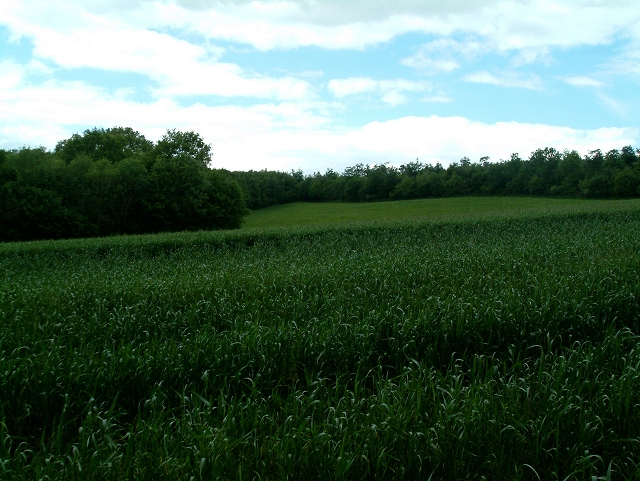
Bedlam Wood is a picturesque woodland area located in Sussex, England. Covering an approximate area of 100 acres, this enchanting forest is nestled within the South Downs National Park, offering visitors a serene and tranquil environment to explore.

Characterized by its dense canopy of trees, Bedlam Wood is primarily composed of oak and beech trees, creating a rich and diverse habitat for a wide range of flora and fauna. The forest floor is adorned with an array of wildflowers, ferns, and mosses, adding to the area's natural beauty.

Walking through Bedlam Wood, visitors can enjoy the peacefulness of nature while listening to the soothing sounds of birdsong and the rustling of leaves. The wood is crisscrossed by numerous footpaths and trails, allowing visitors to explore its different corners and discover hidden gems along the way.

Wildlife enthusiasts will be delighted to know that Bedlam Wood is home to a variety of creatures, including deer, foxes, badgers, and a wide range of bird species. It is also known for its diverse insect population, making it a haven for nature lovers and photographers alike.

Throughout the year, Bedlam Wood offers a changing landscape, with vibrant colors in autumn and a carpet of bluebells in the spring. The wood is a popular destination for both locals and tourists seeking a peaceful retreat, as well as for educational visits and nature study.

Overall, Bedlam Wood in Sussex is a haven of natural beauty, providing a sanctuary for both wildlife and visitors alike. Its serene atmosphere and diverse ecosystem make it a must-visit destination for nature enthusiasts and those seeking a tranquil escape.

If you have any feedback on the listing, please let us know in the comments section below.

Bedlam Wood Images

Images are sourced within 2km of 51.01433/0.31660254 or Grid Reference TQ6226. Thanks to Geograph Open Source API. All images are credited.

Hawksden Park Wood Recently cut chestnut coppice in this large area ancient woodland.  The poles have been cut at about 15 years old and will be used for fencing stakes.
Hawksden Park Wood
Recently cut chestnut coppice in this large area ancient woodland. The poles have been cut at about 15 years old and will be used for fencing stakes.
Batts Wood View westwards to Batts Wood and Clay Wood across an arable field.
Batts Wood
View westwards to Batts Wood and Clay Wood across an arable field.
Newbridge Wood Boundary trees perched on an exposed sandstone outcrop on the south west corner of Newbridge Wood
Newbridge Wood
Boundary trees perched on an exposed sandstone outcrop on the south west corner of Newbridge Wood
Bines Farm Bines Farm from Bivelham Forge Farm looking over the River Rother
Bines Farm
Bines Farm from Bivelham Forge Farm looking over the River Rother
Hawksden Park Wood Corrugated shed on the track into the wood.
Hawksden Park Wood
Corrugated shed on the track into the wood.
View from Turks Lane
Little Broadhurst Farm
Oak by Turk's Bridge In the flat valley bottom of the Rother.
Oak by Turk's Bridge
In the flat valley bottom of the Rother.
View east from Fair Oak Farm Bedlam Wood on the left.
View east from Fair Oak Farm
Bedlam Wood on the left.
View west from entrance to Fair Oak Farm See <span class="nowrap"><a title="http://www.fairoakfarm.co.uk/family-holiday-uk.htm" rel="nofollow ugc noopener" href="http://www.fairoakfarm.co.uk/family-holiday-uk.htm">Link</a><img style="margin-left:2px;" alt="External link" title="External link - shift click to open in new window" src="https://s1.geograph.org.uk/img/external.png" width="10" height="10"/></span> for information about the area, provided by the farm which has self catering accommodation.
View west from entrance to Fair Oak Farm
See LinkExternal link for information about the area, provided by the farm which has self catering accommodation.
Fair Oak Farm Barn Visit <span class="nowrap"><a title="www.fairoakfarm.co.uk" rel="nofollow ugc noopener" href="http://www.fairoakfarm.co.uk">Link</a><img style="margin-left:2px;" alt="External link" title="External link - shift click to open in new window" src="https://s1.geograph.org.uk/img/external.png" width="10" height="10"/></span> for more information about staying in self catering accommodation
Fair Oak Farm Barn
Visit LinkExternal link for more information about staying in self catering accommodation
Fair Oak Farm Oast Visit <span class="nowrap"><a title="www.fairoakfarm.co.uk" rel="nofollow ugc noopener" href="http://www.fairoakfarm.co.uk">Link</a><img style="margin-left:2px;" alt="External link" title="External link - shift click to open in new window" src="https://s1.geograph.org.uk/img/external.png" width="10" height="10"/></span> for more information
Fair Oak Farm Oast
Visit LinkExternal link for more information
Fair Oak Farm - Farmhouse <span class="nowrap"><a title="www.fairoakfarm.co.uk" rel="nofollow ugc noopener" href="http://www.fairoakfarm.co.uk">Link</a><img style="margin-left:2px;" alt="External link" title="External link - shift click to open in new window" src="https://s1.geograph.org.uk/img/external.png" width="10" height="10"/></span>
Fair Oak Farm - Farmhouse
House on the edge of Batts Wood There is a footpath diversion post here, which diverts the footpath left up through the wood.
House on the edge of Batts Wood
There is a footpath diversion post here, which diverts the footpath left up through the wood.
House and buildings of Rolf's Farm Rolf's Farm photographed from the footpath.
House and buildings of Rolf's Farm
Rolf's Farm photographed from the footpath.
Sheep watering hole Thirsty sheep taking a drink at a pond between Combe Farm and Wadhurst Park.
Sheep watering hole
Thirsty sheep taking a drink at a pond between Combe Farm and Wadhurst Park.
Footpath entrance on the edge of  Batts Wood The footpath is enclosed at this point by a deer proof fence and runs around the perimeter of Batts Wood. The photograph was taken looking back to the entrance where a notice warns walkers, entering Wadhurst Park, to keep to the footpath because of rutting stags. Wadhurst Lake can be seen in the distance.
Footpath entrance on the edge of Batts Wood
The footpath is enclosed at this point by a deer proof fence and runs around the perimeter of Batts Wood. The photograph was taken looking back to the entrance where a notice warns walkers, entering Wadhurst Park, to keep to the footpath because of rutting stags. Wadhurst Lake can be seen in the distance.
Track from Hare Holt to Pound Bridge Looking down the continuation of the track from Hare Holt towards Pound Bridge. The track leading off to the left carries a footpath up to Batt's Wood.
Track from Hare Holt to Pound Bridge
Looking down the continuation of the track from Hare Holt towards Pound Bridge. The track leading off to the left carries a footpath up to Batt's Wood.
Show me another place!

Bedlam Wood is located at Grid Ref: TQ6226 (Lat: 51.01433, Lng: 0.31660254)

Administrative County: East Sussex

District: Wealden

Police Authority: Sussex

What 3 Words

///blanket.gravitate.safely. Near Burwash, East Sussex

Related Wikis

Holmshurst Manor

Holmshurst Manor is a Jacobean country house near Burwash in East Sussex, England. In 1970 it was purchased by Roger Daltrey of The Who. == Description... ==

Wadhurst Park

Wadhurst Park is a landed estate located in Wadhurst, East Sussex. It is owned by the Rausing family. The estate is 796 hectares and includes a deer park...

Paines Cross Meadow

Paines Cross Meadow is a 3.7-hectare (9.1-acre) biological Site of Special Scientific Interest north-east of Heathfield in East Sussex.This site is damp...

Stonegate railway station

Stonegate railway station (not to be confused with Stone Crossing) is on the Hastings line in the south of England. It is located between Witherenden Hill...

Tidebrook

Tidebrook is a hamlet within the parish of Wadhurst in East Sussex, England. It is located between the villages of Mayfield and Wadhurst. The brook for...

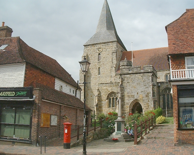
St Dunstan's Church, Mayfield

St Dunstan's, Mayfield in Mayfield, East Sussex was founded in 960 CE by St Dunstan, who was then Archbishop of Canterbury. It is reported as being originally...

Mayfield School, East Sussex

Mayfield School, previously St Leonards-Mayfield School, is an independent Catholic boarding and day school for girls aged 11 to 18. It is in the village...

Mayfield and Five Ashes

Mayfield and Five Ashes is a civil parish in the High Weald of East Sussex, England. The two villages making up the principal part of the parish lie on...

Nearby Amenities

Located within 500m of 51.01433,0.31660254
Barrier: stile
Lat/Long: 51.0157874/0.314823
Barrier: stile
Lat/Long: 51.0165244/0.3129005
The data included in this document is from www.openstreetmap.org. The data is made available under ODbL.

Have you been to Bedlam Wood?

Leave your review of Bedlam Wood below (or comments, questions and feedback).