Hay Wood

Wood, Forest in Cambridgeshire East Cambridgeshire

England

Hay Wood

Bridleway to Grange Road The start of a track which ends at the road from Weston Colville to Dullingham, a mile and a half away.
Bridleway to Grange Road Credit: John Sutton

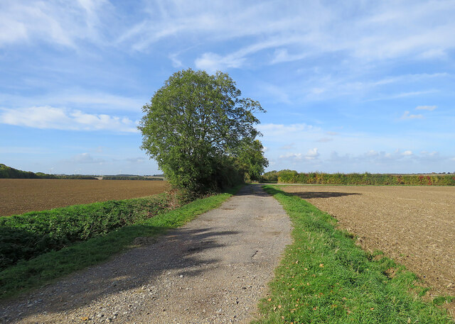
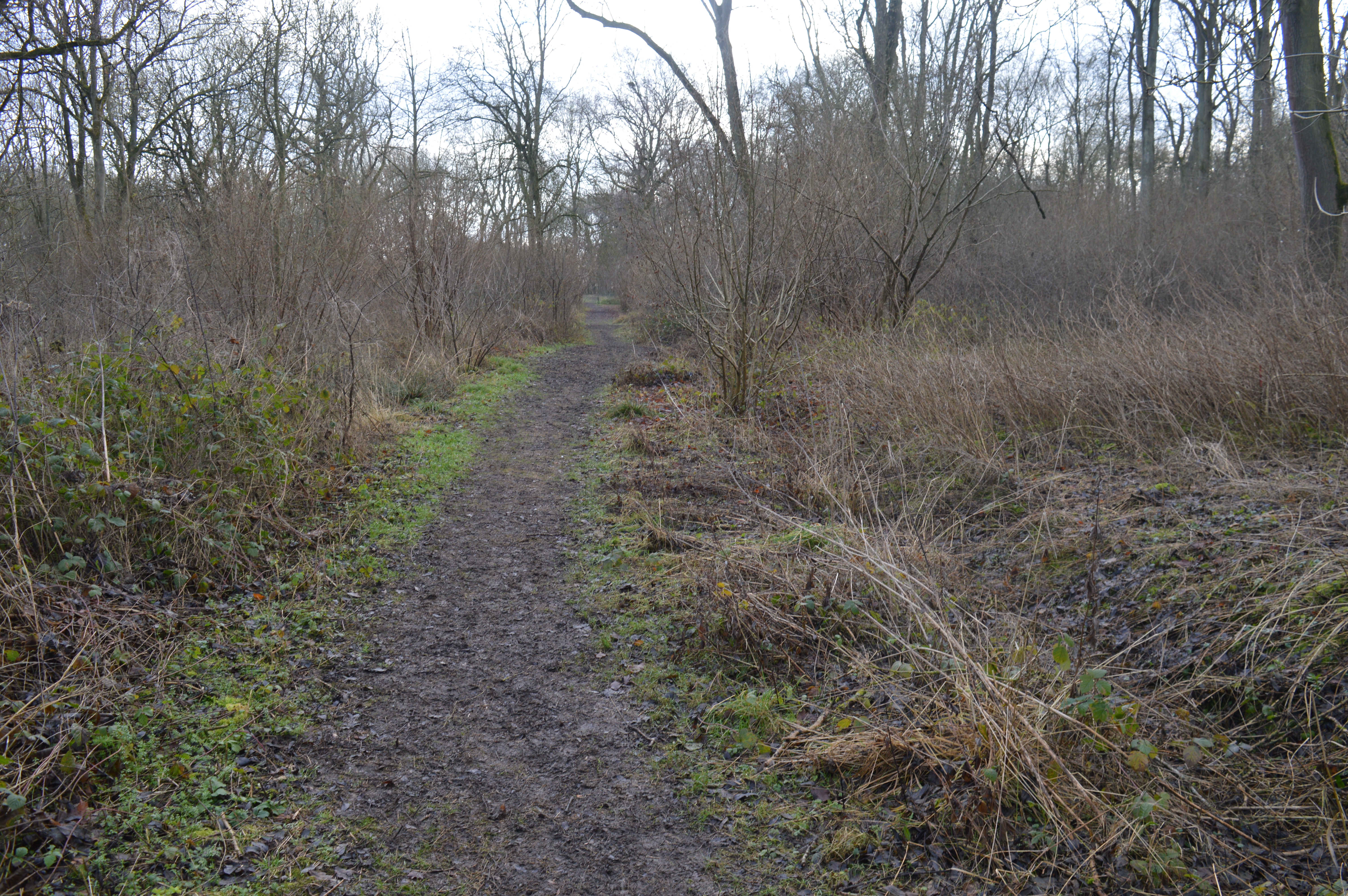
Hay Wood is a small but significant woodland located in the county of Cambridgeshire, England. Situated near the village of Hay, the wood covers an area of approximately 100 acres. It is predominantly made up of mixed deciduous trees, including oak, ash, birch, and beech.

The wood is known for its rich biodiversity and serves as an important habitat for a variety of flora and fauna. It is home to a diverse range of plant species, such as bluebells, wood anemones, and wild garlic, which create a stunning display of colors during the spring months. The wood also provides a sanctuary for a wide range of bird species, including woodpeckers, nuthatches, and tawny owls, making it a popular spot for birdwatchers.

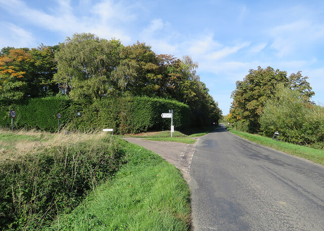
Hay Wood is a popular destination for nature enthusiasts and local residents alike, offering tranquil walking trails that wind through the dense foliage. The wood is also a designated Site of Special Scientific Interest (SSSI), recognizing its ecological importance and ensuring its protection.

The wood has a long history, dating back centuries. It has been managed by local authorities and conservation groups to preserve its natural beauty and promote sustainable woodland management practices. Visitors to Hay Wood can enjoy its peaceful atmosphere, observe wildlife, and appreciate the beauty of a well-preserved woodland in the heart of Cambridgeshire.

If you have any feedback on the listing, please let us know in the comments section below.

Hay Wood Images

Images are sourced within 2km of 52.174667/0.37365567 or Grid Reference TL6255. Thanks to Geograph Open Source API. All images are credited.

Bridleway to Grange Road The start of a track which ends at the road from Weston Colville to Dullingham, a mile and a half away.
Bridleway to Grange Road
The start of a track which ends at the road from Weston Colville to Dullingham, a mile and a half away.
Towards Weston Colville on Brinkley Road This is the winding B1052, between Willingham Green and Weston Colville, photographed on a bright October morning.
Towards Weston Colville on Brinkley Road
This is the winding B1052, between Willingham Green and Weston Colville, photographed on a bright October morning.
Cottages at Willingham Green A hamlet between Weston Colville and Brinkley (ahead) in the gentle hills of East Cambridgeshire.
Cottages at Willingham Green
A hamlet between Weston Colville and Brinkley (ahead) in the gentle hills of East Cambridgeshire.
Willingham Green Road This is a hamlet in East Cambridgeshire. The road leads to Carlton and on into Suffolk.
Willingham Green Road
This is a hamlet in East Cambridgeshire. The road leads to Carlton and on into Suffolk.
The start of a footpath at Willingham Green This is part of a complex network of footpaths linking Carlton, Brinkley and Weston Green.
The start of a footpath at Willingham Green
This is part of a complex network of footpaths linking Carlton, Brinkley and Weston Green.
Turn left for Willingham Green A turn off the road from Carlton to Brinkley (ahead), photographed on a sunny morning in early autumn.
Turn left for Willingham Green
A turn off the road from Carlton to Brinkley (ahead), photographed on a sunny morning in early autumn.
A crossroads on Brinkley Road Brinkley to the left, Six Mile Bottom and Cambridge to the right, Weston Colville and (not very directly) Balsham straight ahead. The road behind the camera runs to Dullingham.
A crossroads on Brinkley Road
Brinkley to the left, Six Mile Bottom and Cambridge to the right, Weston Colville and (not very directly) Balsham straight ahead. The road behind the camera runs to Dullingham.
North-west from Westley Waterless Straight on for Westley Bottom.
North-west from Westley Waterless
Straight on for Westley Bottom.
Westley Waterless: water shortage After the drought summer of 2022 the water level looks low in the pond on Church Lane.

For comparison: <a href="https://www.geograph.org.uk/photo/3276200">TL6156 : Westley Waterless: Church Lane and pond</a> (2012).
Westley Waterless: water shortage
After the drought summer of 2022 the water level looks low in the pond on Church Lane. For comparison: TL6156 : Westley Waterless: Church Lane and pond (2012).
Westley Waterless: St Mary - restoration Two men were working on the bellcote - one on the lead, the other painting the louvres. The spirelet replaced a round tower which collapsed in 1855.

Inside are two exquisite 14th-century brasses: <a href="https://www.geograph.org.uk/photo/3276297">TL6156 : Westley Waterless: brass of Sir John Creke (detail)</a> and <a href="https://www.geograph.org.uk/photo/3276294">TL6156 : Westley Waterless: brass of Lady Creke (detail)</a>.
Westley Waterless: St Mary - restoration
Two men were working on the bellcote - one on the lead, the other painting the louvres. The spirelet replaced a round tower which collapsed in 1855. Inside are two exquisite 14th-century brasses: TL6156 : Westley Waterless: brass of Sir John Creke (detail) and TL6156 : Westley Waterless: brass of Lady Creke (detail).
Westley Waterless: building work A new house on Main Road
Westley Waterless: building work
A new house on Main Road
Converted water tower near Burrough Green A house on the B1061 between Dullingham and Brinkley.
Converted water tower near Burrough Green
A house on the B1061 between Dullingham and Brinkley.
Between Dullingham Ley and Dullingham A cloudless October morning.
Between Dullingham Ley and Dullingham
A cloudless October morning.
Dullingham: a house with a history The Grade II listing for the house on the left begins "Originally the workhouse, now dwellings. Late C17 or early C18. Local red brick; red pantile roof. Two symmetrical stacks and rear stack. Two storeys and attic with outshut. Central facade gable with round window."
Dullingham: a house with a history
The Grade II listing for the house on the left begins "Originally the workhouse, now dwellings. Late C17 or early C18. Local red brick; red pantile roof. Two symmetrical stacks and rear stack. Two storeys and attic with outshut. Central facade gable with round window."
Burrough End: the B1052 near the Westley Waterless turn <a href="https://www.geograph.org.uk/photo/3276486">TL6255 : Nearing Burrough End</a> is a winter view from the other side of the road, taken nearly ten years before.
Burrough End: the B1052 near the Westley Waterless turn
TL6255 : Nearing Burrough End is a winter view from the other side of the road, taken nearly ten years before.
On the B1052 Dullingham Road Nearing Fern Cottage, between Brinkley and Burrough End, on a sparkling October morning.
On the B1052 Dullingham Road
Nearing Fern Cottage, between Brinkley and Burrough End, on a sparkling October morning.
Brinkley: autumn sunlight The fine trees form an avenue to Brinkley Hall. <a href="https://www.geograph.org.uk/photo/3275507">TL6254 : Brinkley: winter sunlight</a> is a closer view, taken almost ten years before.
Brinkley: autumn sunlight
The fine trees form an avenue to Brinkley Hall. TL6254 : Brinkley: winter sunlight is a closer view, taken almost ten years before.
Footpath to Westley Waterless Taken from the side of the road from Six Mile Bottom to Brinkley (right) on a cloudless October morning.
Footpath to Westley Waterless
Taken from the side of the road from Six Mile Bottom to Brinkley (right) on a cloudless October morning.
Show me another place!

Hay Wood is located at Grid Ref: TL6255 (Lat: 52.174667, Lng: 0.37365567)

Administrative County: Cambridgeshire

District: East Cambridgeshire

Police Authority: Cambridgeshire

What 3 Words

///cure.doctors.mammoths. Near Balsham, Cambridgeshire

Nearby Locations

Ladies Grove Hay Wood

Related Wikis

Westley Waterless

Westley Waterless is a small village and civil parish in East Cambridgeshire, England, 5 miles south west of Newmarket. == History == The parish of Westley...

Brinkley, Cambridgeshire

Brinkley is a small village in Cambridgeshire, England. It is situated about 15 miles east of Cambridge and 5 miles south of Newmarket, the horse racing...

Park Wood, Cambridgeshire

Park Wood is an 8.1-hectare (20-acre) biological Site of Special Scientific Interest east of Brinkley in Cambridgeshire.This is woodland of the wet ash/maple...

Burrough Green

Burrough Green is a village and parish in Cambridgeshire, England. The population of the village at the 2011 census was 378. The soil is various; subsoil...

Dullingham

Dullingham is a small village and civil parish in East Cambridgeshire, England. It is situated 4 miles (6 km) south of Newmarket and 14 miles (23 km) east...

Weston Colville

Weston Colville is a village in South Cambridgeshire, 10 miles southeast of Cambridge and 6 miles south of Newmarket, close to the border with Suffolk...

Lower Wood

Lower Wood is a 9 hectare nature reserve east of Weston Colville in Cambridgeshire. It is managed by the Wildlife Trust for Bedfordshire, Cambridgeshire...

Dullingham railway station

Dullingham is a railway station that serves the village of Dullingham in Cambridgeshire, England. It is about 1 mile (1.6 km) north-west of the centre...

Nearby Amenities

Located within 500m of 52.174667,0.37365567
Recycling
Lat/Long: 52.1789429/0.3735573
Parking
Lat/Long: 52.1790232/0.3734259
Bus Stop
Village Hall
Naptan AtcoCode: 0500EWESW002
Naptan Bearing: E
Naptan BusStopType: CUS
Naptan CommonName: Village Hall
Naptan Indicator: near
Naptan Landmark: Village Hall
Naptan NaptanCode: cmbdjmag
Naptan ShortCommonName: Village Hall
Naptan Street: Westley Bottom Road
Naptan Verified: no
Source: naptan_import
Lat/Long: 52.1788625/0.3733733
Bus Stop
Village Hall
Naptan AtcoCode: 0500EWESW004
Naptan Bearing: W
Naptan BusStopType: CUS
Naptan CommonName: Village Hall
Naptan Indicator: opp
Naptan Landmark: Westley Waterless Village Hall
Naptan NaptanCode: cmbdjmam
Naptan ShortCommonName: Village Hall
Naptan Street: Westley Bottom Road
Naptan Verified: no
Source: naptan_import
Lat/Long: 52.1787898/0.3733147
Power: pole
Lat/Long: 52.1787566/0.3765743
Post Box
Collection Times: Mo-Fr 16:15; Sa 10:00
Operator: Royal Mail
Post Box Type: lamp
Ref: CB8 121
Royal Cypher: EIIR
Royal Cypher Wikidata: Q33102113
Source: survey
Lat/Long: 52.1789498/0.3732464
Westley Waterless
Man Made: village_sign
Source: survey
Tourism: artwork
Lat/Long: 52.1787921/0.3733997
The data included in this document is from www.openstreetmap.org. The data is made available under ODbL.

Have you been to Hay Wood?

Leave your review of Hay Wood below (or comments, questions and feedback).