Lake Plantation

Wood, Forest in Cambridgeshire South Cambridgeshire

England

Lake Plantation

Mill Green Water Tower This photo was taken with a DJI mini 2 at 50m of altitude.
Mill Green Water Tower Credit: Aidan

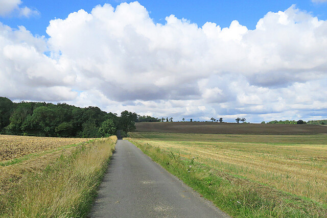
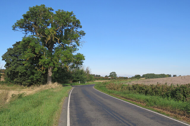
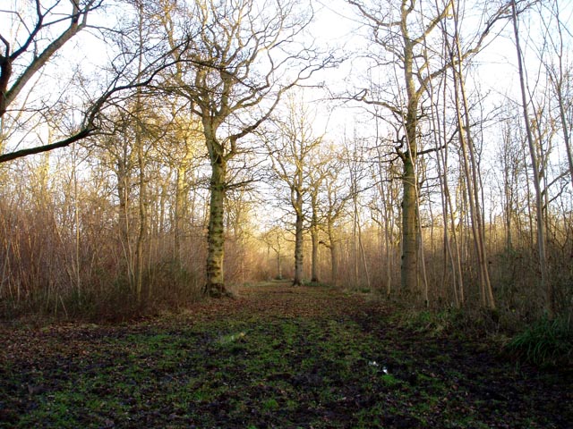
Lake Plantation is a charming woodland area located in Cambridgeshire, England. Situated in the eastern part of the county, it encompasses a sprawling area of lush greenery and is renowned for its picturesque landscape. The plantation is predominantly covered by dense forests, which are home to a diverse array of flora and fauna, making it a haven for nature enthusiasts.

One of the most notable features of Lake Plantation is its serene lake, after which it is named. The lake is surrounded by towering trees and provides a tranquil setting for visitors to relax and unwind. It also serves as a habitat for various waterfowl species, adding to the natural beauty of the area.

The woodland in Lake Plantation is a mix of native and non-native trees, including oak, beech, and pine. The dense canopy created by these trees provides ample shade and creates a cool atmosphere, especially during the summer months. There are numerous walking trails that crisscross the plantation, allowing visitors to explore its natural wonders at their own pace.

In addition to its natural beauty, Lake Plantation offers several recreational activities for visitors. These include birdwatching, fishing in the lake, and picnicking in designated areas. The plantation is also a popular spot for camping, with designated campsites and facilities available for those wishing to spend more time immersing themselves in the natural surroundings.

Overall, Lake Plantation in Cambridgeshire is a tranquil and idyllic destination for nature lovers. With its stunning landscapes, diverse wildlife, and recreational opportunities, it provides a welcome retreat from the hustle and bustle of everyday life.

If you have any feedback on the listing, please let us know in the comments section below.

Lake Plantation Images

Images are sourced within 2km of 52.075742/0.36602443 or Grid Reference TL6244. Thanks to Geograph Open Source API. All images are credited.

Mill Green Water Tower This photo was taken with a DJI mini 2 at 50m of altitude.
Mill Green Water Tower
This photo was taken with a DJI mini 2 at 50m of altitude.
Sunlight, shadow, woodland and rolling fields A late-August morning of high, fast-moving cloud, bright sunlight and shifting shadows. This is the lane from Camps Hall to Steventon End, in the south-eastern corner of Cambridgeshire.
Sunlight, shadow, woodland and rolling fields
A late-August morning of high, fast-moving cloud, bright sunlight and shifting shadows. This is the lane from Camps Hall to Steventon End, in the south-eastern corner of Cambridgeshire.
Camps Hall to Steventon End The road to Steventon End has just crossed a stream which is one of the easternmost tributaries of the many-stranded eastern arm of the River Cam network.
Camps Hall to Steventon End
The road to Steventon End has just crossed a stream which is one of the easternmost tributaries of the many-stranded eastern arm of the River Cam network.
Road junction at Camps Hall The road ahead, to Bartlow, follows one of the easternmost streams of the many-stranded River Cam, which rises near Castle Camps.
Road junction at Camps Hall
The road ahead, to Bartlow, follows one of the easternmost streams of the many-stranded River Cam, which rises near Castle Camps.
The road to Bartlow in August The road follows a stream which rises near Castle Camps and is one of the easternmost of the many strands of the complex River Cam network.
The road to Bartlow in August
The road follows a stream which rises near Castle Camps and is one of the easternmost of the many strands of the complex River Cam network.
Camps End: left to Bartlow, right to the Bumpsteads The words "Together in The Camps" are incised on the bench.
Camps End: left to Bartlow, right to the Bumpsteads
The words "Together in The Camps" are incised on the bench.
Castle Camps: The Old Inn, Park Lane The Grade II listing begins "House, originally an inn. Late C17, extended on south-east and south-west side C19 and renovated mid-late C20. Timber-framed, rendered. Tiled roof with red-brick ridge stack and end and side stack."
Castle Camps: The Old Inn, Park Lane
The Grade II listing begins "House, originally an inn. Late C17, extended on south-east and south-west side C19 and renovated mid-late C20. Timber-framed, rendered. Tiled roof with red-brick ridge stack and end and side stack."
Castle Camps: Castle Meadow Suburban-looking houses on the edge of a Cambridgeshire village.
Castle Camps: Castle Meadow
Suburban-looking houses on the edge of a Cambridgeshire village.
Castle Camps: new houses going up Bartlow Road, on the eastern edge of the village.
Castle Camps: new houses going up
Bartlow Road, on the eastern edge of the village.
Castle Camps: Hill Farm Just outside the village, on Bartlow Road. Several businesses are based here.
Castle Camps: Hill Farm
Just outside the village, on Bartlow Road. Several businesses are based here.
Footpath to Shudy Camps The path crosses a bridge over a ditch. Beyond, the field has been ploughed after harvest and the path has not yet been reinstated.
Footpath to Shudy Camps
The path crosses a bridge over a ditch. Beyond, the field has been ploughed after harvest and the path has not yet been reinstated.
Track to Lordship Farm North of the road from Bartlow to Castle Camps.
Track to Lordship Farm
North of the road from Bartlow to Castle Camps.
Bridleway to Camps Hall South of the road from Bartlow to Castle Camps (left).
Bridleway to Camps Hall
South of the road from Bartlow to Castle Camps (left).
Gentle Cambridgeshire hills Not long after nine o'clock on a fine August morning. This is the road from Castle Camps to Bartlow (ahead). The fingerpost on the left points along a bridle path to Camps Hall.
Gentle Cambridgeshire hills
Not long after nine o'clock on a fine August morning. This is the road from Castle Camps to Bartlow (ahead). The fingerpost on the left points along a bridle path to Camps Hall.
Nearing two turns This is the road from Castle Camps to Bartlow (ahead). The first signpost points to Camps End, the second to Steventon End and Ashdon.
Nearing two turns
This is the road from Castle Camps to Bartlow (ahead). The first signpost points to Camps End, the second to Steventon End and Ashdon.
Uphill to Ashdon The white posts mark where the road crosses a strand of the infant River Granta, the eastern arm of the complex River Cam network, which drains a lot of south and south-east Cambridgeshire. The picture was taken shortly after nine o'clock on a fine August morning.
Uphill to Ashdon
The white posts mark where the road crosses a strand of the infant River Granta, the eastern arm of the complex River Cam network, which drains a lot of south and south-east Cambridgeshire. The picture was taken shortly after nine o'clock on a fine August morning.
Turn left to Shudy Camps Straight on for Castle Camps and the Bumpsteads. The picture was taken against the light at about nine o'clock on the sunny morning of August Bank Holiday Sunday.
Turn left to Shudy Camps
Straight on for Castle Camps and the Bumpsteads. The picture was taken against the light at about nine o'clock on the sunny morning of August Bank Holiday Sunday.
Shudy Camps, St Mary <span class="nowrap"><a title="http://www.druidic.org/camchurch/churches/shudy.htm" rel="nofollow ugc noopener" href="http://www.druidic.org/camchurch/churches/shudy.htm">Link</a><img style="margin-left:2px;" alt="External link" title="External link - shift click to open in new window" src="https://s1.geograph.org.uk/img/external.png" width="10" height="10"/></span>
Shudy Camps, St Mary
Show me another place!

Lake Plantation is located at Grid Ref: TL6244 (Lat: 52.075742, Lng: 0.36602443)

Administrative County: Cambridgeshire

District: South Cambridgeshire

Police Authority: Cambridgeshire

What 3 Words

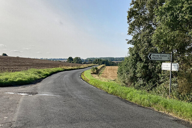
///camper.defensive.handsets. Near Haverhill, Suffolk

Related Wikis

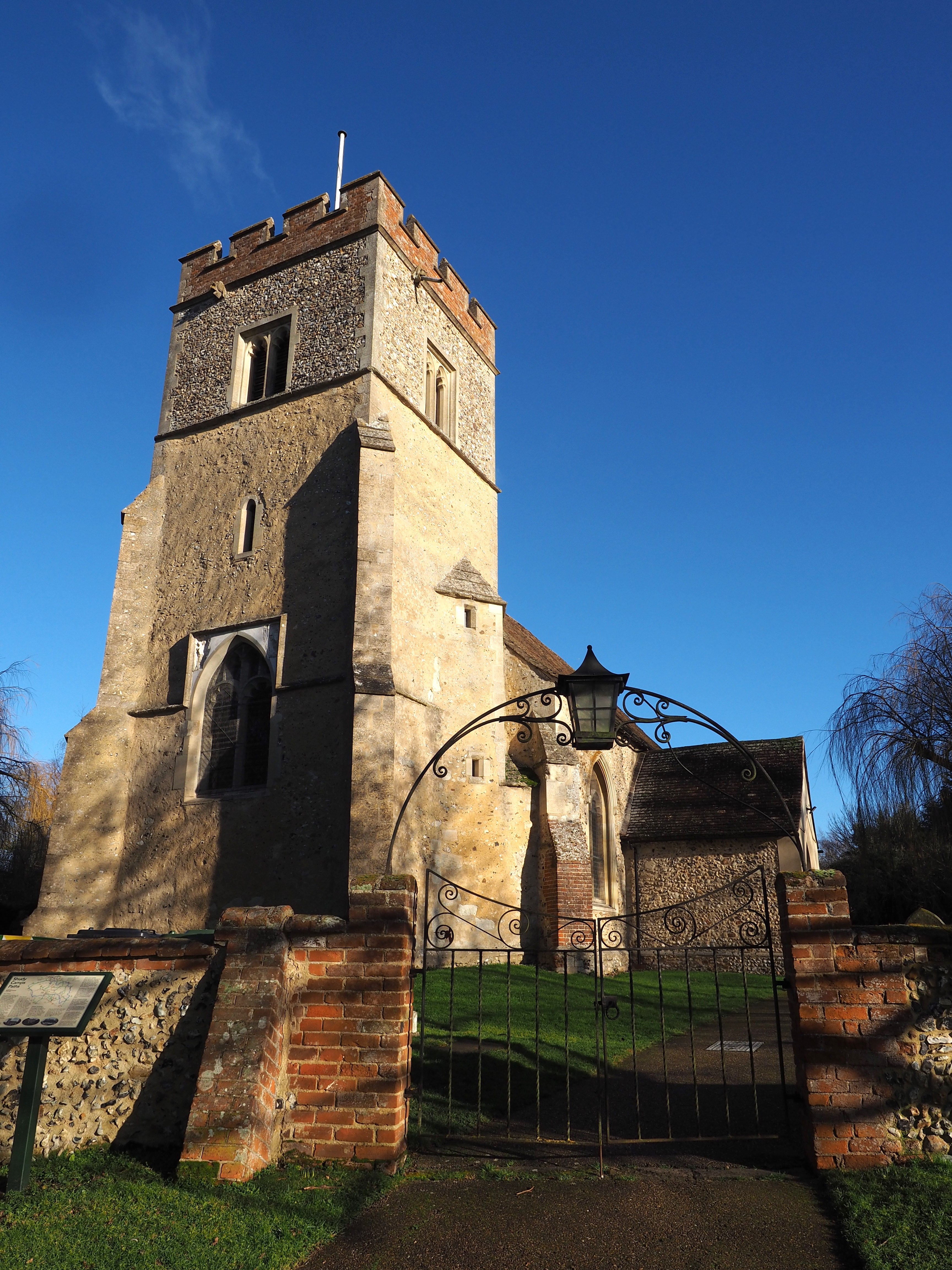
Castle Camps (village)

Castle Camps is a village and civil parish in the South Cambridgeshire district, in the county of Cambridgeshire, England. It is 15 miles (24 km) south...

Castle Camps

Castle Camps was a Norman Castle located in what is now the civil parish of Castle Camps, Cambridgeshire. == Owners == Castle Camps was originally a Saxon...

Langley Wood, Cambridgeshire

Langley Wood is a 31.6-hectare (78-acre) biological Site of Special Scientific Interest in Cambridgeshire, but lying between Saffron Walden in Essex and...

RAF Castle Camps

RAF Castle Camps was listed as being in Cambridgeshire as it is close to its namesake Cambridgeshire village. It is very near the Suffolk border and the...

Horseheath

Horseheath is a village in Cambridgeshire, England, situated a few miles south-east of Cambridge, between Linton and Haverhill, on the A1307 road. It was...
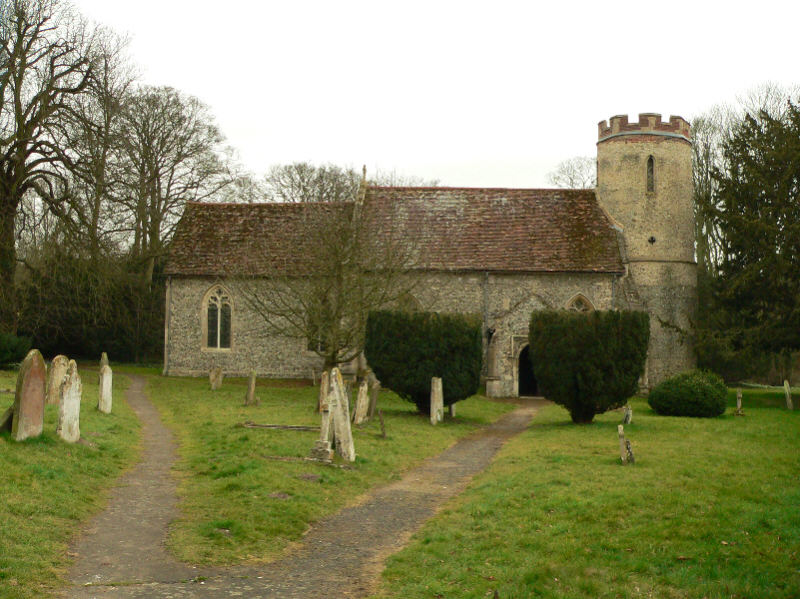
Shudy Camps

Shudy Camps is a village in the south-east corner of Cambridgeshire, England, near the border of Essex and Suffolk, and is part of the Chilford Hundred...

Bragg's Mill, Ashdon

Bragg's Mill, William Bragg's Mill, Bartlow Hamlet Mill or Stevington End Mill is a grade II listed post mill at Ashdon, Essex, England which has been...

Bartlow

Bartlow is a small village and civil parish in the South Cambridgeshire district of Cambridgeshire, England, about 12 miles (19 km) south-east of Cambridge...

Nearby Amenities

Located within 500m of 52.075742,0.36602443
Bus Stop
St Mary's Church
Naptan AtcoCode: 0500SSHUD002
Naptan Bearing: NW
Naptan CommonName: St Mary's Church
Naptan Indicator: opp
Naptan Landmark: St Mary's Church
Naptan NaptanCode: cmbgatdj
Naptan Street: Church Road
Naptan Verified: no
Public Transport: platform
Source: naptan_import
Lat/Long: 52.0744189/0.3626627
Bus Stop
St Mary's Church
Naptan AtcoCode: 0500SSHUD004
Naptan Bearing: SE
Naptan BusStopType: CUS
Naptan CommonName: St Mary's Church
Naptan Indicator: o/s
Naptan Landmark: St Mary's Church
Naptan NaptanCode: cmbgdwda
Naptan Street: Main Street
Naptan Verified: no
Public Transport: platform
Source: naptan_import
Lat/Long: 52.0744351/0.3627511
Power: pole
Lat/Long: 52.0741617/0.3691013
Power: pole
Lat/Long: 52.0730143/0.3647856
Power: pole
Lat/Long: 52.0730506/0.3684815
Power: pole
Lat/Long: 52.0730506/0.3702517
Power: pole
Lat/Long: 52.0730339/0.3667168
Power: pole
Lat/Long: 52.0736111/0.3696831
Power: pole
Lat/Long: 52.0729286/0.3713407
Power: transformer
Lat/Long: 52.0748129/0.3684522
Power: pole
Lat/Long: 52.0734478/0.3619225
Power: pole
Lat/Long: 52.072982/0.3633039
Power: pole
Lat/Long: 52.0764631/0.3595175
Power: pole
Lat/Long: 52.0761943/0.3607491
Power: pole
Lat/Long: 52.0771587/0.3595473
Power: pole
Lat/Long: 52.0778304/0.3595728
Power: transformer
Lat/Long: 52.0759882/0.3617468
Power: pole
Lat/Long: 52.0740082/0.3604675
Power: pole
Lat/Long: 52.0757648/0.3593946
Power: pole
Lat/Long: 52.0749329/0.3599304
Barrier: kissing_gate
Lat/Long: 52.0738931/0.3629296
The data included in this document is from www.openstreetmap.org. The data is made available under ODbL.

Have you been to Lake Plantation?

Leave your review of Lake Plantation below (or comments, questions and feedback).