Burnt Wood

Wood, Forest in Sussex Wealden

England

Burnt Wood

Lambs Larder Village store on the B2169 Bayham Road.
Lambs Larder Credit: David Anstiss

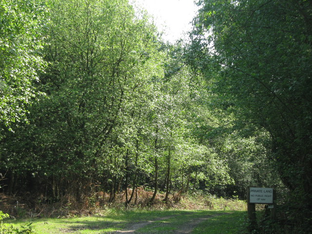
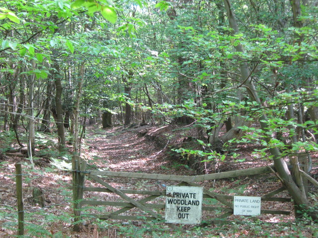
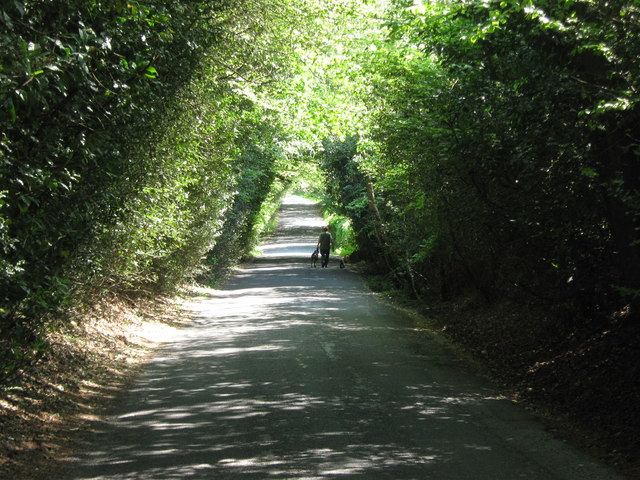
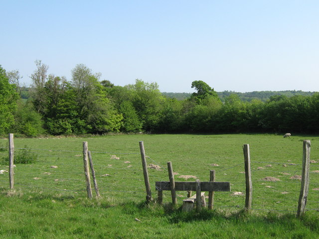
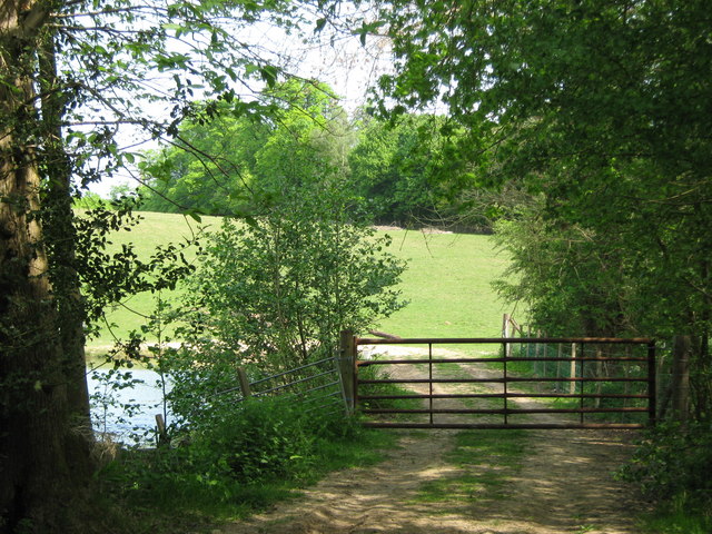
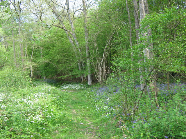
Burnt Wood, Sussex is a picturesque forest located in the county of Sussex, England. It is known for its dense woodlands and enchanting natural beauty. Situated in the heart of the South Downs National Park, Burnt Wood covers a vast area of approximately 500 hectares.

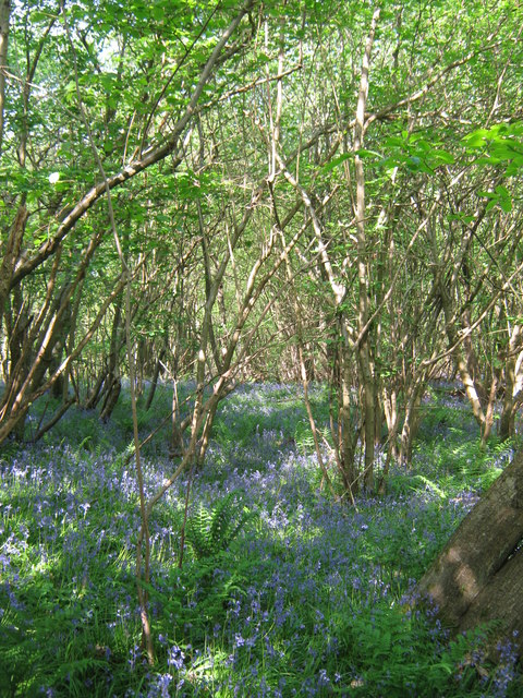
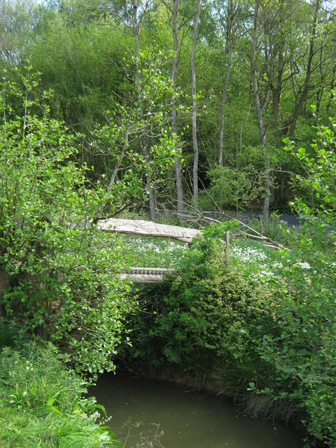
The forest is predominantly composed of various types of deciduous trees, including oak, ash, beech, and birch. These towering trees provide a dense canopy that creates a cool and serene atmosphere within the woodlands. The forest floor is covered with a thick layer of fallen leaves, giving it a rustic and earthy feel.

One of the notable features of Burnt Wood is its rich biodiversity. The forest is home to a wide array of wildlife, including deer, foxes, badgers, and a variety of bird species. The diverse range of habitats in the forest supports a thriving ecosystem, making it a popular destination for nature enthusiasts and wildlife photographers.

The forest offers numerous walking trails and paths, allowing visitors to explore its natural wonders at their own pace. These trails meander through the woodlands, offering breathtaking views of the surrounding countryside and the nearby South Downs.

Burnt Wood is also steeped in history, with evidence of human settlement dating back to the Iron Age. The forest has witnessed centuries of human activity, from traditional woodland management practices to wartime activities during World War II.

Overall, Burnt Wood, Sussex is a captivating destination for those seeking tranquility, natural beauty, and a deeper connection with nature.

If you have any feedback on the listing, please let us know in the comments section below.

Burnt Wood Images

Images are sourced within 2km of 51.100739/0.31350671 or Grid Reference TQ6236. Thanks to Geograph Open Source API. All images are credited.

Lambs Larder Village store on the B2169 Bayham Road.
Lambs Larder
Village store on the B2169 Bayham Road.
Bells Yew Green Village Hall On the B2169 Bayham Road.
Bells Yew Green Village Hall
On the B2169 Bayham Road.
Bells Yew Green Chapel Small chapel on the B2169 Bayham Road, behind a small cottage, facing the village green.
Bells Yew Green Chapel
Small chapel on the B2169 Bayham Road, behind a small cottage, facing the village green.
Brecknock Arms, Pub Sign Outside <a href="https://www.geograph.org.uk/photo/2039350">TQ6036 : The Brecknock Arms</a>, on the junction of Bayham Road and Bell Yew Road.
Brecknock Arms, Pub Sign
Outside TQ6036 : The Brecknock Arms, on the junction of Bayham Road and Bell Yew Road.
Woodland track in Oxpasture Wood This track leads from Hawkenbury Road.
Woodland track in Oxpasture Wood
This track leads from Hawkenbury Road.
Woodland Track in Oxpasture Wood This track leads from Hawkenbury Road. It is opposite the track to Frant Lakes.
Woodland Track in Oxpasture Wood
This track leads from Hawkenbury Road. It is opposite the track to Frant Lakes.
Bush House Field
Bush House Field
Dundale Road This road leads from Hawkenbury Road, towards Kipping's Cross.
On the left is Brown's Wood and Oxpasture Wood is on the right.
Dundale Road
This road leads from Hawkenbury Road, towards Kipping's Cross. On the left is Brown's Wood and Oxpasture Wood is on the right.
Stile near Brown's Wood This stile is on a Natural England permissive path from Dundale Road towards the wood in the background.
Stile near Brown's Wood
This stile is on a Natural England permissive path from Dundale Road towards the wood in the background.
Bluebells in Brown's Wood As seen from a permissive path near Dundale Road.
Bluebells in Brown's Wood
As seen from a permissive path near Dundale Road.
Gate near River Teise This gate is used by a Natural England permissive path leading from the Coneyburrow Wood beside the river, towards Rushet Wood near Dundale Road.
On the left is a small pond on the river.
Gate near River Teise
This gate is used by a Natural England permissive path leading from the Coneyburrow Wood beside the river, towards Rushet Wood near Dundale Road. On the left is a small pond on the river.
Footbridge over River Teise This bridge is used by a Natural England permissive path, leading over the river towards Furnace Wood.
Footbridge over River Teise
This bridge is used by a Natural England permissive path, leading over the river towards Furnace Wood.
Woodland Track in Furnace Wood This track leads from Bayham Lake through Furnace Wood towards Brown's Lodge.
On the left are masses of Wild Garlic and on the right (under the trees) are bluebells.
Woodland Track in Furnace Wood
This track leads from Bayham Lake through Furnace Wood towards Brown's Lodge. On the left are masses of Wild Garlic and on the right (under the trees) are bluebells.
Bluebells in Furnace Wood  As seen from the woodland track beside the wood.
Bluebells in Furnace Wood
As seen from the woodland track beside the wood.
Track in Furnace Wood This track leads from Tollslye Cottage near Bayham Lake, through the wood towards Brown's Lodge on Dundale Road.
Track in Furnace Wood
This track leads from Tollslye Cottage near Bayham Lake, through the wood towards Brown's Lodge on Dundale Road.
River Teise in Furnace Wood This long river flows from Great Bayhall Farm through the wood towards Bayham Lake. The section from Dundale Road towards the lake is also the country boundary. The wild garlic and bluebells are in Kent, across the river is East Sussex.
River Teise in Furnace Wood
This long river flows from Great Bayhall Farm through the wood towards Bayham Lake. The section from Dundale Road towards the lake is also the country boundary. The wild garlic and bluebells are in Kent, across the river is East Sussex.
Wild Garlic in Jews Wood As seen from a track leading into the wood. On the right are a few bluebells.
Wild Garlic in Jews Wood
As seen from a track leading into the wood. On the right are a few bluebells.
Track junction in Jews Wood A woodland track from Oxpasture Wood leads straight on towards Tollslye Cottage and Bayham Abbey. The track on the right climbs up and around to Bayham Lake.
Track junction in Jews Wood
A woodland track from Oxpasture Wood leads straight on towards Tollslye Cottage and Bayham Abbey. The track on the right climbs up and around to Bayham Lake.
Show me another place!

Burnt Wood is located at Grid Ref: TQ6236 (Lat: 51.100739, Lng: 0.31350671)

Administrative County: East Sussex

District: Wealden

Police Authority: Sussex

What 3 Words

///barn.sulk.rather. Near Wadhurst, East Sussex

Related Wikis

Frant railway station

Frant railway station is on the Hastings line in East Sussex, England, and serves the civil parish of Frant (although the station is actually located some...

Tunbridge Wells (UK Parliament constituency)

Tunbridge Wells is a constituency in Kent represented in the House of Commons of the UK Parliament since 2005 by Greg Clark, a Conservative who served...

Bayham Old Abbey

Bayham Old Abbey is an English Heritage property, located near Lamberhurst, Kent, England. Founded c. 1208 through a combination of the failing Premonstratensian...

Frant

Frant is a village and civil parish in the Wealden District of East Sussex, England, on the Kentish border about three miles (5 km) south of Royal Tunbridge...

St Alban's Church, Frant

St Alban's Church is a Church of England parish church in Frant, East Sussex, England. It was built in 1819–22 in a fifteenth-century gothic revival style...

Wadhurst railway station

Wadhurst railway station is on the Hastings line in the south of England and serves the town of Wadhurst, East Sussex. It is 39 miles 23 chains (63.2 km...

Kent and Sussex Crematorium and Cemetery

The Kent and Sussex Crematorium and Cemetery is a crematorium and cemetery located in Royal Tunbridge Wells in the county of Kent, England. == Background... ==

Hawkenbury, Tunbridge Wells

Hawkenbury is a small village area located in the south east of Royal Tunbridge Wells, Kent, England. == History == Hawkenbury was settled before Tunbridge...

Nearby Amenities

Located within 500m of 51.100739,0.31350671
Higham Farm
Place: farm
Lat/Long: 51.0974753/0.3094706
Public Footpath
Information: guidepost
Tourism: information
Lat/Long: 51.0969954/0.3098788
The data included in this document is from www.openstreetmap.org. The data is made available under ODbL.

Have you been to Burnt Wood?

Leave your review of Burnt Wood below (or comments, questions and feedback).