Churchfield Wood

Wood, Forest in Sussex Wealden

England

Churchfield Wood

Lambs Larder Village store on the B2169 Bayham Road.
Lambs Larder Credit: David Anstiss

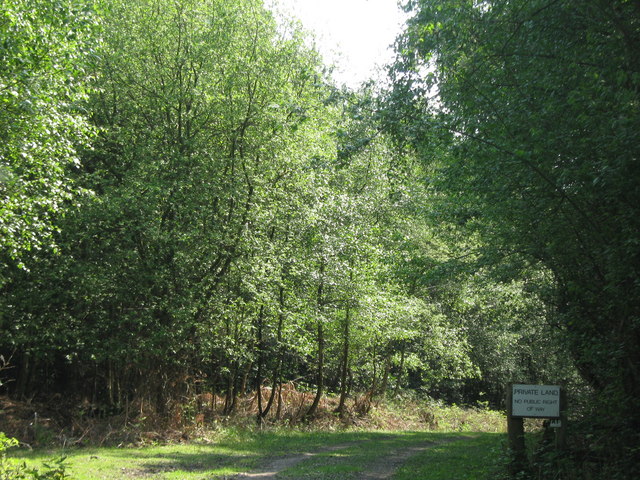
Churchfield Wood is a charming woodland located in Sussex, England. Covering an area of approximately 30 acres, this wood is a delightful retreat for nature lovers and outdoor enthusiasts alike. Composed mainly of broadleaf trees such as oak, beech, and ash, the wood boasts a rich diversity of flora and fauna.

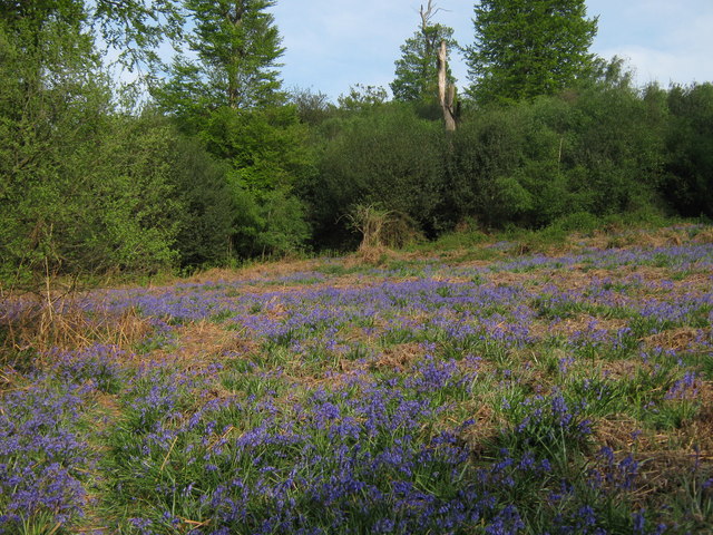
As visitors enter Churchfield Wood, they are captivated by the enchanting atmosphere created by the dense canopy above, filtering sunlight and casting beautiful patterns on the forest floor. The woodland is home to a plethora of wildlife, including various bird species like woodpeckers, owls, and songbirds, as well as small mammals like squirrels and foxes.

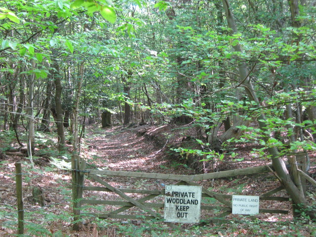
Tranquil pathways wind through the wood, offering visitors the opportunity to immerse themselves in the natural beauty surrounding them. These well-maintained trails lead adventurers past babbling brooks, vibrant wildflowers, and ancient trees, providing a sense of serenity and peace. The wood also features a picnic area, allowing visitors to relax and enjoy a meal amidst the tranquil ambiance.

Churchfield Wood is not only a haven for wildlife and a place of natural beauty, but it also holds historical significance. It is believed that the wood has been in existence for centuries, serving as a vital resource for timber and firewood in the past.

Overall, Churchfield Wood is a captivating woodland that offers an escape from the hustle and bustle of everyday life. Whether visitors come to admire the diverse range of plant and animal life, enjoy a peaceful walk, or simply seek solace in nature, this wood provides a truly enchanting experience.

If you have any feedback on the listing, please let us know in the comments section below.

Churchfield Wood Images

Images are sourced within 2km of 51.095661/0.30788294 or Grid Reference TQ6135. Thanks to Geograph Open Source API. All images are credited.

Lambs Larder Village store on the B2169 Bayham Road.
Lambs Larder
Village store on the B2169 Bayham Road.
Bells Yew Green Village Hall On the B2169 Bayham Road.
Bells Yew Green Village Hall
On the B2169 Bayham Road.
Bells Yew Green Chapel Small chapel on the B2169 Bayham Road, behind a small cottage, facing the village green.
Bells Yew Green Chapel
Small chapel on the B2169 Bayham Road, behind a small cottage, facing the village green.
Brecknock Arms, Pub Sign Outside <a href="https://www.geograph.org.uk/photo/2039350">TQ6036 : The Brecknock Arms</a>, on the junction of Bayham Road and Bell Yew Road.
Brecknock Arms, Pub Sign
Outside TQ6036 : The Brecknock Arms, on the junction of Bayham Road and Bell Yew Road.
Woodland track in Oxpasture Wood This track leads from Hawkenbury Road.
Woodland track in Oxpasture Wood
This track leads from Hawkenbury Road.
Woodland Track in Oxpasture Wood This track leads from Hawkenbury Road. It is opposite the track to Frant Lakes.
Woodland Track in Oxpasture Wood
This track leads from Hawkenbury Road. It is opposite the track to Frant Lakes.
Long Track in Jews Wood This very long straight track leads from Bayham Abbey and Lake towards Oxpasture Wood.
Long Track in Jews Wood
This very long straight track leads from Bayham Abbey and Lake towards Oxpasture Wood.
Stream in Jews Wood This woodland stream, leads from Oxpasture Wood, through Jews Wood and into the River Teise feeding into Bayham Lake.
Stream in Jews Wood
This woodland stream, leads from Oxpasture Wood, through Jews Wood and into the River Teise feeding into Bayham Lake.
Tank Cottages On Bartley Mill Road.
Tank Cottages
On Bartley Mill Road.
Footpath near Brick Kiln Wood A path leads from Bartley Mill Road, along a farm track and then it heads right into the wood, heading towards Great Shoesmith Farm.
Footpath near Brick Kiln Wood
A path leads from Bartley Mill Road, along a farm track and then it heads right into the wood, heading towards Great Shoesmith Farm.
Footpath in Brick Kiln Wood A path leads from Great Shoesmith Farm, through the wood, heading towards Bartley Mill Road .

This section of the path was very muddy, even though it has been dry for the last week.
Footpath in Brick Kiln Wood
A path leads from Great Shoesmith Farm, through the wood, heading towards Bartley Mill Road . This section of the path was very muddy, even though it has been dry for the last week.
Bluebells in Sluice Wood As seen from a footpath passing through the wood towards Bartley Mill Road.
Bluebells in Sluice Wood
As seen from a footpath passing through the wood towards Bartley Mill Road.
Footpath junction in Brick Kiln Wood A footpath from Great Shoesmith Farm, leads right through the wood towards Bartley Mill Road. The permissive path leads left along a woodland stream, before rejoining the footpath.
Footpath junction in Brick Kiln Wood
A footpath from Great Shoesmith Farm, leads right through the wood towards Bartley Mill Road. The permissive path leads left along a woodland stream, before rejoining the footpath.
Footbridge near Brick Kiln Wood A footpath leads from Bartley Mill Road, through Brick Kiln wood and then over a stream towards a field near Great Shoesmith Farm.
Footbridge near Brick Kiln Wood
A footpath leads from Bartley Mill Road, through Brick Kiln wood and then over a stream towards a field near Great Shoesmith Farm.
Gates near Great Shoesmith Farm A bridleway leads from the farm, straight on towards Bartley Mill, on Bartley Mill Road.
A footpath leads right towards Brick Kiln Wood and onwards to Bartley Mill Road.
Gates near Great Shoesmith Farm
A bridleway leads from the farm, straight on towards Bartley Mill, on Bartley Mill Road. A footpath leads right towards Brick Kiln Wood and onwards to Bartley Mill Road.
Barn in Great Shoesmith Farm Part of the complex of farm buildings.
Barn in Great Shoesmith Farm
Part of the complex of farm buildings.
Track to Walnut Tree Cottage This farm track leads from Great Shoesmith Farm towards the farm cottage.
A footpath leads along the track and then towards Little Shoesmiths farm.
Track to Walnut Tree Cottage
This farm track leads from Great Shoesmith Farm towards the farm cottage. A footpath leads along the track and then towards Little Shoesmiths farm.
Gate near Little Shoesmiths This farm gate and stile, is near a field near Great Shoesmith Farm. A footpath leads over the stile towards Little Shoesmiths and onwards to Dewhurst Lane.
Gate near Little Shoesmiths
This farm gate and stile, is near a field near Great Shoesmith Farm. A footpath leads over the stile towards Little Shoesmiths and onwards to Dewhurst Lane.
Show me another place!

Churchfield Wood is located at Grid Ref: TQ6135 (Lat: 51.095661, Lng: 0.30788294)

Administrative County: East Sussex

District: Wealden

Police Authority: Sussex

What 3 Words

///canny.organ.idea. Near Wadhurst, East Sussex

Related Wikis

Frant railway station

Frant railway station is on the Hastings line in East Sussex, England, and serves the civil parish of Frant (although the station is actually located some...

Wadhurst railway station

Wadhurst railway station is on the Hastings line in the south of England and serves the town of Wadhurst, East Sussex. It is 39 miles 23 chains (63.2 km...

Frant

Frant is a village and civil parish in the Wealden District of East Sussex, England, on the Kentish border about three miles (5 km) south of Royal Tunbridge...

St Alban's Church, Frant

St Alban's Church is a Church of England parish church in Frant, East Sussex, England. It was built in 1819–22 in a fifteenth-century gothic revival style...

Tunbridge Wells (UK Parliament constituency)

Tunbridge Wells is a constituency in Kent represented in the House of Commons of the UK Parliament since 2005 by Greg Clark, a Conservative who served...

Best Beech Hill

Best Beech Hill is a locality in the civil parish of Wadhurst in the Wealden district of East Sussex, England. Wadhurst lies approximately 1.6 miles...

Kent and Sussex Crematorium and Cemetery

The Kent and Sussex Crematorium and Cemetery is a crematorium and cemetery located in Royal Tunbridge Wells in the county of Kent, England. == Background... ==

Bayham Old Abbey

Bayham Old Abbey is an English Heritage property, located near Lamberhurst, Kent, England. Founded c. 1208 through a combination of the failing Premonstratensian...

Nearby Amenities

Located within 500m of 51.095661,0.30788294
Higham Farm
Place: farm
Lat/Long: 51.0974753/0.3094706
Public Footpath
Information: guidepost
Tourism: information
Lat/Long: 51.0969954/0.3098788
The data included in this document is from www.openstreetmap.org. The data is made available under ODbL.

Have you been to Churchfield Wood?

Leave your review of Churchfield Wood below (or comments, questions and feedback).