Church Wood

Wood, Forest in Sussex Wealden

England

Church Wood

Road Junction, B2096, towards Heathfield
Road Junction, B2096, towards Heathfield Credit: Julian P Guffogg

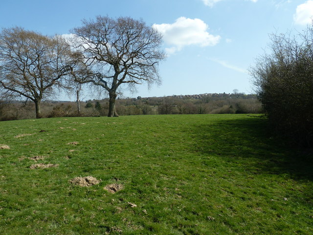
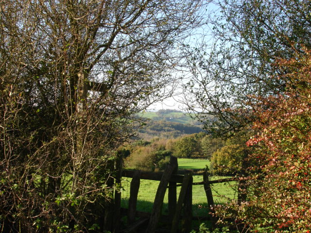
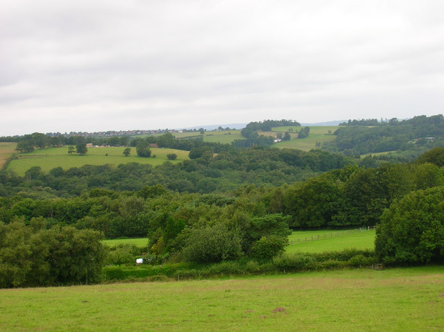
Church Wood is a picturesque woodland located in the county of Sussex, England. Covering an area of approximately 100 acres, this charming forest is situated near the village of Wadhurst, offering visitors a tranquil escape from the hustle and bustle of everyday life.

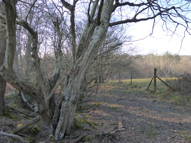
The wood is named after the nearby St. Peter and St. Paul's Church, which adds to its historical significance and charm. The ancient trees that populate Church Wood are predominantly oak, ash, and beech, creating a diverse and vibrant ecosystem. These towering giants provide a rich habitat for a variety of wildlife, including birds, squirrels, and deer.

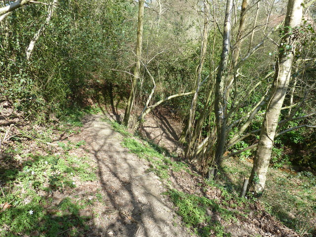
Walking through Church Wood, visitors can explore a network of well-maintained footpaths that wind through the forest, offering breathtaking views of the surrounding countryside. The paths are suitable for all levels of walkers, from casual strollers to more experienced hikers.

The wood is particularly famous for its stunning display of bluebells during the spring months. The forest floor becomes a sea of vibrant blue, attracting nature enthusiasts and photographers alike. In addition to the bluebells, Church Wood is also home to an array of other wildflowers, adding bursts of color to the landscape throughout the year.

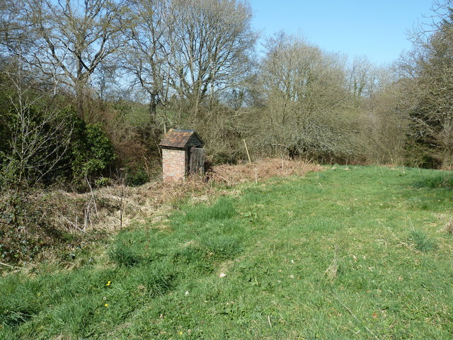
Church Wood has a rich history, with evidence of human activity dating back to the Iron Age. The area has also been used for timber production and charcoal making in the past. Today, it is managed by a local conservation group, ensuring its preservation for future generations to enjoy.

Overall, Church Wood is a captivating woodland that offers a peaceful retreat for nature lovers and history enthusiasts alike. Its stunning natural beauty and diverse wildlife make it a must-visit destination for anyone exploring the Sussex countryside.

If you have any feedback on the listing, please let us know in the comments section below.

Church Wood Images

Images are sourced within 2km of 50.971964/0.29819767 or Grid Reference TQ6121. Thanks to Geograph Open Source API. All images are credited.

Road Junction, B2096, towards Heathfield
Broad Oaks by the footpath to Broad Oak Broad Oak is a village to the east of Heathfield.
Broad Oaks by the footpath to Broad Oak
Broad Oak is a village to the east of Heathfield.
Descent into stream valley near Blackwater Cottage
Privy at Blackwater Cottage
Woodland stream near Blackwater Cottage The stream is a tributary of the River Rother.
Woodland stream near Blackwater Cottage
The stream is a tributary of the River Rother.
Houses on Halley Road near Cade Street
B2096 near Heathfield Community College
Entrance to Heathfield Community College
Buttressed boundary wall to Heathfield Park On School Hill, Old Heathfield.
Buttressed boundary wall to Heathfield Park
On School Hill, Old Heathfield.
All Saints and St Richard's C of E  Primary School On School Hill Old Heathfield.
All Saints and St Richard's C of E Primary School
On School Hill Old Heathfield.
Heathfield Leisure Centre A small establishment as leisure centres go.  Viewed just after opening, which is at 3:30 on Friday afternoons.
Heathfield Leisure Centre
A small establishment as leisure centres go. Viewed just after opening, which is at 3:30 on Friday afternoons.
The B2096 approaching Heathfield At the junction of School Hill
The B2096 approaching Heathfield
At the junction of School Hill
B2096 junction south of Satinstone Farm The road coming in from the left has a signboard: Portland Square.
B2096 junction south of Satinstone Farm
The road coming in from the left has a signboard: Portland Square.
The A265 The A265 road is an 11 mile road from Hurst Green <a href="https://www.geograph.org.uk/photo/7059740">TQ7327 : Junction of A21 & A265, Hurst Green</a> to Heathfield <a href="https://www.geograph.org.uk/photo/6669416">TQ5621 : A265, A267 junction</a>.
Website: <span class="nowrap"><a title="http://www.sabre-roads.org.uk/wiki/index.php?title=A265" rel="nofollow ugc noopener" href="http://www.sabre-roads.org.uk/wiki/index.php?title=A265">Link</a><img style="margin-left:2px;" alt="External link" title="External link - shift click to open in new window" src="https://s1.geograph.org.uk/img/external.png" width="10" height="10"/></span>
The A265
The A265 road is an 11 mile road from Hurst Green TQ7327 : Junction of A21 & A265, Hurst Green to Heathfield TQ5621 : A265, A267 junction. Website: LinkExternal link
Blackdown Mill This Windmill originally stood at "Three Chimneys" in Kent. It was purchased by Samuel Dallaway and brought to this site and erected in 1856 by a Heathfield millwright. It is known as the Blackdown Mill but perhaps more widely known as the Cherry Clack Mill as it was originally in a cherry orchard.
Blackdown Mill
This Windmill originally stood at "Three Chimneys" in Kent. It was purchased by Samuel Dallaway and brought to this site and erected in 1856 by a Heathfield millwright. It is known as the Blackdown Mill but perhaps more widely known as the Cherry Clack Mill as it was originally in a cherry orchard.
Footpath Punnets Town Footpath next to Blackdown Mill across farmland, Punnets Town East Sussex.
Footpath Punnets Town
Footpath next to Blackdown Mill across farmland, Punnets Town East Sussex.
Frost Cottage frost Cottage stands on Flitterbrook Lane in Warbleton Parish. It was named after my ancestor, John Frost, who lived there. John lived from about 1733 to 1809
Frost Cottage
frost Cottage stands on Flitterbrook Lane in Warbleton Parish. It was named after my ancestor, John Frost, who lived there. John lived from about 1733 to 1809
Chapel, Chapel Cross, East Sussex The Independent Chapel in Cade Street, Chapel Cross was built in 1767. It is a simple symmetrical building with oval window over its south facing porch. The chapel was known locally for many years as the chocolate church as the Pastor (P J Pont) gave the children going to Sunday School chocolates. Chapel cross was once considered to be part of Punnetts Town.
Chapel, Chapel Cross, East Sussex
The Independent Chapel in Cade Street, Chapel Cross was built in 1767. It is a simple symmetrical building with oval window over its south facing porch. The chapel was known locally for many years as the chocolate church as the Pastor (P J Pont) gave the children going to Sunday School chocolates. Chapel cross was once considered to be part of Punnetts Town.
Show me another place!

Church Wood is located at Grid Ref: TQ6121 (Lat: 50.971964, Lng: 0.29819767)

Administrative County: East Sussex

District: Wealden

Police Authority: Sussex

What 3 Words

///initiates.smart.crisps. Near Heathfield, East Sussex

Related Wikis

Bingletts Wood

Bingletts Wood is a 16-hectare (40-acre) biological Site of Special Scientific Interest east of Heathfield in East Sussex.Part of this ancient wood is...

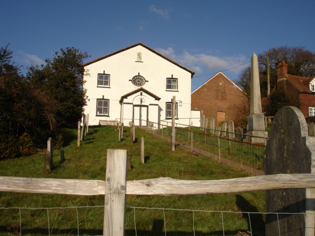
Ebenezer Chapel, Heathfield

Ebenezer Chapel is a Strict Baptist place of worship in the hamlet of Broad Oak, part of the parish of Heathfield in the English county of East Sussex...

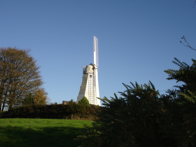
Blackdown Mill, Punnetts Town

Blackdown Mill or Cherry Clack Mill is a grade II listed smock mill at Punnetts Town, East Sussex, England, which has been restored. == History == Blackdown...

Heathfield Community College

Heathfield Community College is a secondary school near the market town of Heathfield, East Sussex, England. == School Enrollment == The college draws...

Punnett's Town

Punnett's Town is a village in the Wealden district of East Sussex. The main street is Battle road, which is part of the B2096 road. Blackdown Mill is...

All Saints Church, Heathfield

All Saints Church is a Church of England parish church in Heathfield, East Sussex, England. It was constructed in the 14th century and is a Grade II* listed...

Paines Cross Meadow

Paines Cross Meadow is a 3.7-hectare (9.1-acre) biological Site of Special Scientific Interest north-east of Heathfield in East Sussex.This site is damp...

Heathfield Park SSSI

Heathfield Park SSSI is a 41-hectare (100-acre) biological Site of Special Scientific Interest east of Heathfield in East Sussex. It is part of Heathfield...

Nearby Amenities

Located within 500m of 50.971964,0.29819767
Power: pole
Lat/Long: 50.9696959/0.3015822
Power: pole
Lat/Long: 50.9701604/0.2976769
Power: pole
Lat/Long: 50.9705227/0.294406
Power: pole
Lat/Long: 50.9704729/0.2923983
Power: pole
Lat/Long: 50.969902/0.2931306
Power: pole
Lat/Long: 50.9717531/0.2952629
Power: pole
Lat/Long: 50.9733458/0.2948821
Power: pole
Lat/Long: 50.9745551/0.294646
Power: pole
Lat/Long: 50.9757576/0.2943724
The data included in this document is from www.openstreetmap.org. The data is made available under ODbL.

Have you been to Church Wood?

Leave your review of Church Wood below (or comments, questions and feedback).