The Plantation

Wood, Forest in Sussex Wealden

England

The Plantation

Newick Lane, near Pheasantry Farm
Newick Lane, near Pheasantry Farm Credit: Julian P Guffogg

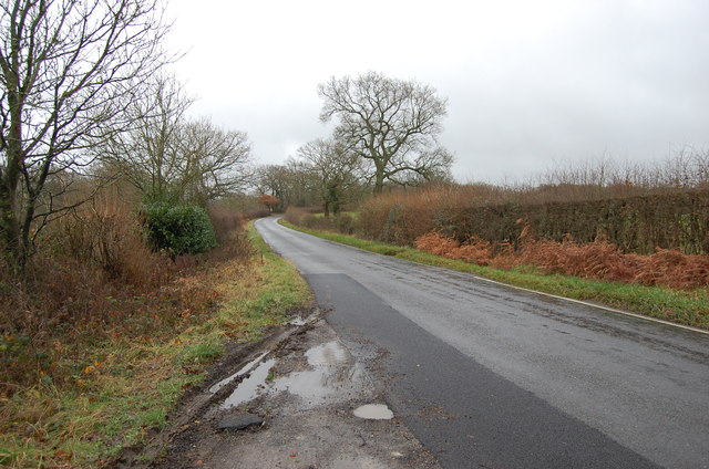
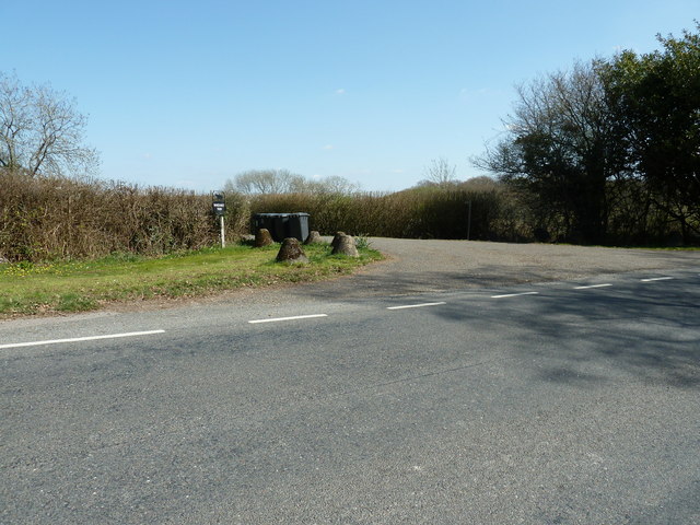
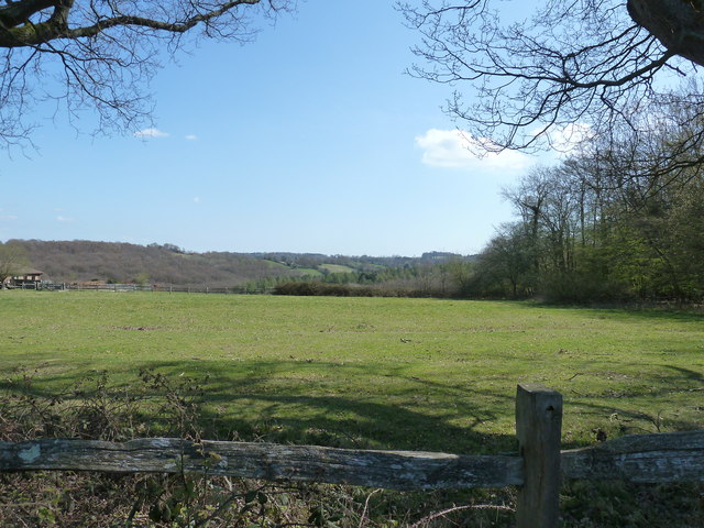
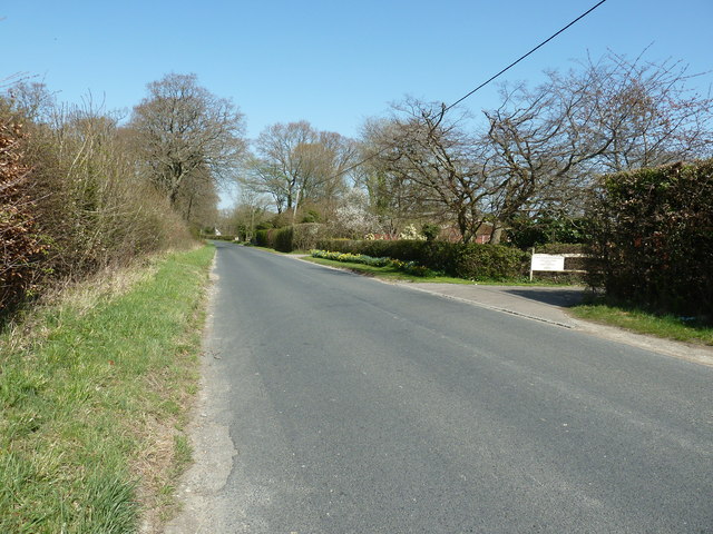
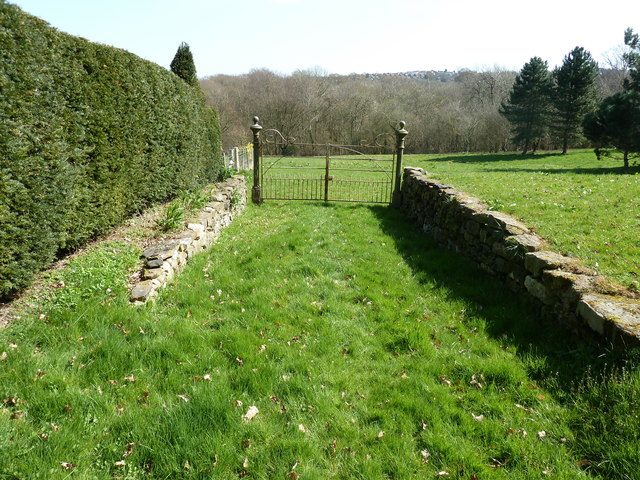
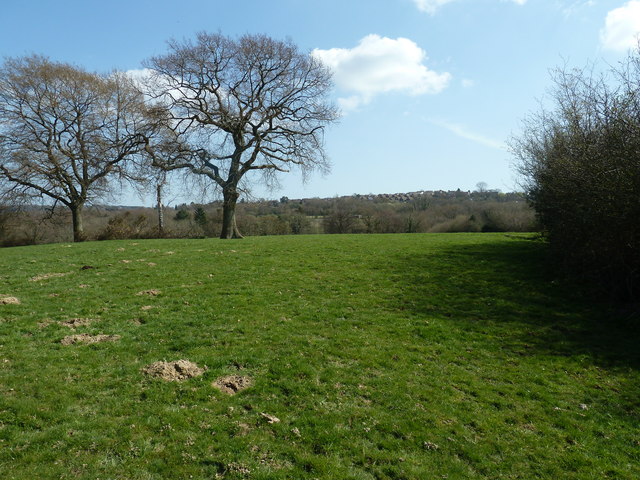
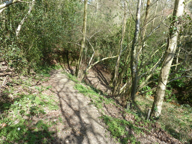
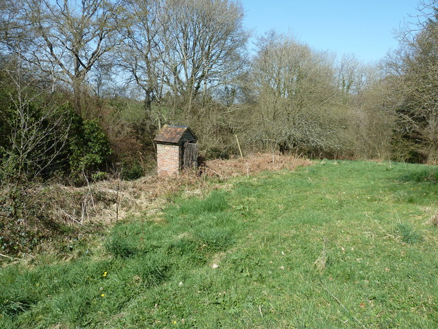
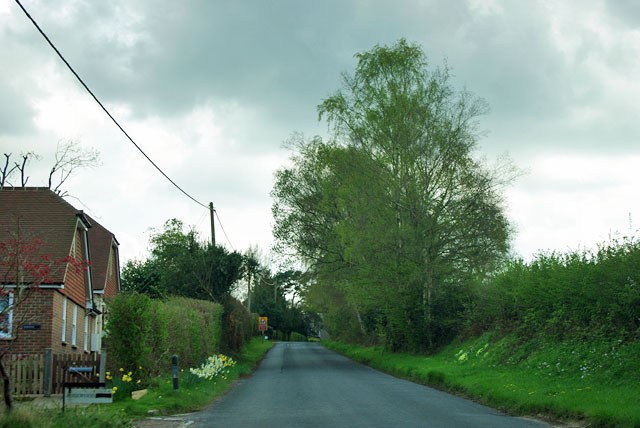
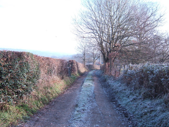
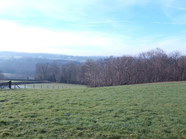
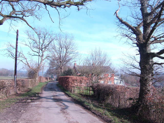
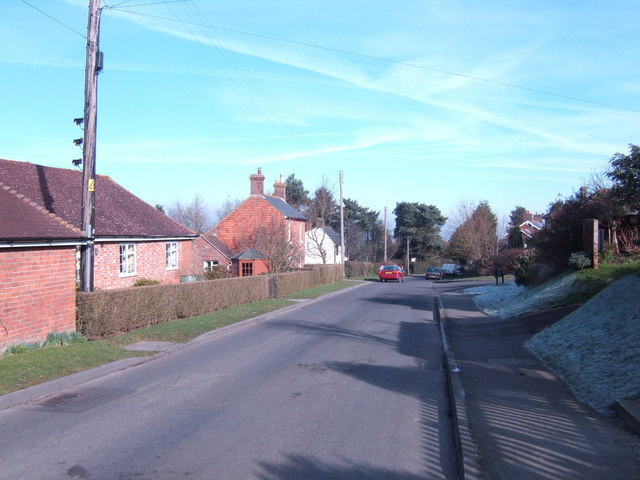
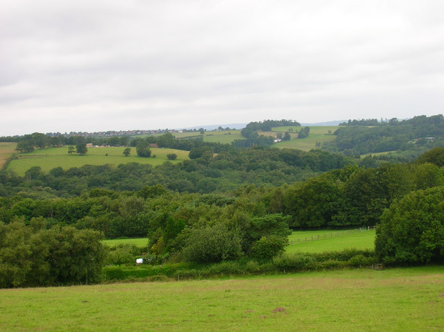
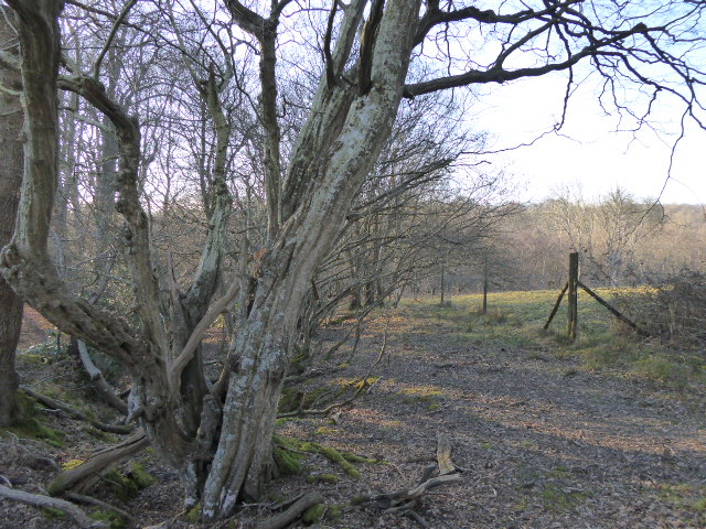
The Plantation, Sussex, also known as Wood or Forest, is a picturesque woodland located in the county of Sussex, England. Spanning over a vast area, it is renowned for its lush greenery, diverse flora and fauna, and tranquil surroundings. The Plantation is a popular destination for nature enthusiasts, hikers, and those seeking a peaceful retreat away from the bustling city life.

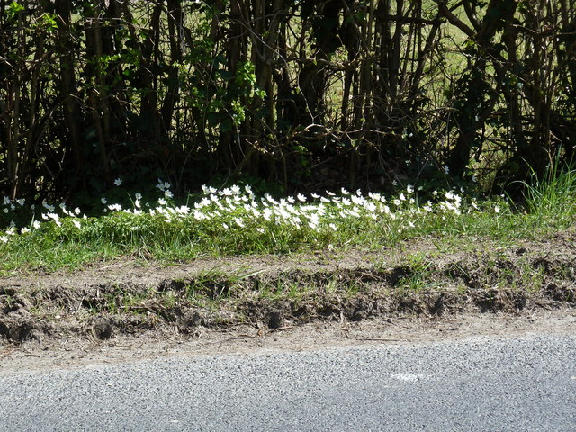
The woodland is characterized by its dense canopy of trees, which include a variety of species such as oak, beech, ash, and birch. These trees create a sheltered environment, providing a habitat for numerous wildlife species, including squirrels, rabbits, and a wide range of bird species. The Plantation is particularly known for its vibrant bird population, attracting birdwatchers from all around.

Trails and pathways wind through the woodland, allowing visitors to explore its beauty at their own pace. As they wander through the Plantation, visitors can admire the natural beauty of the landscape, breathe in the crisp, fresh air, and listen to the soothing sounds of nature.

The Plantation is also home to a number of historical features, including remnants of ancient settlements and archaeological sites. These historical elements add an extra layer of intrigue and fascination to the woodland, making it a destination that caters to both nature lovers and history enthusiasts.

Overall, The Plantation, Sussex is a captivating woodland that offers a delightful escape into nature. With its diverse wildlife, scenic trails, and historical significance, it provides an enriching experience for visitors of all ages.

If you have any feedback on the listing, please let us know in the comments section below.

The Plantation Images

Images are sourced within 2km of 50.983065/0.2944003 or Grid Reference TQ6122. Thanks to Geograph Open Source API. All images are credited.

Newick Lane, near Pheasantry Farm
Entrance to Bungehurst Farm Off Newick Lane.
Entrance to Bungehurst Farm
Off Newick Lane.
Field view to Newick Wood and beyond
Wood Anemones following the afternoon sun On grass verge on Newick Lane.
Wood Anemones following the afternoon sun
On grass verge on Newick Lane.
North on Newick Lane Passing a small number of houses.
North on Newick Lane
Passing a small number of houses.
Ornamental gate on footpath to Newick Wood
Broad Oaks by the footpath to Broad Oak Broad Oak is a village to the east of Heathfield.
Broad Oaks by the footpath to Broad Oak
Broad Oak is a village to the east of Heathfield.
Descent into stream valley near Blackwater Cottage
Privy at Blackwater Cottage
Woodland stream near Blackwater Cottage The stream is a tributary of the River Rother.
Woodland stream near Blackwater Cottage
The stream is a tributary of the River Rother.
Houses on Halley Road near Cade Street
Newick Lane Newick Farm is round the bend ahead.
Newick Lane
Newick Farm is round the bend ahead.
Newick Lane The house on the left is called Rosewood.
Newick Lane
The house on the left is called Rosewood.
The A265 The A265 road is an 11 mile road from Hurst Green <a href="https://www.geograph.org.uk/photo/7059740">TQ7327 : Junction of A21 & A265, Hurst Green</a> to Heathfield <a href="https://www.geograph.org.uk/photo/6669416">TQ5621 : A265, A267 junction</a>.
Website: <span class="nowrap"><a title="http://www.sabre-roads.org.uk/wiki/index.php?title=A265" rel="nofollow ugc noopener" href="http://www.sabre-roads.org.uk/wiki/index.php?title=A265">Link</a><img style="margin-left:2px;" alt="External link" title="External link - shift click to open in new window" src="https://s1.geograph.org.uk/img/external.png" width="10" height="10"/></span>
The A265
The A265 road is an 11 mile road from Hurst Green TQ7327 : Junction of A21 & A265, Hurst Green to Heathfield TQ5621 : A265, A267 junction. Website: LinkExternal link
Track and footpath to Little Pigstrood
Wealden view Looking towards Heathfield, the scene is a typical mix of field and wood.
Wealden view
Looking towards Heathfield, the scene is a typical mix of field and wood.
Nursements Farm At the end of Potten Mill Lane.
Nursements Farm
At the end of Potten Mill Lane.
Broad Oak Older properties on the edge of the hillside village.
Broad Oak
Older properties on the edge of the hillside village.
Show me another place!

The Plantation is located at Grid Ref: TQ6122 (Lat: 50.983065, Lng: 0.2944003)

Administrative County: East Sussex

District: Wealden

Police Authority: Sussex

What 3 Words

///takers.photo.instilled. Near Heathfield, East Sussex

Related Wikis

Ebenezer Chapel, Heathfield

Ebenezer Chapel is a Strict Baptist place of worship in the hamlet of Broad Oak, part of the parish of Heathfield in the English county of East Sussex...

Paines Cross Meadow

Paines Cross Meadow is a 3.7-hectare (9.1-acre) biological Site of Special Scientific Interest north-east of Heathfield in East Sussex.This site is damp...

Bingletts Wood

Bingletts Wood is a 16-hectare (40-acre) biological Site of Special Scientific Interest east of Heathfield in East Sussex.Part of this ancient wood is...

Heathfield Community College

Heathfield Community College is a secondary school near the market town of Heathfield, East Sussex, England. == School Enrollment == The college draws...

Blackdown Mill, Punnetts Town

Blackdown Mill or Cherry Clack Mill is a grade II listed smock mill at Punnetts Town, East Sussex, England, which has been restored. == History == Blackdown...

Heathfield Park SSSI

Heathfield Park SSSI is a 41-hectare (100-acre) biological Site of Special Scientific Interest east of Heathfield in East Sussex. It is part of Heathfield...

Heathfield, East Sussex

Heathfield is a market town and former civil parish, now in the parish of Heathfield and Waldron, in the Wealden District of East Sussex, England. The...

Heathfield and Waldron

Heathfield and Waldron is a civil parish within the Wealden District of East Sussex, England. Heathfield is surrounded by the High Weald Area of Outstanding...

Nearby Amenities

Located within 500m of 50.983065,0.2944003
Power: pole
Lat/Long: 50.9860314/0.2982751
Power: pole
Lat/Long: 50.9856515/0.2974275
Power: pole
Lat/Long: 50.9845979/0.2956063
Power: pole
Lat/Long: 50.983556/0.2887854
Power: pole
Lat/Long: 50.9832453/0.2932835
Power: pole
Lat/Long: 50.9831339/0.2948365
Power: pole
Lat/Long: 50.9833061/0.2961239
Power: pole
Lat/Long: 50.9833956/0.3011504
Power: pole
Lat/Long: 50.983345/0.2977641
Power: pole
Lat/Long: 50.9832242/0.2969809
Power: pole
Lat/Long: 50.9831871/0.2967073
Power: tower
Lat/Long: 50.9857342/0.2903116
Power: tower
Lat/Long: 50.9835189/0.2954185
Power: pole
Lat/Long: 50.9831508/0.2964672
Power: pole
Lat/Long: 50.9826476/0.2958101
Power: pole
Lat/Long: 50.9819181/0.2947533
Power: pole
Lat/Long: 50.980964/0.2934712
Material: wood
Power: pole
Lat/Long: 50.9798343/0.2931681
Material: wood
Power: pole
Lat/Long: 50.9791014/0.2929455
Power: pole
Lat/Long: 50.985665/0.2992031
Power: pole
Lat/Long: 50.984944/0.2983099
Power: pole
Lat/Long: 50.9839478/0.2970976
Power: pole
Lat/Long: 50.9835662/0.2966443
Power: pole
Lat/Long: 50.9808779/0.2897778
Power: pole
Lat/Long: 50.9815736/0.2928275
Power: pole
Lat/Long: 50.9821477/0.2940345
Power: pole
Lat/Long: 50.9827438/0.2953595
Wish End Farm
Place: farm
Lat/Long: 50.9823014/0.2896652
The data included in this document is from www.openstreetmap.org. The data is made available under ODbL.

Have you been to The Plantation?

Leave your review of The Plantation below (or comments, questions and feedback).