Ash Plantation

Wood, Forest in Norfolk King's Lynn and West Norfolk

England

Ash Plantation

Ryston railway station (site), Norfolk Opened in 1882 by the Downham and Stoke Ferry Railway, later part of the Great Eastern Railway, on the branch line between those places, this station closed to passengers in 1930 and completely in 1964.
View east towards Abbey and the end of the line at Stoke Ferry. The single platform can still be seen to the left of the former station house. The level crossing gates shown in <a href="https://www.geograph.org.uk/photo/570582">TL6199 : Ryston Station, West Norfolk</a> were still there in 2021, 57 years after they were probably last used.
Ryston railway station (site), Norfolk Credit: Nigel Thompson

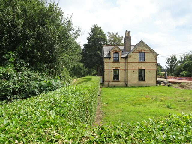
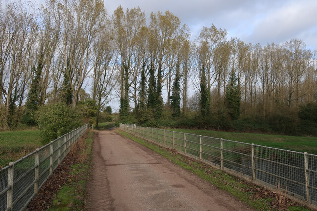
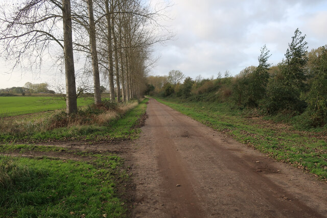
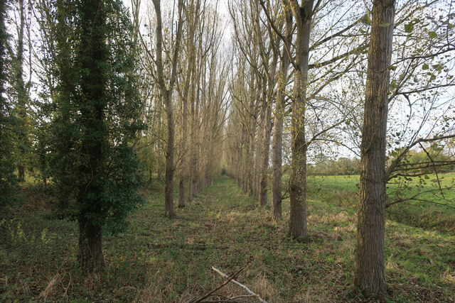
Ash Plantation is a serene and sprawling woodland located in Norfolk, England. Covering an area of approximately 100 acres, this enchanting forest is characterized by its dense growth of ash trees, which give the plantation its name. It is a popular destination for nature enthusiasts, offering a tranquil retreat from the hustle and bustle of everyday life.

The plantation boasts a diverse range of flora and fauna, with the ash trees dominating the landscape. These majestic trees provide a canopy of shade, creating a cool and inviting atmosphere even on the hottest of days. The forest floor is carpeted with a variety of wildflowers, adding a splash of color to the lush green surroundings.

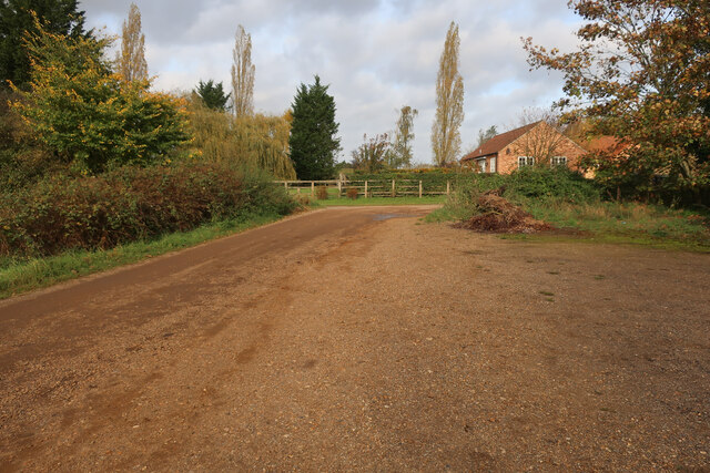
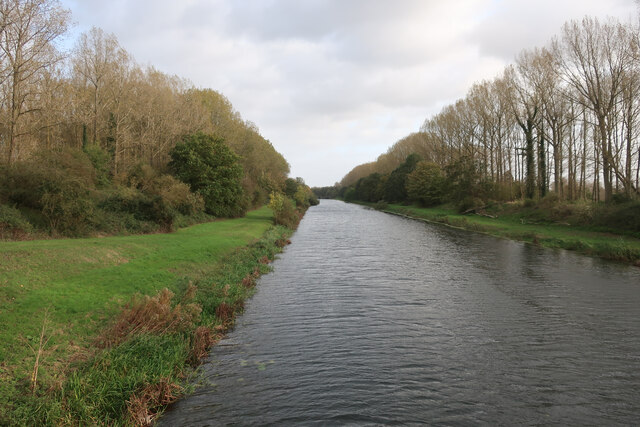
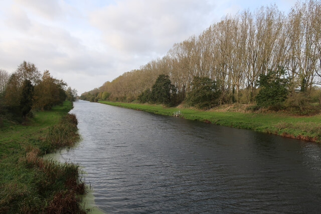
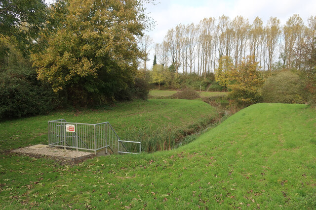
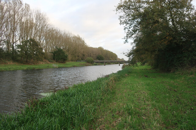
Visitors to Ash Plantation can enjoy a network of well-maintained walking trails, allowing them to explore the woodland at their own pace. These trails wind through the forest, leading visitors past babbling brooks, hidden ponds, and picturesque meadows. The plantation also offers designated picnic areas, making it an ideal spot for a leisurely outdoor lunch.

Wildlife enthusiasts will be delighted by the diverse range of animals that call Ash Plantation home. The forest provides a sanctuary for numerous bird species, including woodpeckers, owls, and various songbirds. Squirrels, rabbits, and even deer can often be spotted darting through the undergrowth, adding to the sense of natural beauty and tranquility.

Overall, Ash Plantation is a haven for those seeking solace in nature. With its lush ash trees, vibrant wildflowers, and abundant wildlife, it offers a captivating experience for visitors of all ages.

If you have any feedback on the listing, please let us know in the comments section below.

Ash Plantation Images

Images are sourced within 2km of 52.580509/0.3694435 or Grid Reference TF6000. Thanks to Geograph Open Source API. All images are credited.

Ryston railway station (site), Norfolk Opened in 1882 by the Downham and Stoke Ferry Railway, later part of the Great Eastern Railway, on the branch line between those places, this station closed to passengers in 1930 and completely in 1964.
View east towards Abbey and the end of the line at Stoke Ferry. The single platform can still be seen to the left of the former station house. The level crossing gates shown in <a href="https://www.geograph.org.uk/photo/570582">TL6199 : Ryston Station, West Norfolk</a> were still there in 2021, 57 years after they were probably last used.
Ryston railway station (site), Norfolk
Opened in 1882 by the Downham and Stoke Ferry Railway, later part of the Great Eastern Railway, on the branch line between those places, this station closed to passengers in 1930 and completely in 1964. View east towards Abbey and the end of the line at Stoke Ferry. The single platform can still be seen to the left of the former station house. The level crossing gates shown in TL6199 : Ryston Station, West Norfolk were still there in 2021, 57 years after they were probably last used.
Parking at Fordham With permissive paths each side of the Cut-off Channel, the area is good for walking.
Parking at Fordham
With permissive paths each side of the Cut-off Channel, the area is good for walking.
Cut-off Channel near Fordham With permissive paths each side.
Cut-off Channel near Fordham
With permissive paths each side.
Cut-off Channel near Fordham With permissive paths each side. The Cut-off Channel is a large man made channel that follows the eastern edge of the Fens.
Cut-off Channel near Fordham
With permissive paths each side. The Cut-off Channel is a large man made channel that follows the eastern edge of the Fens.
Bridge over Cut-off Channel
Bridleway by Cut-off Channel
Catchwater drain entering Cut-off Channel Also linking the bridleway with the permissive path along the Cut-off Channel.
Catchwater drain entering Cut-off Channel
Also linking the bridleway with the permissive path along the Cut-off Channel.
Bridleway by Cut-off Channel
Poplars by the Cut-off Channel Poplars used to be a commercial timber crop, as well as a useful windbreak. They are no longer commercial so the number of plantations is falling and others not being harvested.
Poplars by the Cut-off Channel
Poplars used to be a commercial timber crop, as well as a useful windbreak. They are no longer commercial so the number of plantations is falling and others not being harvested.
Bridleway to Fordham
Barn by bridleway
Barn by bridleway
Stubble field
Stubble field
Ditch on Fordham Fen
Permissive path by Cut-off Channel The Cut-off Channel is a large man made channel that follows the eastern edge of the Fens.
Permissive path by Cut-off Channel
The Cut-off Channel is a large man made channel that follows the eastern edge of the Fens.
Poplars by the Cut-off Channel Poplars used to be a commercial timber crop, as well as a useful windbreak. They are no longer commercial so the number of plantations is falling and others not being harvested.
Poplars by the Cut-off Channel
Poplars used to be a commercial timber crop, as well as a useful windbreak. They are no longer commercial so the number of plantations is falling and others not being harvested.
Bridleway by Harold Covert
Poplar plantation by River Wissey Poplars used to be a commercial timber crop, as well as a useful windbreak. They are no longer commercial so the number of plantations is falling and others not being harvested.
Poplar plantation by River Wissey
Poplars used to be a commercial timber crop, as well as a useful windbreak. They are no longer commercial so the number of plantations is falling and others not being harvested.
Show me another place!

Ash Plantation is located at Grid Ref: TF6000 (Lat: 52.580509, Lng: 0.3694435)

Administrative County: Norfolk

District: King's Lynn and West Norfolk

Police Authority: Norfolk

What 3 Words

///remission.betraying.jousting. Near Downham Market, Norfolk

Nearby Locations

Ash Plantation

Related Wikis

Denver Windmill

Denver Windmill is a Grade II* listed tower mill at Denver, Norfolk, England. In March 2010, there were about 374,000 list entries of which 5.5% were Grade...

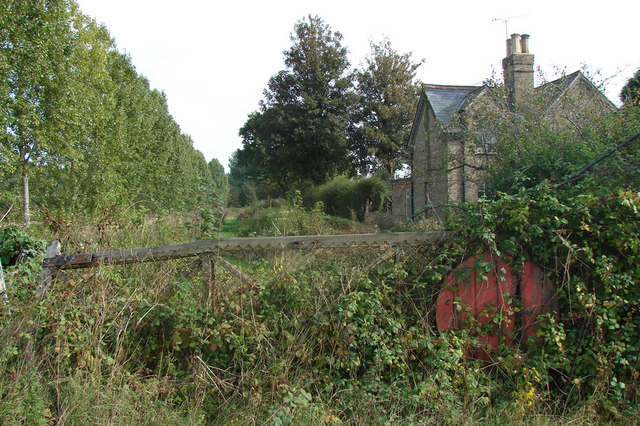
Denver railway station (England)

Denver railway station (originally opened as Denver Road Gate) was a station in Denver, Norfolk on the Great Eastern Railway route between King's Lynn...

Denver, Norfolk

Denver is a village and civil parish in the English county of Norfolk. The village is situated on the River Great Ouse, approximately 1 mile (1.6 km) south...

Ryston railway station

Ryston railway station was a railway station serving Fordham, Norfolk. It was on a branch line from Denver. == History == The Downham and Stoke Ferry Railway...

Fordham, Norfolk

Fordham is a small village and civil parish in the English county of Norfolk. The village is located 2.2 miles (3.5 km) north of Downham Market and 39...

St Mary's Church, Fordham

St Mary's Church is located to the south of the village of Fordham, Norfolk, England. It is a redundant Anglican parish church in the care of the Friends...
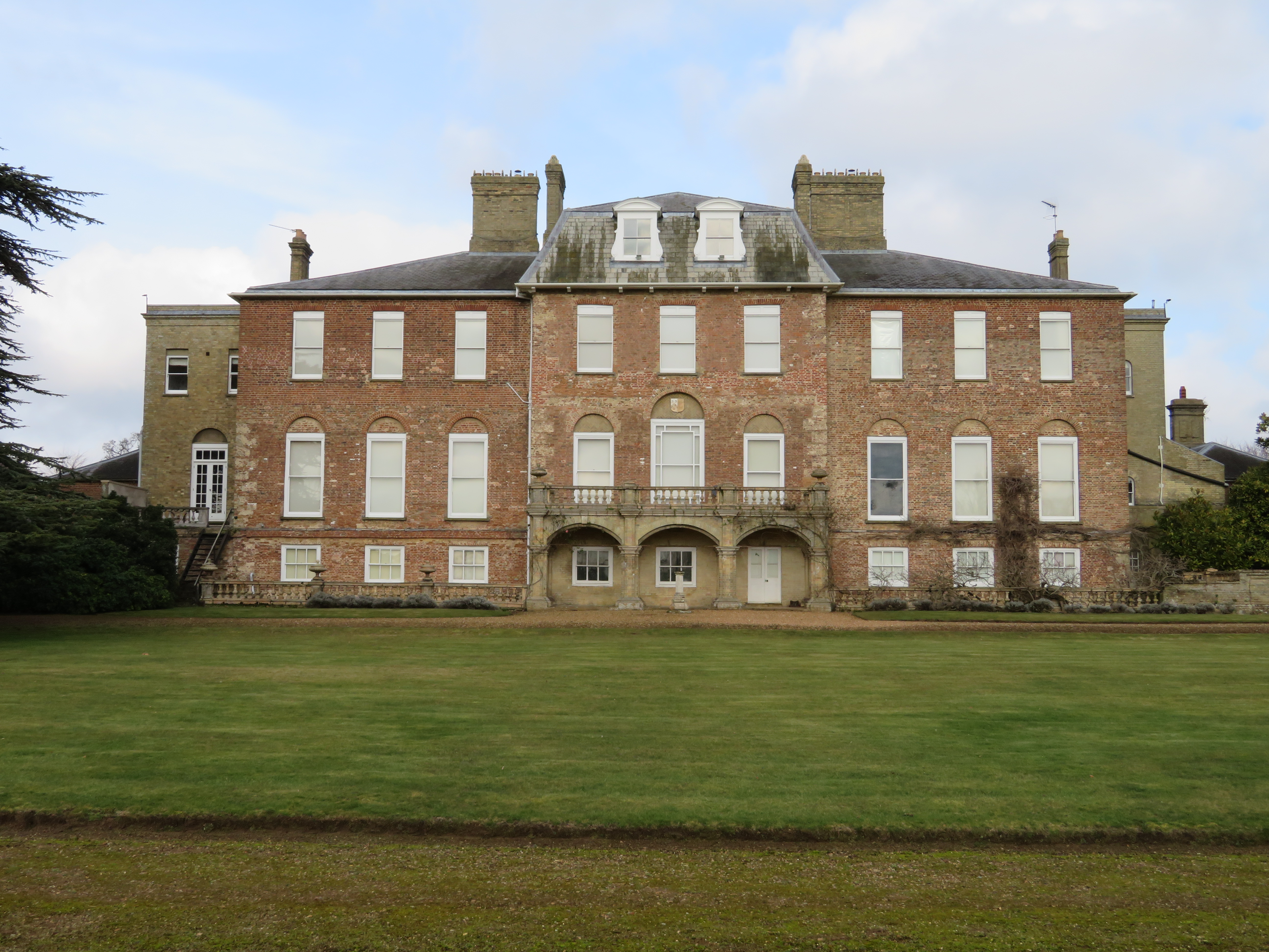
Ryston Hall

Ryston Hall, Ryston, Norfolk, England is a 17th-century country house built by Sir Roger Pratt for himself. The house was constructed between 1669 and...

Well Creek

Well Creek is a waterway in Norfolk, England that is a tributary to the River Great Ouse. Rising from the River Nene, the waterway in its current alignment...

Related Videos

Walking around Norfolk

Insta360 tiny planet AI.

Denver and Downham Market Walk - Fens River Way - Norfolk Walks | Cool Dudes Walking Club

Marek Larwood walks from Stowbridge along the Fens River Way to Denver, taking in the Sluice and Windmill before visiting ...

£49.99 Flight Travel Ukulele Natural M-Guitars

49.99 FLIGHT TRAVEL UKULELE now in store..... 10% Discount with this offer code FBTU918 ONLY FOR SEPTEMBER 18!!!

Downham Market Walks

A tour of Kings Walk Downham Market.

Nearby Amenities

Located within 500m of 52.580509,0.3694435
Bicycle Parking
Lat/Long: 52.5848906/0.3679114
Tourism: caravan_site
Lat/Long: 52.5843976/0.3669142
The data included in this document is from www.openstreetmap.org. The data is made available under ODbL.

Have you been to Ash Plantation?

Leave your review of Ash Plantation below (or comments, questions and feedback).