High Wood
Wood, Forest in Essex Uttlesford
England
High Wood
High Wood is a small woodland area located in Essex, England. Situated near the village of Wood, it forms part of the larger Epping Forest, a designated Site of Special Scientific Interest (SSSI) and a popular recreational area for locals and visitors alike.
Covering an area of approximately 50 acres, High Wood is characterized by its diverse range of tree species. The woodland is predominantly composed of oak, beech, and hornbeam trees, with an undergrowth of ferns, bluebells, and wildflowers. This rich habitat provides a haven for various wildlife, including birds, insects, small mammals, and reptiles.
The wood is crisscrossed by a network of footpaths and trails, making it a popular spot for walkers, joggers, and nature enthusiasts. Visitors can explore the peaceful surroundings, taking in the sights and sounds of the woodland, and enjoying the tranquility of nature. The wood is also a favorite destination for birdwatchers, who can spot a variety of bird species, including woodpeckers, nuthatches, and tawny owls.
High Wood has a long history, with evidence of human activity dating back to the medieval period. The wood was once part of the royal hunting grounds and has been managed by various landowners over the centuries. Today, it is owned and maintained by the City of London Corporation, which strives to preserve its natural beauty and protect its ecological importance.
In summary, High Wood in Essex is a picturesque woodland area within the Epping Forest. With its diverse range of trees, abundant wildlife, and scenic walking trails, it offers a serene and enjoyable experience for nature lovers and outdoor enthusiasts.
If you have any feedback on the listing, please let us know in the comments section below.
High Wood Images
Images are sourced within 2km of 51.873413/0.32704234 or Grid Reference TL6021. Thanks to Geograph Open Source API. All images are credited.


High Wood is located at Grid Ref: TL6021 (Lat: 51.873413, Lng: 0.32704234)
Administrative County: Essex
District: Uttlesford
Police Authority: Essex
What 3 Words
///shields.racks.providing. Near Great Dunmow, Essex
Nearby Locations
Related Wikis

High Wood, Dunmow
High Wood, Dunmow is a 41.5-hectare (103-acre) biological Site of Special Scientific Interest in Great Dunmow in Essex. The local planning authority is...
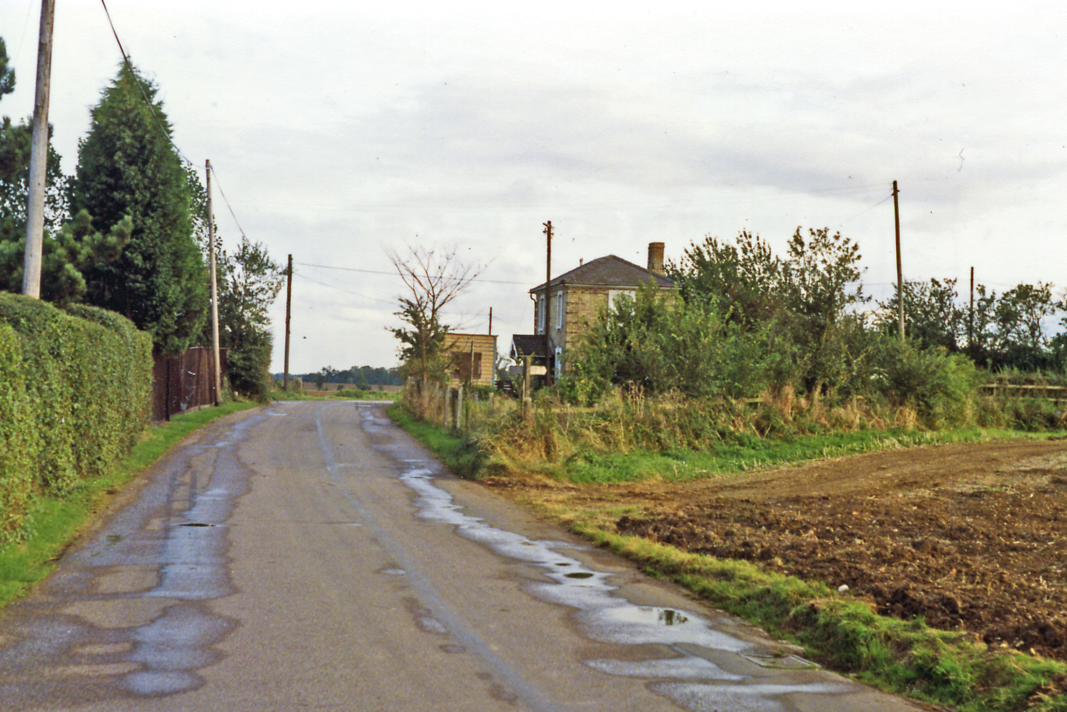
Easton Lodge railway station
Easton Lodge railway station was located to the west of Great Dunmow, Essex, near Easton Lodge. The station on the Bishop's Stortford to Braintree branch...

Stane Street (Colchester)
Stane Street is a 39 mi (63 km) Roman road that runs from Ermine Street at Braughing, Hertfordshire to Colchester in Essex. == Route == Stane Street can...
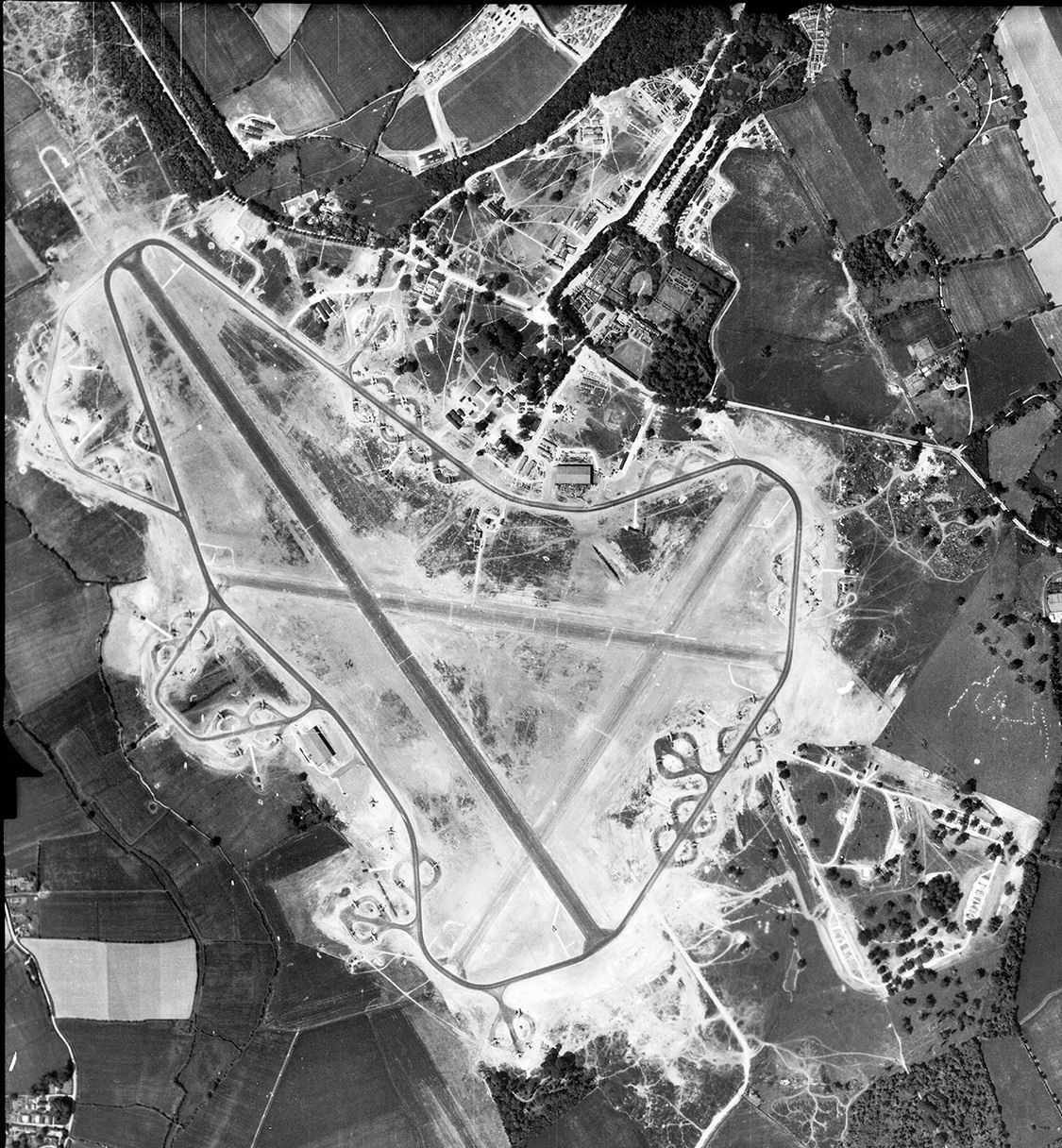
RAF Great Dunmow
Royal Air Force Great Dunmow or more simply RAF Great Dunmow is a former Royal Air Force station in the parish of Little Easton, Essex, England. The airfield...

Talliston House
Talliston House & Gardens is an ex-council house in Essex, England that has been transformed by owner John Trevillian into a miniature palace. The house...

Helena Romanes School
Helena Romanes School (also known/abbreviated as HRS) is a coeducational all-through school and sixth form. It is situated in Great Dunmow in the English...

Easton Lodge
Easton Lodge was a Victorian Gothic style stately home in Little Easton and north-west of Great Dunmow, Essex, England. Once famous for its weekend society...
Little Easton
Little Easton is a village and civil parish in Essex, England. The village is situated approximately 7 miles (11 km) east from the town of Bishop's Stortford...
Nearby Amenities
Located within 500m of 51.873413,0.32704234Have you been to High Wood?
Leave your review of High Wood below (or comments, questions and feedback).