Elder Plantation

Wood, Forest in Cambridgeshire South Cambridgeshire

England

Elder Plantation

On Six Mile Bottom Road The road from Weston Colville to Lark Hall and Six Mile Bottom (ahead), photographed on a fine October morning.
On Six Mile Bottom Road Credit: John Sutton

Elder Plantation is a woodland area located in Cambridgeshire, England. Covering an approximate area of several hectares, it is situated in the heart of the county. The woodland is primarily composed of elder trees, hence its name, with a few additional tree species interspersed throughout.

The plantation boasts a dense and lush forest with a diverse range of flora and fauna. The elder trees, with their characteristic flat-topped appearance and delicate white blossoms in the spring, dominate the landscape. These trees can reach heights of up to 10 meters and provide a rich habitat for a variety of bird species and small mammals.

The forest floor of Elder Plantation is covered in a thick layer of moss and fallen leaves, creating a soft and damp environment. This provides an ideal habitat for various woodland plants such as bluebells, wood anemones, and wild garlic, which flourish in the shade of the towering elder trees.

The plantation is a popular destination for nature enthusiasts and hikers, offering tranquil walking trails that wind their way through the woodland. These paths provide an opportunity to admire the natural beauty of the area while enjoying the peaceful ambiance that the forest provides.

Elder Plantation serves as an important ecological site, contributing to the overall biodiversity of Cambridgeshire. It offers a serene escape from the hustle and bustle of urban life, allowing visitors to immerse themselves in the beauty of nature.

If you have any feedback on the listing, please let us know in the comments section below.

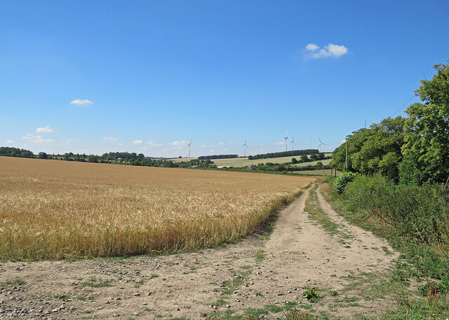
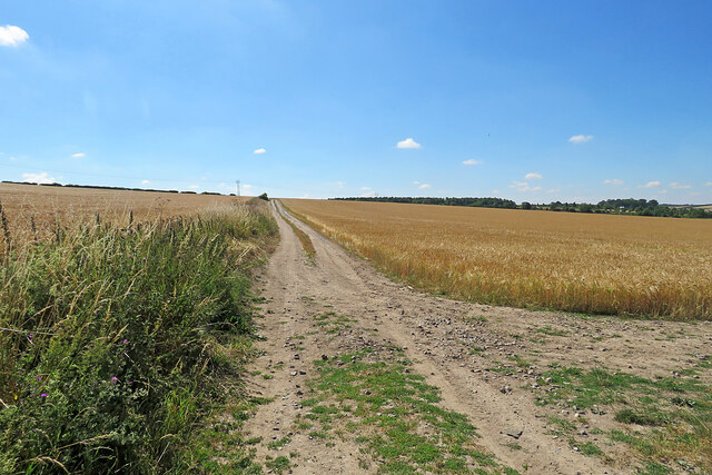
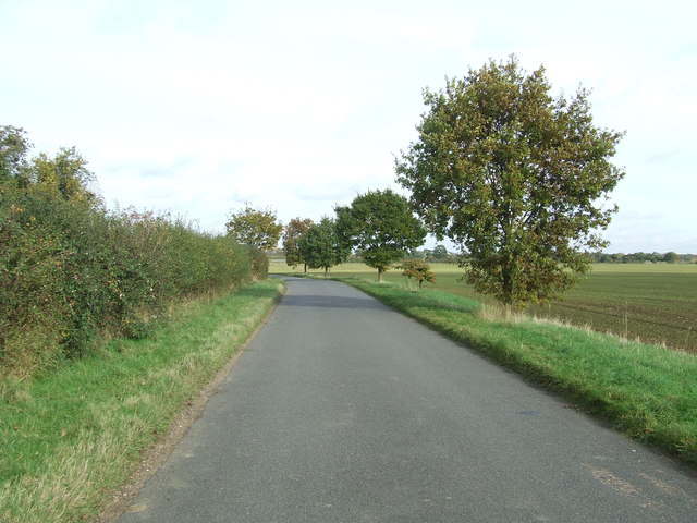
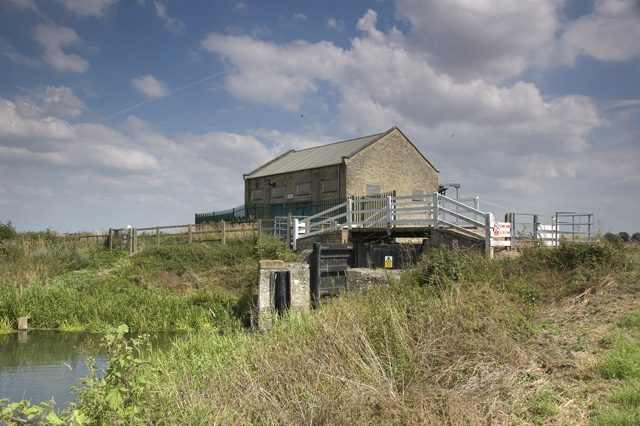
Elder Plantation Images

Images are sourced within 2km of 52.166718/0.33352966 or Grid Reference TL5954. Thanks to Geograph Open Source API. All images are credited.

On Six Mile Bottom Road The road from Weston Colville to Lark Hall and Six Mile Bottom (ahead), photographed on a fine October morning.
On Six Mile Bottom Road
The road from Weston Colville to Lark Hall and Six Mile Bottom (ahead), photographed on a fine October morning.
A crossroads on Brinkley Road Brinkley to the left, Six Mile Bottom and Cambridge to the right, Weston Colville and (not very directly) Balsham straight ahead. The road behind the camera runs to Dullingham.
A crossroads on Brinkley Road
Brinkley to the left, Six Mile Bottom and Cambridge to the right, Weston Colville and (not very directly) Balsham straight ahead. The road behind the camera runs to Dullingham.
Towards Brinkley Wood At over 350ft, the hills of East Cambridgeshire are a lot higher than much of the rest of the county. Big fields and large plantations typify the area. A little further from here, Six Mile Bottom Road, from which this picture was taken, begins to slope down to the lower-lying villages east of Cambridge, near the edge of The Fens.
Towards Brinkley Wood
At over 350ft, the hills of East Cambridgeshire are a lot higher than much of the rest of the county. Big fields and large plantations typify the area. A little further from here, Six Mile Bottom Road, from which this picture was taken, begins to slope down to the lower-lying villages east of Cambridge, near the edge of The Fens.
Bull Hill, Weston Colville
The road to Six Mile Bottom This is the road from West Wratting to Six Mile Bottom, near Lark Hall. The signpost on the right points along a path which cuts a corner and leads to the Weston Colville road (see <a href="https://www.geograph.org.uk/photo/7221136">TL5854 : Footpath through barley</a>).
The road to Six Mile Bottom
This is the road from West Wratting to Six Mile Bottom, near Lark Hall. The signpost on the right points along a path which cuts a corner and leads to the Weston Colville road (see TL5854 : Footpath through barley).
Barley and turbines Looking towards Lark Hall Corner and, on the skyline, some of the turbines of Wadlow Wind Farm on a fine July morning.
Barley and turbines
Looking towards Lark Hall Corner and, on the skyline, some of the turbines of Wadlow Wind Farm on a fine July morning.
Footpath through barley The start, near Lark Hall, of a path which follows a farm track, cutting a corner and leading to the Weston Colville road.
Footpath through barley
The start, near Lark Hall, of a path which follows a farm track, cutting a corner and leading to the Weston Colville road.
A corrugated shed at Green End Farm The farm is on the road from West Wratting to Six Mile Bottom (right). Five of the turbines of Wadlow Wind Farm show on the skyline.
A corrugated shed at Green End Farm
The farm is on the road from West Wratting to Six Mile Bottom (right). Five of the turbines of Wadlow Wind Farm show on the skyline.
On the way to Six Mile Bottom The road from West Wratting, photographed on a fine July morning.
On the way to Six Mile Bottom
The road from West Wratting, photographed on a fine July morning.
Barns by Balsham Lane
Icknield Way The strip on the left of the track is for game cover crops, see <a href="https://www.geograph.org.uk/photo/1637282">TL6054 : Icknield Way Path</a>.
Icknield Way
The strip on the left of the track is for game cover crops, see TL6054 : Icknield Way Path.
Icknield Way This small part of the Icknield Way shares part of a minor country road near to Weston Colville, Cambridgeshire.
Icknield Way
This small part of the Icknield Way shares part of a minor country road near to Weston Colville, Cambridgeshire.
Signs Footpath sign and marker signs for the Icknield Way near to Weston Colville, Cambridgeshire.
Signs
Footpath sign and marker signs for the Icknield Way near to Weston Colville, Cambridgeshire.
Part Of The Icknield Way Looking west along part of the Icknield Way near to Weston Colville, Cambridgeshire.
Part Of The Icknield Way
Looking west along part of the Icknield Way near to Weston Colville, Cambridgeshire.
Long Distance Footpath The Icknield Way looking east near to Weston Colville, Cambridgeshire.
Long Distance Footpath
The Icknield Way looking east near to Weston Colville, Cambridgeshire.
Two Fields Two fields separated by a large hedge line near to Westley Waterless, Cambridgeshire.
Two Fields
Two fields separated by a large hedge line near to Westley Waterless, Cambridgeshire.
Country Road Country road near to Westley Waterless, Cambridgeshire.
Country Road
Country road near to Westley Waterless, Cambridgeshire.
Crossroads Signs Crossroads road signs near to Westley Waterless, Cambridgeshire.
Crossroads Signs
Crossroads road signs near to Westley Waterless, Cambridgeshire.
Show me another place!

Elder Plantation is located at Grid Ref: TL5954 (Lat: 52.166718, Lng: 0.33352966)

Administrative County: Cambridgeshire

District: South Cambridgeshire

Police Authority: Cambridgeshire

What 3 Words

///ideas.prop.cleansed. Near Balsham, Cambridgeshire

Related Wikis

West Wratting

West Wratting is a village and civil parish 10 miles southeast of Cambridge in Cambridgeshire. At 390 feet (120 m) above sea level, it can claim to be...

Weston Colville

Weston Colville is a village in South Cambridgeshire, 10 miles southeast of Cambridge and 6 miles south of Newmarket, close to the border with Suffolk...

Shug Monkey

In the folklore of Cambridgeshire, the Shug Monkey is a creature that shares features of a dog and monkey, which reportedly haunted Slough Hill Lane (a...

Cambridgeshire Lodes

The Cambridgeshire Lodes are a series of man-made waterways, believed to be Roman in origin, located in the county of Cambridgeshire, England. Bottisham...

Westley Waterless

Westley Waterless is a small village and civil parish in East Cambridgeshire, England, 5 miles south west of Newmarket. == History == The parish of Westley...

Six Mile Bottom railway station

Six Mile Bottom railway station is a disused railway station on the Ipswich to Cambridge line between Dullingham and Fulbourn. It served the village of...

Six Mile Bottom

Six Mile Bottom is a hamlet within the parish of Little Wilbraham, near Cambridge in England. == History == In the 1790s the only building at Six Mile...

Brinkley, Cambridgeshire

Brinkley is a small village in Cambridgeshire, England. It is situated about 15 miles east of Cambridge and 5 miles south of Newmarket, the horse racing...

Nearby Amenities

Located within 500m of 52.166718,0.33352966
Power: pole
Lat/Long: 52.1667794/0.3401567
Power: pole
Lat/Long: 52.1673914/0.3406824
Power: pole
Lat/Long: 52.1645039/0.3392107
Power: pole
Lat/Long: 52.1653807/0.3395701
Power: pole
Lat/Long: 52.1661935/0.3396291
Design: delta
Material: wood
Power: pole
Lat/Long: 52.1635616/0.328599
Design: delta
Material: wood
Power: pole
Lat/Long: 52.1634382/0.3296252
Design: delta
Material: wood
Power: pole
Lat/Long: 52.1630419/0.330904
Design: delta
Material: wood
Power: pole
Lat/Long: 52.1626337/0.3319691
The data included in this document is from www.openstreetmap.org. The data is made available under ODbL.

Have you been to Elder Plantation?

Leave your review of Elder Plantation below (or comments, questions and feedback).