Cherry Bush Wood

Wood, Forest in Cambridgeshire South Cambridgeshire

England

Cherry Bush Wood

A crossroads on Brinkley Road Brinkley to the left, Six Mile Bottom and Cambridge to the right, Weston Colville and (not very directly) Balsham straight ahead. The road behind the camera runs to Dullingham.
A crossroads on Brinkley Road Credit: John Sutton

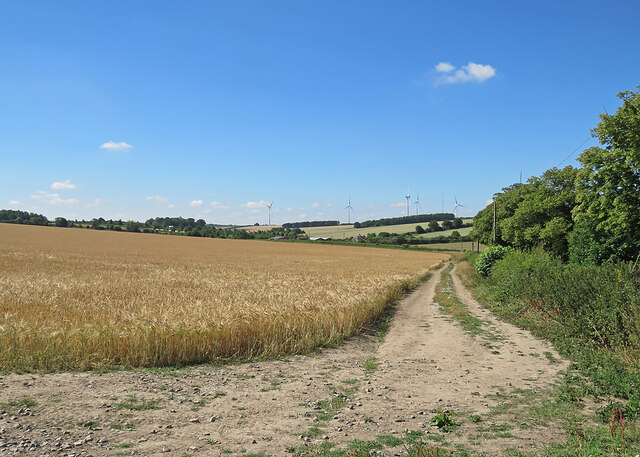
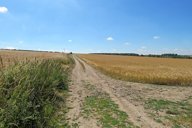
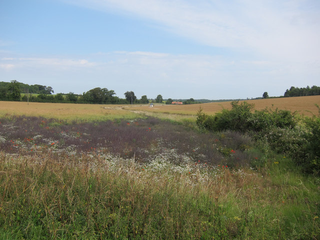
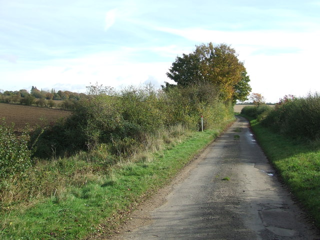
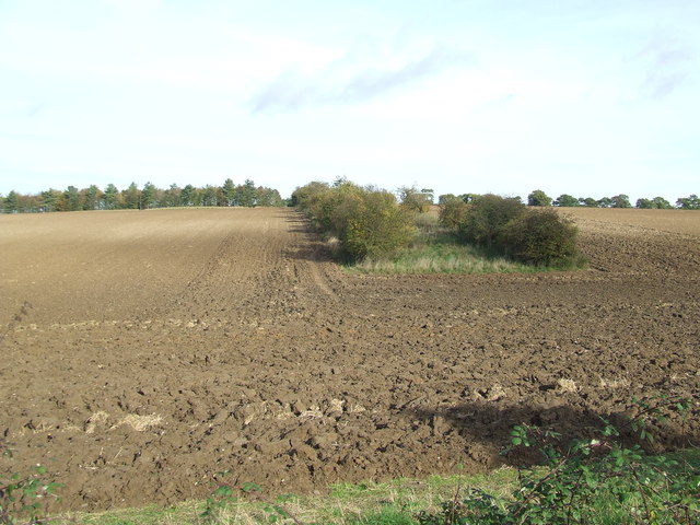
Cherry Bush Wood is a picturesque woodland located in Cambridgeshire, England. Covering an area of approximately 50 hectares, this wood is known for its diverse flora and fauna, making it a popular destination for nature enthusiasts and hikers.

The wood is characterized by its dense cover of cherry trees, which give it its name. These trees provide a stunning display of delicate pink blossoms in the spring, attracting visitors from far and wide. In addition to the cherry trees, the wood is also home to a variety of other tree species including oak, ash, and birch, creating a rich and vibrant ecosystem.

The forest floor of Cherry Bush Wood is carpeted with a diverse range of wildflowers, creating a colorful tapestry throughout the year. Bluebells, primroses, and wood anemones are just a few of the species that can be found here, adding to the natural beauty of the wood.

Wildlife thrives in Cherry Bush Wood, with many species finding sanctuary within its boundaries. Visitors may spot deer grazing amongst the trees, rabbits darting through the undergrowth, or even the elusive red fox. Birdwatchers will also be delighted by the variety of avian species present, including woodpeckers, owls, and numerous songbirds.

The wood is crisscrossed by a network of well-maintained footpaths, allowing visitors to explore its beauty at their leisure. Whether it's a leisurely stroll or a more challenging hike, Cherry Bush Wood offers something for everyone.

If you have any feedback on the listing, please let us know in the comments section below.

Cherry Bush Wood Images

Images are sourced within 2km of 52.175037/0.33299981 or Grid Reference TL5955. Thanks to Geograph Open Source API. All images are credited.

A crossroads on Brinkley Road Brinkley to the left, Six Mile Bottom and Cambridge to the right, Weston Colville and (not very directly) Balsham straight ahead. The road behind the camera runs to Dullingham.
A crossroads on Brinkley Road
Brinkley to the left, Six Mile Bottom and Cambridge to the right, Weston Colville and (not very directly) Balsham straight ahead. The road behind the camera runs to Dullingham.
Towards Brinkley Wood At over 350ft, the hills of East Cambridgeshire are a lot higher than much of the rest of the county. Big fields and large plantations typify the area. A little further from here, Six Mile Bottom Road, from which this picture was taken, begins to slope down to the lower-lying villages east of Cambridge, near the edge of The Fens.
Towards Brinkley Wood
At over 350ft, the hills of East Cambridgeshire are a lot higher than much of the rest of the county. Big fields and large plantations typify the area. A little further from here, Six Mile Bottom Road, from which this picture was taken, begins to slope down to the lower-lying villages east of Cambridge, near the edge of The Fens.
The road to Six Mile Bottom This is the road from West Wratting to Six Mile Bottom, near Lark Hall. The signpost on the right points along a path which cuts a corner and leads to the Weston Colville road (see <a href="https://www.geograph.org.uk/photo/7221136">TL5854 : Footpath through barley</a>).
The road to Six Mile Bottom
This is the road from West Wratting to Six Mile Bottom, near Lark Hall. The signpost on the right points along a path which cuts a corner and leads to the Weston Colville road (see TL5854 : Footpath through barley).
Barley and turbines Looking towards Lark Hall Corner and, on the skyline, some of the turbines of Wadlow Wind Farm on a fine July morning.
Barley and turbines
Looking towards Lark Hall Corner and, on the skyline, some of the turbines of Wadlow Wind Farm on a fine July morning.
Footpath through barley The start, near Lark Hall, of a path which follows a farm track, cutting a corner and leading to the Weston Colville road.
Footpath through barley
The start, near Lark Hall, of a path which follows a farm track, cutting a corner and leading to the Weston Colville road.
Oil seed rape off Westley Bottom Road With a stream running towards Partridge Hall.
Oil seed rape off Westley Bottom Road
With a stream running towards Partridge Hall.
Barns by Balsham Lane
Icknield Way The strip on the left of the track is for game cover crops, see <a href="https://www.geograph.org.uk/photo/1637282">TL6054 : Icknield Way Path</a>.
Icknield Way
The strip on the left of the track is for game cover crops, see TL6054 : Icknield Way Path.
Oil seed rape field Looking past a lone tree towards Westley Waterless.
Oil seed rape field
Looking past a lone tree towards Westley Waterless.
Oil seed rape off Westley Bottom Road Compare with <a href="https://www.geograph.org.uk/photo/2562306">TL6056 : Oil seed rape off Westley Bottom Road</a> from three months earlier.
Oil seed rape off Westley Bottom Road
Compare with TL6056 : Oil seed rape off Westley Bottom Road from three months earlier.
Icknield Way This small part of the Icknield Way shares part of a minor country road near to Weston Colville, Cambridgeshire.
Icknield Way
This small part of the Icknield Way shares part of a minor country road near to Weston Colville, Cambridgeshire.
Signs Footpath sign and marker signs for the Icknield Way near to Weston Colville, Cambridgeshire.
Signs
Footpath sign and marker signs for the Icknield Way near to Weston Colville, Cambridgeshire.
Part Of The Icknield Way Looking west along part of the Icknield Way near to Weston Colville, Cambridgeshire.
Part Of The Icknield Way
Looking west along part of the Icknield Way near to Weston Colville, Cambridgeshire.
Westley Bottom Road Westley Bottom Road looking north east near to Westley Waterless, Cambridgeshire.
Westley Bottom Road
Westley Bottom Road looking north east near to Westley Waterless, Cambridgeshire.
Leading To Partridge Hall Track leading to Partridge Hall near to Westley Waterless, Cambridgeshire.
Leading To Partridge Hall
Track leading to Partridge Hall near to Westley Waterless, Cambridgeshire.
Country Road Westley Bottom Road looking south east near to Westley Waterless, Cambridgeshire.
Country Road
Westley Bottom Road looking south east near to Westley Waterless, Cambridgeshire.
Broad Belt Belt of trees marked on the map as Broad Belt near to Westley Waterless, Cambridgeshire.
Broad Belt
Belt of trees marked on the map as Broad Belt near to Westley Waterless, Cambridgeshire.
Tree Single tree in a large field near to Westley Waterless, Cambridgeshire.
Tree
Single tree in a large field near to Westley Waterless, Cambridgeshire.
Show me another place!

Cherry Bush Wood is located at Grid Ref: TL5955 (Lat: 52.175037, Lng: 0.33299981)

Administrative County: Cambridgeshire

District: South Cambridgeshire

Police Authority: Cambridgeshire

What 3 Words

///leathers.rails.claim. Near Balsham, Cambridgeshire

Related Wikis

Six Mile Bottom railway station

Six Mile Bottom railway station is a disused railway station on the Ipswich to Cambridge line between Dullingham and Fulbourn. It served the village of...

Six Mile Bottom

Six Mile Bottom is a hamlet within the parish of Little Wilbraham, near Cambridge in England. == Etymology == The hamlet was named in 1801, deriving its...

Westley Waterless

Westley Waterless is a small village and civil parish in East Cambridgeshire, England, 5 miles south west of Newmarket. == History == The parish of Westley...

Weston Colville

Weston Colville is a village in South Cambridgeshire, 10 miles southeast of Cambridge and 6 miles south of Newmarket, close to the border with Suffolk...

West Wratting

West Wratting is a village and civil parish 10 miles southeast of Cambridge in Cambridgeshire. At 390 feet (120 m) above sea level, it can claim to be...

Cambridgeshire Lodes

The Cambridgeshire Lodes are a series of man-made waterways, believed to be Roman in origin, located in the county of Cambridgeshire, England. Bottisham...

Shug Monkey

In the folklore of Cambridgeshire, the Shug Monkey is a creature that shares features of a dog and monkey, which reportedly haunted Slough Hill Lane (a...

Brinkley, Cambridgeshire

Brinkley is a small village in Cambridgeshire, England. It is situated about 15 miles east of Cambridge and 5 miles south of Newmarket, the horse racing...

Nearby Amenities

Located within 500m of 52.175037,0.33299981
Power: pole
Lat/Long: 52.1762249/0.3278355
Power: pole
Lat/Long: 52.1736029/0.33372
Power: pole
Lat/Long: 52.1728101/0.3365256
Power: pole
Lat/Long: 52.1740206/0.332277
Power: pole
Lat/Long: 52.1745864/0.331188
Power: pole
Lat/Long: 52.1723857/0.3379365
Power: pole
Lat/Long: 52.1756623/0.3289513
Power: pole
Lat/Long: 52.1732115/0.3350933
Power: pole
Lat/Long: 52.1751393/0.3300778
The data included in this document is from www.openstreetmap.org. The data is made available under ODbL.

Have you been to Cherry Bush Wood?

Leave your review of Cherry Bush Wood below (or comments, questions and feedback).