Bottle Shaw

Wood, Forest in Sussex Wealden

England

Bottle Shaw

Footpath crossing the Cuckoo Trail On the southern outskirts of Heathfield.
Footpath crossing the Cuckoo Trail Credit: Dave Spicer

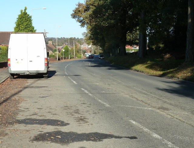
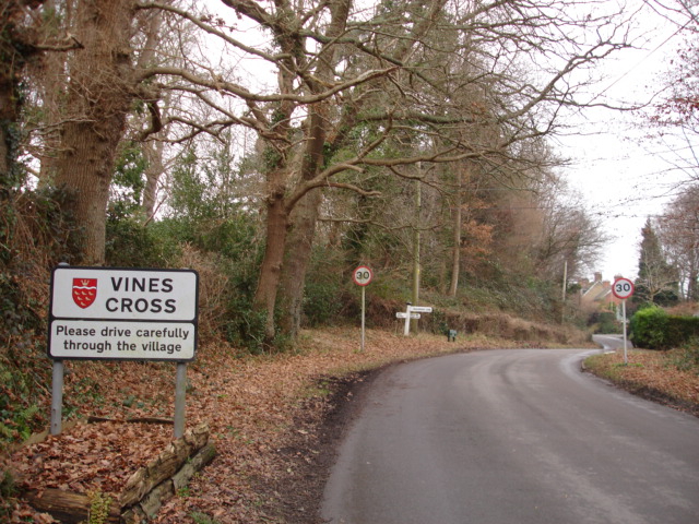
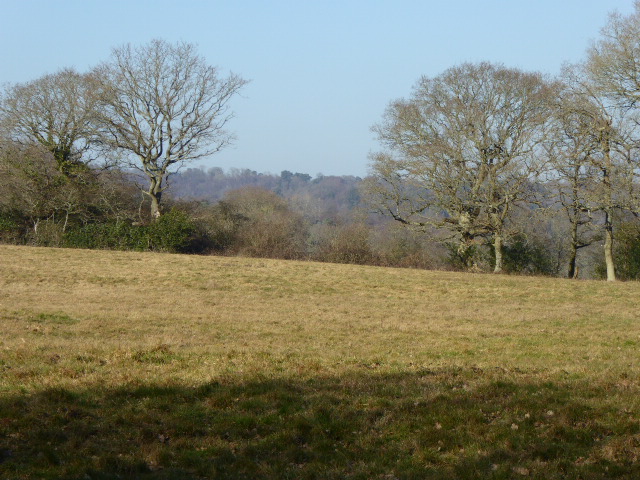
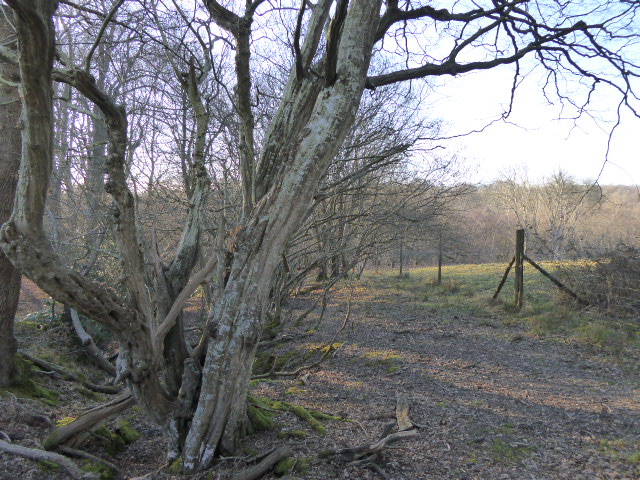
Bottle Shaw is a woodland area located in Sussex, England. It is situated within the larger region known as the Sussex Weald, renowned for its scenic beauty and rich biodiversity. Bottle Shaw is characterized by its dense forest cover, consisting primarily of a mix of deciduous and coniferous trees.

The woodland is named after a nearby hamlet called Bottle Shaw, which is believed to have derived its name from a natural spring or well known for its unique-shaped bottle-like formations. The forest itself covers an area of approximately 100 hectares, providing a habitat for a wide range of flora and fauna.

The woodland is dominated by species such as oak, beech, and pine trees, creating a varied and picturesque landscape. It is also home to a diverse array of plant life, including bluebells, wild garlic, and ferns. These plants provide a source of food and shelter for numerous animal species that inhabit the area, such as deer, squirrels, and various bird species.

Bottle Shaw is a popular destination for nature enthusiasts, offering opportunities for recreational activities such as hiking, birdwatching, and photography. Several well-marked trails traverse the woodland, allowing visitors to explore its natural beauty and discover its hidden treasures. The forest's tranquil ambiance, combined with its stunning scenery, makes it an ideal location for those seeking solace and a closer connection with nature.

In conclusion, Bottle Shaw in Sussex is a captivating woodland area that showcases the beauty of the Sussex Weald. With its diverse plant and animal life, as well as its recreational opportunities, it provides a haven for nature lovers and a chance to immerse oneself in the enchanting English countryside.

If you have any feedback on the listing, please let us know in the comments section below.

Bottle Shaw Images

Images are sourced within 2km of 50.942505/0.25554692 or Grid Reference TQ5818. Thanks to Geograph Open Source API. All images are credited.

Footpath crossing the Cuckoo Trail On the southern outskirts of Heathfield.
Footpath crossing the Cuckoo Trail
On the southern outskirts of Heathfield.
Theobald's Green, Sandy Cross Heathfield This is the B2203 from Horam.
Theobald's Green, Sandy Cross Heathfield
This is the B2203 from Horam.
Roadside conifers on the east side of Theobald's Green
Path junction with Weavers Rock Lane
Park road on the right meets Sandy Cross Lane The aptly named Park Road is the western edge of Heathfield Park an old country estate dating back to the seventeen hundreds. The grounds and house have been remodelled a few times since then.
Part of the park has SSSI status for its Lichen habitat.
Park road on the right meets Sandy Cross Lane
The aptly named Park Road is the western edge of Heathfield Park an old country estate dating back to the seventeen hundreds. The grounds and house have been remodelled a few times since then. Part of the park has SSSI status for its Lichen habitat.
East on Weavers Rock Lane The wall is the southern boundary of Heathfield Park.
East on Weavers Rock Lane
The wall is the southern boundary of Heathfield Park.
Steel post on the Cuckoo Trail I don't know if it's a railway relic or not but to me it looks more like an arm off a JCB.
Steel post on the Cuckoo Trail
I don't know if it's a railway relic or not but to me it looks more like an arm off a JCB.
Bollards on the Cuckoo Trail at Heathfield The Cuckoo Trail crosses Ghyll Road and continues on the tarmac path to the left of the houses. The path is a licensed cycleway.
Bollards on the Cuckoo Trail at Heathfield
The Cuckoo Trail crosses Ghyll Road and continues on the tarmac path to the left of the houses. The path is a licensed cycleway.
House on Weavers Rock Lane The wall at the left, rather lower than elsewhere, is of the private Heathfield Park.
House on Weavers Rock Lane
The wall at the left, rather lower than elsewhere, is of the private Heathfield Park.
Ghyll Road Top of Ghyll Road photographed on November 7th 2005 before the Sylvas Grange housing estate was built.
Ghyll Road
Top of Ghyll Road photographed on November 7th 2005 before the Sylvas Grange housing estate was built.
The site of Horam railway station Situated on the railway which ran northwards from Polegate to Heathfield, known as the Cuckoo Line, after the Cuckoo Fair held annually at Heathfield, this is now part of the Cuckoo Trail cycle path.
The site of Horam railway station
Situated on the railway which ran northwards from Polegate to Heathfield, known as the Cuckoo Line, after the Cuckoo Fair held annually at Heathfield, this is now part of the Cuckoo Trail cycle path.
Vines Cross East Sussex Vines Cross Village lies just outside Heathfield in Southern England.It is a small Village surrounded by lovely countryside much of which is Farmland.During the second World War Vines Cross had the dubious honour of being the second village in the area to be hit by doodlebugs.
Vines Cross East Sussex
Vines Cross Village lies just outside Heathfield in Southern England.It is a small Village surrounded by lovely countryside much of which is Farmland.During the second World War Vines Cross had the dubious honour of being the second village in the area to be hit by doodlebugs.
Narrow Lane  Vines  Cross  East Sussex Ballsocks Lane is a very narrow lane joining Laundry Lane and Foords Lane Vines Cross.  Although the house in the picture looks like an old oast house it is in fact about six years old.
Narrow Lane Vines Cross East Sussex
Ballsocks Lane is a very narrow lane joining Laundry Lane and Foords Lane Vines Cross. Although the house in the picture looks like an old oast house it is in fact about six years old.
Stile Vines Cross East Sussex Stile just in grid sq TQ5918.Footpath heading west to the Old Heathfield / Vines Cross road over Hales Hill Farmland.
Stile Vines Cross East Sussex
Stile just in grid sq TQ5918.Footpath heading west to the Old Heathfield / Vines Cross road over Hales Hill Farmland.
Stile Old Heathfield East Sussex Stile to footpath across farmland to Old Heathfield from Vines Cross Road. Old Heathfield Church (<a href="https://www.geograph.org.uk/gridref/TQ5920">TQ5920</a>) in background.
Stile Old Heathfield East Sussex
Stile to footpath across farmland to Old Heathfield from Vines Cross Road. Old Heathfield Church (TQ5920) in background.
The Brewers Arms Vines Cross East Sussex Brewers Arms on the junction of Foords Lane and the Horam and Old Heathfield Road.
The Brewers Arms Vines Cross East Sussex
Brewers Arms on the junction of Foords Lane and the Horam and Old Heathfield Road.
Constance Scott Recreation Ground, Horam On the southern edge of the village of Horam. It also includes tennis courts, playgrounds and skateboard ramps.
Constance Scott Recreation Ground, Horam
On the southern edge of the village of Horam. It also includes tennis courts, playgrounds and skateboard ramps.
Merrydown Cider, Horam The famous cider maker operated on these premises from 1947 until 2004 when brewing was contracted out. The premises are currently up for sale.
Merrydown Cider, Horam
The famous cider maker operated on these premises from 1947 until 2004 when brewing was contracted out. The premises are currently up for sale.
Show me another place!

Bottle Shaw is located at Grid Ref: TQ5818 (Lat: 50.942505, Lng: 0.25554692)

Administrative County: East Sussex

District: Wealden

Police Authority: Sussex

What 3 Words

///eradicate.stooping.ounce. Near Horam, East Sussex

Related Wikis

Maynard's Green

Maynard's Green is a village in the Wealden district of East Sussex. == External links == Maynards Green Community Primary School

Sapperton Meadows

Sapperton Meadows is a 14.7-hectare (36-acre) biological Site of Special Scientific Interest south of Heathfield in East Sussex.These poorly drained hay...

Horam railway station

Horam railway station was on the Cuckoo Line between Hellingly and Heathfield, serving the village of Horam. == History == The station was opened by the...

Horam

Horam is a village, electoral ward and civil parish in the Wealden District of East Sussex, situated three miles (4.8 km) south of Heathfield. Included...

St Dunstan's Farm Meadows

St Dunstan's Farm Meadows is a 10.2-hectare (25-acre) biological Site of Special Scientific Interest south-east of Heathfield in East Sussex. It is in...

All Saints Church, Heathfield

All Saints Church is a Church of England parish church in Heathfield, East Sussex, England. It was constructed in the 14th century and is a Grade II* listed...

Warbleton

Warbleton is a village and civil parish in the Wealden district of East Sussex, England. Within its bounds are three other settlements. It is located south...

Heathfield Park SSSI

Heathfield Park SSSI is a 41-hectare (100-acre) biological Site of Special Scientific Interest east of Heathfield in East Sussex. It is part of Heathfield...

Nearby Amenities

Located within 500m of 50.942505,0.25554692
Maynard's Green
Is In: East Sussex, England, UK
Place: village
Wikidata: Q73376302
Wikipedia: en:Maynard's Green
Lat/Long: 50.9452508/0.2505177
Post Box
Operator: Royal Mail
Operator Wikidata: Q638098
Post Box Type: lamp
Ref: TN21 47
Royal Cypher: EIIR
Royal Cypher Wikidata: Q33102113
Lat/Long: 50.9447208/0.2503792
Power: pole
Lat/Long: 50.9404185/0.2618024
Power: pole
Lat/Long: 50.9416421/0.2619982
Power: pole
Lat/Long: 50.9431665/0.2622342
The data included in this document is from www.openstreetmap.org. The data is made available under ODbL.

Have you been to Bottle Shaw?

Leave your review of Bottle Shaw below (or comments, questions and feedback).