Tunbridge Wells Common

Wood, Forest in Kent Tunbridge Wells

England

Tunbridge Wells Common

Crossroads, Upper Grosvenor Rd
Crossroads, Upper Grosvenor Rd Credit: N Chadwick

Tunbridge Wells Common is a large and picturesque area of woodland and forest located in Kent, England. Covering an expansive area of approximately 256 acres, the common is a popular destination for locals and visitors alike, offering a tranquil escape from the hustle and bustle of everyday life.

The common is home to a diverse range of flora and fauna, with a rich variety of tree species such as oak, beech, and birch creating a vibrant and colorful landscape throughout the year. It provides a habitat for various wildlife, including birds, deer, and squirrels, making it a haven for nature enthusiasts and birdwatchers.

The common features a network of well-maintained footpaths and trails, allowing visitors to explore its natural beauty and discover hidden gems. There are also several designated picnic areas, providing the perfect spot for a leisurely outdoor lunch or a peaceful break amidst the serene surroundings.

In addition to its natural beauty, Tunbridge Wells Common has historical significance. It was originally part of the ancient Forest of Anderida, and remnants of this past can still be seen in the form of ancient boundary banks and ditches. The common has also been used for various recreational activities over the years, including cricket matches and traditional fairs.

Overall, Tunbridge Wells Common offers a delightful blend of natural beauty, tranquility, and historical charm. Whether it's a leisurely walk, a family picnic, or a chance to connect with nature, the common provides a perfect escape for visitors seeking respite in the heart of Kent.

If you have any feedback on the listing, please let us know in the comments section below.

Tunbridge Wells Common Images

Images are sourced within 2km of 51.128687/0.25338738 or Grid Reference TQ5739. Thanks to Geograph Open Source API. All images are credited.

Crossroads, Upper Grosvenor Rd
Grosvenor Bridge
Grosvenor Bridge
St Barnabas Primary School
The Black Horse
The Black Horse
Camden Rd The shops in Camden Road are a diverse and specialist mix of traders, proud of their heritage and the unique atmosphere that the road brings to Tunbridge Wells. Enjoy a refreshing change from the regular chain stores - you will have an interesting shopping experience! 
Visitors to Camden Road can find a wide range of specialist goods from over 130 shops, just a few of which include: designer furniture and upholsterers, lighting, hairdressers and barbers, photography studios, picture framers, sewing machines and fabrics, pet shop, shoe repairs, wedding specialists, clothing and a shoe shop. There are many restaurants, cafes, pubs and bars offering everything from cocktails, Italian coffees, cakes, milkshakes and specialist chocolates to Greek, Italian, Chinese and Indian restaurants and fish and chips. Source: <span class="nowrap"><a title="http://www.camdenroad.co.uk/?page=about" rel="nofollow ugc noopener" href="http://www.camdenroad.co.uk/?page=about">Link</a><img style="margin-left:2px;" alt="External link" title="External link - shift click to open in new window" src="https://s1.geograph.org.uk/img/external.png" width="10" height="10"/></span>
Camden Rd
The shops in Camden Road are a diverse and specialist mix of traders, proud of their heritage and the unique atmosphere that the road brings to Tunbridge Wells. Enjoy a refreshing change from the regular chain stores - you will have an interesting shopping experience! Visitors to Camden Road can find a wide range of specialist goods from over 130 shops, just a few of which include: designer furniture and upholsterers, lighting, hairdressers and barbers, photography studios, picture framers, sewing machines and fabrics, pet shop, shoe repairs, wedding specialists, clothing and a shoe shop. There are many restaurants, cafes, pubs and bars offering everything from cocktails, Italian coffees, cakes, milkshakes and specialist chocolates to Greek, Italian, Chinese and Indian restaurants and fish and chips. Source: LinkExternal link
Box junction, Camden Rd A box junction is a traffic control measure designed to prevent gridlock at busy road junctions. The surface of the junction is marked with a criss-cross grid of diagonal painted lines and vehicles may not enter the area so marked unless their exit from the junction is clear; drivers may enter the box and wait when they want to turn right and are stopped from doing so only by oncoming traffic or by other vehicles waiting to turn right. <span class="nowrap"><a title="http://en.wikipedia.org/wiki/Box_junction" rel="nofollow ugc noopener" href="http://en.wikipedia.org/wiki/Box_junction">Link</a><img style="margin-left:2px;" alt="External link" title="External link - shift click to open in new window" src="https://s1.geograph.org.uk/img/external.png" width="10" height="10"/></span>
Box junction, Camden Rd
A box junction is a traffic control measure designed to prevent gridlock at busy road junctions. The surface of the junction is marked with a criss-cross grid of diagonal painted lines and vehicles may not enter the area so marked unless their exit from the junction is clear; drivers may enter the box and wait when they want to turn right and are stopped from doing so only by oncoming traffic or by other vehicles waiting to turn right. LinkExternal link
End of Camden Rd
End of Camden Rd
TN1, Monson Rd Monson Road is a short curved shopping street in Tunbridge Wells. One side of the road is taken up by a row of Victorian houses with a first floor balcony and ground floor shops, which are Grade II listed. <span class="nowrap"><a title="http://www.britishlistedbuildings.co.uk/en-168065-8-36-royal-tunbridge-wells" rel="nofollow ugc noopener" href="http://www.britishlistedbuildings.co.uk/en-168065-8-36-royal-tunbridge-wells">Link</a><img style="margin-left:2px;" alt="External link" title="External link - shift click to open in new window" src="https://s1.geograph.org.uk/img/external.png" width="10" height="10"/></span> 
Tunbridge Wells Adult Education Centre is also on this road.
TN1, Monson Rd
Monson Road is a short curved shopping street in Tunbridge Wells. One side of the road is taken up by a row of Victorian houses with a first floor balcony and ground floor shops, which are Grade II listed. LinkExternal link Tunbridge Wells Adult Education Centre is also on this road.
Former Congregational Church Jabez Scholes may have been the original architect of this large Classical-style chapel, erected for £3,700 in 1845–48. The Tuscan portico at the front cost a further £1,400 in 1866. Acquired by Pentecostalists in 1977, it was sold three years later and turned into shops.At present occupied by Cotswold.
Grade II* listed. <span class="nowrap"><a title="http://www.britishlistedbuildings.co.uk/en-168097-lecture-hall-mount-pleasant-congregation" rel="nofollow ugc noopener" href="http://www.britishlistedbuildings.co.uk/en-168097-lecture-hall-mount-pleasant-congregation">Link</a><img style="margin-left:2px;" alt="External link" title="External link - shift click to open in new window" src="https://s1.geograph.org.uk/img/external.png" width="10" height="10"/></span>
Former Congregational Church
Jabez Scholes may have been the original architect of this large Classical-style chapel, erected for £3,700 in 1845–48. The Tuscan portico at the front cost a further £1,400 in 1866. Acquired by Pentecostalists in 1977, it was sold three years later and turned into shops.At present occupied by Cotswold. Grade II* listed. LinkExternal link
Tunbridge Wells War Memorial The memorial is in the form of a low wall surrounding a central memorial with the figure of a soldier holding a rifle mounted on a plinth. The names of the dead from World War 1, 764 names, are set in plaques around the wall. The memorial was unveiled and dedicated February 1923; the sculptor was  Stanley Babb.
Grade II listed. <span class="nowrap"><a title="http://www.britishlistedbuildings.co.uk/en-1401309-tunbridge-wells-war-memorial-non-civil-" rel="nofollow ugc noopener" href="http://www.britishlistedbuildings.co.uk/en-1401309-tunbridge-wells-war-memorial-non-civil-">Link</a><img style="margin-left:2px;" alt="External link" title="External link - shift click to open in new window" src="https://s1.geograph.org.uk/img/external.png" width="10" height="10"/></span> 
More information at <span class="nowrap"><a title="http://www.roll-of-honour.com/Kent/TunbridgeWells.html" rel="nofollow ugc noopener" href="http://www.roll-of-honour.com/Kent/TunbridgeWells.html">Link</a><img style="margin-left:2px;" alt="External link" title="External link - shift click to open in new window" src="https://s1.geograph.org.uk/img/external.png" width="10" height="10"/></span>
Tunbridge Wells War Memorial
The memorial is in the form of a low wall surrounding a central memorial with the figure of a soldier holding a rifle mounted on a plinth. The names of the dead from World War 1, 764 names, are set in plaques around the wall. The memorial was unveiled and dedicated February 1923; the sculptor was Stanley Babb. Grade II listed. LinkExternal link More information at LinkExternal link
Vacant Site The three-screen cinema at the corner of Mount Pleasant Road and Church Road closed in October 2000, after a new multiplex opened on the edge of town. The building was built around 1934.  Previously the site was Belvedere House. 

Along with the adjoining shop buildings on Mount Pleasant Road and Church Road, the site had numerous planning applications and owners since it was disused in 2000, and the old buildings were finally demolished and cleared in 2014.

A new planning application for the site was submitted in July 2017. It includes retail and restaurant use, cinema, and 99 flats (Application ref 17/02262/FULL ).
Vacant Site
The three-screen cinema at the corner of Mount Pleasant Road and Church Road closed in October 2000, after a new multiplex opened on the edge of town. The building was built around 1934. Previously the site was Belvedere House. Along with the adjoining shop buildings on Mount Pleasant Road and Church Road, the site had numerous planning applications and owners since it was disused in 2000, and the old buildings were finally demolished and cleared in 2014. A new planning application for the site was submitted in July 2017. It includes retail and restaurant use, cinema, and 99 flats (Application ref 17/02262/FULL ).
Mount Pleasant Rd
Mount Pleasant Rd
Tunbridge Wells Station Tunbridge Wells Station was opened by the South Eastern Railway (SER) on 25th November 1846. It is on "the Hastings line" ( <a title="https://www.geograph.org.uk/snippet/2428" href="https://www.geograph.org.uk/snippet/2428">Link</a> ). The station is a cut station with access in both directions by tunnels, the Grove Tunnel from the south and the Wells Tunnel from the north.
The station has a regular service to both London Charing Cross and Hastings as well as shuttles to Tonbridge and some to London Bridge via Redhill.
A Grade II listed building. <span class="nowrap"><a title="http://www.britishlistedbuildings.co.uk/en-168166-tunbridge-wells-central-railway-station-" rel="nofollow ugc noopener" href="http://www.britishlistedbuildings.co.uk/en-168166-tunbridge-wells-central-railway-station-">Link</a><img style="margin-left:2px;" alt="External link" title="External link - shift click to open in new window" src="https://s1.geograph.org.uk/img/external.png" width="10" height="10"/></span>
Tunbridge Wells Station
Tunbridge Wells Station was opened by the South Eastern Railway (SER) on 25th November 1846. It is on "the Hastings line" ( Link ). The station is a cut station with access in both directions by tunnels, the Grove Tunnel from the south and the Wells Tunnel from the north. The station has a regular service to both London Charing Cross and Hastings as well as shuttles to Tonbridge and some to London Bridge via Redhill. A Grade II listed building. LinkExternal link
The Bedford
The Bedford
High St
High St
The White Bear
The White Bear
Zizzi, High St
Zizzi, High St
Show me another place!

Tunbridge Wells Common is located at Grid Ref: TQ5739 (Lat: 51.128687, Lng: 0.25338738)

Administrative County: Kent

District: Tunbridge Wells

Police Authority: Kent

What 3 Words

///blank.bucks.debate. Near Royal Tunbridge Wells, Kent

Related Wikis

Higher Common Ground

Higher Common Ground is a cricket ground on Tunbridge Wells Common in the town of Royal Tunbridge Wells in Kent. It was used as a ground by Kent County...

Linden Park Cricket Club

Linden Park Cricket Club (LPCC) is a cricket club based at Higher Cricket Ground, Fir Tree Road, Royal Tunbridge Wells, Kent, England.The club has a senior...

The Forum, Tunbridge Wells

The Forum is an independent music venue in Royal Tunbridge Wells, Kent, England, with a standing capacity of 250. The venue opened in 1993, the building...

The Pantiles

The Pantiles is a Georgian colonnade in the town of Royal Tunbridge Wells, Kent, England. Formerly known as "The Walks" and the (Royal) "Parade", it leads...

Corn Exchange, Tunbridge Wells

The Corn Exchange is a commercial building in The Pantiles, Royal Tunbridge Wells, Kent, England. The structure, which is currently used as an antiques...

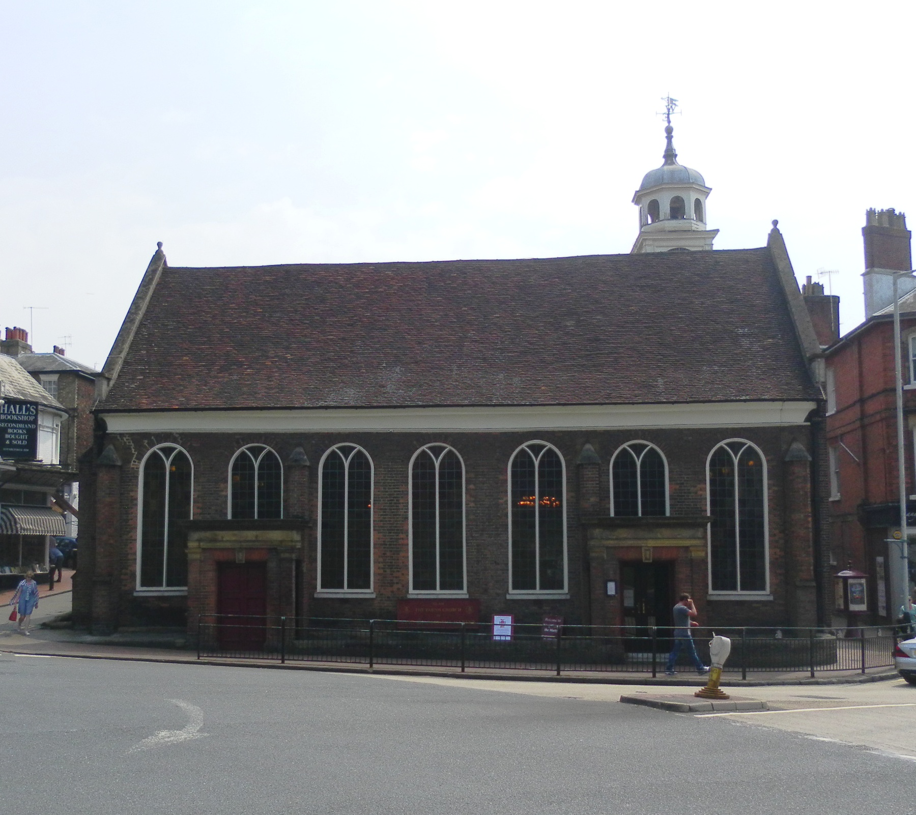
Church of King Charles the Martyr, Royal Tunbridge Wells

The Church of King Charles the Martyr is a Church of England parish church in Royal Tunbridge Wells, Kent, England. It is a Grade I listed building....

Borough of Tunbridge Wells

The Borough of Tunbridge Wells is a local government district with borough status in Kent, England. It takes its name from its main town, Royal Tunbridge...

G. Collins and Sons

G. Collins & Sons Limited is a jewellery firm at 76/78 High St, Royal Tunbridge Wells in southeast England. == Background == Queen Elizabeth II appointed...

Nearby Amenities

Located within 500m of 51.128687,0.25338738
Mini Roundabout
Direction: clockwise
Lat/Long: 51.1269015/0.2590693
Mini Roundabout
Direction: clockwise
Lat/Long: 51.1301914/0.2472778
Mini Roundabout
Direction: clockwise
Lat/Long: 51.1261011/0.2571115
Crossing
Crossing: unmarked
Crossing Island: no
Tactile Paving: no
Lat/Long: 51.1279526/0.2516972
Crossing
Crossing: traffic_signals
Crossing Island: no
Kerb: flush
Tactile Paving: yes
Lat/Long: 51.1265144/0.2591549
Chalybeate Spring
Natural: spring
Lat/Long: 51.1266675/0.2586233
Fuel
Pantile Service Station
Addr Housenumber: 13-14
Addr Postcode: TN4 8HJ
Addr Street: Eridge Road
Addr Town: Tunbridge Wells
Brand: Esso
Brand Wikidata: Q867662
Designation: 1174
Fuel Diesel: yes
Fuel Octane 95: yes
Operator: Rontec
Operator Website: http://www.rontec-servicestations.co.uk/ss_results-id.cfm?id=7136
Operator Wikidata: Q107439152
Phone: +44 1892 528612
Lat/Long: 51.1244053/0.2533438
Crossing
Crossing: uncontrolled
Crossing Markings: zebra
Crossing Ref: zebra
Lat/Long: 51.126477/0.2576497
Crossing
Crossing: uncontrolled
Crossing Island: no
Crossing Markings: zebra;dots
Crossing Ref: zebra
Tactile Paving: yes
Lat/Long: 51.1306736/0.2523747
Bus Stop
Bishops Down Road
Bench: yes
Bin: no
Flag: no
Lit: no
Naptan AtcoCode: 2400100553
Naptan Bearing: SE
Naptan BusStopType: CUS
Naptan CommonName: Bishops Down Road
Naptan Indicator: opp
Naptan Landmark: Bishops Down Road
Naptan PlusbusZoneRef: TUNWELL
Naptan Street: Hurstwood Lane
Naptan Verified: no
Public Transport: platform
Shelter: no
Source: naptan_import
Tactile Paving: no
Lat/Long: 51.1314075/0.2510456
Bus Stop
Bishops Down Road
Bench: yes
Bin: no
Flag: no
Lit: no
Naptan AtcoCode: 2400100555
Naptan Bearing: NW
Naptan BusStopType: CUS
Naptan CommonName: Bishops Down Road
Naptan Indicator: adj
Naptan Landmark: Bishops Down Road
Naptan PlusbusZoneRef: TUNWELL
Naptan Street: Hurstwood Lane
Naptan Verified: no
Public Transport: platform
Shelter: no
Source: naptan_import
Tactile Paving: no
Lat/Long: 51.131413/0.25076
Bus Stop
Manor Park
Bench: yes
Bin: no
Flag: no
Lit: no
Naptan AtcoCode: 2400100557
Naptan Bearing: SW
Naptan BusStopType: CUS
Naptan CommonName: Manor Park
Naptan Indicator: opp
Naptan Landmark: Manor Park
Naptan PlusbusZoneRef: TUNWELL
Naptan Street: Bishops Down Road
Naptan Verified: no
Public Transport: platform
Shelter: no
Source: naptan_import
Tactile Paving: no
Lat/Long: 51.1308165/0.2485726
Bus Stop
Hungershall Park
Naptan AtcoCode: 2400A007920A
Naptan Bearing: SE
Naptan CommonName: Hungershall Park
Naptan Indicator: opp
Naptan Landmark: Hungershall Park
Naptan NaptanCode: kntajpjd
Naptan PlusbusZoneRef: TUNWELL
Naptan Street: Major York's Road
Naptan Verified: no
Public Transport: platform
Source: naptan_import
Lat/Long: 51.1279553/0.2518788
Bus Stop
Hungershall Park
Naptan AtcoCode: 2400A007930A
Naptan Bearing: NW
Naptan CommonName: Hungershall Park
Naptan Indicator: adj
Naptan Landmark: Fir Tree Av
Naptan NaptanCode: kntajpjg
Naptan PlusbusZoneRef: TUNWELL
Naptan Street: Major York's Road
Naptan Verified: no
Public Transport: platform
Source: naptan_import
Lat/Long: 51.1279515/0.2515261
Bus Stop
Vale Road
Bus: yes
Naptan AtcoCode: 2400A013800A
Naptan Bearing: S
Naptan CommonName: Vale Road
Naptan Indicator: S-bound
Naptan Landmark: Vale Rd
Naptan NaptanCode: kntapdwa
Naptan PlusbusZoneRef: TUNWELL
Naptan Street: Mount Pleasant Rd
Naptan Verified: no
Public Transport: platform
Source: naptan_import
Lat/Long: 51.1271955/0.2596127
Bus Stop
Vale Road
Bus: yes
Naptan AtcoCode: 2400A013890A
Naptan Bearing: N
Naptan CommonName: Vale Road
Naptan Indicator: N-bound
Naptan Landmark: Vale Rd
Naptan NaptanCode: kntapgaj
Naptan PlusbusZoneRef: TUNWELL
Naptan Street: London Rd
Naptan Verified: no
Public Transport: platform
Shelter: yes
Source: naptan_import
Lat/Long: 51.1271699/0.2593466
Bus Stop
Broadwater Lane
Bus: yes
Flag: no
Naptan AtcoCode: 2400A014590A
Naptan Bearing: E
Naptan BusStopType: CUS
Naptan CommonName: Broadwater Lane
Naptan Indicator: opp
Naptan Landmark: Sommerfield Lodge
Naptan NaptanCode: kntapjgw
Naptan PlusbusZoneRef: TUNWELL
Naptan Street: Eridge Road
Naptan Verified: no
Public Transport: platform
Source: naptan_import
Lat/Long: 51.1243695/0.2519037
Bus Stop
The Pantiles
Bench: no
Bin: yes
Bus: yes
Flag: no
Lit: no
Naptan AtcoCode: 2400A073060A
Naptan Bearing: SW
Naptan BusStopType: CUS
Naptan CommonName: Pantiles
Naptan Indicator: adj
Naptan Landmark: Shopping Arc
Naptan NaptanCode: kntgjadg
Naptan PlusbusZoneRef: TUNWELL
Naptan Street: Frant Rd
Naptan Verified: no
Public Transport: platform
Shelter: no
Source: naptan_import
Tactile Paving: no
Lat/Long: 51.1263879/0.2576368
Bus Stop
The Pantiles
Bench: yes
Bin: yes
Bus: yes
Flag: no
Naptan AtcoCode: 2400A073070A
Naptan Bearing: NE
Naptan BusStopType: CUS
Naptan CommonName: Swan Hotel
Naptan Indicator: NE-bound
Naptan Landmark: Hotel
Naptan NaptanCode: kntgjadj
Naptan PlusbusZoneRef: TUNWELL
Naptan Street: Neville Street
Naptan Verified: no
Public Transport: platform
Shelter: yes
Source: naptan_import
Lat/Long: 51.1262866/0.2572805
Bus Stop
Wellington Hotel
Flag: no
Naptan AtcoCode: 2400A073080A
Naptan Bearing: NE
Naptan BusStopType: CUS
Naptan CommonName: Wellington Hotel
Naptan Indicator: NE-bound
Naptan Landmark: Hotel
Naptan NaptanCode: kntgjadm
Naptan PlusbusZoneRef: TUNWELL
Naptan Street: Mount Ephraim
Naptan Verified: no
Public Transport: platform
Source: naptan_import
Lat/Long: 51.1319489/0.2542166
Pharmacy
Imperial Pharmacy
Addr Housenumber: 4
Addr Postcode: TN2 5TN
Fax: 01892 535430
Healthcare: pharmacy
Phone: +44 1892 525630
Lat/Long: 51.1266612/0.2587622
The Swan Hotel
Tourism: hotel
Wikidata: Q26318959
Lat/Long: 51.1258676/0.2571784
Parking
Access: yes
Fee: yes
Parking: surface
Lat/Long: 51.1263324/0.2560292
Barrier: bollard
Bollard: fixed
Lat/Long: 51.1266504/0.2566621
Barrier: bollard
Lat/Long: 51.1302041/0.2588999
Barrier: bollard
Lat/Long: 51.1302291/0.2573108
Halls Bookshop
Addr Postcode: TN1 1YQ
Shop: books
Website: https://www.hallsbookshop.com/
Wheelchair: no
Lat/Long: 51.1268734/0.2595529
Traffic Signals
Traffic Signals Direction: forward
Lat/Long: 51.1265498/0.2591444
Kerb: raised
Lat/Long: 51.1323117/0.2566575
Glitterati
Shop: jewelry
Lat/Long: 51.1266308/0.2589701
Cafe
Hudsons Coffee
Addr Housenumber: 13
Addr Postcode: TN1 1YQ
Addr Street: Chapel Place
Cuisine: coffee_shop
Lat/Long: 51.1270075/0.259871
Old Name: Luigi's Car Wash
Removed Amenity: car_wash
Self Service: no
Lat/Long: 51.1274857/0.2596742
Pour Les Femmes
Addr City: Tunbridge Wells
Addr Housenumber: 87
Addr Postcode: TN1 1YG
Addr Street: High Street
Phone: +44 1892 616707
Shop: clothes
Lat/Long: 51.1272712/0.2601146
Dylan Miles
Shop: car
Lat/Long: 51.1276754/0.2599042
Pub
The Ragged Trousers
Addr Housenumber: 44
Addr Postcode: TN2 5TN
Addr Street: The Pantiles
Fhrs Id: 18522
Internet Access: wlan
Internet Access Fee: no
Website: www.raggedtrousers.co.uk
Lat/Long: 51.126156/0.2577414
Pub
The Duke of York
Addr Housenumber: 17
Addr Postcode: TN2 5TD
Addr Street: The Pantiles
Brand: Fuller's
Brand Wikidata: Q5253950
Internet Access: wlan
Internet Access Fee: no
Website: https://www.dukeofyorktunbridgewells.co.uk/
Wikidata: Q26319485
Lat/Long: 51.1263239/0.2582295
Pub
The Sussex Arms
Addr Housename: The Sussex Arms
Addr Postcode: TN2 5TE
Addr Street: The Pantiles
Wikidata: Q26318896
Lat/Long: 51.1255655/0.2583442
Bench
Backrest: yes
Lat/Long: 51.1278634/0.2556425
Traffic Signals
Traffic Signals Direction: backward
Lat/Long: 51.126482/0.2591624
Post Box
Brand: Royal Mail
Brand Wikidata: Q638098
Collection Times: Mo-Fr 16:15; Sa 12:30
Operator: Royal Mail
Operator Wikidata: Q638098
Post Box Design: reproduction_penfold
Post Box Type: pillar
Ref: TN2 70
Royal Cypher: VR
Royal Cypher Wikidata: Q33102356
Source: survey
Lat/Long: 51.1260948/0.2578789
le petit jardin
Addr City: Tunbridge Wells
Addr Housenumber: 14
Addr Postcode: TN1 1YQ
Addr Street: Chapel Place
Phone: +44 1892 541151
Shop: garden,_interiors
Source: Owner
Website: https://www.le-petit-jardin.com/
Lat/Long: 51.1269635/0.2597769
Travelodge
Addr Housenumber: 84
Addr Postcode: TN4 8BU
Addr Street: Mount Ephraim
Brand: Travelodge
Brand Wikidata: Q9361374
Brand Wikipedia: en:Travelodge UK
Fhrs Authority: Tunbridge Wells
Fhrs Id: 22837
Fhrs Local Authority Id: 07/00338/MIXED
Internet Access: wlan
Internet Access Fee: customers
Internet Access Ssid: Travelodge WiFi
Tourism: hotel
Website: https://www.travelodge.co.uk/hotels/354/Tunbridge-Wells-hotel
Lat/Long: 51.1312319/0.253081
Addr Housename: Chartwell Lodge
Addr Street: Bishops Down Road
Building: apartments
Lat/Long: 51.1314803/0.2520396
Post Box
Collection Times: Mo-Fr 09:00; Sa 07:00
Operator: Royal Mail
Post Box Type: pillar
Ref: TN4 45D
Royal Cypher: no
Lat/Long: 51.1313128/0.2536594
Law 365
Office: lawyer
Lat/Long: 51.1263508/0.2570623
Bar
Chapel Place
Addr Housenumber: 18
Addr Street: Chapel Place
Opening Hours: Tu-Su 11:45-23:00
Phone: +44 1892 522304
Website: https://www.chapelplacetw.co.uk/
Lat/Long: 51.1269104/0.2596612
Cafe
Chocolati
Addr Housenumber: 11
Addr Postcode: TN2 5TD
Addr Street: The Pantiles
Opening Hours: Mo-Sa 10:00-18:00; Su 10:00-17:00
Phone: +44 1892 457575
Website: https://www.chocolatl.co.uk/
Lat/Long: 51.1264512/0.2584417
Cafe
The Cake Shed
Lat/Long: 51.126326/0.2579588
Restaurant;music Venue
The Grey Lady
Addr City: Royal Tunbridge Wells
Addr Housenumber: 70-72
Addr Postcode: TN2 5TW
Addr Street: The Pantiles
Alt Name: La Casa Vecchia
Cuisine: italian
Fhrs Id: 66730
Source: survey
Source Addr: FHRS Open Data
Website: http://www.thegreylady.co.uk
Lat/Long: 51.1255036/0.2569616
Cafe
Fine Grind Coffee House
Addr Housenumber: 90-92
Addr Postcode: TN1 1YF
Addr Street: High Street
Fhrs Id: 698559
Source: Mapillary
Source Addr: FHRS Open Data
Lat/Long: 51.127439/0.2602675
The Pantilles Camera
Shop: paint
Lat/Long: 51.1264935/0.2582394
The Spa Galleries
Shop: art
Lat/Long: 51.1264652/0.258192
Any Occasion
Shop: clothes
Lat/Long: 51.1264373/0.2581452
Cafe
The Cake Shed
Lat/Long: 51.1264094/0.2580985
The Pantiles Bride
Clothes: wedding
Shop: clothes
Website: https://thepantiles.com/shops/the-pantiles-bride/
Lat/Long: 51.1263811/0.2580511
Restaurant
Hattons
Lat/Long: 51.1262524/0.2578353
Special Things
Shop: antiques
Lat/Long: 51.1262009/0.2577764
Trevor Mottram
Addr Housenumber: 37
Addr Street: The Pantiles
Phone: +44 1892 538915
Shop: kitchen
Website: https://www.trevormottram.co.uk/
Lat/Long: 51.1261142/0.258007
Peter Jenner
Addr City: Tunbridge Wells
Addr Housenumber: 43
Addr Postcode: TN2 5TE
Addr Street: The Pantiles
Contact Phone: +44 1892 521796
Contact Website: http://www.peterjenner.com/
Phone: +44 1892 521796
Shop: jewelry
Lat/Long: 51.1259862/0.2578649
Morgan Hodges
Shop: hairdresser
Lat/Long: 51.1259904/0.2575269
Pantiles Oriental Carpets
Shop: carpet
Lat/Long: 51.1259341/0.2581868
Clinic
Bella Vou
Healthcare: clinic
Lat/Long: 51.1258734/0.2580929
The Tunbridge Wells Hotel
Addr Housenumber: 58
Addr Street: The Pantiles
Tourism: hotel
Lat/Long: 51.1258785/0.257419
Restaurant
Kirthon
Cuisine: indian
Phone: +44 1892 526633
Website: https://www.kirthon.com/
Lat/Long: 51.1258053/0.2573338
Restaurant
Woods Restaurant & Bar
Addr Housenumber: 62
Addr Street: The Pantiles
Opening Hours Covid19: closed down
Phone: +44 1892 614411
Lat/Long: 51.1257295/0.2572614
The Pantiles News
Addr Housenumber: 66
Addr Street: The Pantiles
Shop: newsagent
Lat/Long: 51.1256294/0.25714
Oak & Interiors
Addr Housenumber: 68
Addr Street: The Pantiles
Phone: +44 1892 457104
Shop: interior_decoration
Website: www.oandi.co.uk
Lat/Long: 51.1255902/0.2570609
Joseph McCarthy
Note: Mirror frame makers
Opening Hours: Mo-Sa 09:00-17:30
Shop: yes
Lat/Long: 51.1260019/0.2568227
Give Way
Direction: backward
Lat/Long: 51.1322548/0.2554594
Bench
Backrest: yes
Lat/Long: 51.1321088/0.2572823
Bench
Victorian Bench
Access: yes
Backrest: yes
Material: metal
Lat/Long: 51.1274399/0.2558402
Bench
Backrest: yes
Material: wood
Lat/Long: 51.1288281/0.259106
Bench
Backrest: yes
Lat/Long: 51.1291992/0.2555574
Bench
Backrest: yes
Lat/Long: 51.1290211/0.2549184
Bench
Backrest: yes
Lat/Long: 51.1291734/0.255444
Bench
Backrest: yes
Lat/Long: 51.1289045/0.2546055
Bench
Backrest: yes
Lat/Long: 51.1288272/0.254453
Oxfam Bookshop
Brand: Oxfam Bookshop
Brand Wikidata: Q7115196
Brand Wikipedia: en:Oxfam bookshops
Second Hand: only
Shop: books
Website: https://www.oxfam.org.uk/shops/oxfam-bookshop-tunbridge-wells/
Lat/Long: 51.1270666/0.2599623
Loop Cycle & Social Meet Point
Lat/Long: 51.1297345/0.2519984
Parking Entrance
Parking: underground
Lat/Long: 51.1253423/0.2579699
Cafe
The Pantiles Cafe
Lat/Long: 51.12618/0.2577752
Artwork Type: installation
Tourism: artwork
Lat/Long: 51.1253232/0.2568986
Stop
Direction: forward
Stop: minor
Lat/Long: 51.1323325/0.2564365
The data included in this document is from www.openstreetmap.org. The data is made available under ODbL.

Have you been to Tunbridge Wells Common?

Leave your review of Tunbridge Wells Common below (or comments, questions and feedback).