Faulkland

Settlement in Somerset Mendip

England

Faulkland

Old Milestone by A366, North of Hemington, just West of Crossroads The Milestone is located on grass verge on the South of the road.  Parish of Hemington (Mendip District). Metal plate attached to stone post, Radstock iron plate design, erected by the Radstock turnpike trust in the 18th century, top right corner of plate gone; chips on top left of stone. An earlier photograph can be found here: <a title="https://www.geograph.org.uk/photo/6035396" href="https://www.geograph.org.uk/photo/6035396">Link</a> 

Inscription reads:-  
RADSTOCK / 3 / P. NORTON / 3   

Grade II listed. List Entry Number: 1408656 <span class="nowrap"><a title="https://historicengland.org.uk/listing/the-list/list-entry/1408656" rel="nofollow ugc noopener" href="https://historicengland.org.uk/listing/the-list/list-entry/1408656">Link</a><img style="margin-left:2px;" alt="External link" title="External link - shift click to open in new window" src="https://s1.geograph.org.uk/img/external.png" width="10" height="10"/></span> 

Milestone Society National ID: SO_FRPN11
Old Milestone by A366, North of Hemington, just West of Crossroads Credit: Janet Dowding

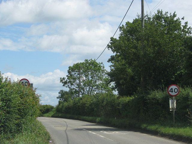
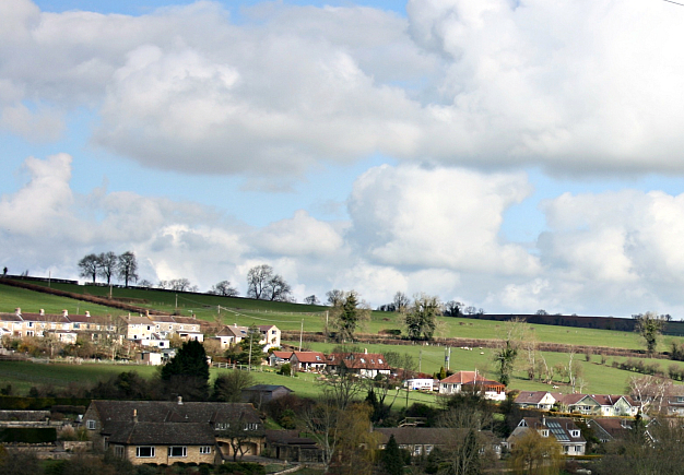
Faulkland is a charming village located in the county of Somerset, England. Situated approximately 10 miles southwest of the city of Bath, Faulkland is nestled amidst the picturesque rolling hills of the Mendip district.

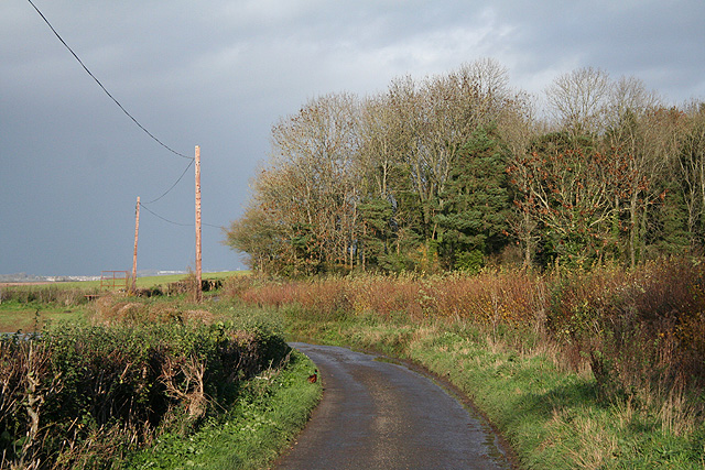
The village is renowned for its peaceful and idyllic atmosphere, making it a popular destination for those seeking a tranquil retreat. The surrounding countryside offers breathtaking views and is perfect for outdoor activities such as hiking, cycling, and horseback riding.

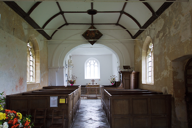
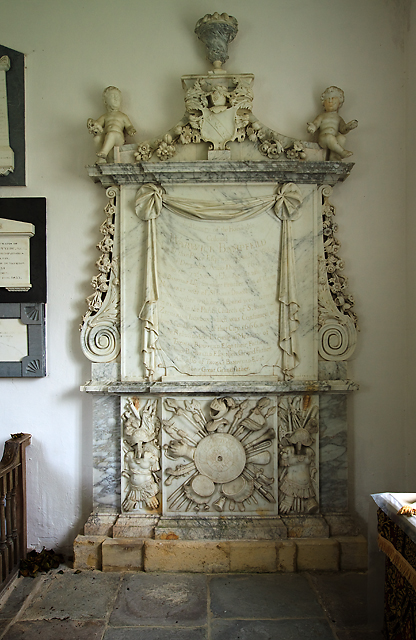
Faulkland is steeped in history, with evidence of human settlements dating back to the Bronze Age. The village is home to several Grade II listed buildings, including Faulkland Inn, a traditional 17th-century coaching inn that has been welcoming visitors for centuries. Additionally, the village boasts a beautiful church, St. George's, which dates back to the 12th century and features stunning medieval architecture.

Despite its small size, Faulkland is well-served by amenities. The village has a community-run shop and café, providing residents with essential supplies and a place to socialize. There is also a primary school, ensuring that families have convenient access to education for their children.

Faulkland's convenient location allows for easy access to nearby towns and cities. The bustling city of Bath, with its rich history and cultural attractions, is just a short drive away. Additionally, the village is well-connected by public transport, with regular bus services to surrounding areas.

In conclusion, Faulkland is a delightful and historic village, offering a peaceful and picturesque setting amidst the scenic Somerset countryside.

If you have any feedback on the listing, please let us know in the comments section below.
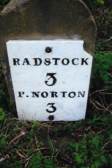
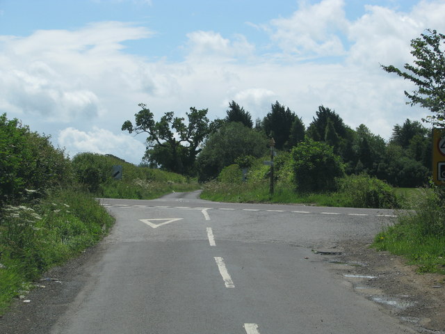
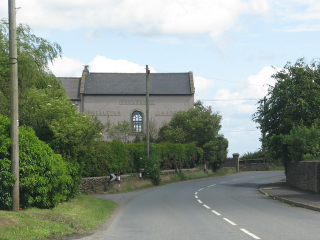
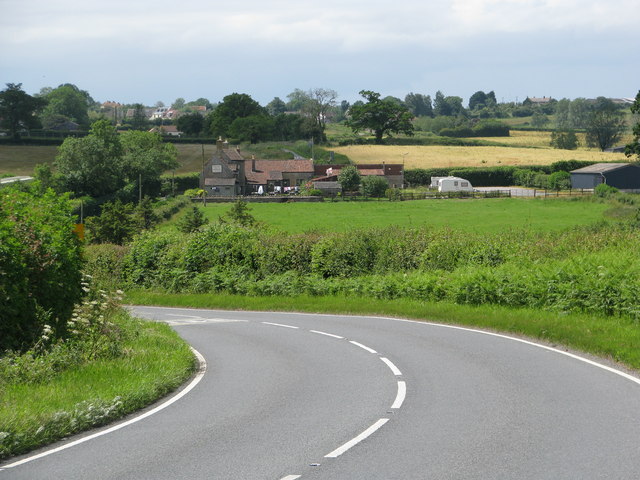
Faulkland Images

Images are sourced within 2km of 51.287806/-2.376393 or Grid Reference ST7354. Thanks to Geograph Open Source API. All images are credited.

Old Milestone by A366, North of Hemington, just West of Crossroads The Milestone is located on grass verge on the South of the road.  Parish of Hemington (Mendip District). Metal plate attached to stone post, Radstock iron plate design, erected by the Radstock turnpike trust in the 18th century, top right corner of plate gone; chips on top left of stone. An earlier photograph can be found here: <a title="https://www.geograph.org.uk/photo/6035396" href="https://www.geograph.org.uk/photo/6035396">Link</a> 

Inscription reads:-  
RADSTOCK / 3 / P. NORTON / 3   

Grade II listed. List Entry Number: 1408656 <span class="nowrap"><a title="https://historicengland.org.uk/listing/the-list/list-entry/1408656" rel="nofollow ugc noopener" href="https://historicengland.org.uk/listing/the-list/list-entry/1408656">Link</a><img style="margin-left:2px;" alt="External link" title="External link - shift click to open in new window" src="https://s1.geograph.org.uk/img/external.png" width="10" height="10"/></span> 

Milestone Society National ID: SO_FRPN11
Old Milestone by A366, North of Hemington, just West of Crossroads
The Milestone is located on grass verge on the South of the road.  Parish of Hemington (Mendip District). Metal plate attached to stone post, Radstock iron plate design, erected by the Radstock turnpike trust in the 18th century, top right corner of plate gone; chips on top left of stone. An earlier photograph can be found here: Link  Inscription reads:- RADSTOCK / 3 / P. NORTON / 3 Grade II listed. List Entry Number: 1408656 LinkExternal link Milestone Society National ID: SO_FRPN11
Road from Foxcote meets the A366
The A366 leaves Faulkland past a converted chapel
The A366 drops down the hill towards Tucker's Bottom
The A366 leaves Tucker's Bottom
St Mary's church, Hardington Bampfylde (interior) Belying the building's Norman origins is an interior that looks distinctly Georgian. The pulpit and altar rails are of the late C18, whilst the box pews are early C19; it followed much rebuilding in the early C17. The Royal Arms of Charles I above the chancel arch was repainted in 1817. The 'wonky' chancel arch itself is possibly Norman, whilst the nave is late C14. This little church sits amongst modern farm buildings and is now cared for by the Churches Conservation Trust.
St Mary's church, Hardington Bampfylde (interior)
Belying the building's Norman origins is an interior that looks distinctly Georgian. The pulpit and altar rails are of the late C18, whilst the box pews are early C19; it followed much rebuilding in the early C17. The Royal Arms of Charles I above the chancel arch was repainted in 1817. The 'wonky' chancel arch itself is possibly Norman, whilst the nave is late C14. This little church sits amongst modern farm buildings and is now cared for by the Churches Conservation Trust.
St Mary's church, Hardington Bampfylde - Bampfylde monument This fine wall monument to Colonel Warwick Bampfylde (†1694) in the chancel stands 12 feet tall. As well as the Colonel, the memorial inscription also commemorates three further generations of the Bampfylde family.
St Mary's church, Hardington Bampfylde - Bampfylde monument
This fine wall monument to Colonel Warwick Bampfylde (†1694) in the chancel stands 12 feet tall. As well as the Colonel, the memorial inscription also commemorates three further generations of the Bampfylde family.
Blessed Virgin Mary, Hemington
FAULKLAND, Hemington, Somerset The former Wesleyan Chapel was converted into a house recently
FAULKLAND, Hemington, Somerset
The former Wesleyan Chapel was converted into a house recently
HARDINGTON,  Somerset This small redundant church is in the care of the Churches Conservation Trust
HARDINGTON, Somerset
This small redundant church is in the care of the Churches Conservation Trust
Blessed Virgin Mary, Hemington
Tuckers Grave Bottom A view looking to the north from the A366 Wells Road into Tuckers Grave Bottom.  The course of a tributary of the Norton Brook is marked by the treeline below the ploughed field.
Tuckers Grave Bottom
A view looking to the north from the A366 Wells Road into Tuckers Grave Bottom. The course of a tributary of the Norton Brook is marked by the treeline below the ploughed field.
A366 Wells Road A view looking west along the A366 Wells Road as it descends into Tuckers Grave Bottom, before climbing up to the Tuckers Grave Inn, out of sight at the crossroads on the ridge to the left of the image.
A366 Wells Road
A view looking west along the A366 Wells Road as it descends into Tuckers Grave Bottom, before climbing up to the Tuckers Grave Inn, out of sight at the crossroads on the ridge to the left of the image.
Hemington: Faulkland Looking west-north-west to houses on the green at Faulkland. Seen from the A366 road
Hemington: Faulkland
Looking west-north-west to houses on the green at Faulkland. Seen from the A366 road
Hemington: near Faulkland Looking east-south-east towards cottages on the A366 Norton St Philip road. The Westbury White Horse is just visible on the far hill, over the border in Wiltshire
Hemington: near Faulkland
Looking east-south-east towards cottages on the A366 Norton St Philip road. The Westbury White Horse is just visible on the far hill, over the border in Wiltshire
Wellow: by Baggeridge Belt Baggeridge Belt is the plantation on the right. Looking north-north-east on the lane to Upper Baggeridge Farm
Wellow: by Baggeridge Belt
Baggeridge Belt is the plantation on the right. Looking north-north-east on the lane to Upper Baggeridge Farm
Ranscombe cottage, Hassage
Ford on Faulkland Lane A view looking north along Faulkland Lane showing the ford on the stream which forms the county boundary at this point.  The ford is quite shallow, despite recent heavy rains.
Ford on Faulkland Lane
A view looking north along Faulkland Lane showing the ford on the stream which forms the county boundary at this point. The ford is quite shallow, despite recent heavy rains.
Show me another place!

Faulkland is located at Grid Ref: ST7354 (Lat: 51.287806, Lng: -2.376393)

Administrative County: Somerset

District: Mendip

Police Authority: Avon and Somerset

What 3 Words

///spilled.basic.pranced. Near Wellow, Somerset

Nearby Locations

Faulkland

Related Wikis

Hemington, Somerset

Hemington is a village and civil parish 5.5 miles (8.9 km) north west of Frome, in the Mendip district of Somerset, England. It is located just off the...

St Mary's Church, Hemington

St. Mary's Hemington is an Anglican church in Hemington, Somerset, England. The Norman church underwent major renovation in the 14th, 15th, 17th and 19th...

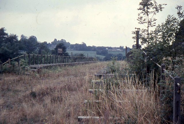
Shoscombe and Single Hill Halt railway station

Shoscombe & Single Hill Halt was a small railway station on the Somerset and Dorset Joint Railway serving small villages between Wellow and Radstock, about...

Church of St James The Less, Foxcote

The Anglican Church of St James The Less in Foxcote, within the English county of Somerset, was rebuilt in the early 18th century incorporating a 15th...

Shoscombe

Shoscombe is a small village and civil parish in the valley of the Wellow Brook in north-east Somerset, about 7 miles (11 km) south of Bath, England. The...

Radstock rail accident

The Radstock rail accident took place on the Somerset and Dorset Joint Railway in south west England, on 7 August 1876. Two trains collided on a single...

Stoney Littleton Long Barrow

The Stoney Littleton Long Barrow (also known as the Bath Tumulus and the Wellow Tumulus) is a Neolithic chambered tomb with multiple burial chambers, located...

Ammerdown House, Kilmersdon

Ammerdown House in Kilmersdon, Somerset, England, was built in 1788. It has been designated as Grade I listed building.It was built as a country house...

Nearby Amenities

Located within 500m of 51.287806,-2.376393
Faulkland
Place: village
Lat/Long: 51.2894898/-2.3778964
Note: 40 mph speed limit sign (SW-bound)
Traffic Sign Backward: GB:670[40]
Lat/Long: 51.2875231/-2.3815061
Post Office
Faulkland Post Office
Addr Country: GB
Addr Postcode: BA3 5UZ
Brand: Post Office
Brand Wikidata: Q1783168
Ref Pol Id: 128548
Website: https://www.postoffice.co.uk/branch-finder/2774712/faulkland
Lat/Long: 51.2900645/-2.3755449
Note: 30 mph speed limit sign (SW-bound)
Source: survey
Traffic Sign Backward: GB:670[30]
Lat/Long: 51.2909529/-2.3720691
Barrier: stile
Lat/Long: 51.2850647/-2.377298
Bench
Lat/Long: 51.2896856/-2.3757591
Bench
Lat/Long: 51.2898668/-2.3756679
Historic: stocks
Lat/Long: 51.2897661/-2.3757215
Addr City: Faulkland
Addr Housenumber: 1
Addr Postcode: BA3 5XB
Addr Street: Pond Cottages
Description: Access to 1 is not via Bishop Street
Lat/Long: 51.2894986/-2.3755394
Post Box
Post Box Type: lamp
Lat/Long: 51.2886928/-2.3772941
Bus Stop
The Village Green
Bus: yes
Naptan AtcoCode: 3600SOB21893
Naptan Bearing: W
Naptan CommonName: The Village Green
Naptan Indicator: W-bound
Naptan NaptanCode: sotdjtdm
Naptan Street: A366
Naptan Verified: no
Public Transport: platform
Lat/Long: 51.2893963/-2.3757844
Public Bookcase
Exchange
Booth: K6
Disused Amenity: telephone
Man Made: telephone_box
Public Bookcase Type: phone_box
Lat/Long: 51.2893185/-2.3761219
Advertising: board
Lat/Long: 51.2892987/-2.3761317
Clock
Display: analog
Support: wall_mounted
Lat/Long: 51.2900494/-2.3755642
The data included in this document is from www.openstreetmap.org. The data is made available under ODbL.

Have you been to Faulkland?

Leave your review of Faulkland below (or comments, questions and feedback).