Cophall Wood

Wood, Forest in Sussex Wealden

England

Cophall Wood

Pond and dam in Abbot's Wood
Pond and dam in Abbot's Wood Credit: David Martin

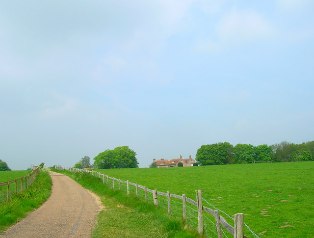
Cophall Wood is a picturesque woodland located in Sussex, England. Spanning over 200 acres, it is a popular destination for nature enthusiasts and outdoor lovers. The wood is situated near the village of Copthorne, approximately 8 miles east of Crawley.

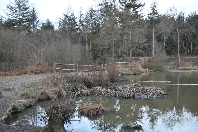
Cophall Wood is a diverse ecosystem, home to a wide variety of flora and fauna. Walking through the wood, visitors can expect to see ancient oak and beech trees, providing a dense canopy that creates a tranquil and enchanting atmosphere. Bluebells carpet the forest floor in spring, creating a stunning display of color. Other plants such as wild garlic, primroses, and ferns can also be spotted throughout the wood.

The woodland is known for its rich biodiversity, attracting a range of wildlife. Birdwatchers can enjoy the sight of various species, including woodpeckers, tawny owls, and nuthatches. Squirrels, foxes, and even deer can also be spotted in the area.

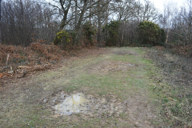
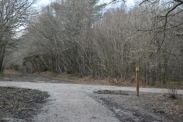
Cophall Wood offers a network of well-maintained footpaths and trails, making it ideal for leisurely walks, jogging, and dog walking. The wood is also a popular spot for picnics, with several designated areas equipped with benches and tables.

Managed by the Woodland Trust, Cophall Wood is dedicated to conservation and preservation. The trust actively works to maintain the wood's natural beauty, allowing visitors to enjoy its tranquility and natural charm.

If you have any feedback on the listing, please let us know in the comments section below.

Cophall Wood Images

Images are sourced within 2km of 50.837273/0.23755776 or Grid Reference TQ5706. Thanks to Geograph Open Source API. All images are credited.

Pond and dam in Abbot's Wood
End of forest track, Abbot's Wood
Path junction in Abbot's Wood
Road Junction Lewes Road A27 The A27 runs 103 miles from Whiteparish near Salisbury to Pevensey near Eastbourne. It runs parallel with the south coast and the South Downs. <span class="nowrap"><a title="http://www.sabre-roads.org.uk/wiki/index.php?title=A27" rel="nofollow ugc noopener" href="http://www.sabre-roads.org.uk/wiki/index.php?title=A27">Link</a><img style="margin-left:2px;" alt="External link" title="External link - shift click to open in new window" src="https://s1.geograph.org.uk/img/external.png" width="10" height="10"/></span>
Road Junction Lewes Road A27
The A27 runs 103 miles from Whiteparish near Salisbury to Pevensey near Eastbourne. It runs parallel with the south coast and the South Downs. LinkExternal link
Footpath Junction in Abbot's Wood Abbot's Wood is a mixed woodland of approximately 360 hectares, offering waymarked forest trails, an adventure play area and barbecue/picnic area. <span class="nowrap"><a title="http://www.forestry.gov.uk/website/Recreation.nsf/LUwebdocsBykey/EnglandEastSussexAbbotsWood" rel="nofollow ugc noopener" href="http://www.forestry.gov.uk/website/Recreation.nsf/LUwebdocsBykey/EnglandEastSussexAbbotsWood">Link</a><img style="margin-left:2px;" alt="External link" title="External link - shift click to open in new window" src="https://s1.geograph.org.uk/img/external.png" width="10" height="10"/></span>
Footpath Junction in Abbot's Wood
Abbot's Wood is a mixed woodland of approximately 360 hectares, offering waymarked forest trails, an adventure play area and barbecue/picnic area. LinkExternal link
Polegate Road, Hailsham
The Cottage Restaurant, Hailsham
Abbot's Amble Trail, Abbots Wood, Arlington, Abbot's Wood is a mixed woodland of approximately 360 hectares, offering waymarked forest trails, an adventure play area and barbecue/picnic area. <span class="nowrap"><a title="http://www.forestry.gov.uk/website/Recreation.nsf/LUwebdocsBykey/EnglandEastSussexAbbotsWood" rel="nofollow ugc noopener" href="http://www.forestry.gov.uk/website/Recreation.nsf/LUwebdocsBykey/EnglandEastSussexAbbotsWood">Link</a><img style="margin-left:2px;" alt="External link" title="External link - shift click to open in new window" src="https://s1.geograph.org.uk/img/external.png" width="10" height="10"/></span>
Abbot's Amble Trail, Abbots Wood, Arlington,
Abbot's Wood is a mixed woodland of approximately 360 hectares, offering waymarked forest trails, an adventure play area and barbecue/picnic area. LinkExternal link
Row of shops, Station Road, Polegate On a grey July morning.
Row of shops, Station Road, Polegate
On a grey July morning.
Polegate sorting office The wide pavement along Station Road.
Polegate sorting office
The wide pavement along Station Road.
Polegate Station Polegate Station is on the East Coastway Line. The original station opened in 1846, it was re-sited in 1881, see <a href="https://www.geograph.org.uk/photo/2418172">TQ5804 : The old station at Polegate</a>. The present station was built in 1986 on the site of the original station
Wikipedia: <span class="nowrap"><a title="http://en.wikipedia.org/wiki/Polegate_railway_station" rel="nofollow ugc noopener" href="http://en.wikipedia.org/wiki/Polegate_railway_station">Link</a><img style="margin-left:2px;" alt="External link" title="External link - shift click to open in new window" src="https://s1.geograph.org.uk/img/external.png" width="10" height="10"/></span>
Polegate Station
Polegate Station is on the East Coastway Line. The original station opened in 1846, it was re-sited in 1881, see TQ5804 : The old station at Polegate. The present station was built in 1986 on the site of the original station Wikipedia: LinkExternal link
High St
High St
Polegate Station Polegate Station is on the East Coastway Line. The original station opened in 1846, it was re-sited in 1881, see <a href="https://www.geograph.org.uk/photo/2418172">TQ5804 : The old station at Polegate</a>. The present station was built in 1986 on the site of the original station
Wikipedia: <span class="nowrap"><a title="http://en.wikipedia.org/wiki/Polegate_railway_station" rel="nofollow ugc noopener" href="http://en.wikipedia.org/wiki/Polegate_railway_station">Link</a><img style="margin-left:2px;" alt="External link" title="External link - shift click to open in new window" src="https://s1.geograph.org.uk/img/external.png" width="10" height="10"/></span>
Polegate Station
Polegate Station is on the East Coastway Line. The original station opened in 1846, it was re-sited in 1881, see TQ5804 : The old station at Polegate. The present station was built in 1986 on the site of the original station Wikipedia: LinkExternal link
High St, Polegate
High St, Polegate
Allotments, Polegate
Looking from Church Road across the High Street towards Old Drive
Show me another place!

Cophall Wood is located at Grid Ref: TQ5706 (Lat: 50.837273, Lng: 0.23755776)

Administrative County: East Sussex

District: Wealden

Police Authority: Sussex

What 3 Words

///abode.drop.corporate. Near Hailsham, East Sussex

Related Wikis

Cuckoo Line

The Cuckoo Line is an informal name for the now defunct railway service which linked Polegate and Eridge in East Sussex, England, from 1880 to 1968. It...

Otham Abbey

Otham Abbey was a medieval monastic house in Polegate, East Sussex, England. == History == Otham Abbey was founded about 1180 by Ralph de Dene as the Abbey...

Otham Feed

Otham Feed is a minor, 532-metre (1,745 ft) long river (brook) and drainage ditch of the Pevensey Levels in the civil parish of Westham, Wealden District...

Wootton Manor

Wootton Manor is a country house in Folkington, East Sussex. Originally a mediaeval manor house, from which parts of the chapel survive, it was rebuilt...

Polegate

Polegate is a town and civil parish in the Wealden District of East Sussex, England, United Kingdom. It is located five miles (8 km) north of the seaside...

Polegate railway station

Polegate railway station serves Polegate in East Sussex, England. It is on the East Coastway Line, 61 miles 39 chains (99.0 km) from London Bridge, and...

Downwash Ditch

Downwash Ditch is a 1.4-kilometre (0.87 mi) long river (brook) and drainage ditch of the Pevensey Levels in the civil parish of Hailsham, Wealden District...

St George's Church, Polegate

St George's Church is a Roman Catholic church of the parish of Hailsham and Polegate serving the town of Polegate in the Wealden district of East Sussex...

Nearby Amenities

Located within 500m of 50.837273,0.23755776
Give Way
Direction: forward
Lat/Long: 50.834507/0.2385724
Rhino Removals
Addr City: Polegate
Addr Postcode: BN26 6RE
Office: yes
Lat/Long: 50.8375937/0.2442232
Give Way
Direction: forward
Lat/Long: 50.8356036/0.2386993
The data included in this document is from www.openstreetmap.org. The data is made available under ODbL.

Have you been to Cophall Wood?

Leave your review of Cophall Wood below (or comments, questions and feedback).