Saxonbury Wood

Wood, Forest in Sussex Wealden

England

Saxonbury Wood

Footpath to Brickyard Lane This is the footpath from Mark Cross to Brickyard Lane where it passes through a small woodland.
Footpath to Brickyard Lane Credit: Marathon

Saxonbury Wood is a charming forest located in the county of Sussex, England. Covering an area of approximately 100 hectares, the wood is a haven for nature enthusiasts and a popular destination for locals and tourists alike.

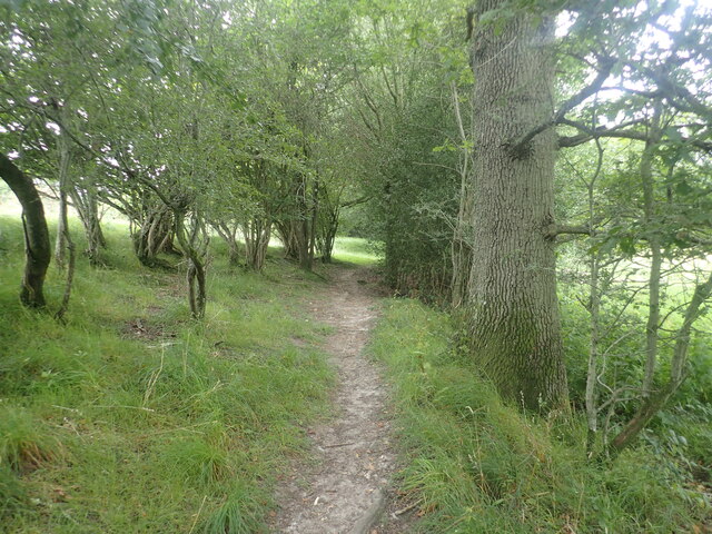
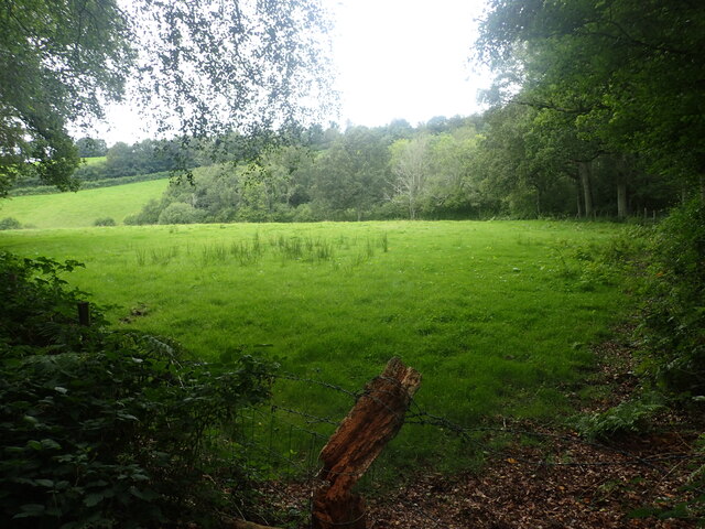
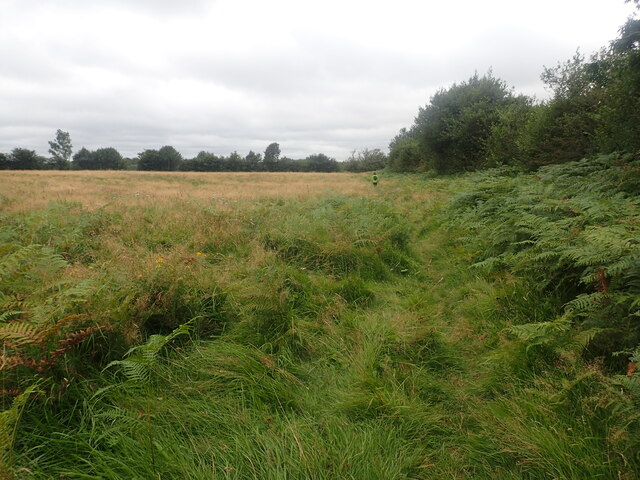
The wood is characterized by its diverse range of tree species, including oak, beech, and birch, which create a picturesque landscape throughout the year. In spring, the woodland floor comes alive with a vibrant carpet of bluebells, adding a touch of enchantment to the surroundings.

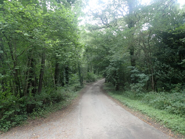
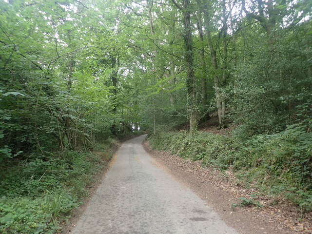
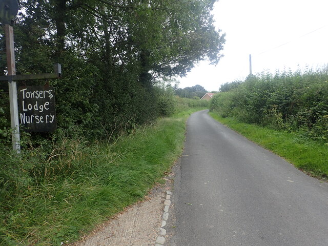
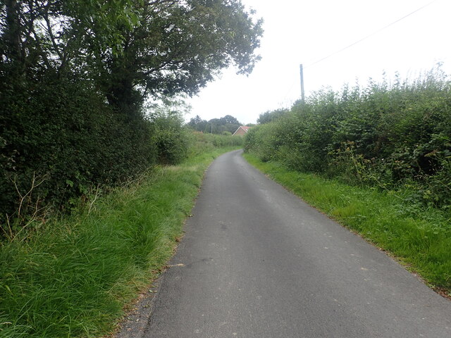
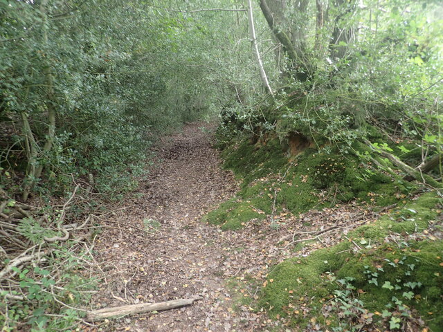
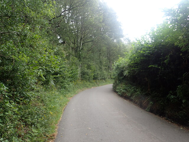
Saxonbury Wood offers a variety of walking trails that wind through its dense foliage, providing visitors with an opportunity to immerse themselves in the natural beauty of the area. The trails are well-maintained and suitable for all abilities, making it an ideal destination for families and individuals seeking a peaceful escape from the hustle and bustle of everyday life.

The wood is also home to a rich array of wildlife, including deer, foxes, and a plethora of bird species. Birdwatchers will be delighted by the chance to spot rare and migratory birds amidst the tranquil surroundings.

On the outskirts of the wood, there is a small visitor center where visitors can obtain information about the area, including maps, guides, and any current events or activities taking place. The center also hosts educational programs and events for schools and local communities, further promoting the appreciation and conservation of the woodland ecosystem.

Overall, Saxonbury Wood is a true gem in the Sussex countryside, offering a serene escape for nature lovers and a valuable habitat for a diverse range of flora and fauna.

If you have any feedback on the listing, please let us know in the comments section below.

Saxonbury Wood Images

Images are sourced within 2km of 51.076292/0.24678605 or Grid Reference TQ5733. Thanks to Geograph Open Source API. All images are credited.

Footpath to Brickyard Lane This is the footpath from Mark Cross to Brickyard Lane where it passes through a small woodland.
Footpath to Brickyard Lane
This is the footpath from Mark Cross to Brickyard Lane where it passes through a small woodland.
Brickyard Lane Brickyard Lane drops down ahead to cross a stream which is a tributary of Eridge Brook. Entryhill Wood is to the left.
Brickyard Lane
Brickyard Lane drops down ahead to cross a stream which is a tributary of Eridge Brook. Entryhill Wood is to the left.
View from the edge of Card's Wood The footpath from Brickyard Lane through Card's Wood emerges here, just before Blackdown Lane is reached.
View from the edge of Card's Wood
The footpath from Brickyard Lane through Card's Wood emerges here, just before Blackdown Lane is reached.
The Deer Park Campsite This is just outside the Deer Park Cafe.
The Deer Park Campsite
This is just outside the Deer Park Cafe.
The Tunbridge Wells Circular Walk passes through Eridge Park The current Georgian-style house of Eridge Park was built in the late 1930s to replace the neo-Gothic Eridge Castle that had been inspired by Strawberry Hill House in Twickenham. The Castle had been begun in 1787. Eridge Park is said to be the oldest enclosed deer park in the country. The lakes were created in the 16th century to hold water to power iron works on the estate.
The Tunbridge Wells Circular Walk passes through Eridge Park
The current Georgian-style house of Eridge Park was built in the late 1930s to replace the neo-Gothic Eridge Castle that had been inspired by Strawberry Hill House in Twickenham. The Castle had been begun in 1787. Eridge Park is said to be the oldest enclosed deer park in the country. The lakes were created in the 16th century to hold water to power iron works on the estate.
Lake in Eridge Park The current Georgian-style house of Eridge Park was built in the late 1930s to replace the neo-Gothic Eridge Castle that had been inspired by Strawberry Hill House in Twickenham. The Castle had been begun in 1787. Eridge Park is said to be the oldest enclosed deer park in the country. The lakes were created in the 16th century to hold water to power iron works on the estate.

This view is from the Tunbridge Wells Circular Walk where it passes through the park.
Lake in Eridge Park
The current Georgian-style house of Eridge Park was built in the late 1930s to replace the neo-Gothic Eridge Castle that had been inspired by Strawberry Hill House in Twickenham. The Castle had been begun in 1787. Eridge Park is said to be the oldest enclosed deer park in the country. The lakes were created in the 16th century to hold water to power iron works on the estate. This view is from the Tunbridge Wells Circular Walk where it passes through the park.
The Tunbridge Wells Circular Walk passes through Eridge Park The current Georgian-style house of Eridge Park was built in the late 1930s to replace the neo-Gothic Eridge Castle that had been inspired by Strawberry Hill House in Twickenham. The Castle had been begun in 1787. Eridge Park is said to be the oldest enclosed deer park in the country. The lakes were created in the 16th century to hold water to power iron works on the estate.
The Tunbridge Wells Circular Walk passes through Eridge Park
The current Georgian-style house of Eridge Park was built in the late 1930s to replace the neo-Gothic Eridge Castle that had been inspired by Strawberry Hill House in Twickenham. The Castle had been begun in 1787. Eridge Park is said to be the oldest enclosed deer park in the country. The lakes were created in the 16th century to hold water to power iron works on the estate.
Outflow from the lake in Eridge Park The current Georgian-style house of Eridge Park was built in the late 1930s to replace the neo-Gothic Eridge Castle that had been inspired by Strawberry Hill House in Twickenham. The Castle had been begun in 1787. Eridge Park is said to be the oldest enclosed deer park in the country. The lakes were created in the 16th century to hold water to power iron works on the estate.

This view is from the Tunbridge Wells Circular Walk where it passes through the park. See <a title="https://www.geograph.org.uk/photo/6950791" href="https://www.geograph.org.uk/photo/6950791">Link</a>  for a view of the lake.
Outflow from the lake in Eridge Park
The current Georgian-style house of Eridge Park was built in the late 1930s to replace the neo-Gothic Eridge Castle that had been inspired by Strawberry Hill House in Twickenham. The Castle had been begun in 1787. Eridge Park is said to be the oldest enclosed deer park in the country. The lakes were created in the 16th century to hold water to power iron works on the estate. This view is from the Tunbridge Wells Circular Walk where it passes through the park. See Link for a view of the lake.
The Tunbridge Wells Circular Walk passes through Eridge Park The current Georgian-style house of Eridge Park was built in the late 1930s to replace the neo-Gothic Eridge Castle that had been inspired by Strawberry Hill House in Twickenham. The Castle had been begun in 1787. Eridge Park is said to be the oldest enclosed deer park in the country. The lakes were created in the 16th century to hold water to power iron works on the estate.
The Tunbridge Wells Circular Walk passes through Eridge Park
The current Georgian-style house of Eridge Park was built in the late 1930s to replace the neo-Gothic Eridge Castle that had been inspired by Strawberry Hill House in Twickenham. The Castle had been begun in 1787. Eridge Park is said to be the oldest enclosed deer park in the country. The lakes were created in the 16th century to hold water to power iron works on the estate.
Oast house at Great Hedges Farm This view is from a bridleway leading up from Brickyard Lane. For more information about the oast and for a photograph on a better day see <a title="https://www.geograph.org.uk/photo/1803085" href="https://www.geograph.org.uk/photo/1803085">Link</a>
Oast house at Great Hedges Farm
This view is from a bridleway leading up from Brickyard Lane. For more information about the oast and for a photograph on a better day see Link
Brickyard Lane Entryhill Wood is to the right. A footpath from Mark Cross crosses the road here. For the view in the other direction see <a title="https://www.geograph.org.uk/photo/6950574" href="https://www.geograph.org.uk/photo/6950574">Link</a>
Brickyard Lane
Entryhill Wood is to the right. A footpath from Mark Cross crosses the road here. For the view in the other direction see Link
Brickyard Lane The A267 and Mark Cross are reached just ahead.
Brickyard Lane
The A267 and Mark Cross are reached just ahead.
Brickyard Lane The A267 and Mark Cross are reached just ahead.
Brickyard Lane
The A267 and Mark Cross are reached just ahead.
Footpath to Brickyard Lane This is the footpath from Mark Cross to Brickyard Lane just before Stonehouse Farm is reached.
Footpath to Brickyard Lane
This is the footpath from Mark Cross to Brickyard Lane just before Stonehouse Farm is reached.
Footpath into Card's Wood This is just after the footpath leaves Cowford Bridge Lane near the crossroads with Eridge Lane and Hackdon Hill.
Footpath into Card's Wood
This is just after the footpath leaves Cowford Bridge Lane near the crossroads with Eridge Lane and Hackdon Hill.
Cowford Bridge Lane near Card's Wood This is just east of the crossroads with Eridge Lane and Hackdon Hill. A footpath leaves on the left just ahead and heads into Card's Wood - see <a title="https://www.geograph.org.uk/photo/6951285" href="https://www.geograph.org.uk/photo/6951285">Link</a>
Cowford Bridge Lane near Card's Wood
This is just east of the crossroads with Eridge Lane and Hackdon Hill. A footpath leaves on the left just ahead and heads into Card's Wood - see Link
The Sussex Border Path heading towards Stitches Farm Beyond the farm, the Sussex Border Path drops down to the valley of the Eridge Brook which also carries the Uckfield Line between Eridge and Crowborough. See <span class="nowrap"><a title="https://www.walkingenglishman.com/ldp/sussexborderpath.html" rel="nofollow ugc noopener" href="https://www.walkingenglishman.com/ldp/sussexborderpath.html">Link</a><img style="margin-left:2px;" alt="External link" title="External link - shift click to open in new window" src="https://s1.geograph.org.uk/img/external.png" width="10" height="10"/></span>
The Sussex Border Path heading towards Stitches Farm
Beyond the farm, the Sussex Border Path drops down to the valley of the Eridge Brook which also carries the Uckfield Line between Eridge and Crowborough. See LinkExternal link
The Sussex Border Path on the way to Stitches Farm Beyond the farm, the Sussex Border Path drops down to the valley of the Eridge Brook which also carries the Uckfield Line between Eridge and Crowborough. See <span class="nowrap"><a title="https://www.walkingenglishman.com/ldp/sussexborderpath.html" rel="nofollow ugc noopener" href="https://www.walkingenglishman.com/ldp/sussexborderpath.html">Link</a><img style="margin-left:2px;" alt="External link" title="External link - shift click to open in new window" src="https://s1.geograph.org.uk/img/external.png" width="10" height="10"/></span>
The Sussex Border Path on the way to Stitches Farm
Beyond the farm, the Sussex Border Path drops down to the valley of the Eridge Brook which also carries the Uckfield Line between Eridge and Crowborough. See LinkExternal link
Show me another place!

Saxonbury Wood is located at Grid Ref: TQ5733 (Lat: 51.076292, Lng: 0.24678605)

Administrative County: East Sussex

District: Wealden

Police Authority: Sussex

What 3 Words

///snack.unheated.request. Near Town Row, East Sussex

Nearby Locations

Saxonbury Wood Rocks Wood

Related Wikis

Eridge Park

Eridge Park () is a village and historic park located north of the parish of Rotherfield, to the north-east of Crowborough in East Sussex, England. The...

Walter's Mill, Mark Cross

Walter's Mill is a tower mill at Mark Cross, Sussex, England which has been converted to residential accommodation. == History == Walter's Mill was first...

St Joseph's College, Mark Cross

St Joseph's College was a Roman Catholic minor seminary in Mark Cross, outside Rotherfield in East Sussex. It was designed by Edward Pugin and the site...

Jameah Islameah School

Jameah Islameah School was an independent Islamic school in East Sussex. The school was located on a 54 acre site and had residential facilities to house...

Frant

Frant is a village and civil parish in the Wealden District of East Sussex, England, on the Kentish border about three miles (5 km) south of Royal Tunbridge...

St Alban's Church, Frant

St Alban's Church is a Church of England parish church in Frant, East Sussex, England. It was built in 1819–22 in a fifteenth-century gothic revival style...

Rotherfield and Mark Cross railway station

Rotherfield and Mark Cross (also Rotherfield) is the name of a closed station on the Eridge - Heathfield - Polegate railway (the Cuckoo Line) in East Sussex...

Bowles Rocks

Bowles Rocks is a sandstone crag in the county of East Sussex, on the border with Kent, approximately 8 kilometres (5 mi) south of the town of Royal Tunbridge...

Have you been to Saxonbury Wood?

Leave your review of Saxonbury Wood below (or comments, questions and feedback).