Whortleberry Wood

Wood, Forest in Kent Tunbridge Wells

England

Whortleberry Wood

Crendon Road in Southborough A view along Crendon Road looking towards Yew Tree Road in Southborough in Kent.
Crendon Road in Southborough Credit: John P Reeves

Whortleberry Wood is a charming woodland area located in Kent, England. Covering an area of approximately 100 acres, it is known for its rich biodiversity and picturesque landscapes. The wood is situated on gently sloping terrain, with a mix of mature trees including oak, beech, and birch, creating a dense canopy that provides shade and shelter for a variety of wildlife.

One of the notable features of Whortleberry Wood is the presence of whortleberries, a type of wild blueberry that grows abundantly in the area. These small, sweet fruits are a favorite among visitors who often enjoy picking them during the summer months. In addition to whortleberries, the wood is also home to a wide range of other flora, such as ferns, mosses, and wildflowers, which add to its natural beauty.

The wood is a haven for nature enthusiasts and offers a range of recreational activities. There are well-maintained walking trails that wind through the wood, allowing visitors to explore its diverse habitats and observe the local wildlife. Birdwatching is particularly popular, as Whortleberry Wood is home to a variety of species, including woodpeckers, owls, and warblers.

Managed by the local conservation trust, Whortleberry Wood is kept in a pristine condition, ensuring the preservation of its natural habitats and species. The wood also plays an important role in the local ecosystem, acting as a buffer zone between urban areas and the nearby countryside.

Overall, Whortleberry Wood is a delightful destination for nature lovers, offering a tranquil escape from the hustle and bustle of daily life. Its scenic beauty and diverse wildlife make it a must-visit location for anyone seeking a peaceful and immersive natural experience in the heart of Kent.

If you have any feedback on the listing, please let us know in the comments section below.

Whortleberry Wood Images

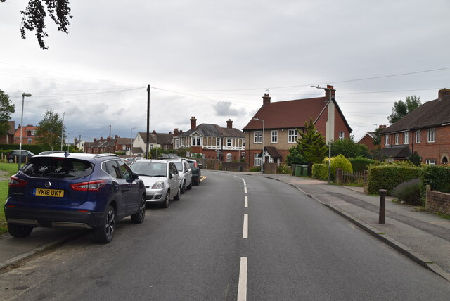
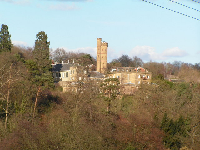
Images are sourced within 2km of 51.163118/0.24898625 or Grid Reference TQ5742. Thanks to Geograph Open Source API. All images are credited.

Crendon Road in Southborough A view along Crendon Road looking towards Yew Tree Road in Southborough in Kent.
Crendon Road in Southborough
A view along Crendon Road looking towards Yew Tree Road in Southborough in Kent.
Cunningham Rd meets Powdermill Lane
Powdermill Lane
Powdermill Lane
Chestnut Avenue
Chestnut Avenue
Chestnut Avenue
Chestnut Avenue
Southfields
Southfields
Yew Tree Rd
Yew Tree Rd
The Ridgewaye
The Ridgewaye
The Ridgewaye
The Ridgewaye
The Ridgewaye
The Ridgewaye
End of The Ridgewaye
Footpath to Pennington Rd
Pennington Place
Pennington Place
The Oast Single round kiln oast house. Sussex blinkered cowl.
The Oast
Single round kiln oast house. Sussex blinkered cowl.
Valley View
Valley View
Colonel's Way
Colonel's Way
Fernhurst Crescent
Fernhurst Crescent
Fernhurst Crescent
Fernhurst Crescent
Show me another place!

Whortleberry Wood is located at Grid Ref: TQ5742 (Lat: 51.163118, Lng: 0.24898625)

Administrative County: Kent

District: Tunbridge Wells

Police Authority: Kent

What 3 Words

///began.croutons.clocks. Near Speldhurst, Kent

Related Wikis

Related Videos

High Brooms, Kent | മലയാളം ട്രാവൽ വ്‌ളോഗ് | Travel With Anjana

Grosvenor and Hilbert Park : Grosvenor and Hilbert is one of the town's oldest public parks designed by the renowned Victorian ...

Fart Ninjas

Farting until the battery runs out.

England 🏴󠁧󠁢󠁥󠁮󠁧󠁿: Kent Walks | Haysden Country Park in Tonbridge

A short hike exploring Haysden Country Park, including Barden Lake, in Tonbridge on a lovely spring morning Filmed with my DJI ...

Nearby Amenities

Located within 500m of 51.163118,0.24898625
Speed Camera
Maxspeed: 30 mph
Lat/Long: 51.163032/0.2544317
Restaurant
Hand and Sceptre
Cuisine: regional
Lat/Long: 51.1638177/0.2538175
Bus Stop
Birchwood Avenue
Naptan AtcoCode: 2400A007970A
Naptan Bearing: S
Naptan CommonName: Birchwood Avenue
Naptan Indicator: opp
Naptan Landmark: Birchwood Avenue
Naptan NaptanCode: kntajpjw
Naptan PlusbusZoneRef: TONBDG
Naptan Street: London Road
Naptan Verified: no
Public Transport: platform
Source: naptan_import
Lat/Long: 51.1649616/0.2528853
Bus Stop
The Fountain
Naptan AtcoCode: 2400A007980A
Naptan Bearing: S
Naptan CommonName: The Fountain
Naptan Indicator: adj
Naptan Landmark: Nr The Fountain Ph
Naptan NaptanCode: kntajpma
Naptan PlusbusZoneRef: TONBDG;TUNWELL
Naptan Street: London Road
Naptan Verified: no
Public Transport: platform
Source: naptan_import
Lat/Long: 51.1621132/0.2557402
Bus Stop
The Fountain
Naptan AtcoCode: 2400A008210A
Naptan Bearing: N
Naptan CommonName: The Fountain
Naptan Indicator: opp
Naptan Landmark: Opp The Fountain
Naptan NaptanCode: kntajtaj
Naptan PlusbusZoneRef: TONBDG;TUNWELL
Naptan Street: London Road
Naptan Verified: no
Public Transport: platform
Source: naptan_import
Lat/Long: 51.1624925/0.2550325
Bus Stop
Birchwood Avenue
Bench: no
Bin: no
Naptan AtcoCode: 2400A008220A
Naptan Bearing: N
Naptan CommonName: Birchwood Avenue
Naptan Indicator: adj
Naptan Landmark: Birchwood Avenue
Naptan NaptanCode: kntajtam
Naptan PlusbusZoneRef: TONBDG
Naptan Street: London Road
Naptan Verified: no
Public Transport: platform
Shelter: no
Source: naptan_import
Lat/Long: 51.1658275/0.2525744
Turning Circle
Lat/Long: 51.1655567/0.2484936
Noexit: yes
Lat/Long: 51.1659089/0.2542613
Barrier: kissing_gate
Lat/Long: 51.165391/0.2430461
Barrier: stile
Lat/Long: 51.160832/0.2452026
Barrier: kissing_gate
Material: metal
Lat/Long: 51.1615573/0.2449435
Barrier: kissing_gate
Material: metal
Lat/Long: 51.1625538/0.2437217
Barrier: kissing_gate
Material: metal
Lat/Long: 51.1637091/0.2429007
Bench
Lat/Long: 51.1624291/0.2550655
Bench
Lat/Long: 51.1636671/0.2531853
Historic: memorial
Lat/Long: 51.163911/0.2529251
Bench
Lat/Long: 51.1636738/0.2531316
Bench
Lat/Long: 51.1636788/0.2530753
Fountain
Note: looks like it has been converted into lampost
Lat/Long: 51.1623787/0.2551594
Post Box
Operator: Royal Mail
Post Box Type: pillar
Ref: TN4 312
Royal Cypher: GVIR
Royal Cypher Wikidata: Q33102169
Lat/Long: 51.1667477/0.2485467
Post Box
Operator: Royal Mail
Post Box Type: lamp
Ref: TN4 47D
Royal Cypher: EIIR
Royal Cypher Wikidata: Q33102113
Lat/Long: 51.1653391/0.2521762
Social Facility
Fountains Lodge Care Home
Social Facility: assisted_living
Social Facility For: senior
Lat/Long: 51.1651999/0.2533105
Peter Hoare
Addr Housenumber: 14
Contact Website: http://phantiques.co.uk/
Shop: antiques
Lat/Long: 51.1624956/0.2546785
Tallow
Addr Housenumber: 15a
Lat/Long: 51.1624448/0.2547547
Generator Method: photovoltaic
Generator Output Electricity: yes
Generator Source: solar
Generator Type: solar_photovoltaic_panel
Location: roof
Power: generator
Lat/Long: 51.1663251/0.2465326
Generator Method: photovoltaic
Generator Output Electricity: yes
Generator Source: solar
Generator Type: solar_photovoltaic_panel
Location: roof
Power: generator
Lat/Long: 51.1665455/0.2512586
Generator Method: photovoltaic
Generator Output Electricity: yes
Generator Source: solar
Generator Type: solar_photovoltaic_panel
Location: roof
Power: generator
Lat/Long: 51.1669323/0.2492523
Generator Method: photovoltaic
Generator Output Electricity: yes
Generator Source: solar
Generator Type: solar_photovoltaic_panel
Location: roof
Power: generator
Lat/Long: 51.1653143/0.2512532
Generator Method: photovoltaic
Generator Output Electricity: yes
Generator Source: solar
Generator Type: solar_photovoltaic_panel
Location: roof
Power: generator
Lat/Long: 51.1653564/0.2514195
Generator Method: photovoltaic
Generator Output Electricity: yes
Generator Source: solar
Generator Type: solar_photovoltaic_panel
Location: roof
Power: generator
Lat/Long: 51.1653833/0.2515268
Generator Method: photovoltaic
Generator Output Electricity: yes
Generator Source: solar
Generator Type: solar_photovoltaic_panel
Location: roof
Power: generator
Lat/Long: 51.1652807/0.2532166
Generator Method: photovoltaic
Generator Output Electricity: yes
Generator Source: solar
Generator Type: solar_photovoltaic_panel
Location: roof
Power: generator
Lat/Long: 51.164364/0.2542895
Generator Method: photovoltaic
Generator Output Electricity: yes
Generator Source: solar
Generator Type: solar_photovoltaic_panel
Location: roof
Power: generator
Lat/Long: 51.1643539/0.2541259
Noexit: yes
Lat/Long: 51.1656507/0.2540173
The data included in this document is from www.openstreetmap.org. The data is made available under ODbL.

Have you been to Whortleberry Wood?

Leave your review of Whortleberry Wood below (or comments, questions and feedback).