Cadenham Plantation

Wood, Forest in Cambridgeshire East Cambridgeshire

England

Cadenham Plantation

Farmland at Commercial End
Farmland at Commercial End Credit: Mr Ignavy

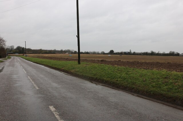
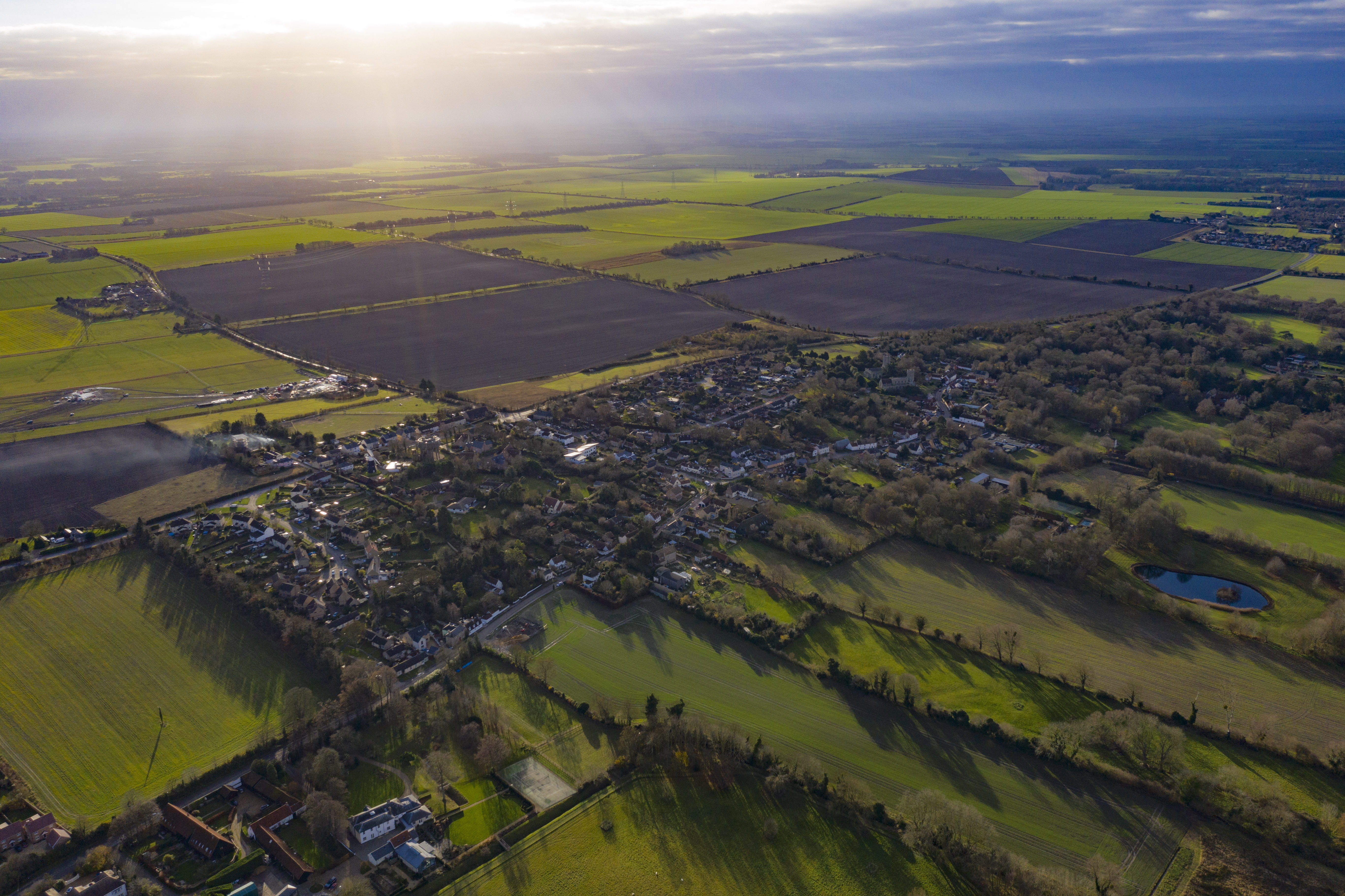
Cadenham Plantation is a picturesque woodland area located in the county of Cambridgeshire, England. Covering a vast expanse of approximately 500 acres, this beautiful plantation is known for its dense forest and diverse range of tree species. Situated near the town of Cadenham, the plantation is easily accessible and attracts nature enthusiasts, hikers, and families alike.

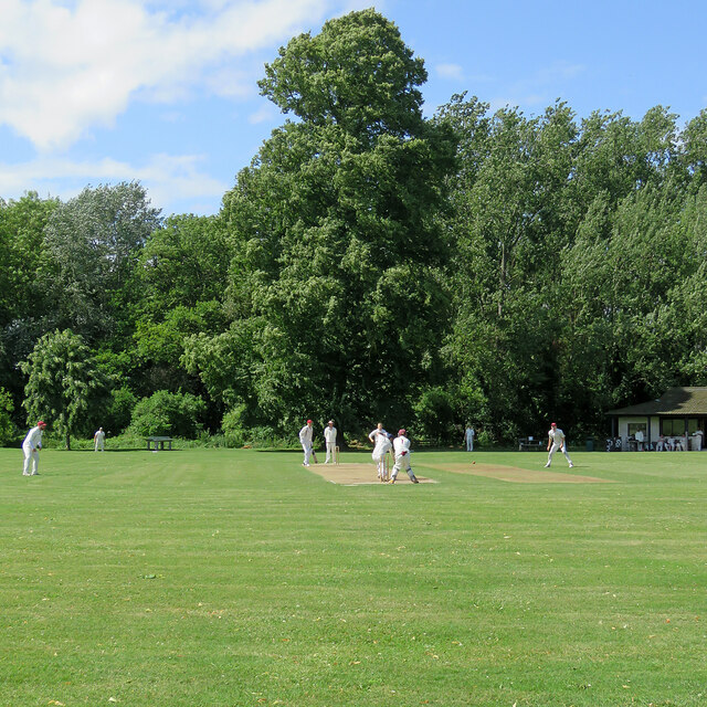
The woodland is primarily composed of deciduous trees, such as oak, beech, and ash, which create a lush and vibrant landscape throughout the year. These trees, some of which are several centuries old, provide a sanctuary for various wildlife species, including deer, foxes, and a wide variety of birds.

Cadenham Plantation offers a network of well-maintained footpaths and trails, allowing visitors to explore the area and experience its natural beauty up close. The paths wind through the forest, leading to hidden clearings and peaceful ponds, adding to the charm of the plantation.

In addition to its natural splendor, Cadenham Plantation also boasts a rich history. It is believed to have been part of a larger estate during the medieval period, with remnants of old structures and boundaries still visible today. The plantation has been managed by the local council for conservation purposes, ensuring the preservation of its ecological importance and historical significance.

With its tranquil atmosphere and breathtaking scenery, Cadenham Plantation offers a serene escape from the hustle and bustle of everyday life. Whether it's a leisurely walk, birdwatching, or simply enjoying the beauty of nature, this enchanting woodland is a must-visit destination for anyone seeking solace in Cambridgeshire's natural wonders.

If you have any feedback on the listing, please let us know in the comments section below.

Cadenham Plantation Images

Images are sourced within 2km of 52.242425/0.29912179 or Grid Reference TL5762. Thanks to Geograph Open Source API. All images are credited.
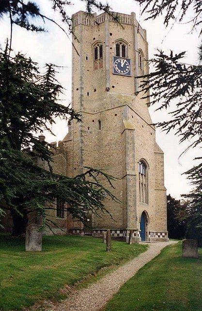
Farmland at Commercial End
Heath Road, Swaffham Bulbeck This is typical fen scenery.
Heath Road, Swaffham Bulbeck
This is typical fen scenery.
Field by Heath Road, Swaffham Bulbeck
Mill Hill, Swaffham Prior
Swaffham Prior: a view from the churchyard The houses are some of many listed buildings in the village. The one on the left was the home of the poet Edwin Muir, who with his wife Willa was a distinguished translator of Kafka. Both are buried in Swaffham Prior churchyard: see <a href="https://www.geograph.org.uk/photo/2334831">TL5663 : Swaffham Prior: the grave of the poet Edwin Muir (1887-1959)</a>.
Swaffham Prior: a view from the churchyard
The houses are some of many listed buildings in the village. The one on the left was the home of the poet Edwin Muir, who with his wife Willa was a distinguished translator of Kafka. Both are buried in Swaffham Prior churchyard: see TL5663 : Swaffham Prior: the grave of the poet Edwin Muir (1887-1959).
Swaffham Prior: St Mary Swaffham Prior is a fen-edge village and its two churches stand on a little hill on the edge of the chalklands of Newmarket Heath. (The other, St Cyriac and St Julitta, a little way to the right, in the same churchyard, is redundant and used for local events.)

St Mary's tower is rather splendid, with a square Norman base, followed by an octagonal stage, also Norman ("So there was an octagonal tower in Cambridgeshire long before the Ely octagon was designed" - Nikolaus Pevsner). For Pevsner, the thrill was the upper stage, which is sixteen-sided, though at the time of his visit in 1953 it was ruinous. This may be of interest: <a href="https://www.geograph.org.uk/photo/4302254">TL5663 : Swaffham Prior: St Mary - inside the tower</a>.

Robin Webster's <a href="https://www.geograph.org.uk/photo/5064900">TL5663 : Swaffham Prior - two churches, three saints</a> shows both churches.
Swaffham Prior: St Mary
Swaffham Prior is a fen-edge village and its two churches stand on a little hill on the edge of the chalklands of Newmarket Heath. (The other, St Cyriac and St Julitta, a little way to the right, in the same churchyard, is redundant and used for local events.) St Mary's tower is rather splendid, with a square Norman base, followed by an octagonal stage, also Norman ("So there was an octagonal tower in Cambridgeshire long before the Ely octagon was designed" - Nikolaus Pevsner). For Pevsner, the thrill was the upper stage, which is sixteen-sided, though at the time of his visit in 1953 it was ruinous. This may be of interest: TL5663 : Swaffham Prior: St Mary - inside the tower. Robin Webster's TL5663 : Swaffham Prior - two churches, three saints shows both churches.
Swaffham Prior: excavations for a heating scheme To reduce dependency on central-heating oil, Swaffham Prior is to have a 100% renewable heat network, using air- and ground-source heat pumps.

For more about the scheme, try <span class="nowrap"><a title="https://heatingswaffhamprior.co.uk/about/" rel="nofollow ugc noopener" href="https://heatingswaffhamprior.co.uk/about/">Link</a><img style="margin-left:2px;" alt="External link" title="External link - shift click to open in new window" src="https://s1.geograph.org.uk/img/external.png" width="10" height="10"/></span>.
Swaffham Prior: excavations for a heating scheme
To reduce dependency on central-heating oil, Swaffham Prior is to have a 100% renewable heat network, using air- and ground-source heat pumps. For more about the scheme, try LinkExternal link.
Swaffham Bulbeck: Commercial End Commercial End was, until the arrival of the railway in 1884, a river port, connected to the River Cam by Swaffham Bulbeck Lode. The buildings to the left of the terrace, a warehouse and The Merchant's House, are some of many Grade II listed buildings in the village.

<a href="https://www.geograph.org.uk/photo/6486492">TL5563 : Swaffham Bulbeck: the north end of Commercial End</a>
<a href="https://www.geograph.org.uk/photo/6486481">TL5563 : Swaffham Bulbeck: The Merchant's House, Commercial End</a>
Swaffham Bulbeck: Commercial End
Commercial End was, until the arrival of the railway in 1884, a river port, connected to the River Cam by Swaffham Bulbeck Lode. The buildings to the left of the terrace, a warehouse and The Merchant's House, are some of many Grade II listed buildings in the village. TL5563 : Swaffham Bulbeck: the north end of Commercial End TL5563 : Swaffham Bulbeck: The Merchant's House, Commercial End
Swaffham Bulbeck: pollarded trees near Cow Bridge A bright and blustery morning in February.
Swaffham Bulbeck: pollarded trees near Cow Bridge
A bright and blustery morning in February.
Swaffham Bulbeck: Cow Bridge The bridge over Swaffham Bulbeck Lode was built by the then local authority, Newmarket Rural District Council, in 1927.

<a href="https://www.geograph.org.uk/photo/2343875">TL5563 : Cow Bridge and Swaffham Bulbeck Lode</a>
Swaffham Bulbeck: Cow Bridge
The bridge over Swaffham Bulbeck Lode was built by the then local authority, Newmarket Rural District Council, in 1927. TL5563 : Cow Bridge and Swaffham Bulbeck Lode
Swaffham Bulbeck: St Mary - chancel and chancel arch The church is "mostly C14" according to Nikolaus Pevsner. "The chancel E window of five lights [has] the flowing tracery of the second quarter of the century." Cool winter sunlight flooded the building late on a January morning.
Swaffham Bulbeck: St Mary - chancel and chancel arch
The church is "mostly C14" according to Nikolaus Pevsner. "The chancel E window of five lights [has] the flowing tracery of the second quarter of the century." Cool winter sunlight flooded the building late on a January morning.
Swaffham Bulbeck: Ram Cottage, Commercial End Timber-framed Ram Cottage dates from 1630 and is Grade II listed.
Swaffham Bulbeck: Ram Cottage, Commercial End
Timber-framed Ram Cottage dates from 1630 and is Grade II listed.
Swaffham Bulbeck: Commercial End Commercial End has a mixture of quite grand houses and humbler cottages.
Swaffham Bulbeck: Commercial End
Commercial End has a mixture of quite grand houses and humbler cottages.
Swaffham Bulbeck: The Malt House, Commercial End The malt kiln is now part of a house, whose elaborate doorway is dated 1697. The house, largely hidden from the street by a substantial wall, is Grade II listed.

Commercial End flourished from the 17th century onwards, when goods were brought along the Lode from the Cam. River traffic dwindled after the coming of the railway,
Swaffham Bulbeck: The Malt House, Commercial End
The malt kiln is now part of a house, whose elaborate doorway is dated 1697. The house, largely hidden from the street by a substantial wall, is Grade II listed. Commercial End flourished from the 17th century onwards, when goods were brought along the Lode from the Cam. River traffic dwindled after the coming of the railway,
Swaffham Bulbeck: winter sunlight, Commercial End The Malt House is on the left, with the grand 17th-century Merchant's House beyond it and The Granary straight ahead. These all date from the time before the coming of the railway, when Commercial End was a thriving river port, connected to the River Cam by Swaffham Bulbeck Lode.

<a href="https://www.geograph.org.uk/photo/7386899">TL5563 : Swaffham Bulbeck: The Malt House, Commercial End</a>
<a href="https://www.geograph.org.uk/photo/6486481">TL5563 : Swaffham Bulbeck: The Merchant's House, Commercial End</a>
<a href="https://www.geograph.org.uk/photo/6486492">TL5563 : Swaffham Bulbeck: the north end of Commercial End</a>
Swaffham Bulbeck: winter sunlight, Commercial End
The Malt House is on the left, with the grand 17th-century Merchant's House beyond it and The Granary straight ahead. These all date from the time before the coming of the railway, when Commercial End was a thriving river port, connected to the River Cam by Swaffham Bulbeck Lode. TL5563 : Swaffham Bulbeck: The Malt House, Commercial End TL5563 : Swaffham Bulbeck: The Merchant's House, Commercial End TL5563 : Swaffham Bulbeck: the north end of Commercial End
Swaffham Bulbeck: cricket on the village green Camden (Cambridge) batting first against Bottisham-Lode in a Cambridgeshire Cricket Association league match. Camden made 162 for 7. Despite being 140 for 5 after only 21 overs, BottLode lost their last five wickets for only 15 runs and Camden won, somewhat unexpectedly, by 7 runs.
Swaffham Bulbeck: cricket on the village green
Camden (Cambridge) batting first against Bottisham-Lode in a Cambridgeshire Cricket Association league match. Camden made 162 for 7. Despite being 140 for 5 after only 21 overs, BottLode lost their last five wickets for only 15 runs and Camden won, somewhat unexpectedly, by 7 runs.
Show me another place!

Cadenham Plantation is located at Grid Ref: TL5762 (Lat: 52.242425, Lng: 0.29912179)

Administrative County: Cambridgeshire

District: East Cambridgeshire

Police Authority: Cambridgeshire

What 3 Words

///blossom.trump.cycle. Near Bottisham, Cambridgeshire

Related Wikis

Swaffham Prior

Swaffham Prior is a small village in East Cambridgeshire, England. Lying 5 miles west of Newmarket, and two miles south west of Burwell, the village is...

Church of St Cyriac and St Julitta, Swaffham Prior

The Church of St Cyriac and St Julitta is a redundant Anglican church in the village of Swaffham Prior, Cambridgeshire, England. It is recorded in the...

Swaffham Bulbeck Priory

Swaffham Bulbeck Priory was a priory in Cambridgeshire, England. == References ==

Swaffham Prior railway station

The railway station at Swaffham Prior was on the Cambridge and Mildenhall branch of the Great Eastern Railway. The railway began operating to Swaffham...

Have you been to Cadenham Plantation?

Leave your review of Cadenham Plantation below (or comments, questions and feedback).