Church Wood

Wood, Forest in Sussex Wealden

England

Church Wood

A267 near Heathfield The A267 road is a 21 mile long road from Tunbridge Wells <a href="https://www.geograph.org.uk/photo/6669020">TQ5838 : A26, A267 junction</a> to Horsebridge.
Website: <span class="nowrap"><a title="http://www.sabre-roads.org.uk/wiki/index.php?title=A267" rel="nofollow ugc noopener" href="http://www.sabre-roads.org.uk/wiki/index.php?title=A267">Link</a><img style="margin-left:2px;" alt="External link" title="External link - shift click to open in new window" src="https://s1.geograph.org.uk/img/external.png" width="10" height="10"/></span>
A267 near Heathfield Credit: N Chadwick

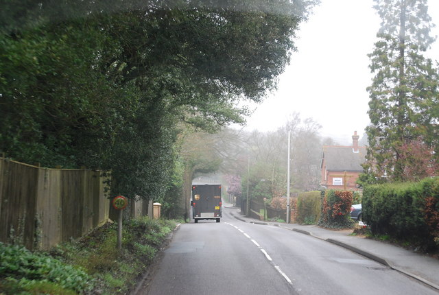
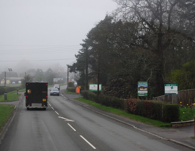
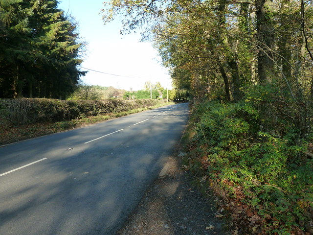
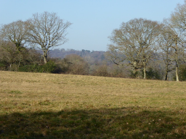
Church Wood is a picturesque woodland located in the county of Sussex, England. Spanning over a vast area, the wood is an enchanting mixture of ancient trees, dense undergrowth, and meandering pathways, making it a popular destination for nature enthusiasts and walkers alike.

The woodland is predominantly made up of deciduous trees such as oak, beech, and ash, which provide a stunning display of colors during the autumn months. The canopy formed by these trees creates a serene and shaded environment, perfect for escaping the summer heat. Additionally, the wood is home to a variety of wildlife, including woodland birds, deer, and small mammals, making it a haven for nature lovers and photographers.

Church Wood is known for its tranquil atmosphere, with the only sounds being the rustling of leaves and the occasional chirping of birds. Numerous well-marked trails wind their way through the wood, allowing visitors to explore its hidden corners and discover its natural beauty. Along these trails, one can find several benches and picnic spots, providing ample opportunities for visitors to relax and enjoy the surroundings.

The wood is also home to an ancient church, lending its name to the woodland. The church, which dates back several centuries, adds a touch of history and mystique to the area. Visitors can marvel at the architectural beauty of the church and explore its surroundings, which include a small graveyard.

Overall, Church Wood in Sussex is a captivating destination, offering a peaceful retreat from the hustle and bustle of everyday life. Its natural beauty, diverse wildlife, and historic church make it an ideal location for those seeking solace in nature.

If you have any feedback on the listing, please let us know in the comments section below.

Church Wood Images

Images are sourced within 2km of 50.956077/0.23117095 or Grid Reference TQ5619. Thanks to Geograph Open Source API. All images are credited.

A267 near Heathfield The A267 road is a 21 mile long road from Tunbridge Wells <a href="https://www.geograph.org.uk/photo/6669020">TQ5838 : A26, A267 junction</a> to Horsebridge.
Website: <span class="nowrap"><a title="http://www.sabre-roads.org.uk/wiki/index.php?title=A267" rel="nofollow ugc noopener" href="http://www.sabre-roads.org.uk/wiki/index.php?title=A267">Link</a><img style="margin-left:2px;" alt="External link" title="External link - shift click to open in new window" src="https://s1.geograph.org.uk/img/external.png" width="10" height="10"/></span>
A267 near Heathfield
The A267 road is a 21 mile long road from Tunbridge Wells TQ5838 : A26, A267 junction to Horsebridge. Website: LinkExternal link
A267 north of Little London The A267 road is a 21 mile long road from Tunbridge Wells <a href="https://www.geograph.org.uk/photo/6669020">TQ5838 : A26, A267 junction</a> to Horsebridge.
Website: <span class="nowrap"><a title="http://www.sabre-roads.org.uk/wiki/index.php?title=A267" rel="nofollow ugc noopener" href="http://www.sabre-roads.org.uk/wiki/index.php?title=A267">Link</a><img style="margin-left:2px;" alt="External link" title="External link - shift click to open in new window" src="https://s1.geograph.org.uk/img/external.png" width="10" height="10"/></span>
A267 north of Little London
The A267 road is a 21 mile long road from Tunbridge Wells TQ5838 : A26, A267 junction to Horsebridge. Website: LinkExternal link
Pook Reed Lane off the A267 The A267 road is a 21 mile long road from Tunbridge Wells <a href="https://www.geograph.org.uk/photo/6669020">TQ5838 : A26, A267 junction</a> to Horsebridge.
Website: <span class="nowrap"><a title="http://www.sabre-roads.org.uk/wiki/index.php?title=A267" rel="nofollow ugc noopener" href="http://www.sabre-roads.org.uk/wiki/index.php?title=A267">Link</a><img style="margin-left:2px;" alt="External link" title="External link - shift click to open in new window" src="https://s1.geograph.org.uk/img/external.png" width="10" height="10"/></span>
Pook Reed Lane off the A267
The A267 road is a 21 mile long road from Tunbridge Wells TQ5838 : A26, A267 junction to Horsebridge. Website: LinkExternal link
A267 on the edge of Heathfield The A267 road is a 21 mile long road from Tunbridge Wells <a href="https://www.geograph.org.uk/photo/6669020">TQ5838 : A26, A267 junction</a> to Horsebridge.
Website: <span class="nowrap"><a title="http://www.sabre-roads.org.uk/wiki/index.php?title=A267" rel="nofollow ugc noopener" href="http://www.sabre-roads.org.uk/wiki/index.php?title=A267">Link</a><img style="margin-left:2px;" alt="External link" title="External link - shift click to open in new window" src="https://s1.geograph.org.uk/img/external.png" width="10" height="10"/></span>
A267 on the edge of Heathfield
The A267 road is a 21 mile long road from Tunbridge Wells TQ5838 : A26, A267 junction to Horsebridge. Website: LinkExternal link
A267, Cross in Hand The A267 road is a 21 mile long road from Tunbridge Wells <a href="https://www.geograph.org.uk/photo/6669020">TQ5838 : A26, A267 junction</a> to Horsebridge.
Website: <span class="nowrap"><a title="http://www.sabre-roads.org.uk/wiki/index.php?title=A267" rel="nofollow ugc noopener" href="http://www.sabre-roads.org.uk/wiki/index.php?title=A267">Link</a><img style="margin-left:2px;" alt="External link" title="External link - shift click to open in new window" src="https://s1.geograph.org.uk/img/external.png" width="10" height="10"/></span>
A267, Cross in Hand
The A267 road is a 21 mile long road from Tunbridge Wells TQ5838 : A26, A267 junction to Horsebridge. Website: LinkExternal link
Road sign, Cross in Hand
St Bartholomew's Church, Cross in Hand Built 1863
St Bartholomew's Church, Cross in Hand
Built 1863
A267 north to Heathfield
Footpath nearing Broadfield Wood
Stand alone Oak by Holman's Wood
Footpath to Broadfield Wood Also access road to a few houses.
Footpath to Broadfield Wood
Also access road to a few houses.
Looking south on New Pond Hill New Pond is on the right opposite the car.
Looking south on New Pond Hill
New Pond is on the right opposite the car.
Concrete footpath marker in Holman's Wood ESCC used these a lot a few years ago but mainly to mark footpaths by a road.
Concrete footpath marker in Holman's Wood
ESCC used these a lot a few years ago but mainly to mark footpaths by a road.
Footpath to the Cross in Hand Stud On the A267.
Footpath to the Cross in Hand Stud
On the A267.
Pook Reed Lane off the A267 The lane leads into the centre of Heathfield.
Pook Reed Lane off the A267
The lane leads into the centre of Heathfield.
Cross in Hand Stud From the footpath to Slade Wood.
Cross in Hand Stud
From the footpath to Slade Wood.
Autumn colours on the edge of Slade Wood Possibly in the grounds of private house.
Autumn colours on the edge of Slade Wood
Possibly in the grounds of private house.
Show me another place!

Church Wood is located at Grid Ref: TQ5619 (Lat: 50.956077, Lng: 0.23117095)

Administrative County: East Sussex

District: Wealden

Police Authority: Sussex

What 3 Words

///kitten.times.jousting. Near Heathfield, East Sussex

Related Wikis

Maynard's Green

Maynard's Green is a village in the Wealden district of East Sussex. == External links == Maynards Green Community Primary School

Selwyns Wood

Selwyns Wood is a 11-hectare (27-acre) nature reserve west of Heathfield in Sussex. It is managed by the Sussex Wildlife Trust.This reserve has woodland...

Waldron Cutting

Waldron Cutting is a 0.2-hectare (0.49-acre) geological Site of Special Scientific Interest in East Sussex. It is a Geological Conservation Review site...

Roser's Cross

Roser's Cross is a village in the Wealden district of East Sussex.

Heathfield railway station (East Sussex)

Heathfield railway station was on the Cuckoo Line between Horam and Mayfield, serving the market town of Heathfield. It was opened in 1880 by London, Brighton...

Cross-in-Hand

Cross-in-Hand is a small village outside Heathfield town to its west, in the Wealden District situated in East Sussex, England. It is occasionally referred...

Sapperton Meadows

Sapperton Meadows is a 14.7-hectare (36-acre) biological Site of Special Scientific Interest south of Heathfield in East Sussex.These poorly drained hay...

Heathfield transmitting station

The Heathfield transmitting station is a facility for FM and television transmission at Heathfield, East Sussex, UK (grid reference TQ566220). Opened in...

Nearby Amenities

Located within 500m of 50.956077,0.23117095
Post Box
Operator: Royal Mail
Post Box Type: lamp
Ref: TN21 41
Royal Cypher: EIIR
Royal Cypher Wikidata: Q33102113
Lat/Long: 50.956279/0.2341639
Little London
Place: village
Lat/Long: 50.9551032/0.2359459
Little London Farm
Place: farm
Lat/Long: 50.9527937/0.2308577
Turning Circle
Lat/Long: 50.9598935/0.2277377
The data included in this document is from www.openstreetmap.org. The data is made available under ODbL.

Have you been to Church Wood?

Leave your review of Church Wood below (or comments, questions and feedback).