Eastland Coppice

Wood, Forest in Sussex Wealden

England

Eastland Coppice

Abbot's Wood car park A Forestry England pay and display car park.
Abbot's Wood car park Credit: David Martin

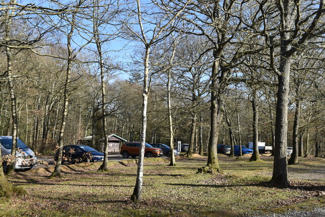
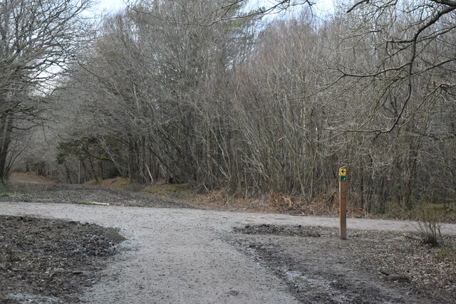
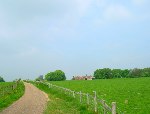
Eastland Coppice is a picturesque woodland located in Sussex, England. Covering an area of approximately 50 acres, it is renowned for its natural beauty and rich biodiversity, attracting nature enthusiasts and visitors alike.

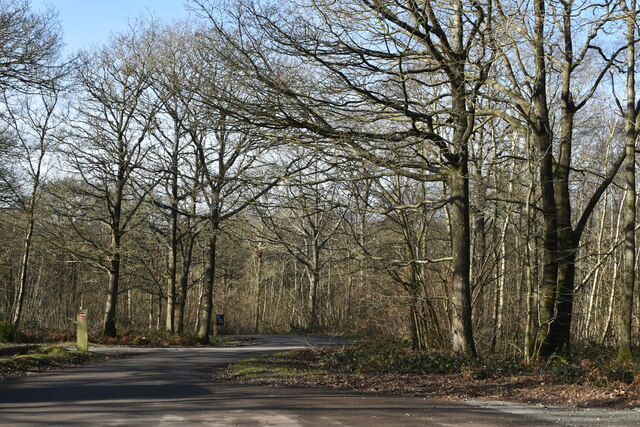
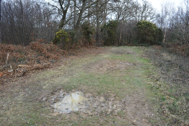
The coppice is predominantly composed of various tree species, including oak, beech, ash, and birch. These trees create a dense canopy, providing a shaded and tranquil environment for visitors to explore. The woodland floor is adorned with a diverse array of wildflowers, ferns, and mosses, adding to the overall natural charm of the area.

Walking through Eastland Coppice, one can expect to encounter an abundance of wildlife. The woodland is home to numerous bird species, such as woodpeckers, owls, and thrushes, making it a haven for birdwatchers. Squirrels scamper among the trees, and if lucky, visitors may catch a glimpse of a shy deer or fox.

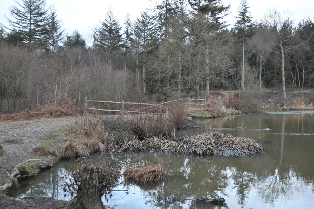
The coppice has a network of well-maintained footpaths, allowing visitors to navigate through the woodland easily. These paths lead to various points of interest, including a tranquil pond and a small stream that meanders through the forest, contributing to the overall serenity of the area.

Eastland Coppice offers a peaceful retreat from the hustle and bustle of everyday life. Whether it is for a leisurely stroll, birdwatching, or simply connecting with nature, this woodland gem in Sussex promises a memorable and rejuvenating experience for all who visit.

If you have any feedback on the listing, please let us know in the comments section below.

Eastland Coppice Images

Images are sourced within 2km of 50.834224/0.21917607 or Grid Reference TQ5606. Thanks to Geograph Open Source API. All images are credited.

Abbot's Wood car park A Forestry England pay and display car park.
Abbot's Wood car park
A Forestry England pay and display car park.
Road towards entrance, Abbot's Wood
Pond and dam in Abbot's Wood
End of forest track, Abbot's Wood
Path junction in Abbot's Wood
Footpath Junction in Abbot's Wood Abbot's Wood is a mixed woodland of approximately 360 hectares, offering waymarked forest trails, an adventure play area and barbecue/picnic area. <span class="nowrap"><a title="http://www.forestry.gov.uk/website/Recreation.nsf/LUwebdocsBykey/EnglandEastSussexAbbotsWood" rel="nofollow ugc noopener" href="http://www.forestry.gov.uk/website/Recreation.nsf/LUwebdocsBykey/EnglandEastSussexAbbotsWood">Link</a><img style="margin-left:2px;" alt="External link" title="External link - shift click to open in new window" src="https://s1.geograph.org.uk/img/external.png" width="10" height="10"/></span>
Footpath Junction in Abbot's Wood
Abbot's Wood is a mixed woodland of approximately 360 hectares, offering waymarked forest trails, an adventure play area and barbecue/picnic area. LinkExternal link
Abbot's Amble Trail, Abbots Wood, Arlington, Abbot's Wood is a mixed woodland of approximately 360 hectares, offering waymarked forest trails, an adventure play area and barbecue/picnic area. <span class="nowrap"><a title="http://www.forestry.gov.uk/website/Recreation.nsf/LUwebdocsBykey/EnglandEastSussexAbbotsWood" rel="nofollow ugc noopener" href="http://www.forestry.gov.uk/website/Recreation.nsf/LUwebdocsBykey/EnglandEastSussexAbbotsWood">Link</a><img style="margin-left:2px;" alt="External link" title="External link - shift click to open in new window" src="https://s1.geograph.org.uk/img/external.png" width="10" height="10"/></span>
Abbot's Amble Trail, Abbots Wood, Arlington,
Abbot's Wood is a mixed woodland of approximately 360 hectares, offering waymarked forest trails, an adventure play area and barbecue/picnic area. LinkExternal link
Monken Pyn
Monken Pyn
Farmland by the East Coastway Line
Woodland by the East Coastway Line
Farmland near Monken Pyn
A22, southbound The A22 is one of the  major roads in the south east of England. It carries traffic from London to Eastbourne on the East Sussex coast. The route goes through Purley, East Grinstead, Forest Row, Hailsham and Polegate. A distance of 48 miles.
<span class="nowrap"><a title="http://www.sabre-roads.org.uk/wiki/index.php?title=B2104" rel="nofollow ugc noopener" href="http://www.sabre-roads.org.uk/wiki/index.php?title=B2104">Link</a><img style="margin-left:2px;" alt="External link" title="External link - shift click to open in new window" src="https://s1.geograph.org.uk/img/external.png" width="10" height="10"/></span>
A22, southbound
The A22 is one of the major roads in the south east of England. It carries traffic from London to Eastbourne on the East Sussex coast. The route goes through Purley, East Grinstead, Forest Row, Hailsham and Polegate. A distance of 48 miles. LinkExternal link
Bend, A22
Bend, A22
A22, southbound The A22 is one of the  major roads in the south east of England. It carries traffic from London to Eastbourne on the East Sussex coast. The route goes through Purley, East Grinstead, Forest Row, Hailsham and Polegate. A distance of 48 miles.
<span class="nowrap"><a title="http://www.sabre-roads.org.uk/wiki/index.php?title=B2104" rel="nofollow ugc noopener" href="http://www.sabre-roads.org.uk/wiki/index.php?title=B2104">Link</a><img style="margin-left:2px;" alt="External link" title="External link - shift click to open in new window" src="https://s1.geograph.org.uk/img/external.png" width="10" height="10"/></span>
A22, southbound
The A22 is one of the major roads in the south east of England. It carries traffic from London to Eastbourne on the East Sussex coast. The route goes through Purley, East Grinstead, Forest Row, Hailsham and Polegate. A distance of 48 miles. LinkExternal link
Dual carriageway The A22 is one of the  major roads in the south east of England. It carries traffic from London to Eastbourne on the East Sussex coast. The route goes through Purley, East Grinstead, Forest Row, Hailsham and Polegate. A distance of 48 miles.
<span class="nowrap"><a title="http://www.sabre-roads.org.uk/wiki/index.php?title=B2104" rel="nofollow ugc noopener" href="http://www.sabre-roads.org.uk/wiki/index.php?title=B2104">Link</a><img style="margin-left:2px;" alt="External link" title="External link - shift click to open in new window" src="https://s1.geograph.org.uk/img/external.png" width="10" height="10"/></span>
Dual carriageway
The A22 is one of the major roads in the south east of England. It carries traffic from London to Eastbourne on the East Sussex coast. The route goes through Purley, East Grinstead, Forest Row, Hailsham and Polegate. A distance of 48 miles. LinkExternal link
The A22 The A22 is one of the  major roads in the south east of England. It carries traffic from London to Eastbourne on the East Sussex coast. The route goes through Purley, East Grinstead, Forest Row, Hailsham and Polegate. A distance of 48 miles.
<span class="nowrap"><a title="http://www.sabre-roads.org.uk/wiki/index.php?title=B2104" rel="nofollow ugc noopener" href="http://www.sabre-roads.org.uk/wiki/index.php?title=B2104">Link</a><img style="margin-left:2px;" alt="External link" title="External link - shift click to open in new window" src="https://s1.geograph.org.uk/img/external.png" width="10" height="10"/></span>
The A22
The A22 is one of the major roads in the south east of England. It carries traffic from London to Eastbourne on the East Sussex coast. The route goes through Purley, East Grinstead, Forest Row, Hailsham and Polegate. A distance of 48 miles. LinkExternal link
A22 to Eastbourne The A22 is one of the  major roads in the south east of England. It carries traffic from London to Eastbourne on the East Sussex coast. The route goes through Purley, East Grinstead, Forest Row, Hailsham and Polegate. A distance of 48 miles.
<span class="nowrap"><a title="http://www.sabre-roads.org.uk/wiki/index.php?title=B2104" rel="nofollow ugc noopener" href="http://www.sabre-roads.org.uk/wiki/index.php?title=B2104">Link</a><img style="margin-left:2px;" alt="External link" title="External link - shift click to open in new window" src="https://s1.geograph.org.uk/img/external.png" width="10" height="10"/></span>
A22 to Eastbourne
The A22 is one of the major roads in the south east of England. It carries traffic from London to Eastbourne on the East Sussex coast. The route goes through Purley, East Grinstead, Forest Row, Hailsham and Polegate. A distance of 48 miles. LinkExternal link
On to the A27 The A27 runs 103 miles from Whiteparish near Salisbury to Pevensey near Eastbourne. It runs parallel with the south coast and the South Downs. <span class="nowrap"><a title="http://www.sabre-roads.org.uk/wiki/index.php?title=A27" rel="nofollow ugc noopener" href="http://www.sabre-roads.org.uk/wiki/index.php?title=A27">Link</a><img style="margin-left:2px;" alt="External link" title="External link - shift click to open in new window" src="https://s1.geograph.org.uk/img/external.png" width="10" height="10"/></span>
On to the A27
The A27 runs 103 miles from Whiteparish near Salisbury to Pevensey near Eastbourne. It runs parallel with the south coast and the South Downs. LinkExternal link
Show me another place!

Eastland Coppice is located at Grid Ref: TQ5606 (Lat: 50.834224, Lng: 0.21917607)

Administrative County: East Sussex

District: Wealden

Police Authority: Sussex

What 3 Words

///excusing.creamed.glosses. Near Hailsham, East Sussex

Nearby Locations

Eastland Coppice

Related Wikis

Wootton Manor

Wootton Manor is a country house in Folkington, East Sussex. Originally a mediaeval manor house, from which parts of the chapel survive, it was rebuilt...

Long Man

Long Man is a civil parish in the Wealden District of East Sussex, England, which includes the villages of Wilmington, Milton Street and Folkington. The...

Arlington, East Sussex

Arlington is a village and civil parish in the Wealden district of East Sussex, England. The parish is on the River Cuckmere, and is the location of a...

Polegate

Polegate is a town and civil parish in the Wealden District of East Sussex, England, United Kingdom. It is located five miles (8 km) north of the seaside...

Folkington Manor

Folkington Manor (pronounced Fo'ington) is a grade II* listed country house situated in the village of Folkington two miles (3.2 km) west of Polegate,...

Otham Abbey

Otham Abbey was a medieval monastic house in Polegate, East Sussex, England. == History == Otham Abbey was founded about 1180 by Ralph de Dene as the Abbey...

St George's Church, Polegate

St George's Church is a Roman Catholic church of the parish of Hailsham and Polegate serving the town of Polegate in the Wealden district of East Sussex...

Polegate railway station

Polegate railway station serves Polegate in East Sussex, England. It is on the East Coastway Line, 61 miles 39 chains (99.0 km) from London Bridge, and...

Nearby Amenities

Located within 500m of 50.834224,0.21917607
Power: tower
Lat/Long: 50.8359599/0.2211563
Power: tower
Lat/Long: 50.8346949/0.2245594
Power: tower
Lat/Long: 50.8373611/0.2174236
The data included in this document is from www.openstreetmap.org. The data is made available under ODbL.

Have you been to Eastland Coppice?

Leave your review of Eastland Coppice below (or comments, questions and feedback).